For cyclists interested in cycling adventure stories, the “Books Sandwiched In” series at Rundel is having a discussion of the book “The Lost Cyclist” on September 28- hosted by the owner of Full Moon Vista bike shop. I’ll be out of town that day, but it looks fun!
Rails WITH trails? Advantage to Railroads
from Rails-to-Trails Conservancy www.RailstoTrails.org
They should see their rates go down. Sometimes people will walk on
the track as a shortcut, then don’t hear the train in time and get
hit. This is eliminated by having a multi use path next to it.
Comrades- they’re on to us!
The Denver Post reports that Maes, a Tea Party friendly candidate facing former Rep. Scott McInnis in the August 10 Republican primary, has come out against a public bicycle program run by the city of Denver. Denver’s mayor, John Hickenlooper, is the presumptive Democratic nominee, and a cycling supporter.
“This is all very well-disguised, but it will be exposed,” Maes said at a small campaign rally last week, according to the Post. “These aren’t just warm, fuzzy ideas from the mayor. These are very specific strategies that are dictated to us by this United Nations program that mayors have signed on to.”
-Bill Collins
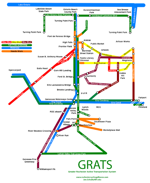
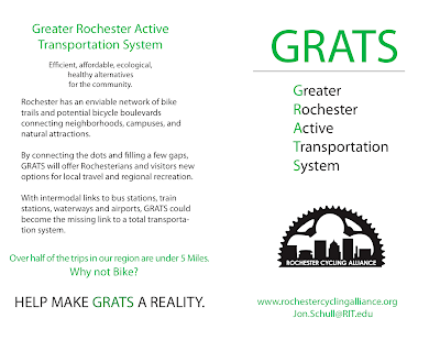
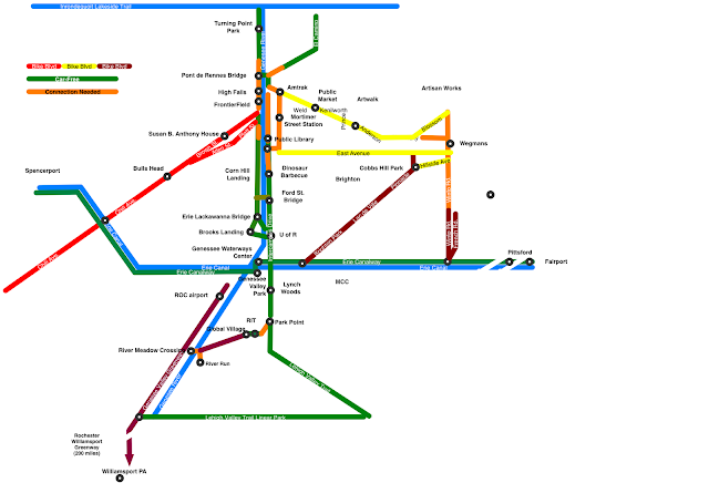
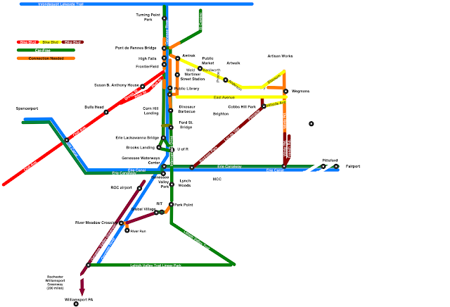
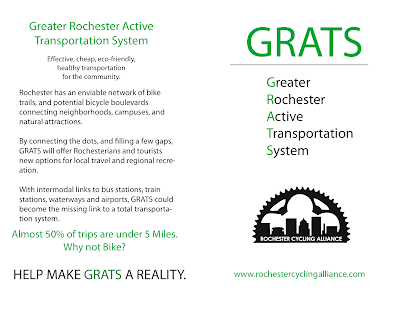
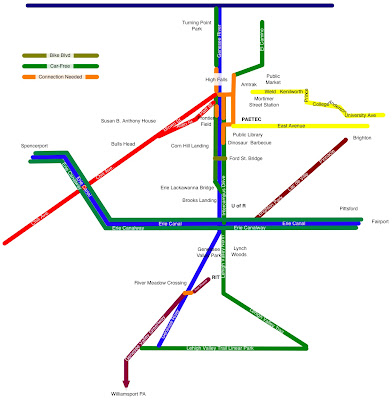
Greater Rochester Active Transportation System brochure
Greater Rochester Active Transportation System brochure
Dark forces are waiting for us to let down our guard
Electronics companies try to start a pro-distracted driving lobby, but backtrack quickly when the Secretary of Transportation raises a fuss.
Dark forces are waiting for us to let down our guard
Electronics companies try to start a pro-distracted driving lobby, but backtrack quickly when the Secretary of Transportation raises a fuss.
River Meadow Crossing
- would create new recreational options for local residents,
- would create a short and safe bike-commute to and from RIT and RIT’s new Global Village
- would create a scenic and efficient 10 mile bike ride to downtown Rochester via RIT, Park Point and the Rochester Greenway.
- would make us essential links in the emerging Rochester-Williamsport Greenway
- would establish Henrietta, RIT, and Rochester as leaders in the transition to more ecological, economical, and healthy life styles.
- would enrich the community.
U.S. Bicycle Route System – FAQs – Adventure Cycling Association
U.S. Bicycle Route System – FAQs – Adventure Cycling Association: “USBRS – Frequently Asked Questions
1. What is the U.S. Bicycle Route System?
2. What are the advantages of having a U.S. Bicycle Route?
3. Is there demand?
4. Who is funding this initiative?
5. Are there any existing routes?
6. How are routes decided upon?
7. Who oversees/maintains the U.S. Bicycle Route System?
8. What does designation mean?
9. What stipulations are there for developing U.S. Bicycle Routes?
10. What if the best route or an important connection is not on a road managed by the State Department of Transportation?
11. What is AASHTO?
12. What is the Adventure Cycling Association?
1. What is the U.S. Bicy”
"Safe Passing" Law passes NYS Legislature
A bill that mandates cars to pass a bicyclist at a “safe distance” passed the Legislature yesterday:
http://www.democratandchronicle.com/apps/pbcs.dll/article?AID=2010100630006
Thanks to Richard, Harvey, and all the other NYS cyclist advocates that worked hard to get this bill passed! Hopefully the governor will sign, but it appeared to pass both houses with more than 2/3 vote, so an override shouldn’t be difficult, if it comes to that.
-Bill Collins
And another City bike tour
This one focuses on Artwalk and Cobbs Hill area, July 20th:
Guided Bike Ride
Free guided bike tour of Marketview Heights and the Arts District, sponsored by the City of Rochester and MVP, July 6th:
And another City bike tour
This one focuses on Artwalk and Cobbs Hill area, July 20th:
