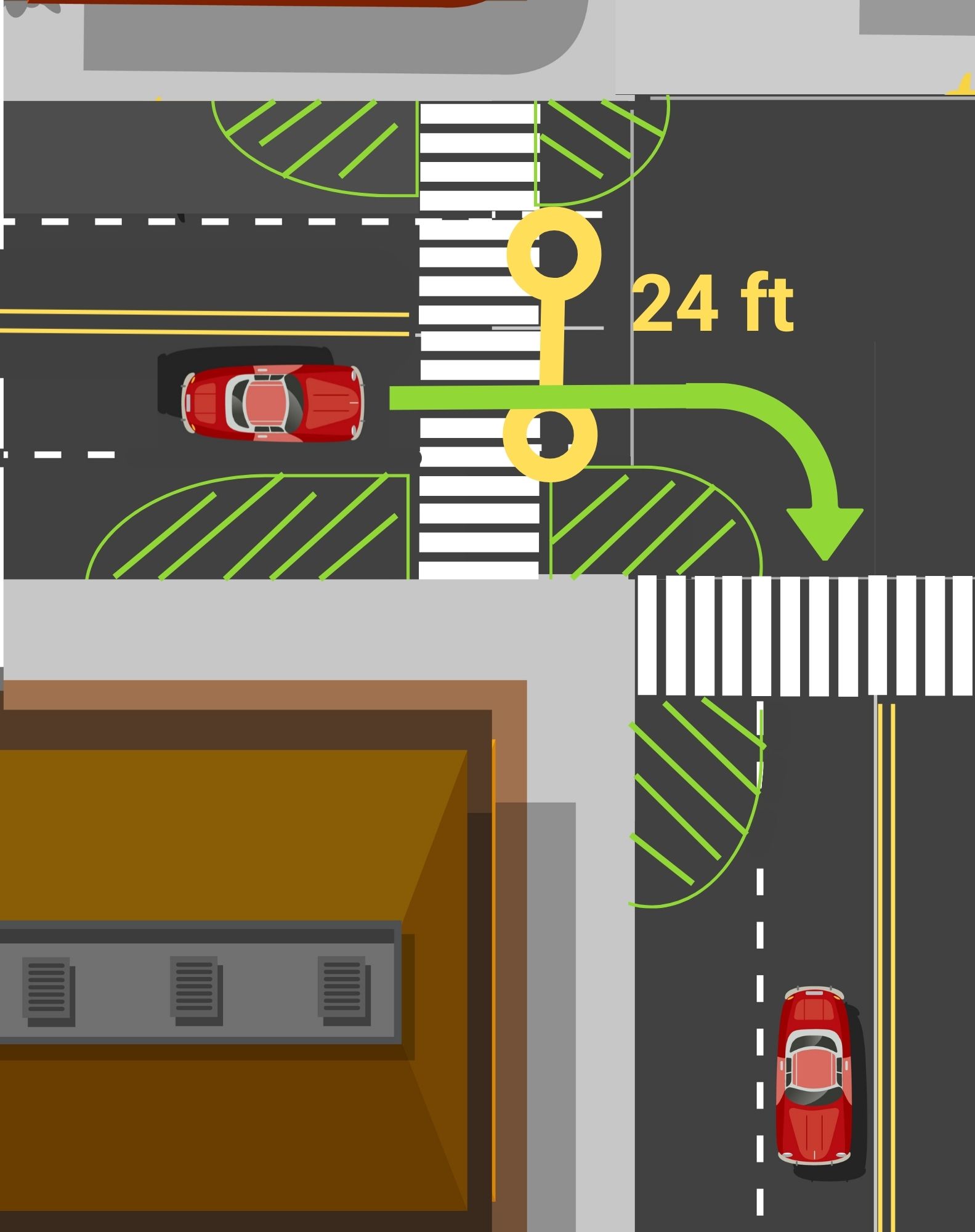
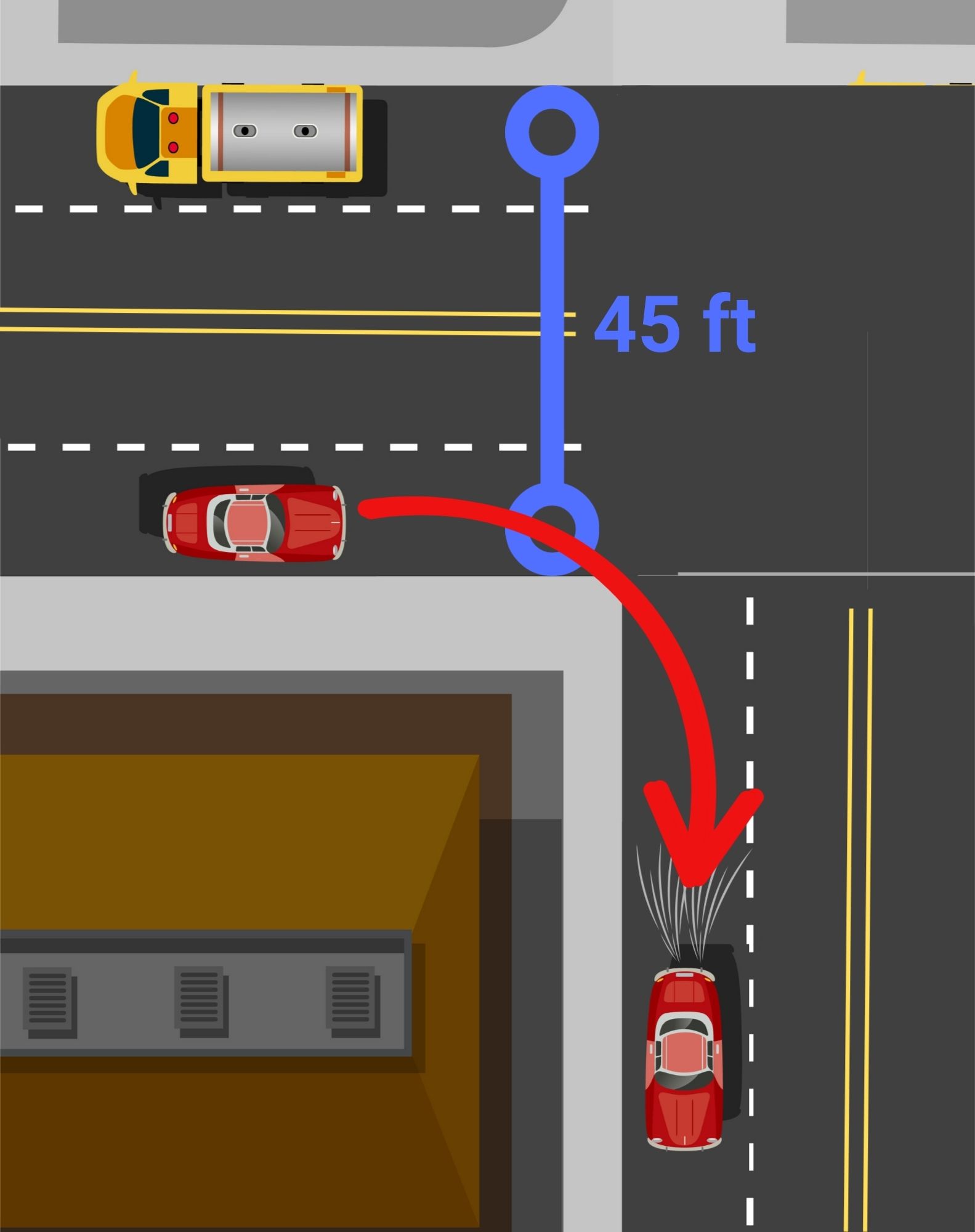
The main goal of curb extensions is to slow down turning vehicles by narrowing the space available and shorten the distance that pedestrians have to interact with cars in the road. Following the installations, more than two-thirds of survey respondents said they felt safer crossing at these intersections. Perceptions of safety emerged as the strongest indicator from last year’s project that the improvements are making a difference while adding a splash of creativity to downtown Rochester.
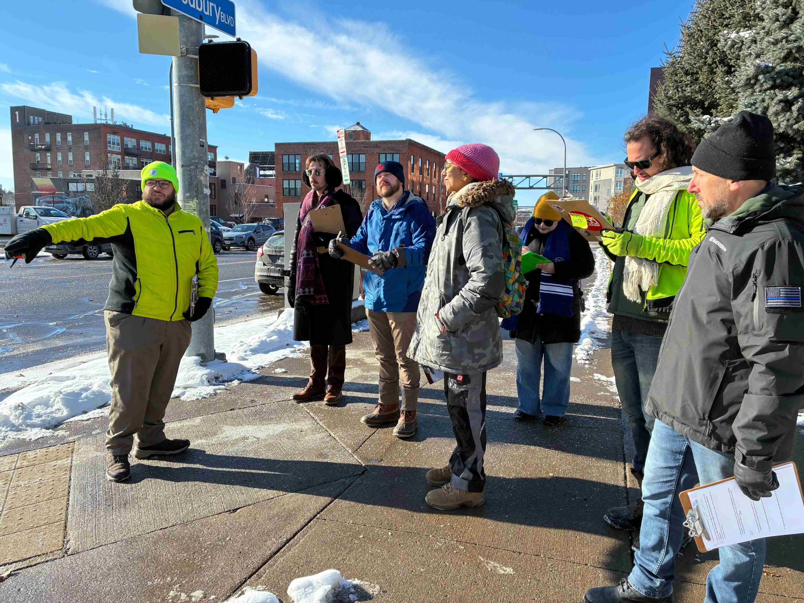
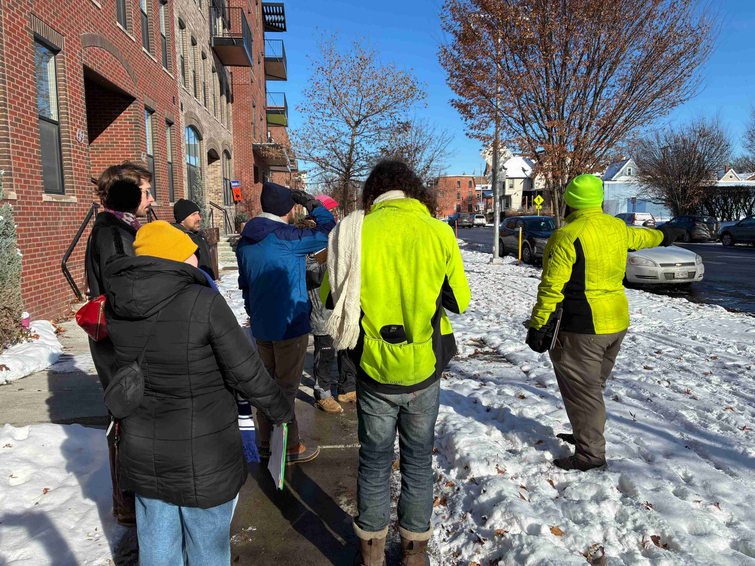
Using lessons learned from last year’s debut of the project, our Community Advisory Committee (CAC) met again in late 2025 to walk through downtown and assess potential locations for the next two installations. As we explored the streets together, we discussed areas with safety concerns and places with the greatest potential for improvement. We also considered pedestrian and vehicle traffic, along with proximity to busy downtown spaces.
Without Further Ado, Our Selections!
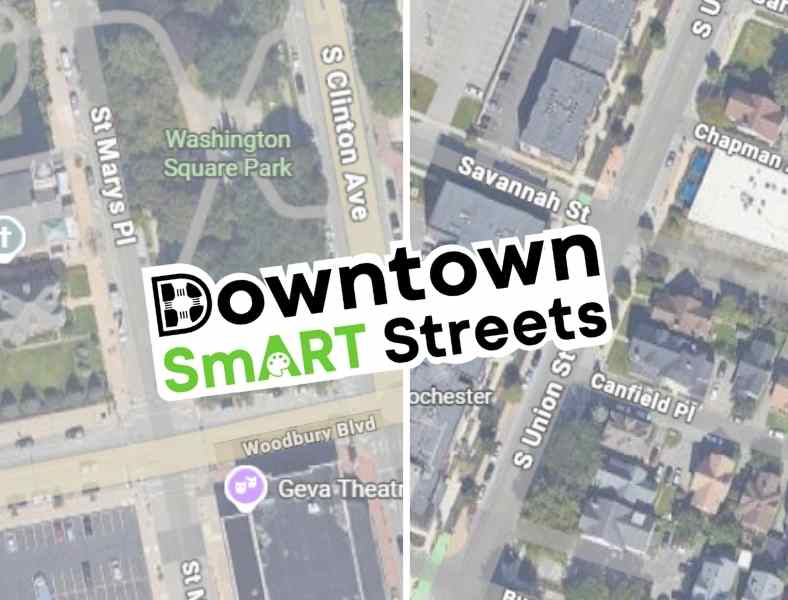
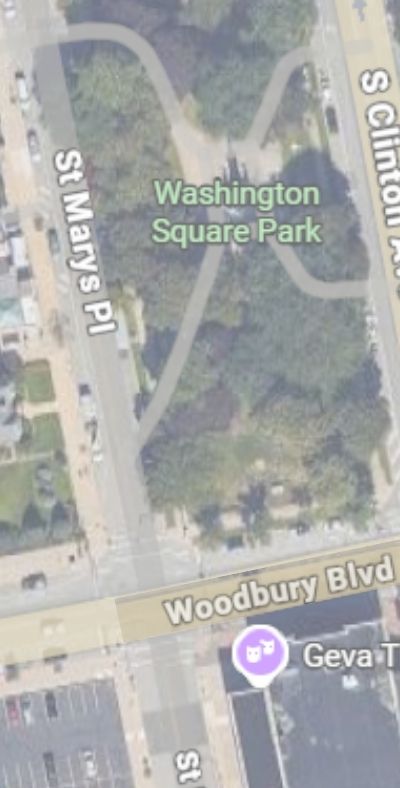
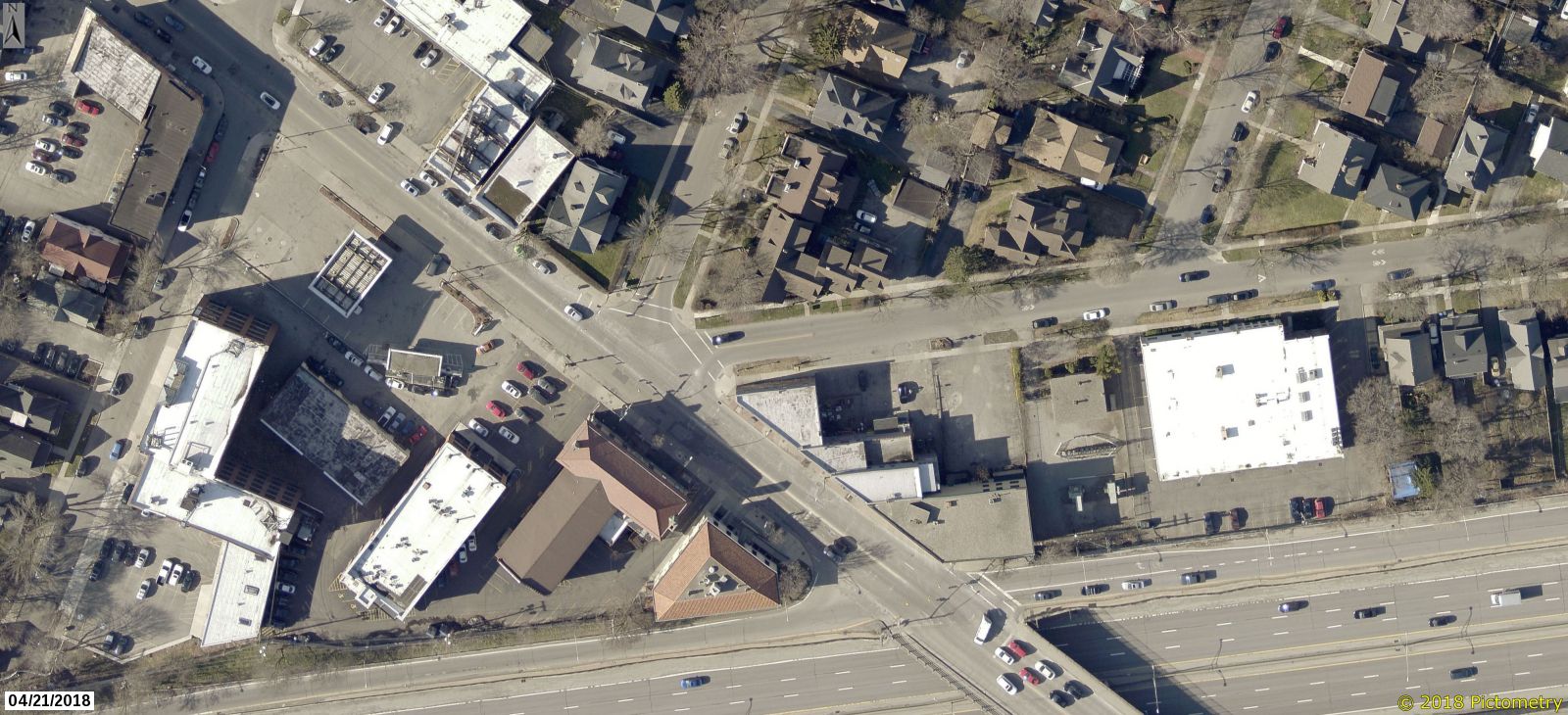
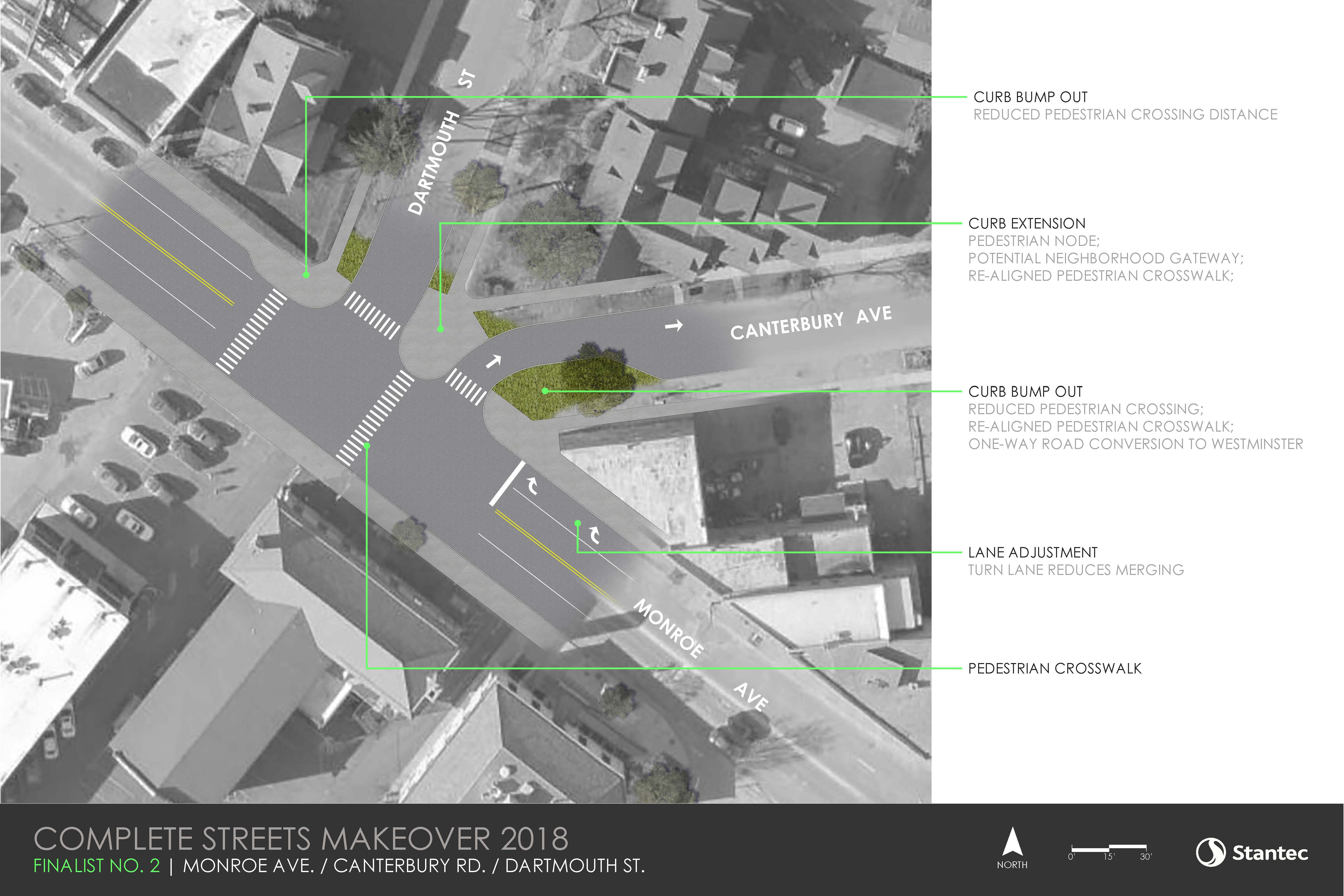
Woodbury Blvd & St Mary’s Place
And
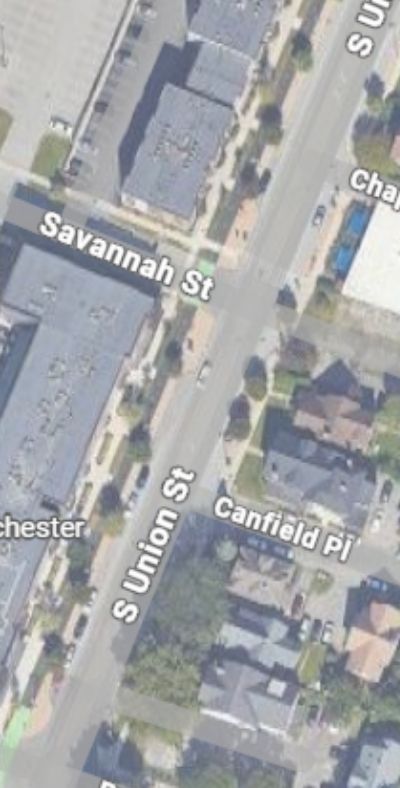
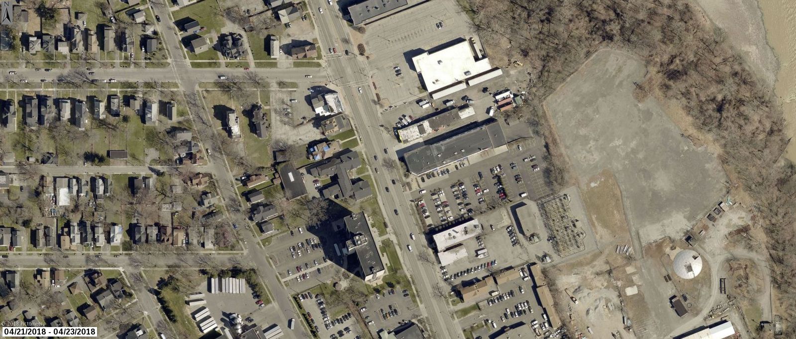
S. Union, Savannah, & Canfield Place
Why Woodbury Blvd & St Mary’s Place?
Woodbury and St. Mary’s offers a clear opportunity to redesign the streetscape and better allocate space. Plus three of the four corners of this intersection are home to Washington Square Park, Geva Theatre, and St Mary’s Catholic Church; with all the various programs that draw people to those places.You can also find Fuego Coffee just a hop skip away. This project will create a more comfortable crossing for the many visitors and downtown residents who pass through the area on foot.
Why S. Union, Savannah, & Canfield Place?
While we love the Union Street cycle track, this long, unsignalized, stretch of road offers little to deter high driver speeds. In turn, residents of S Union Street apartments, Strong Museum of Play visitors, as well as customers walking or rolling to places like Spotted Octopus, Fattey Beer Co, or Nerdvana, often struggle to find safe gaps in traffic when crossing.
These concerns became even more urgent after a tragic hit-and-run pedestrian fatality in June 2025. A driver hit 70 year old Henry “Hank” Brown, long time doorman at Salinger’s, while he was crossing S. Union walking home from work. This tragedy was a factor in including Canfield intersection where Hank was hit and killed, in the project area. While the west side of the intersection already has a substantial bump-out, the east side could be improved to harden daylighting zones and prevent illegal parking.
Next Steps…
The design team at GPI is creating renderings to redesign the project area for a safer and smarter street. Renderings for both locations will be reviewed by Rochester’s Traffic Control Board. Once the street safety design and artwork for the murals receive proper approval, we will gear up to bring these concepts to reality this spring/early summer!
We need volunteers for this project! Want to help us paint?! Reach out to project manager, Lourdes Sharp (Lourdes@ReconnectRochester.org, 585-210-9716) to explore opportunities.
We will also be updating the paint and reinstalling the delineator posts for both of our 2025 installations at E. Main & Gibbs Street and Broad and Fitzhugh! Have you visited one of these installations from last year? Let us know what you think!
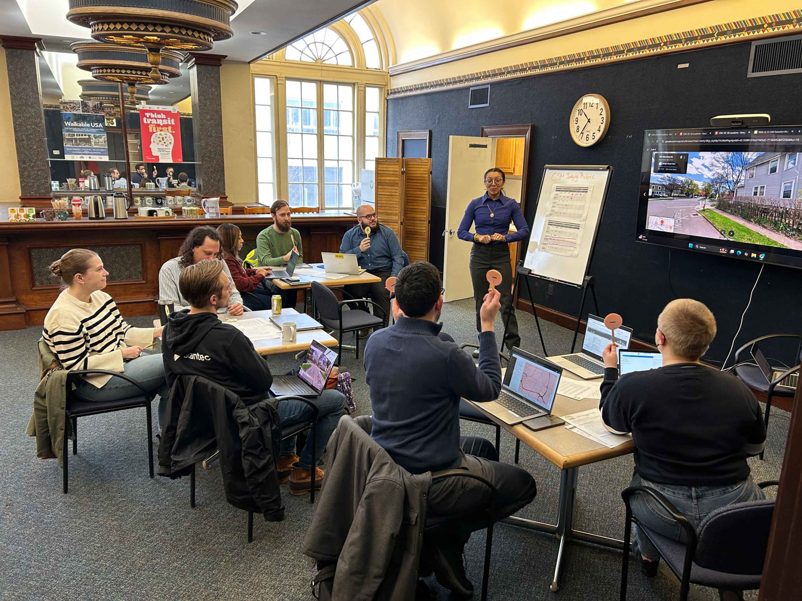
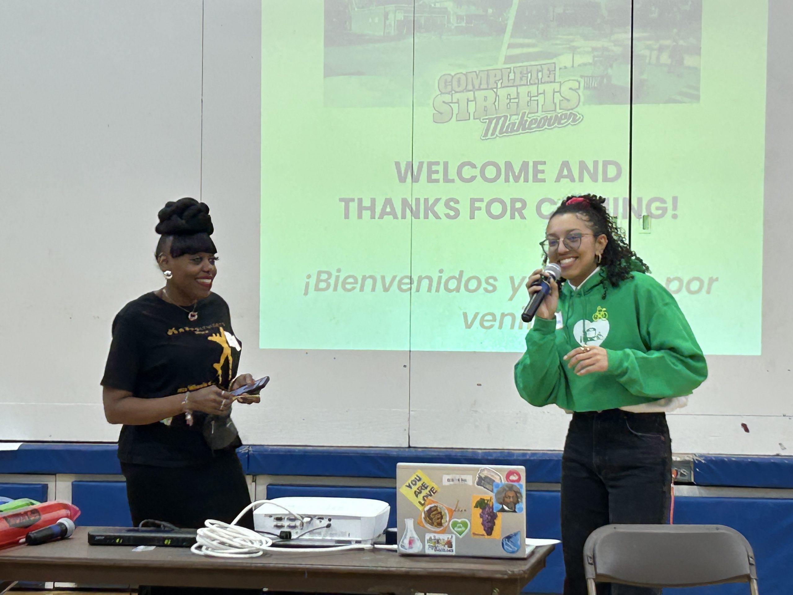
Reconnect Rochester’s Complete Streets Makeover project transforms a neighborhood intersection through a temporary installation designed to make it safer for everyone passing through, whether on bike, on foot, or in a car. We selected the winning location for our 6th project from a pool of 48 trouble spots that community members identified as places in your daily travels where you don’t feel comfortable walking or biking. After carefully evaluating each location using established criteria, such as safety concerns and design improvement potential, our Program Steering Committee held a popsicle stick voting session and landed on this year’s winner!
(Drumroll please…)
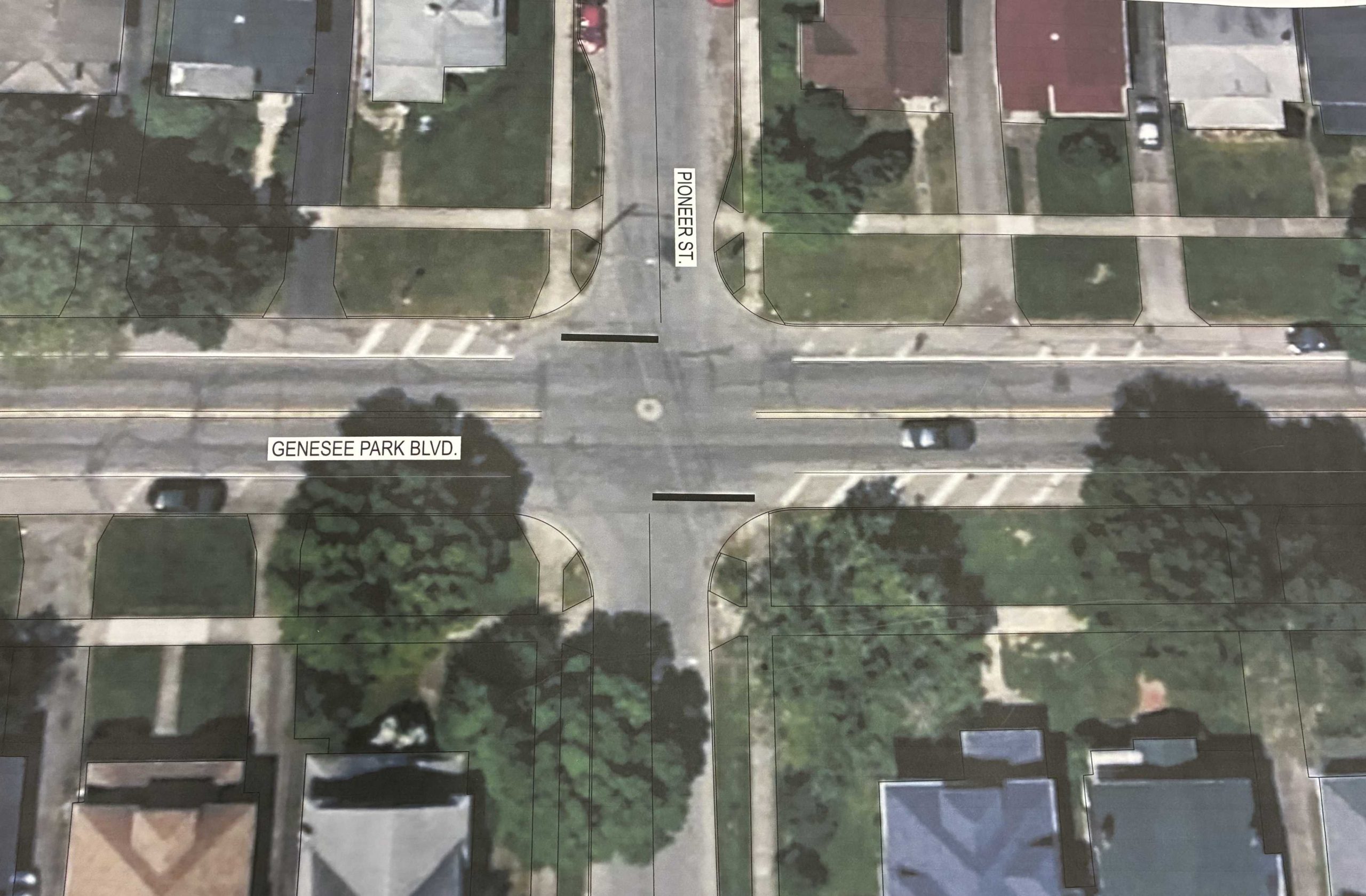
Genesee Park Blvd & Pioneer St in the 19th Ward neighborhood!
Genesee Park Blvd & Pioneer St sees a high number of crashes under normal conditions but a recent detour has exacerbated the issue. With the detour recently removed and traffic flows returning to normal conditions, residents have since raised real safety concerns traveling through the intersection.
While pedestrian crashes have been less frequent than vehicle collisions, drivers failing to yield the right of way has led to residents feeling unsafe. Some report that they take a longer route to bike or walk to Genesee Valley Park because it feels safer than passing through this intersection. Genesee Park Blvd & Pioneer St sits just steps from the Empire State Trail and Genesee Riverway Trail, where people regularly walk, run, and bike. Its proximity to University of Rochester off campus student housing and School #53 leads many students and families to rely on this intersection on a daily basis.
This intersection also has extra road space to work with, and the layout presents strong potential for design improvements. Plus, Rochester is planning a reconstruction of Genesee Park Blvd in 2032 which creates an opportunity to test safer street design on a temporary basis. Through data collection, we can evaluate what works for all road users and center community voice to help inform the permanent redesign.
Next Steps…
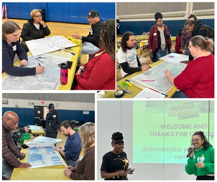
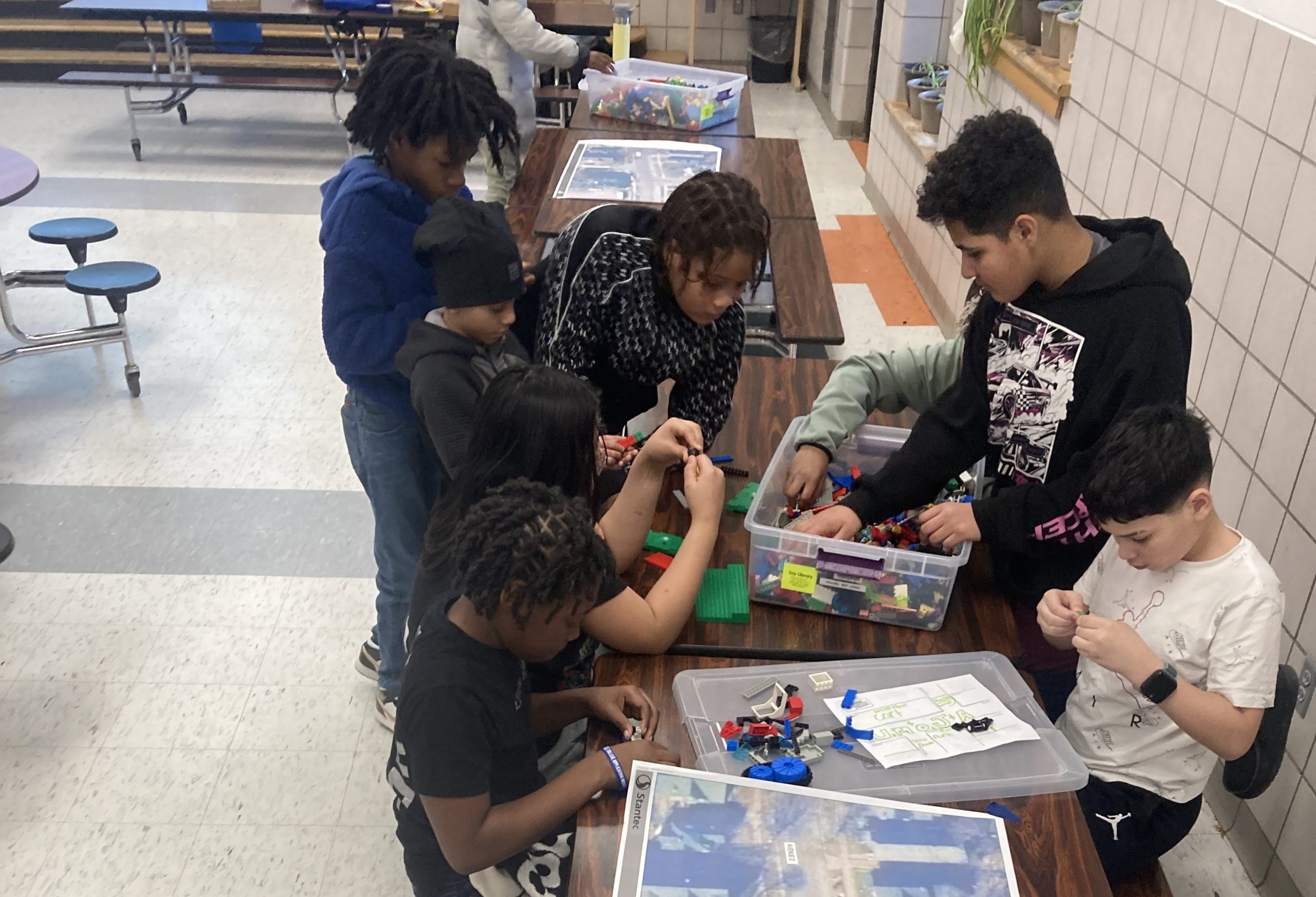
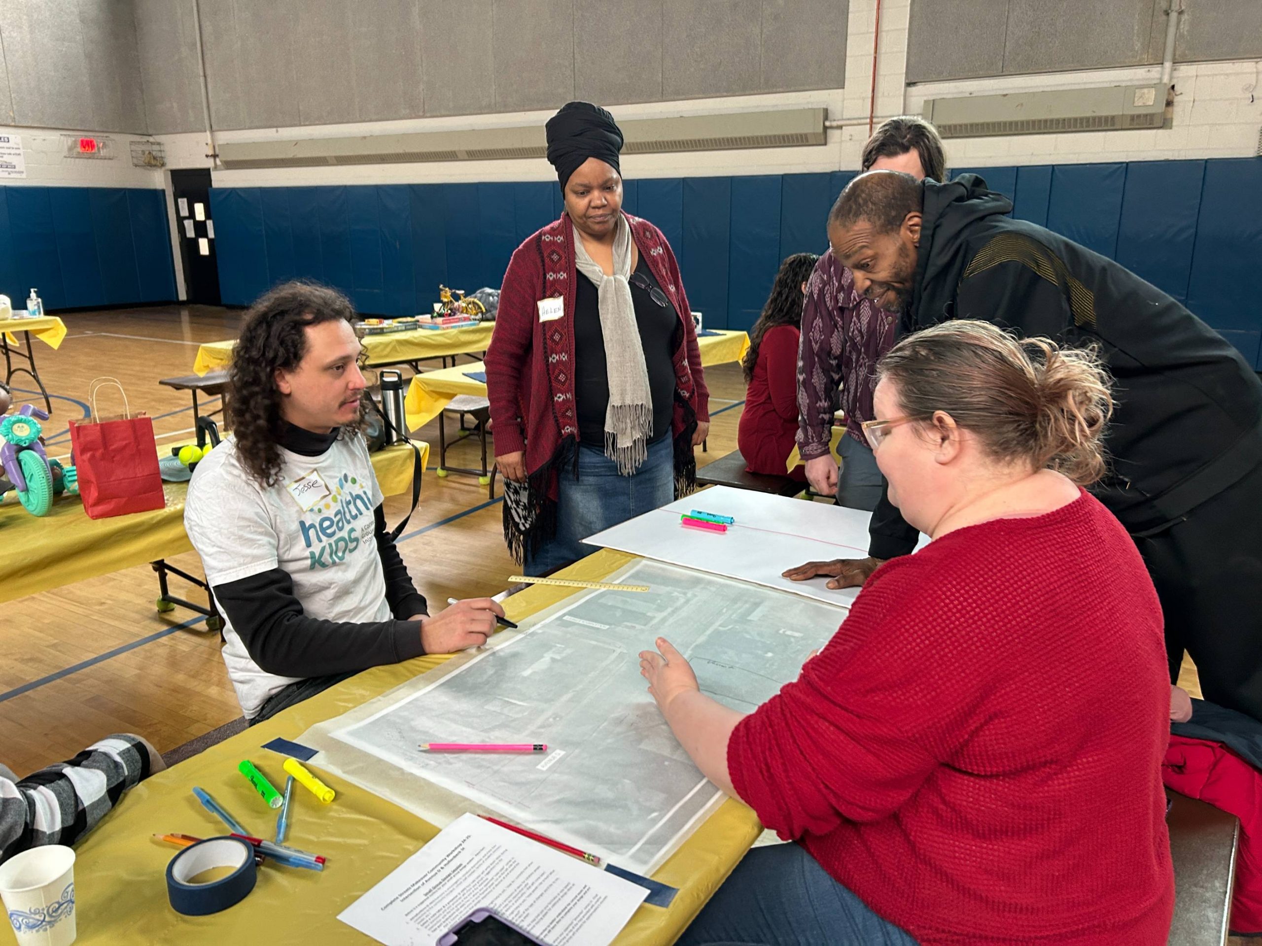
We’ll hold a Community Workshop in March to gain insight from the residents of the 19th Ward about the enhancements they would like in the intersection. No one understands what it’s like to use our streets better than those who walk, bike, roll, and ride along them everyday.
Complete Streets Makeover Community Workshop in 2025
Our friends on the complete streets design team at Stantec will use community input from the workshop to create conceptual design enhancements of an improved streetscape. We’ll then see these concepts transform into reality through a temporary on-street installation in May. This transformation is only possible through the input and support of neighborhood residents coming out to help with the installation. Keep a look out for updates along the way!
*Community Partners
The Complete Streets Makeover of Genesee Park Blvd & Pioneer St is a collaborative venture with the following community partners:
Is there an intersection or trouble spot in your daily travels where you don’t feel safe to walk or bike? Nominate it for our next Complete Streets Makeover project!FILL OUT OUR NOMINATION FORM.
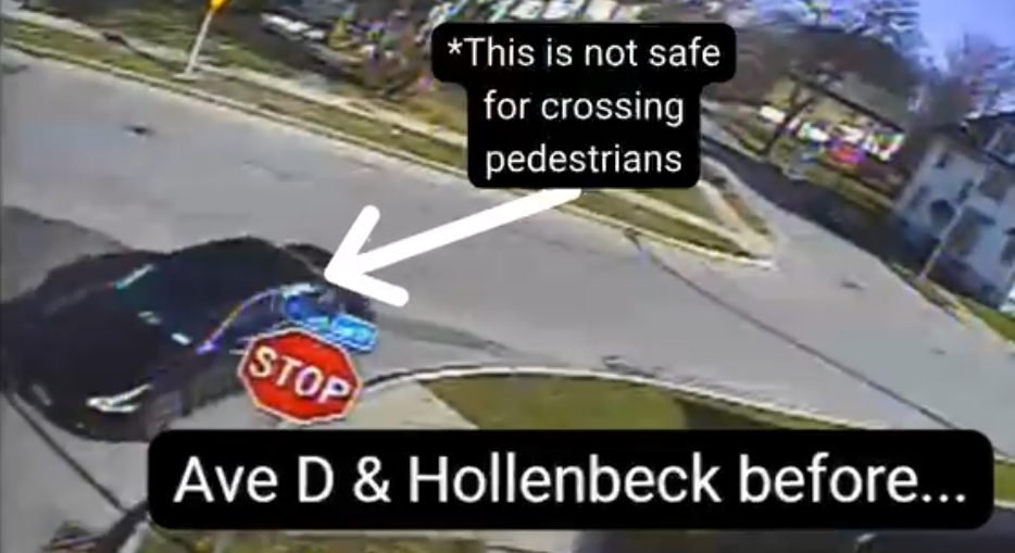
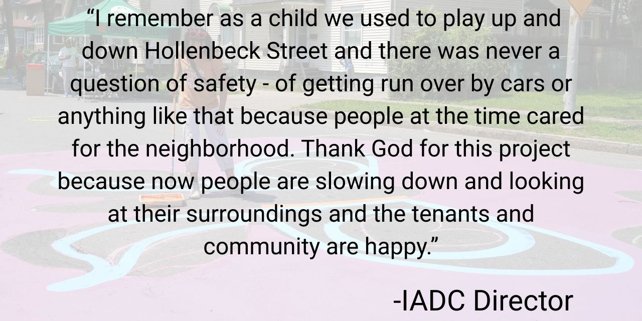
Our fifth Complete Streets Makeover project at Avenue D & Hollenbeck Street is now complete! Since 2018, we’ve partnered with Rochester neighbors to transform neighborhood intersections in every quadrant of the city. By listening closely to community voices and focusing on safety over speed, we’ve transformed these intersections into spaces where pedestrians, cyclists, and drivers can all move with greater confidence.
The Selection Process
Located smack dab in the middle of the El Camino neighborhood, Avenue D is often treated as a thruway for traffic connecting larger roads such as St Paul St and N Clinton Ave where driver speeds tend to be higher. From Conkey Ave to N Clinton Ave, a one block distance from either side of the intersection, we saw a total of 16 crashes with pedestrians and cyclists between 2014-2023 with a noticeable cluster occurring right at the intersection of Avenue D & Hollenbeck St.
These safety concerns raised red flags for vulnerable road users passing through this intersection. The nomination for this location came from an R-Center staff member who had helped move the needle with traffic safety improvements in this area through organizing R-Center youth to lobby for temporary speed humps as a traffic calming measure along Avenue D.
With the Avenue D R-Center, an attractive third space for neighborhood youth, at one end of the block and senior housing nearby, the Steering Committee saw a need and opportunity to protect vulnerable road users in the area.
Getting Community Input
At a community workshop in February 2025, we sat down with residents of the El Camino neighborhood to hear firsthand what it’s really like to navigate this intersection every day. After walking everyone through the idea of complete streets and how they can make roads safer and friendlier for everyone, we opened the floor. People shared stories, frustrations, and creative ideas, and we listened closely. A visit to School No. 8 added youth voices and ideas to the mix. Then we got to work turning those hopes and concerns into concrete design features—practical changes that reflect the community’s vision for a safer, smarter intersection.
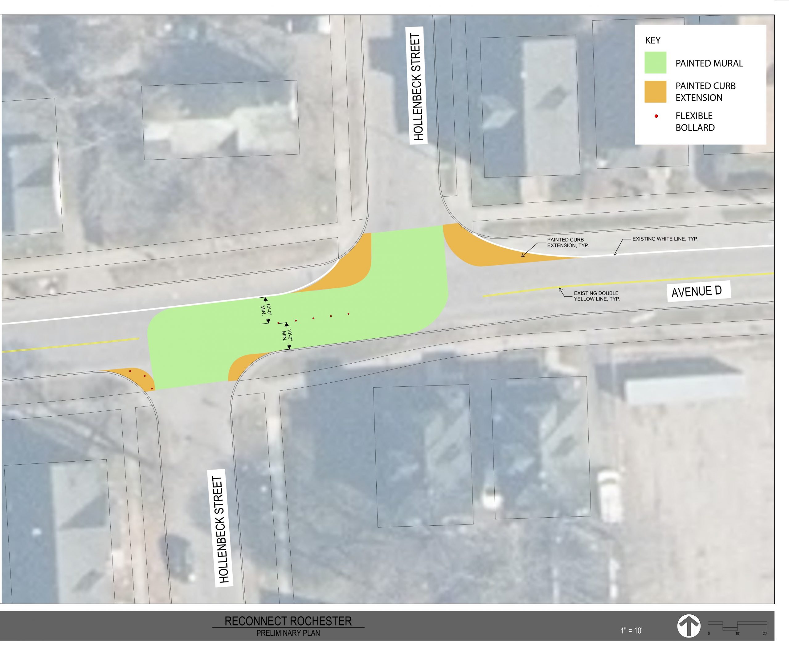
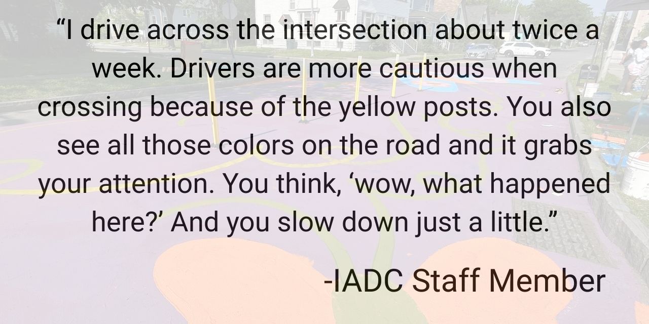
A unique element to Avenue D & Hollenbeck St is that it is an “offset” intersection as opposed to a conventional t-intersection meaning that Hollenbeck St ends at Avenue D and continues again a few feet down on Avenue D. A recurring comment from the community was that drivers cutting diagonally across the intersection when traveling along Hollenbeck St posed a high risk for pedestrians.
Based on community input from this session, the Stantec team drafted a conceptual drawing of street design improvements. Their rendering focused on elements that could be brought to life in the temporary, on-street installation and then translated into permanent improvements. For this project, they proposed flex posts in the center of Avenue D to direct vehicles to turn right, then left, giving drivers more time to watch for pedestrians and making their movements easier for pedestrians to anticipate. Flex posts in the middle of the roadway is the first installation of its kind in Rochester. This project will serve as a pilot of this intervention to improve pedestrian safety at offset intersections.
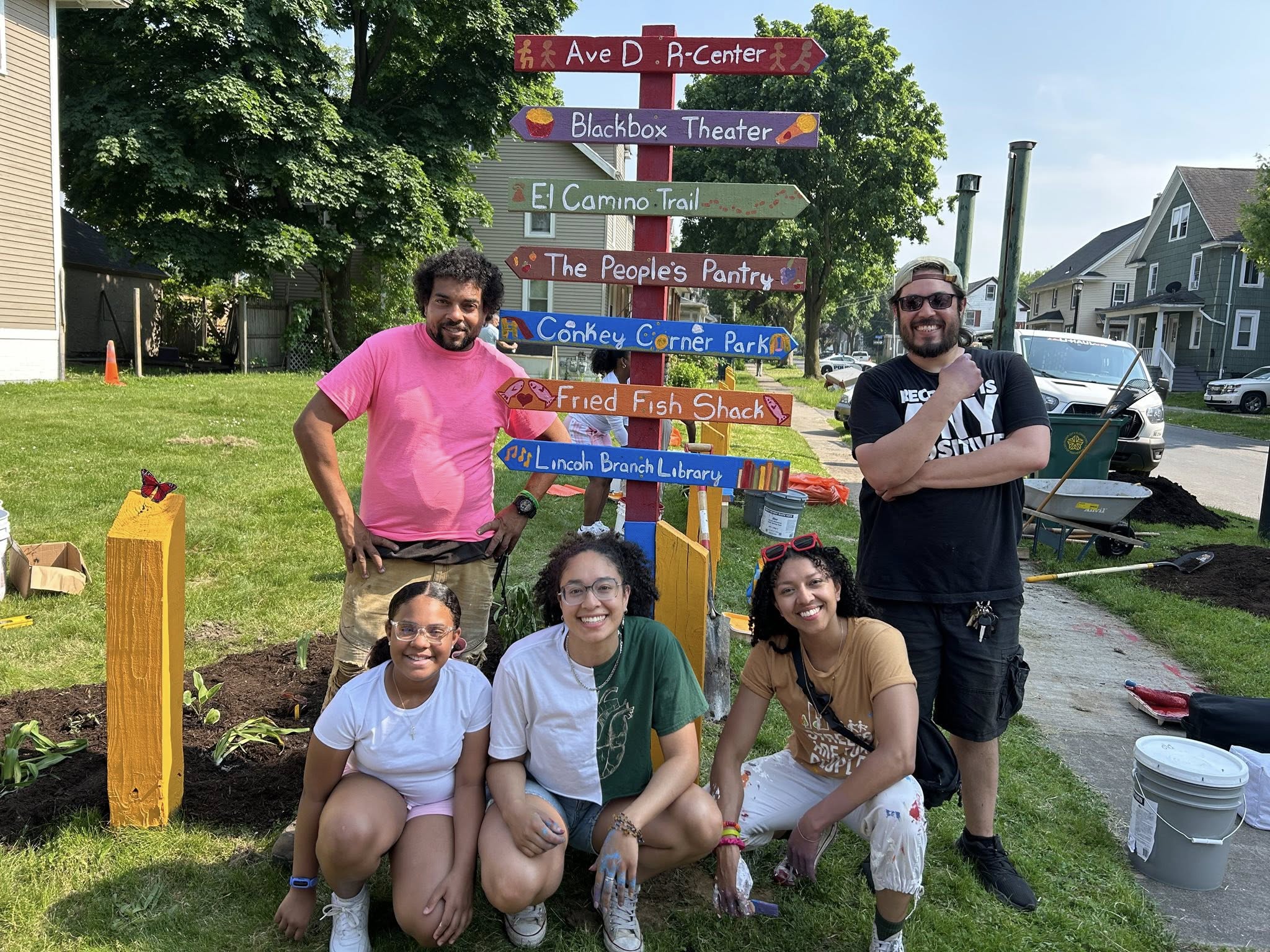
Making the Magic Happen at Avenue D & Hollenbeck
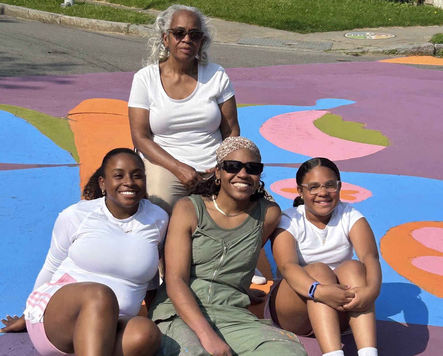
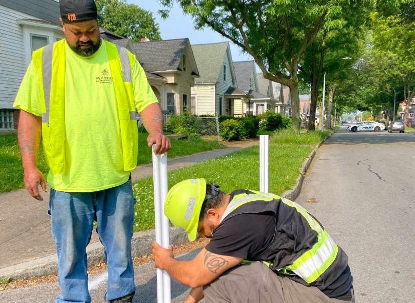
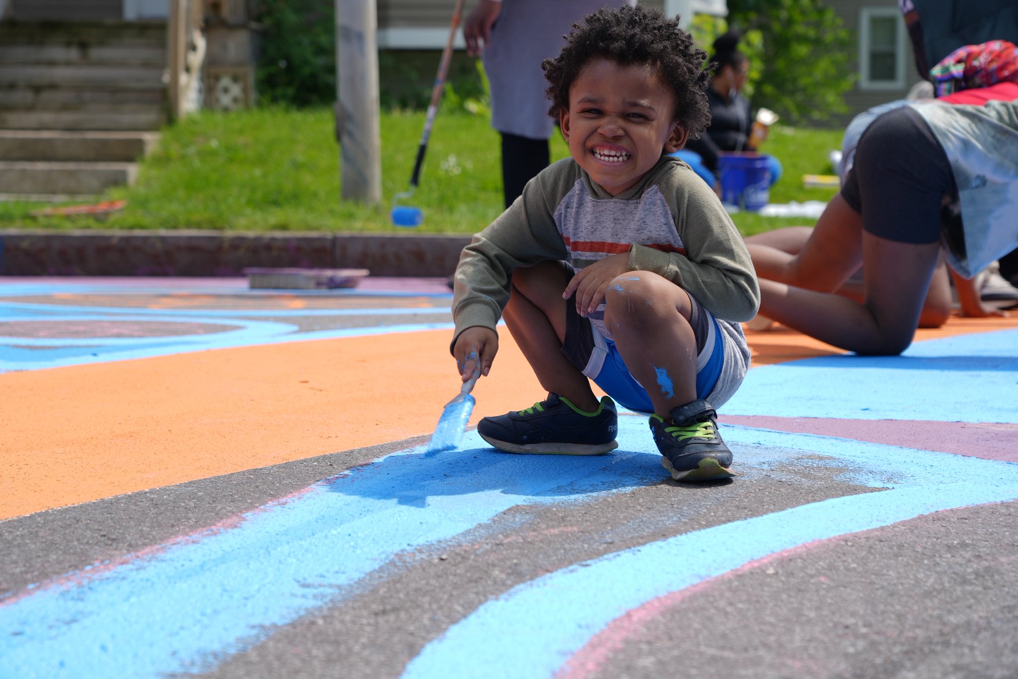
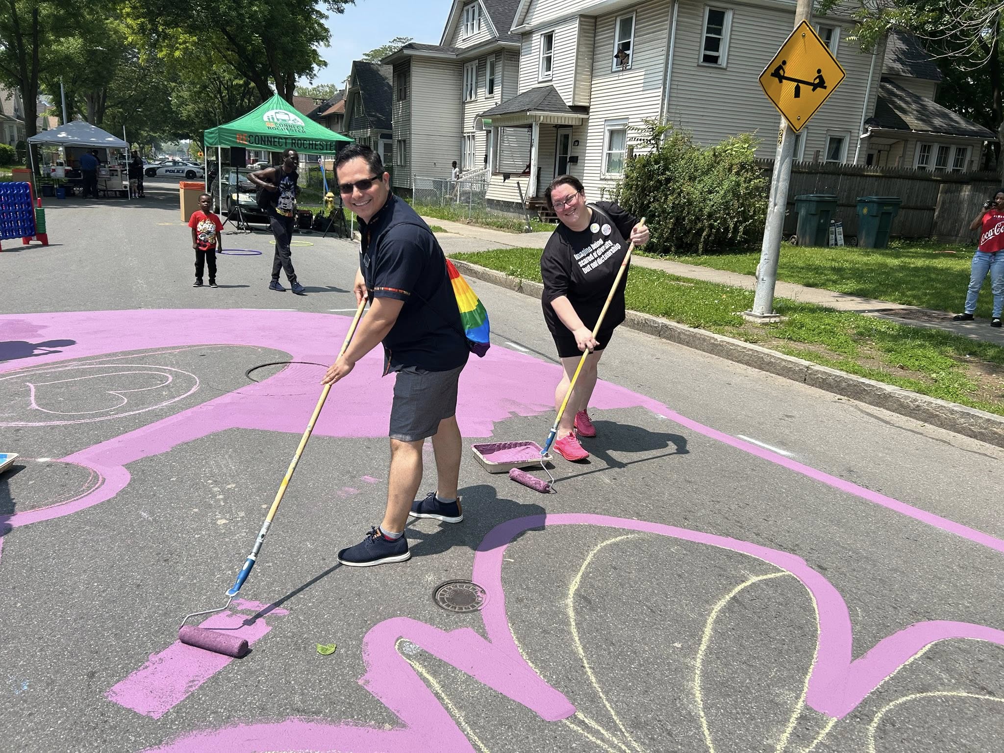
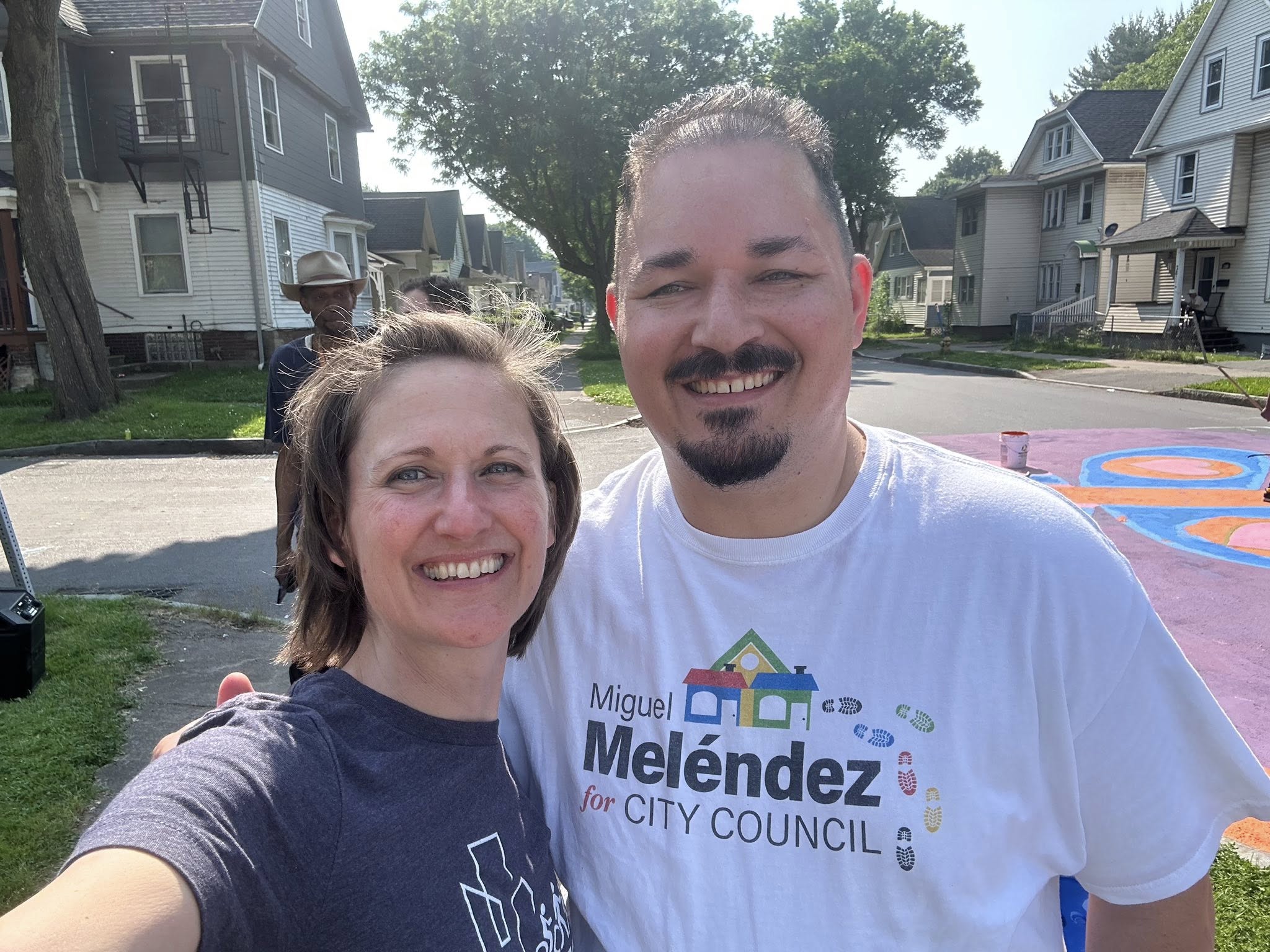
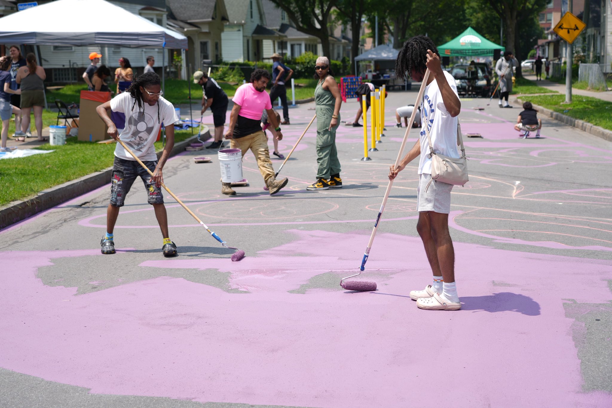
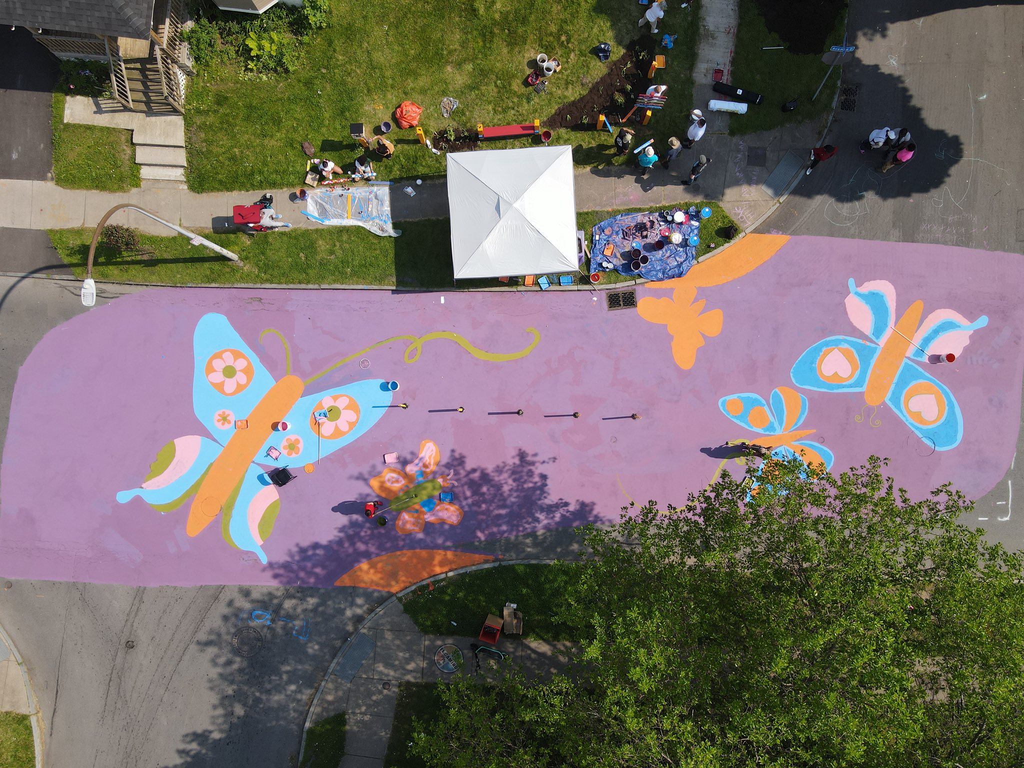
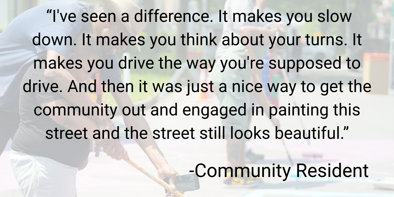
On Saturday, June 7, the street came alive as neighbors, the school community, and community partners* rolled up their sleeves together—painting a vibrant mural (designed by Artist TaQiyya Burrs), setting flex posts in place, and brightening the block with fence art and flower planters in the adjacent empty lot.
We are continually grateful to Floating Home Films, for documenting the transformation and producing a video of the process.
The Impact
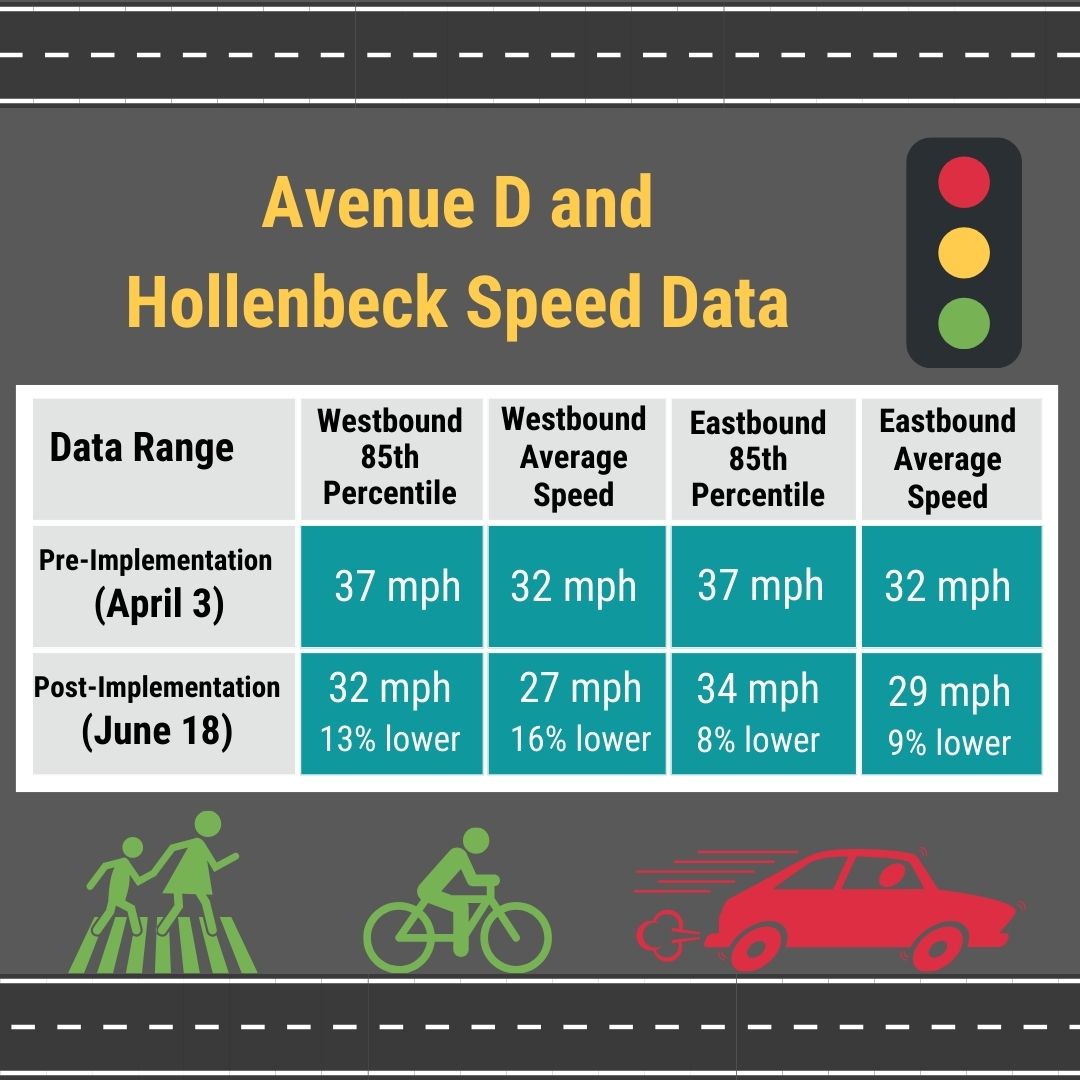
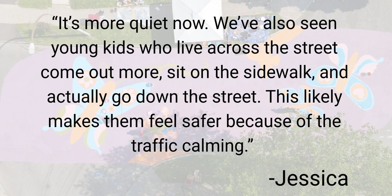
The flex posts have helped to guide drivers on how to safely navigate through the intersection. The butterfly mural helps to reinforce the El Camino neighborhood’s identity while serving as a visible reminder that streets are shared spaces. Pre and post-installation data collection showed that the roadway has seen up to 16% reduction in the average speed off vehicles traveling westbound.
Most importantly, testimonials from neighborhood residents indicated a marked improvement in safe vehicle movement, feelings of safety, and added vibrancy in and around the intersection.
The Complete Streets Makeover of Avenue D & Hollenbeckinspired wide local news coverage:
In collaboration with the amazing neighborhood team, we will continue taking action on long-term advocacy opportunities, working with community partners for as long as it takes to achieve permanent changes to further improve pedestrian safety on Avenue D.
If you have a spot where you don’t feel safe, keep an eye out for our next project when we ask for nominations from the community. In the meantime, make sure to let the county know by filling out their Traffic Safety Concern Form.
*Community Partners
The Complete Streets Makeover of Avenue D & Hollenbeck was a collaborative venture with the following community partners:
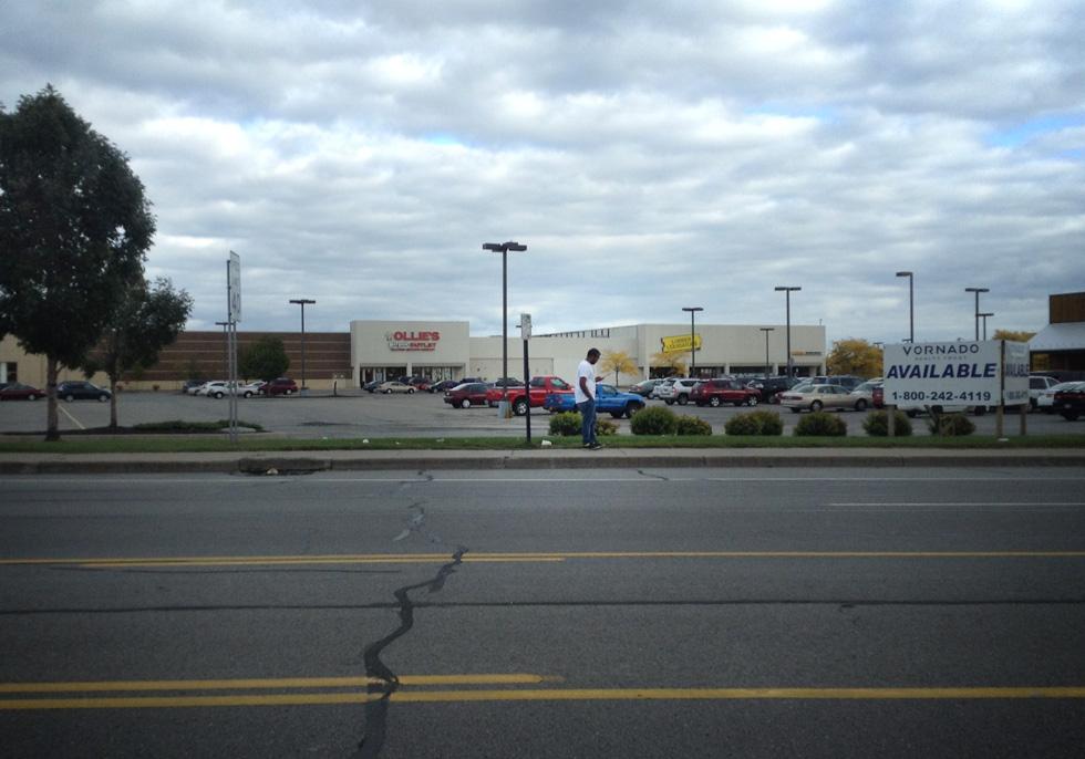
In November 2024, Reconnect Rochester organized a street walk through downtown Rochester with our Community Advisory Committee (CAC) to select locations for the inaugural year of our Downtown SmART Streets program. There were eight possible locations scheduled which met the criteria of high pedestrian volume, safety concerns, and proximity to busy areas.
From these eight locations, our CAC team looked for the two spots that were good candidates for design improvement potential via curb extension murals. The curb extensions are meant to slow down vehicle turns and shorten crosswalks, ensuring pedestrians spend less time in the road—making every step across the street safer. The murals, inspired by Washington DC’s Arts in the Right of Way program, add a splash of creativity while drawing further focus to pedestrian zones.
Without Further Ado, Our Selections!
Why East Main & Gibbs?
Due to its immediate proximity to the Eastman School of Music with all its associated student housing, as well as its adjacency to Rochester’s East End neighborhood, not to mention the half mile walk to the RTS Transit Center or Jazz & Fringe festivals, East Main & Gibbs St would certainly qualify as a pedestrian heavy zone. Car speeds and the width of the road itself show strong potential for design improvement for the numerous daily pedestrians. Plus this intersection is no stranger to on-street art installations.
Why West Broad & Fitzhugh?
Just down the road from Blue Cross Arena, the Rochester Riverside Convention Center, the Genesee River, and local government buildings, West Broad and Fitzhugh is a vibrant area of downtown Rochester with heavy pedestrian traffic which would benefit strongly from safer pedestrian infrastructure. This is a large intersection with ample asphalt, offering an opportunity to optimize space for all road users.
Next Steps…
The design team at GPI is creating renderings for E. Main & Gibbs and W. Broad & Fitzhugh featuring curb extensions. Once the plans are ready, Rochester’s Traffic Control Board will conduct a site review to determine if these proposals get the green light.
We’re now accepting local artist submissions in response to our RFQ to design vibrant murals that will breathe life into the curb extensions. Partnering with local artist Shawn Dunwoody, we’ll select mural design concepts and plan for their seamless implementation. After final approvals from both the CAC and the Traffic Control Board, we’ll gather data on vehicle speeds and pedestrian activity to measure the real impact of these changes.
This temporary on-street project will debut this summer. Keep an eye out for updates!
In August, we asked you to help identify the intersections and trouble-spots in your daily travels where you don’t feel comfortable walking or biking, and that could be designed to be safer for everyone.
A big shout out to all those who took the time to submit a nomination! We received a total of 64 nominations for 39 locations in Monroe County.
Click here to view the nomination locations in Google Maps
Met with such esteemed and thought-provoking submissions, the Steering Committee employed the utmost levels of consideration to determine the winners for this year! After establishing criteria for both the Complete Streets Makeover Winner and the Design Rendering Winner, we reviewed each and every submission with painstaking care.
Without Further Ado, Our Winners!
COMPLETE STREETS MAKEOVER WINNER: Avenue D & Hollenbeck St in the El Camino neighborhood
DESIGN RENDERING WINNER: Webster Ave and Bay St in the Beechwood neighborhood
Why Avenue D & Hollenbeck?
Street redesign potential
High degree of safety concerns showing need for intervention
Strong community support from impassioned residents and community organizations to combat the area’s historical marginalization
We will collaborate with organizations such as the Ave D R-Center, the Northeast Neighborhood Service Center, and Ibero-American Action League to help us capture the spirit of El Camino and transform this intersection in the spring of 2025!
Next Steps…
We’ll hold a Community Workshop in February to gain insight from the residents of the El Camino neighborhood about the enhancements they would like in the intersection. No one understands what it’s like to use our streets better than those who walk, bike, roll, and ride along them everyday.
Our friends in the complete streets design team at Stantec will use community input from the workshop to create conceptual design enhancements of an improved streetscape. We’ll then see these concepts transform into reality through a temporary on-street installation in May. This transformation is only possible through the input and support of neighborhood residents coming out to help with the installation. Keep a look out for updates along the way!
Let’s not forget about our Design Rendering Winner (Webster Ave & Bay St)!
The design team at Stantec will create a conceptual drawing of street design improvements that will be given to the communities surrounding Webster & Bay. The neighborhoods can use these illustrations as a launch pad for community discussion, and a tool to help advocate for changes that would make these streets safer for everyone.
Do you have an intersection where you don’t feel safe? Although our Complete Streets Makeover nominations are closed for the year, you can always fill out the Traffic Safety Concern form from Monroe County to ask for special attention for trouble spots in your daily travels!
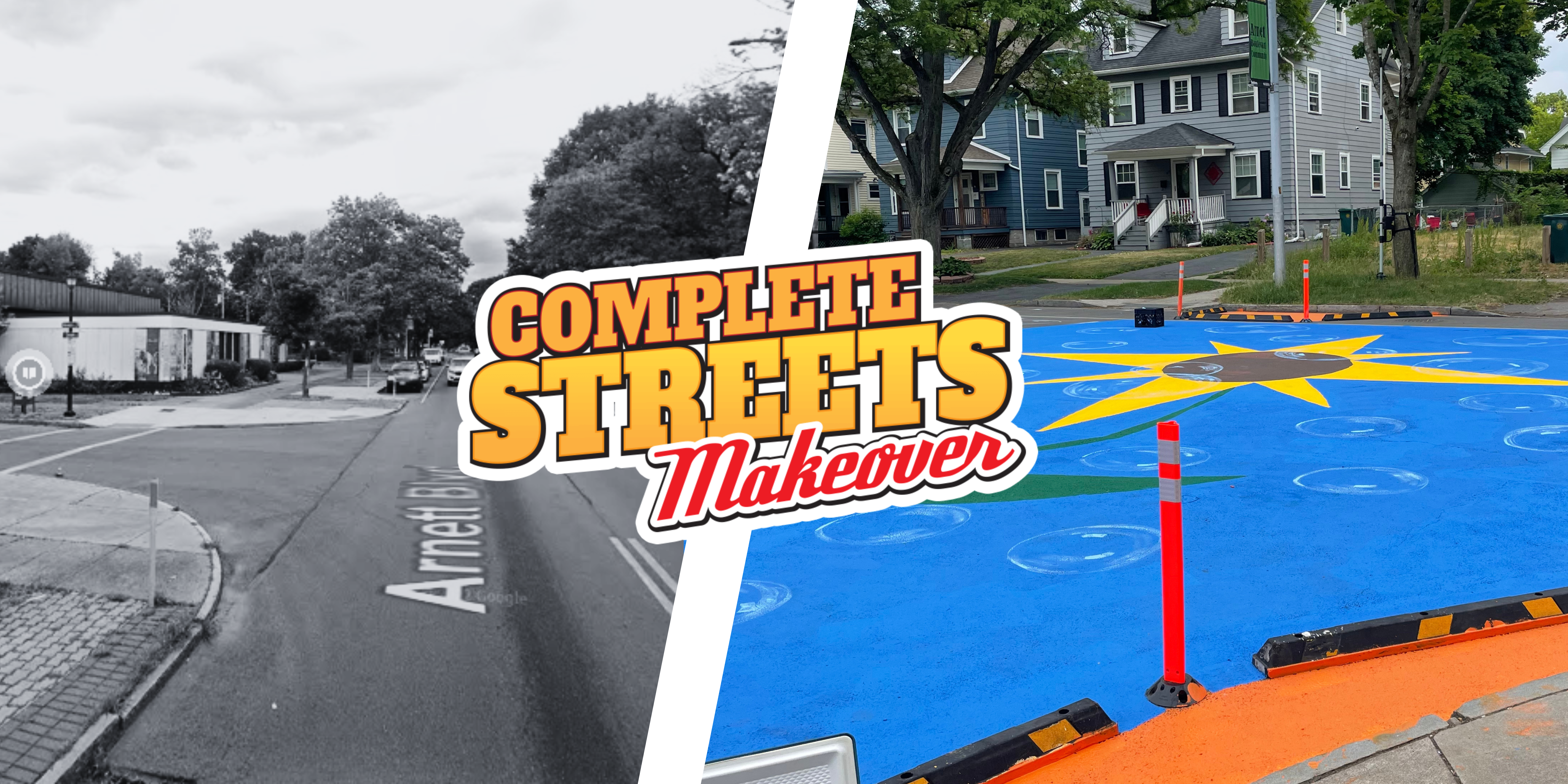
On June 10, Reconnect Rochester and an amazing team of partners came together to transform the intersection of Arnett Boulevard and Warwick Avenue in the 19th Ward. This project was our fourth Complete Streets Makeover, completing our ‘quadfecta’ of a project in every quadrant of the city. Before we dive into how we made the magic happen, let’s remember why this program is central to our work and mission at Reconnect Rochester.
Responding to this growing epidemic was the impetus behind the creation of our Complete Streets Makeover (CSM) program in 2018. Our goal is to bring attention to complete street design as one critical factor in creating streets that are safe for everyone. A “complete street” allows everyone—regardless of age, ability or mode of transportation—safe access on that street. It is a street shared by pedestrians, bicyclists, transit riders and motorists.
“Complete Streets are streets for everyone. Complete Streets is an approach to planning, designing, building, operating, and maintaining streets that enables safe access for all people who need to use them, including pedestrians, bicyclists, motorists and transit riders of all ages and abilities.”
Along Arnett Boulevard in Rochester’s southwest quadrant, 12 crashes with pedestrians and cyclists occurred between 2012-2021 that resulted in serious or traumatic injuries.
Experiencing the harm of this road violence is perhaps what motivated members of the Arnett Block Association to nominate the intersection of Arnett & Warwick for a Complete Streets Makeover. The submission was the most extravagant we’ve ever received, complete with a compelling narrative, stated commitments from neighborhood organizations, and a host of images and videos (check one of them out here) providing evidence and testimony from concerned community members who wanted to see change.
In reviewing this nomination and judging the location by a set of established criteria, our Steering Committee was convinced that Arnett and Warwick presented the right mix of community support, evidence of safety concerns, and had great potential for a street redesign. A Complete Streets Makeover at the intersection would create real, transformative change for the community through this project.
This intersection is also at the heart of a community hub featuring the Arnett Branch Library, the family-owned Arnett Cafe and School #16 right around the corner. Because of the proximity to kids, there was an emphasis on improving safety for children and families, the community’s most vulnerable road users.
Gathering Community Input
We kicked off the project with a community workshop in February 2023 at the Arnett Branch Library Community Room. Over 40 community members came out to share their experiences, identify the issues that they have seen along this corridor, and offer their ideas and solutions to improve safety and create a welcoming space.
Common issues identified by the community included: lack of crosswalks across Arnett Boulevard, frequent speeding, and low visibility of cars for pedestrians.
Common solutions identified by the community included: installing crosswalks, curb bumpouts, more signage and installing beautification features and pedestrian infrastructure including benches and planters.
The Stantec Team provided a map and transfer paper so that community members could draw street design elements and solutions.
Following the workshop, the Stantec team got to work creating a rendering that would reflect the community’s input, and bi-weekly meetings with a core group of neighbors commenced to begin planning for the many aspects of the event: the street mural, food, music, a parklet outside of the library, and other placemaking elements. The community identified neighborhood artist Richmond Futch Jr. to lead the design and implementation of the street mural which would become a focal point of the project and a crucial design element to capture the attention of drivers and encourage them to slow down.
Richmond’s initial design of the street mural:
Stantec’s design rendering incorporating Richmond’s design and the community’s input:
You can imagine that at this point during the process, there was a lot of excitement and energy looking forward to the day of the event where we would bring this all to life.
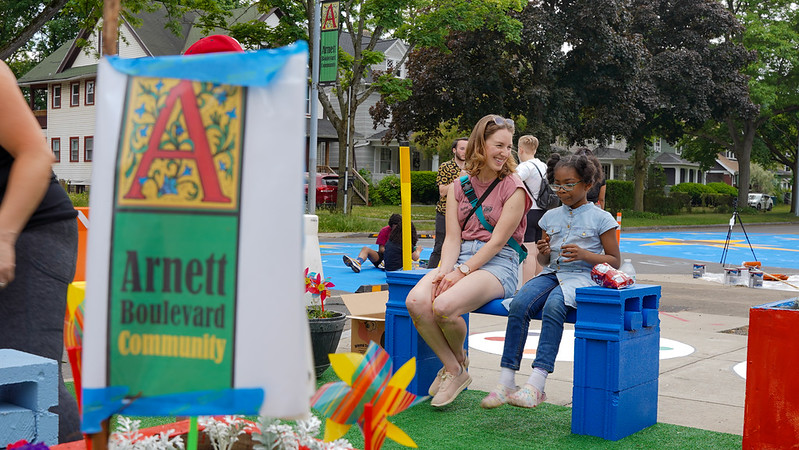
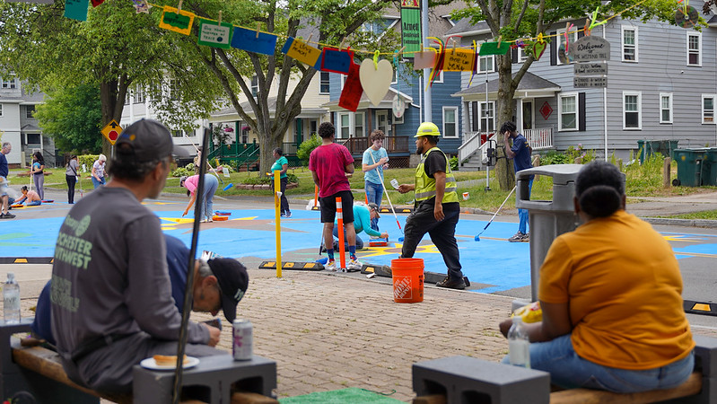
Making the Magic Happen at Arnett & Warwick
After much planning, over 100 people came out to Arnett & Warwick on June 10 to make the magic happen! Attendees were made up of people from the neighborhood, youth organizers and leaders from The Center for Teen Empowerment, children from School No. 16, and a team of community partners*. Together, we worked to make the intersection of Arnett Blvd and Warwick Avenue a more vibrant, safer place for everyone.
Design elements to calm traffic and improve safety included curb bump outs with bollards to slow cars turning onto Warwick or Arnett, and a street mural. Other elements to beautify the space included:
A wishing tree where community members can leave positive messages to uplift others
Flower planters made from repurposed bus stop cubes
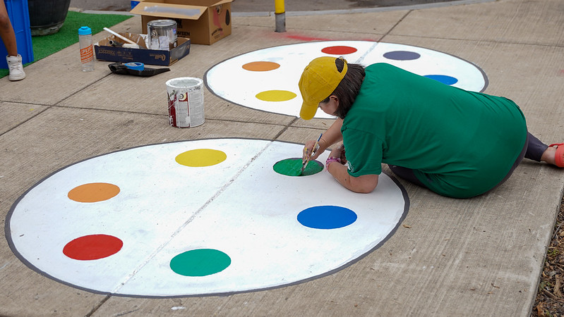
A built out parklet that used a parking space in front of the Arnett Branch Library and transformed it into a kid-friendly space with colorful benches, turf, a copycat Simon Says game and hopscotch.
Nothing captures the life of a project better than film. Reconnect Rochester is pleased to share this short film, produced by Floating Home Films, that tells the full story.
But did it make a difference? YES! Data collected before and after the implementation (April and July, respectively) shows a measurable decrease in vehicle speeds along Arnett & Warwick.
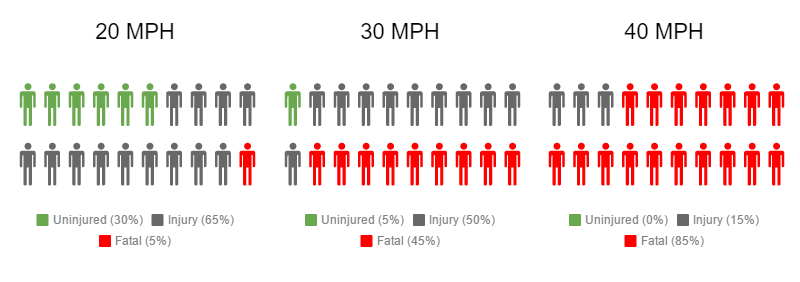
After implementation, the 85th percentile speed (the speed that 85% of vehicles travel at or below) declined 9% and the average speed declined 10%. When it comes to speed, each mile-per-hour a driver is traveling makes a difference for pedestrian and cyclist safety, and can be the difference between life and death or a person sustaining life altering injuries.
The City of Rochester has already approved a permanent crosswalk for the intersection as a direct result of this project, so the neighborhood can look forward to that coming soon!
Looking Ahead
Our awesome team is taking one year off in between projects, but we’ll be back in mid-2024 with a public call for submissions, so keep taking note of the intersections and trouble spots you experience in your daily travels that could use a Complete Streets Makeover! Together, we’ll keep advocating to design our streets for people, and we’ll keep making it happen one intersection at a time.
Community Partners
The Complete Streets Makeover of Arnett & Warwick was a collaborative venture with the following community partners:
and,
Richmond Futch, Jr., 19th Ward Neighborhood Artist
Amy Schramm, School 16 Art Teacher
Funding Support
This project is supported with funding provided by ESL Charitable Foundation, The Community Foundation, Genesee Transportation Council, and New York State Department of Health’s Creating Healthy Schools and Communities initiative.
As we report out on the third successful Complete Streets Makeover project, let’s remember why we do this.
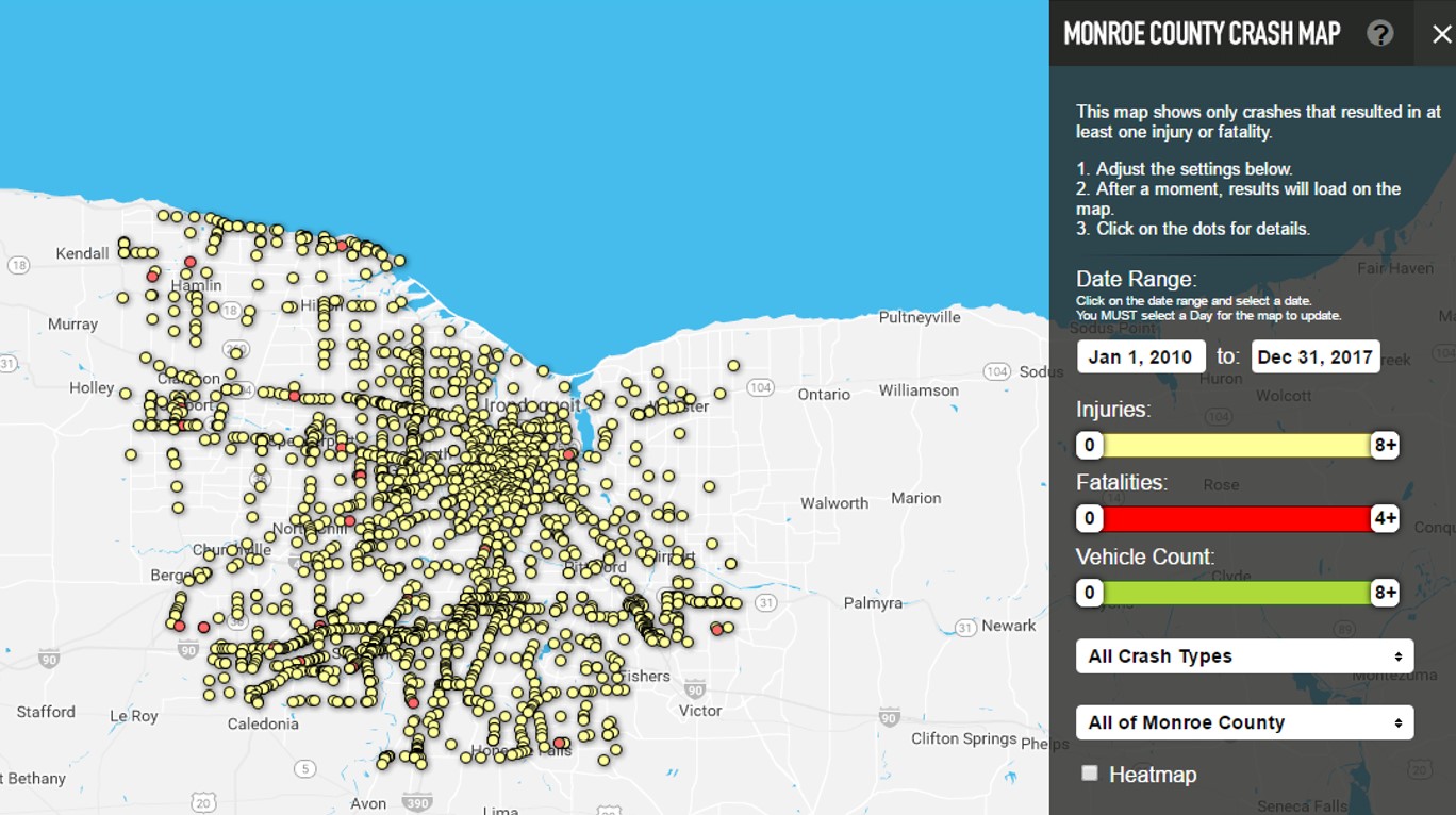
In the U.S., pedestrian fatalities have skyrocketed, increasing by 59% from 2009-2020. According to the latest “Dangerous By Design” report, between 2009-2020, drivers struck and killed 64,073 pedestrians in this country. Here in Monroe County, from 2012-2021, over 5,000 crashes involved bicyclists and pedestrians, and ten people die on our local streets every year as a result of these crashes.
Responding to this growing epidemic was the impetus behind our Complete Streets Makeover project, created to bring attention to street design as one critical factor in the safe streets equation.
The Selection Process
We began this year’s project back in July 2021 by asking you (the people that walk, bike, and roll along our streets every day) to help identify the intersections and trouble spots where you live, work and play that could be redesigned to make them safer for everyone. The community response was tremendous, and we received a total of 76 nominations for 68 locations in Monroe County.
From these submissions, our Steering Committee selected the intersection of Orange Street & Orchard Street in the JOSANA neighborhood for this year’s project.
The Steering Committee hard at work
The Orange & Orchard location presented the right mix of community support, evidence of safety concerns, and potential for a street redesign that would create real, transformative change for the community through this project. School 17 is located right at this intersection and was a strong advocate for implementing change. Last fall, the Rochester City School District eliminated the Walker-Bus Program that had provided transportation for students living within 1.5 miles of their school, which contributed to the school’s desire to improve safety for its walkers.
Getting Community Input
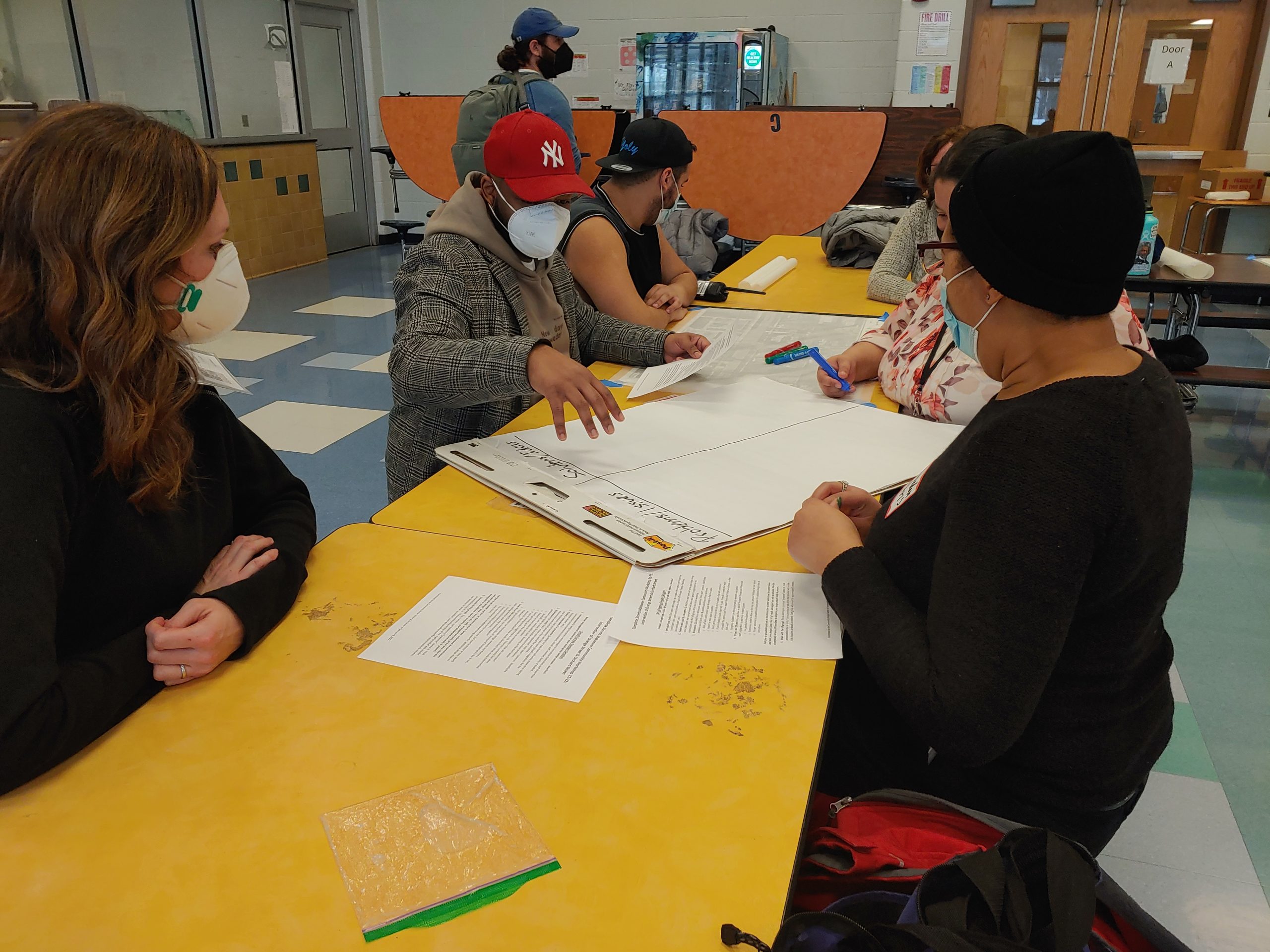
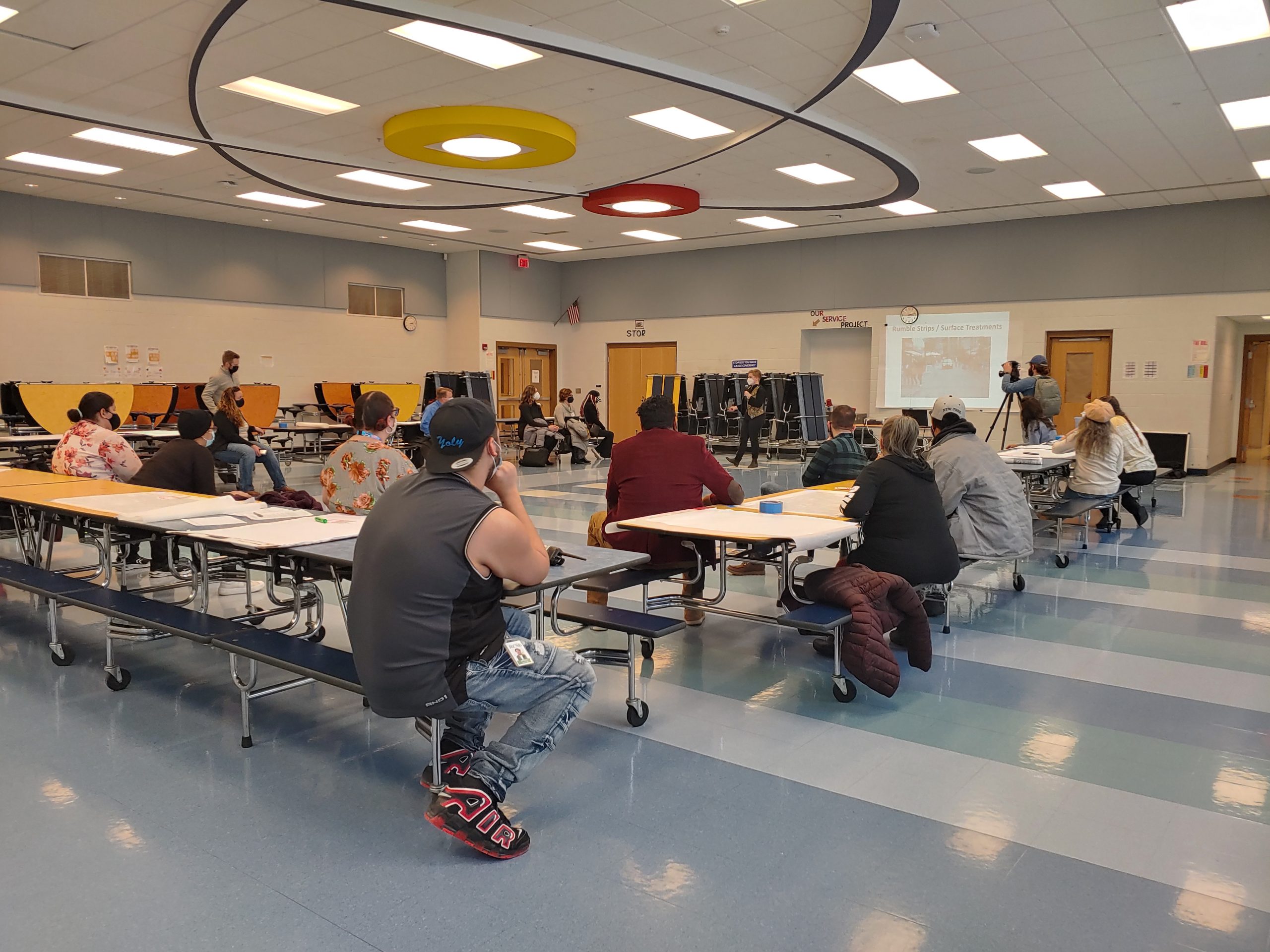
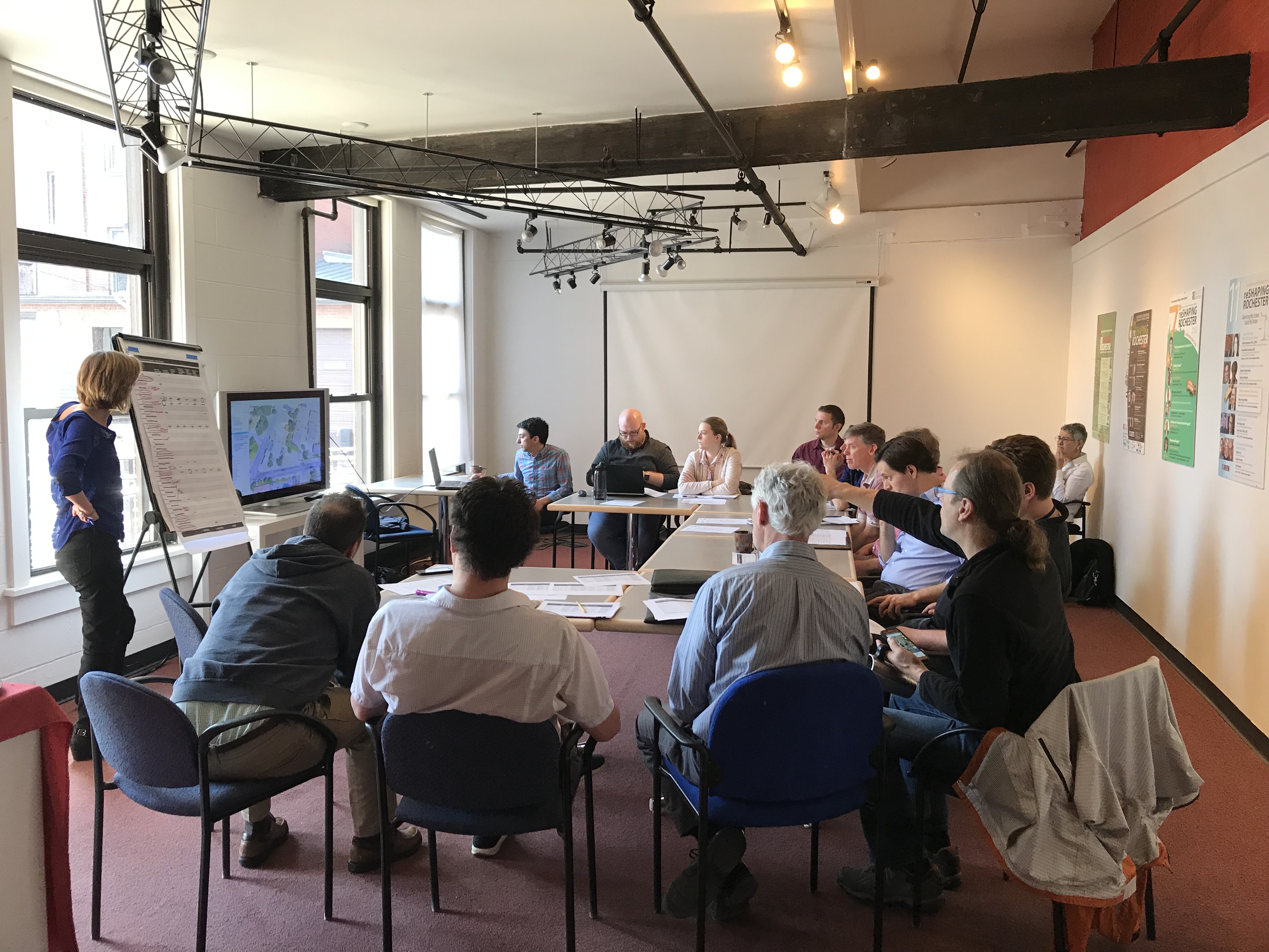
So what happened next? We connected with representatives of School 17 and the JOSANA neighborhood, and together we planned a community workshop held in February at the school. We invited school families and residents to come share their experiences at this intersection and ideas for how it could be safer. At the workshop, which was facilitated by the Community Design Center of Rochester-CDCR, attendees were first led through the basics of road safety statistics and complete streets. Then, CDCR volunteers helped translate the community’s thoughts and desires into actionable design elements that would improve the intersection.
Community Workshop at School 17 on February 9, 2022
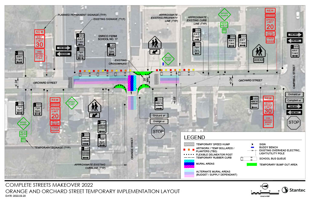
Based on community input from this session, the Stantec team drafted a conceptual drawing of street design improvements. Their rendering focused on elements that could be brought to life in the temporary, on-street installation and then translated into permanent improvements.
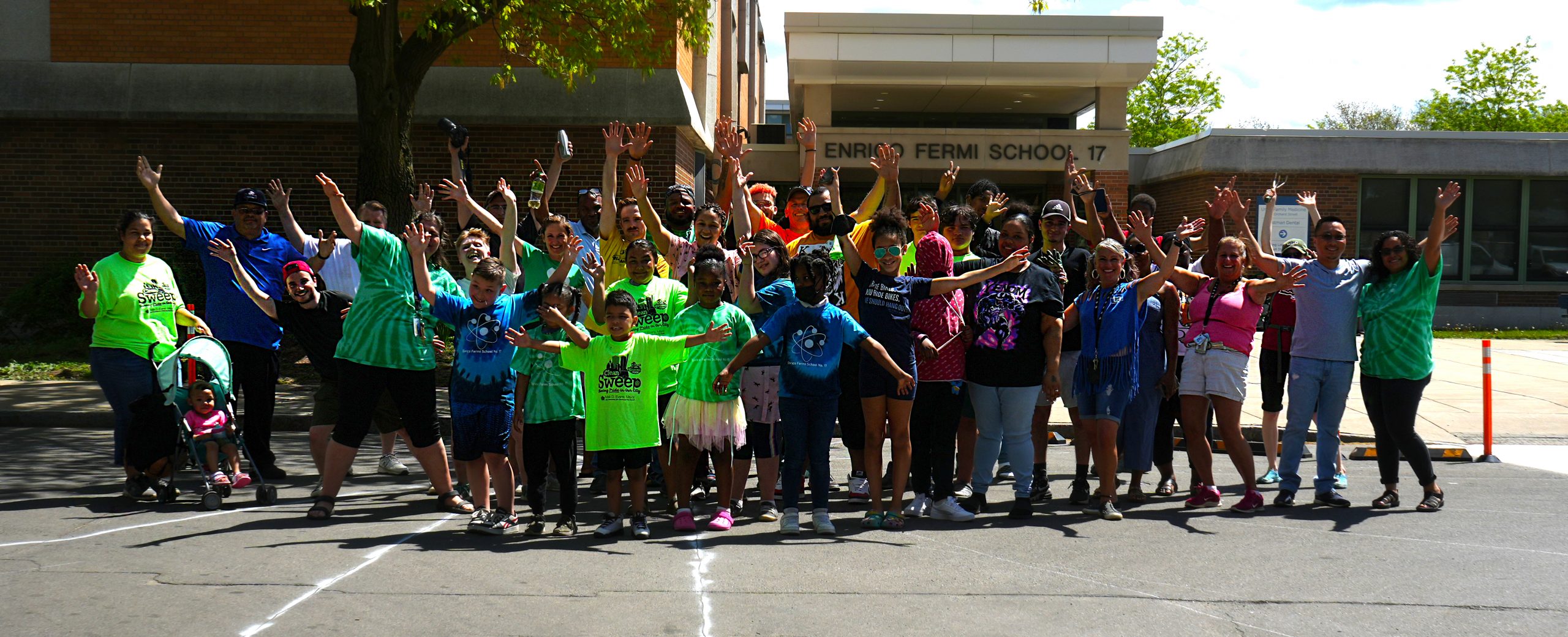
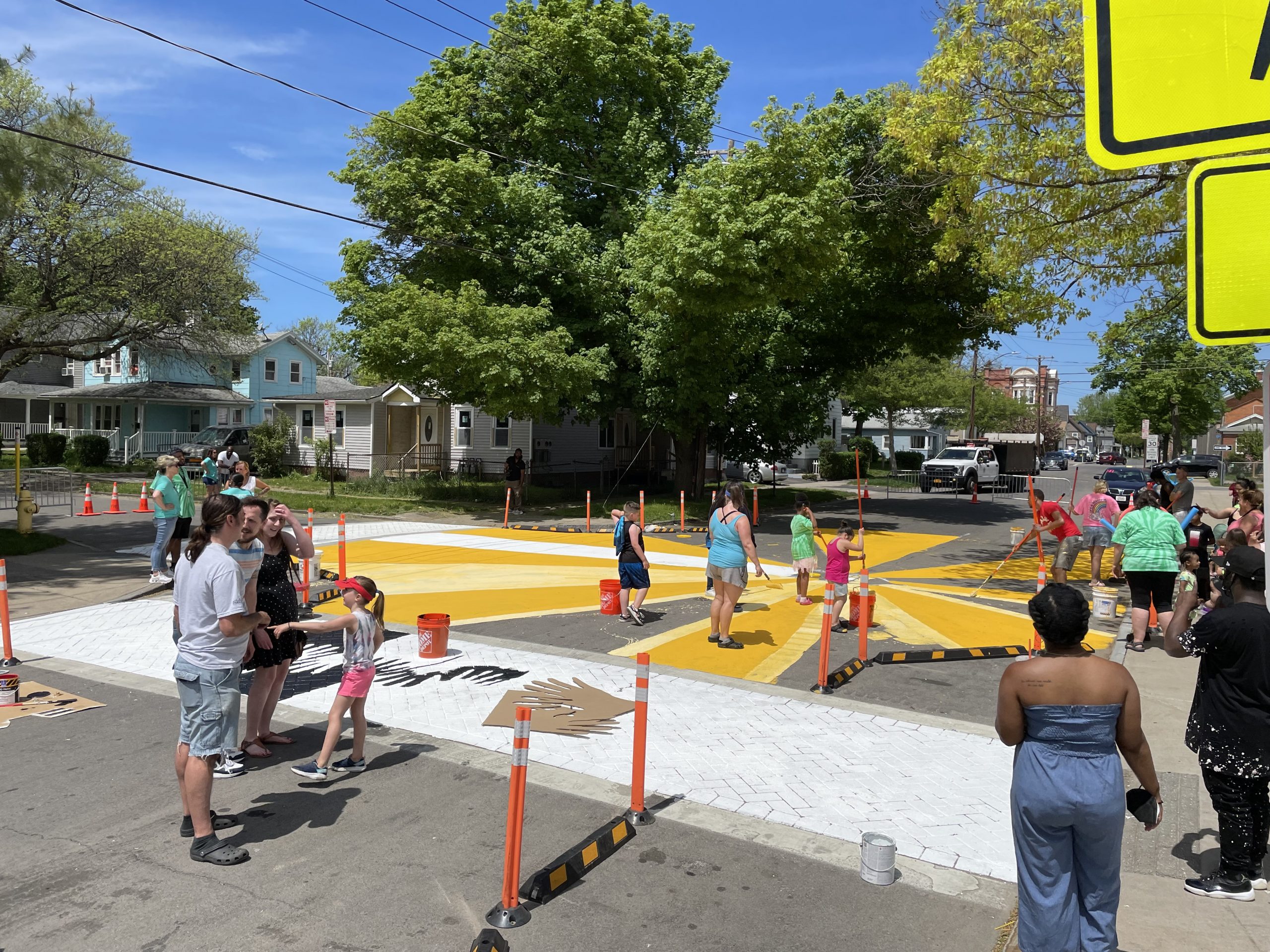
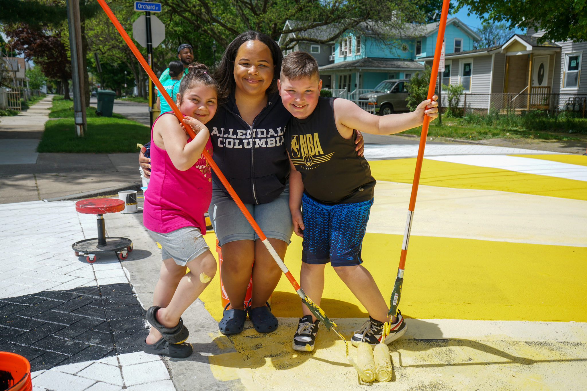
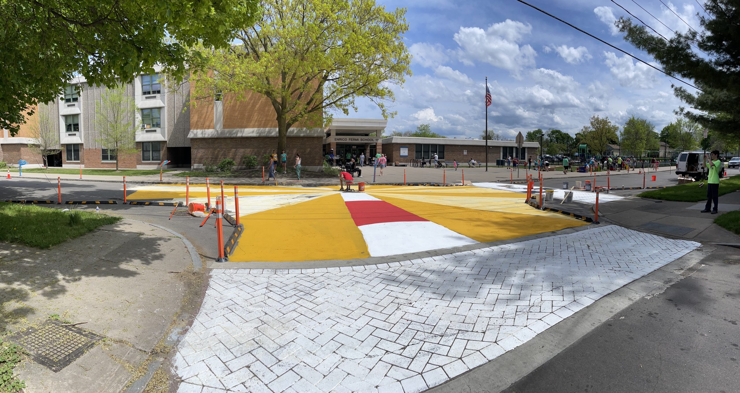
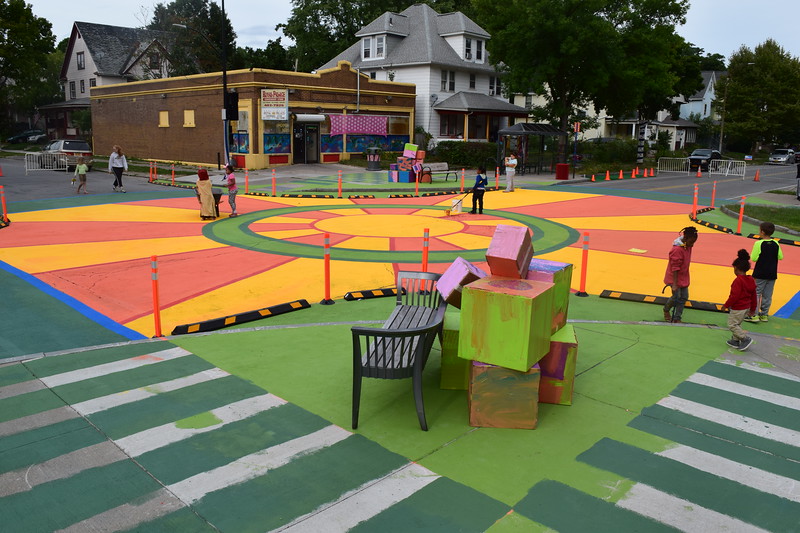
Making Magic at Orange & Orchard
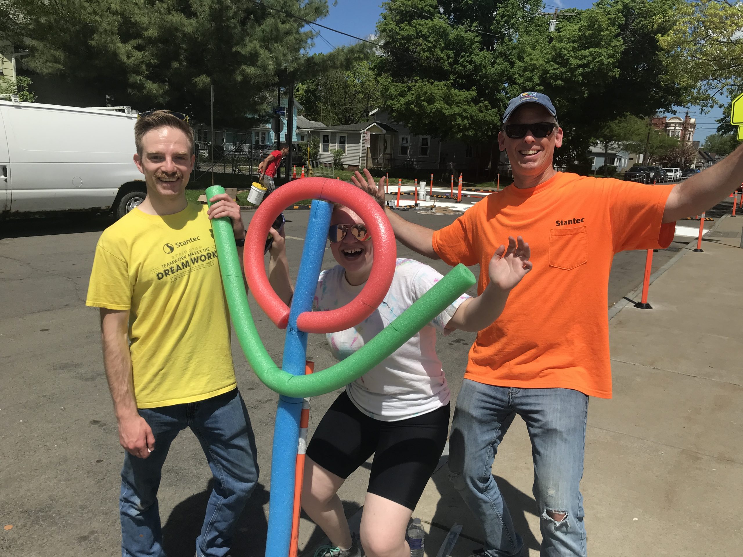
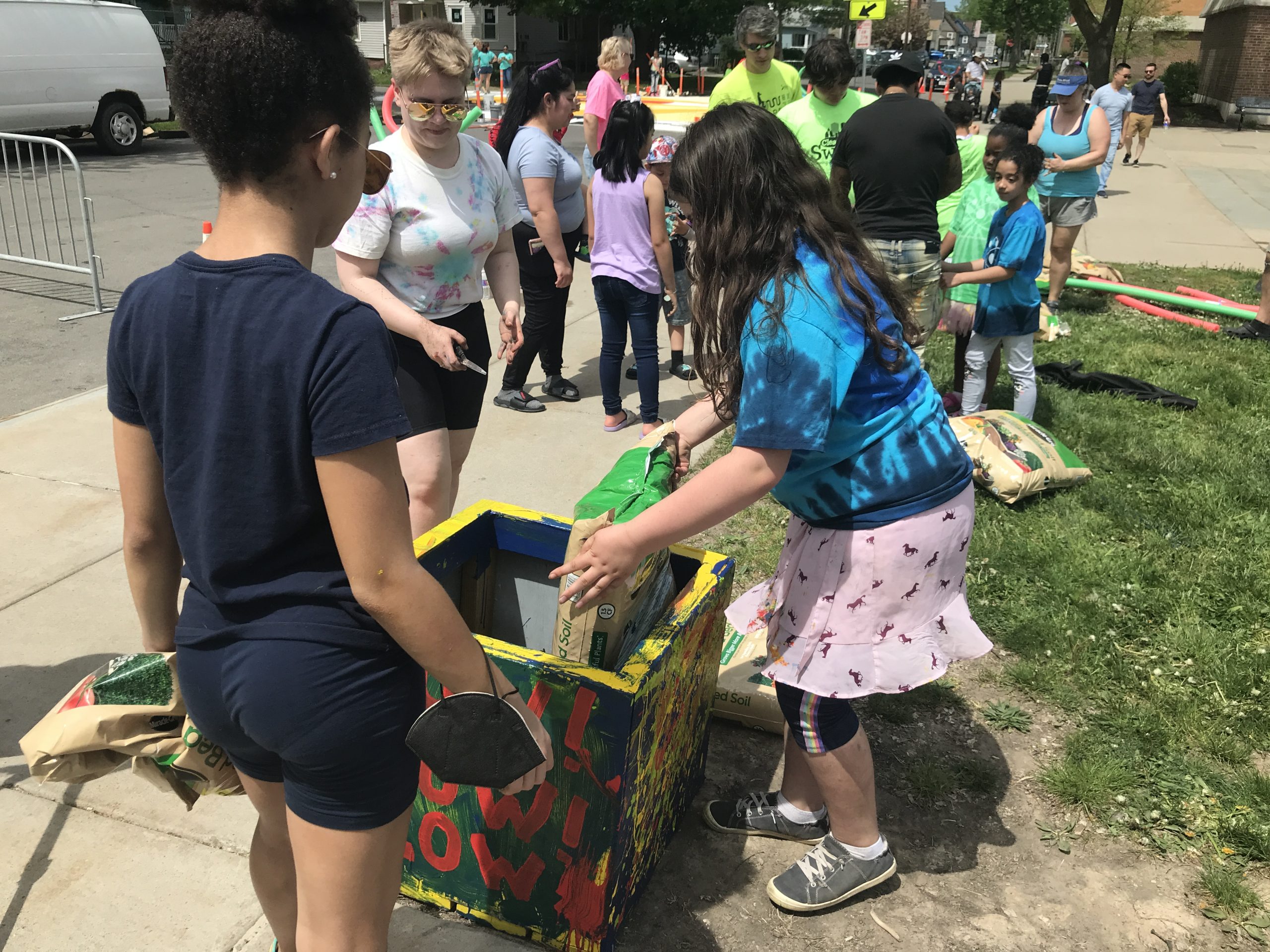
After much planning with the JOSANA neighborhood, over 150 people came out to Orange & Orchard on May 14 to make the magic happen! Attendees were made up of people from the neighborhood, school community, and a team of community partners*. Together, we worked to make the intersection of Orange Street & Orchard Street a more vibrant, safer place for everyone.
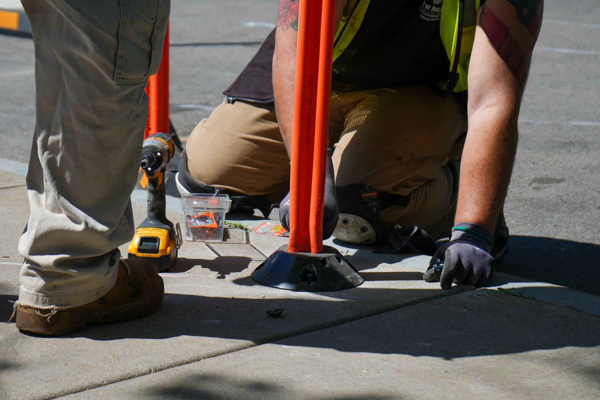
Design elements to calm traffic and improve safety included enhanced signage, curb extensions, temporary speed cushions, and a street mural designed by local artist Shawn Dunwoody. The temporary design was created by Stantec, which donates pro bono professional engineering services for the project. Other elements to beautify the space, like fence art and flower planters, were done with help of 2nd graders as part of their class project.
Nothing captures the life of a project better than film. Reconnect Rochester is pleased to share this short film, produced by Floating Home Films, that tells the full story.
We hope you enjoyed watching a beautiful display of community! We will continue supporting the neighborhood in their effort to make these temporary street design improvements permanent.
Complete Streets Makeover On-street Installation on May 14, 2022 Photos 1 & 5: Stantec | Photos 2 & 3: Common Ground Health | Photos 4 & 6: Reconnect Rochester
The Impact
But did it make a difference? YES! Data collected before and after the implementation (April and July, respectively) shows a measurable decrease in vehicle speeds along Orchard Street. Let’s get specific.
Since the implementation, the 85th percentile speed (the speed that 85% of vehicles travel at or below) declined 28% and the maximum speed declined 26%. It’s worth noting that the maximum recorded speed in July happened between 1:15am and 1:30am. Other than that outlier, the maximum speed was only 32 mph! Even the average speed dropped 20%, despite there being no school in July. This is particularly notable with the safe assumption that arrival/dismissal congestion suppressed the speed of a great deal of traffic during our April data collection. Finally, the speed data showed only 13 of 1,017 vehicles were traveling over 25 mph.
When it comes to speed, each mile-per-hour a driver is traveling makes a difference for pedestrian and cyclist safety, and can be the difference between life and death or a person sustaining life altering injuries.
Our awesome team is on board to continue our Complete Streets Makeover program in 2023 and beyond! So keep taking note of the intersections and trouble spots you experience in your daily travels that could use a re-design, and keep an eye out for calls for public submissions. Together, we’ll keep advocating to design our streets for people, and we’ll keep making it happen one intersection at a time.
*Community Partners
The Complete Streets Makeover of Orange & Orchard was a collaborative venture with the following community partners:
In July, we asked you to help identify the intersections and trouble-spots in your daily travels where you don’t feel comfortable walking or biking, and that could be designed to be safer for everyone.
The community response was tremendous, and we thank all those who took the time to submit nominations! We received a total of 76 nominations for 68 locations in Monroe County.
Click here to view the nomination locations in Google Maps
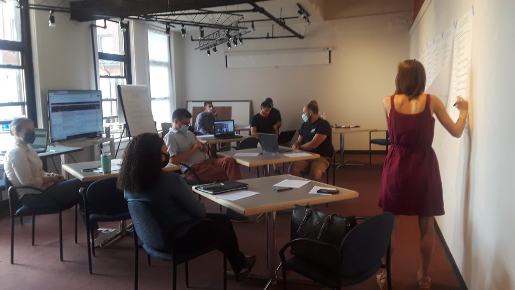
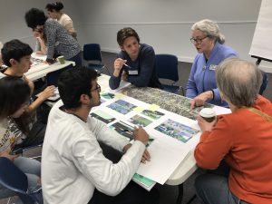
The Steering Committee had a tough task to choose from so many quality submissions and deserving locations! A set of established judging criteria helped guide us through the selection process. Here we are, hard at work examining each and every submission:
So What’s the Good Word?
In the end, we selected the following locations as this year’s winners:
COMPLETE STREETS MAKEOVER WINNER: Orange Street & Orchard Street in the JOSANA neighborhood
CITY DESIGN RENDERING WINNER: Arnett Boulevard between Genesee Street & Warwick Avenue in the 19th Ward neighborhood
SUBURBAN DESIGN RENDERING WINNER: Monroe Avenue between Highland Avenue & 12 Corners in the Town of Brighton
Orange & Orchard in the JOSANA Neighborhood will be the focus of our on-street installation
The Orange & Orchard location presented the right mix of community support, evidence of safety concerns, and potential for a street re-design that would create real, transformative change for the community through our project. We are eager to get to work with the families at School 17, Charles House Neighbors in Action, the Americorp Vista team, and JOSANA neighbors on a project to transform the intersection and create a safer space for the community.
The Steering Committee also selected two Design Rendering Winners. These locations might not be suitable for the on-street makeover project (because of their size or other feasibility issues), but we want to highlight them as places where the community would like to see improvements made.
What Happens Now? Let’s start with our Complete Streets Makeover Winner.
The Complete Streets Makeover will kick off with a community input session in January (facilitated by the Community Design Center) to hear from the residents of the JOSANA neighborhood about their experiences and ideas. No one understands what it’s like to use our streets better than those who walk, bike, roll, and ride along them everyday.
2019’s community input session in the El Camino neighborhood.
Based on feedback from this session, the complete streets design team at Stantec will draft conceptual design improvements of an improved streetscape. The design will be brought to life through a temporary on-street installation in May. We will rely on people power from the neighborhood community, and equipment from the Healthi Kids traffic calming library to lay down the temporary design on the street. Stay tuned for project updates as we go along!
What About the Design Rendering Winners?
The design team at Stantec will provide each of our Design Rendering Winners with a conceptual drawing of street design improvements. The neighborhoods can use these illustrations as a launch pad for community discussion, and a tool to help advocate for changes that would make these streets safer for everyone.
Arnett Blvd between Genesee St & Warwick Ave
Monroe Ave between Highland Ave & 12 Corners Plaza
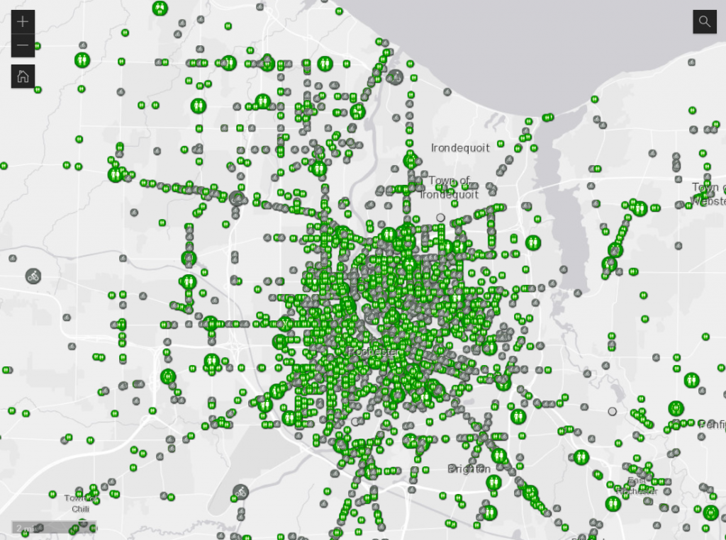
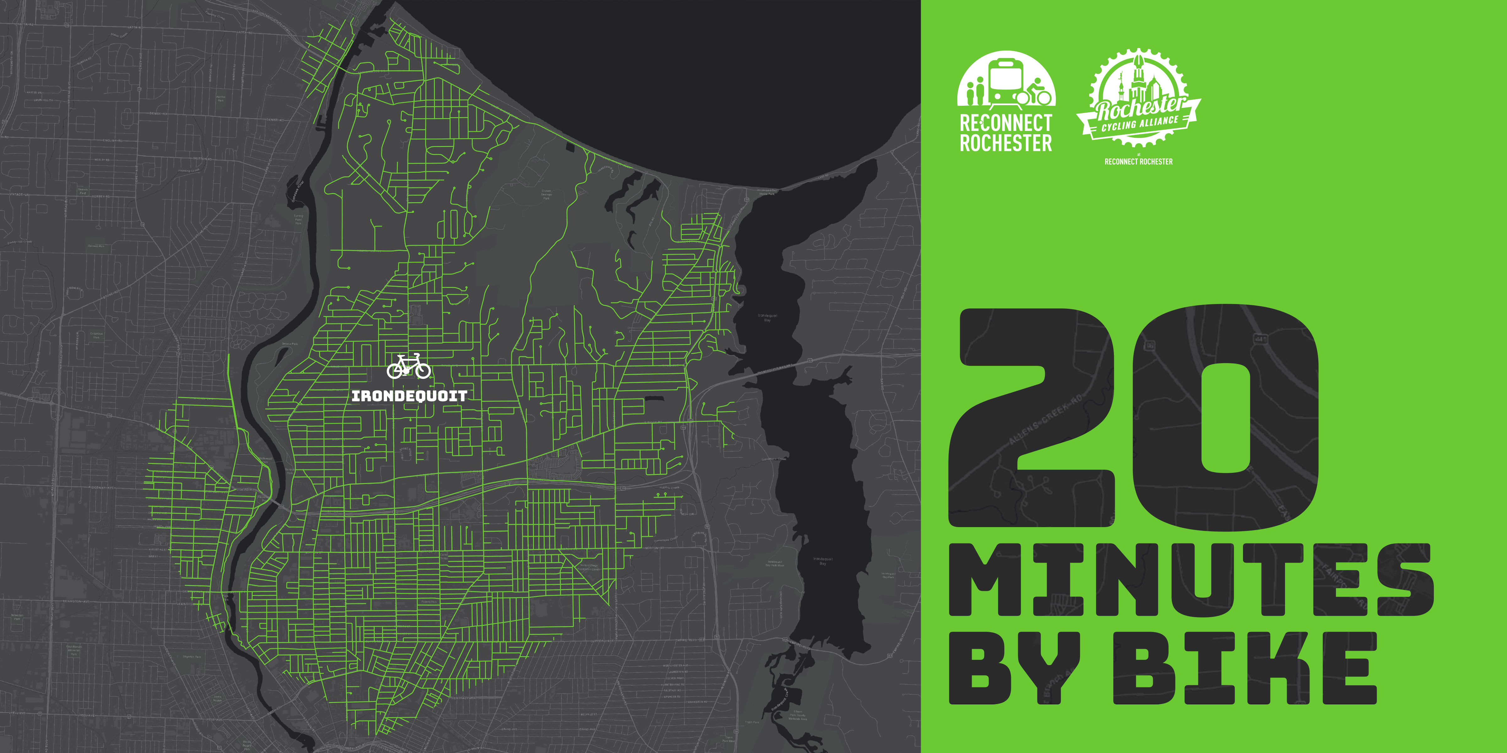
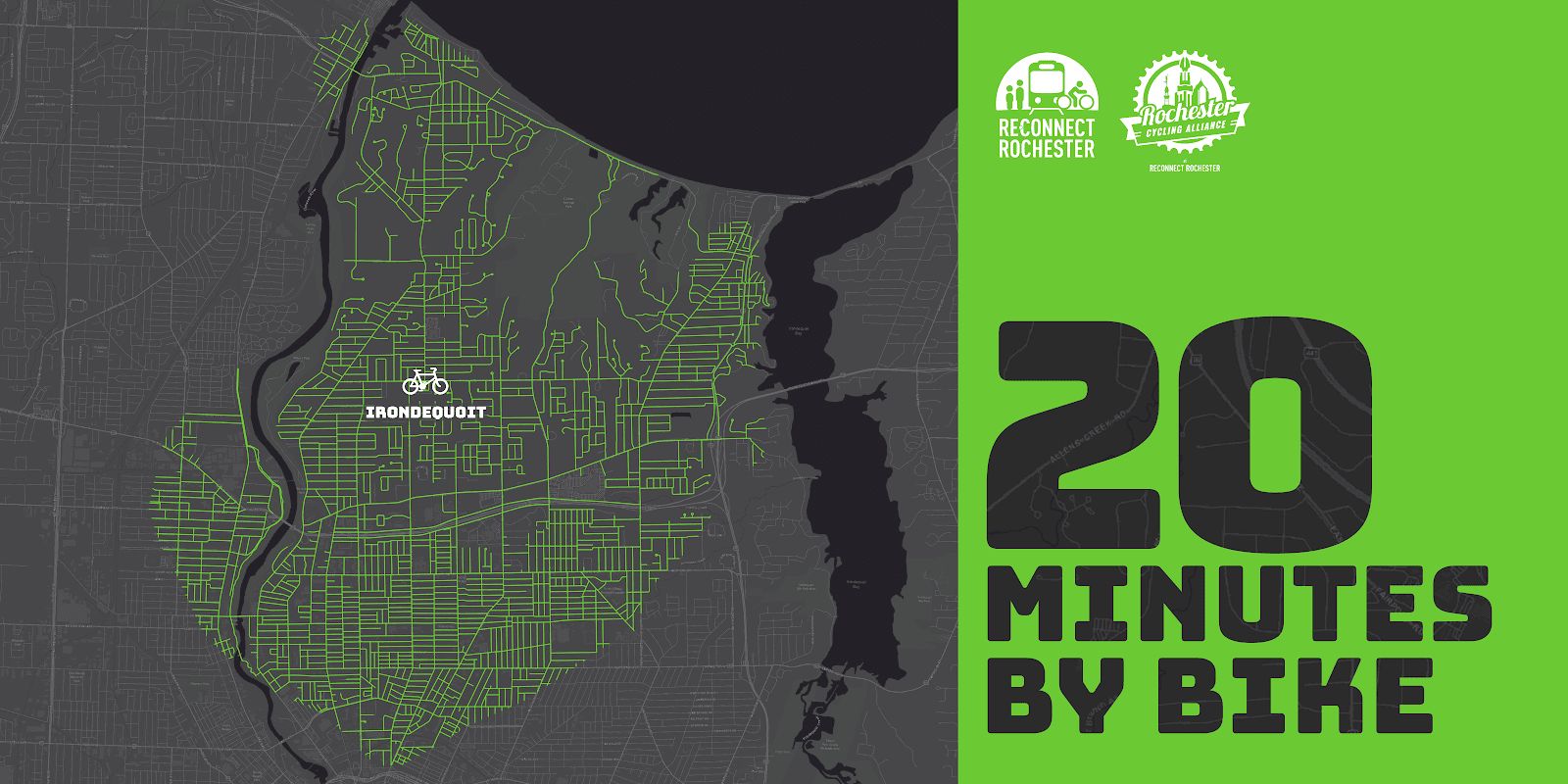
The Rochester area is famous for its 20-minute commute. For driving that is. Reconnect Rochester and the Rochester Cycling Alliance are excited to ask a different question in this blog series: Where can you get within 20 minutes on a bike?
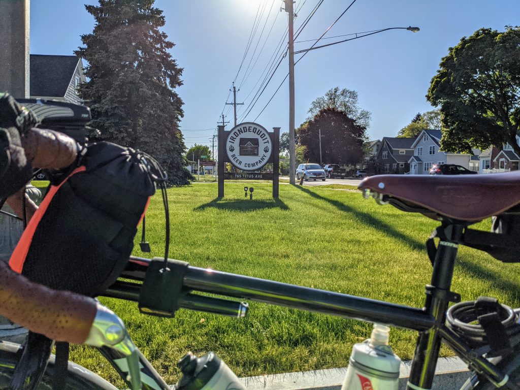
Presenting the second in a series of custom “bike shed maps.” For this next installment, we chose Irondequoit’s “central square” – I-Square – and are showing how far out in every direction you can get on a bike at a casual but steady pace of 10 miles per hour. This means that if you live anywhere in this green area, you can get to I-Square within 20ish minutes on a bike. Thanks again to Brendan Ryan and Mike Governale for their help putting these maps together for us.
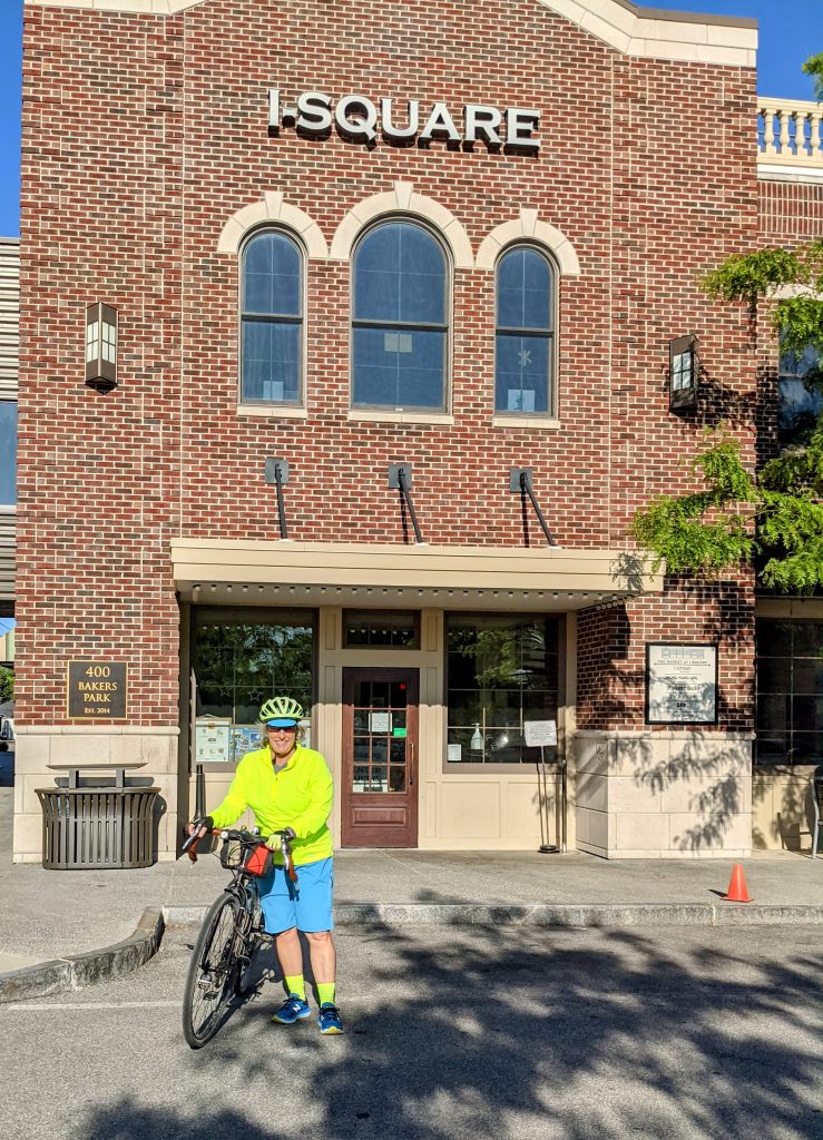
To get us familiar with this green territory in Irondequoit, here’s Pam Rogers sharing her personal travel-by-bike experiences.
Introduction
I’m so excited to share with you my personal recommendations for cycling in my favorite area of Rochester, which also happens to be my local neighborhood! Forgive me if it turns out to be an homage to Irondequoit, but it’s my way of letting you know all the best reasons to find yourself cycling here.
If you’re looking for places to ride, no matter what kind of cycling you enjoy, you’ll find something to love here in Irondequoit. It’s full of hills and flats, roads and trails, natural beauty, local history, family fun, and great places to stop and rest for food and drink. Whatever you’re looking for, it can be found between the shores of the Genesee River, Lake Ontario, and Irondequoit Bay!
How To Ride Here
The best route into town are as follows:
From the Northwest – the LOSP trail that follows along the parkway is the best, and it drops you out right by Pattonwood Dr and will take you over the river and into Irondequoit.
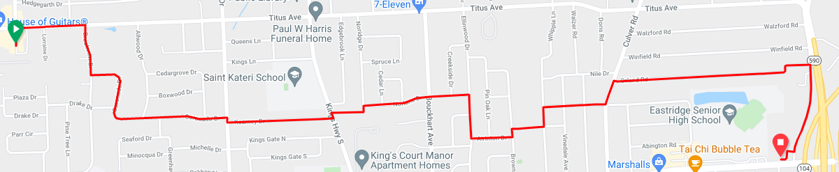
From the Southwest city environs – come on up St Paul St and then hop on the El Camino Trail that begins at Scrantom St and takes you north all the way up to Navarre Rd and across from the Zoo entrance – you’ll love the old railroad bridge that takes you over 104 without worry
From the Northeast – Well, when the swing bridge is available it’s easy peasy, but when it’s not you’ll need to approach from the south of the Bay and come around by way of Empire Blvd. Yes, busy with traffic and a very challenging hill to climb – bail out as soon as you can, on Orchard Park Blvd, if you don’t mind a few more hills to climb with a bay view, and then follow Bay Shore Blvd to get you to Ridge Rd and turn right at Kane Dr before it ever gets busy, that will take you right up to Sea Breeze Dr!
From the Southeast – The only way to get over the 104 expressway is to take Culver Rd but there are plenty of side streets to stay on south of it, and just north you can turn right on Brower Rd and cut through the neighborhood to come out on Ridge at Walnut Park, then quick jog over to Kane Dr to get to Sea Breeze Dr.
All Roads Lead To/From I-Square!
If you live in Irondequoit, you know our town’s “central square” is now I-Square. It was developed with a vision, to not only improve quality of life for town residents, but also to be a role model for green, environmentally responsible and energy efficient building projects. It’s a destination unto itself with restaurants, rooftop gardens and dining, outdoor amphitheatre, the Imaginarium, Art Gallery and Science Center.
From here, it will take you less than 20 minutes to ride in any direction and find our other local treasures. West to the zoo and the river, north to the lake, east to the bay, and all wonderful tree-lined neighborhood streets along the way. When riding in town, and you must cross busy intersections, it’s safest to pick the crossroads with lights. For example, riding in northern neighborhoods divided by Hudson Ave, you can cross safely at the light using Brookview Dr to Diane Park.
You can find steep hills, nice flats, and occasional rollers. You’ll find most of the steep hills along the shores of Irondequoit Bay. There are serene and quiet neighborhoods tucked away in all corners of town: check out Rock Beach Rd off Lakeshore Blvd in the North, follow Winona off St Paul Blvd, or discover Huntington Hills nestled up against Durand Eastman Park by taking Pine Valley Rd to Wisner, and be sure to take a fun ride down Hoffman Rd behind the Irondequoit Cemetery to the end where it stops at a trail you can take through the Durand Eastman Golf Course. There, you’ll find an old hidden road overgrown with weeds that you can ride from Kings Hwy N, where Horseshoe Rd stops being a maintained road, and you can ride it along the northern edge of the golf course, across the creek, and back up to Lakeshore Blvd.
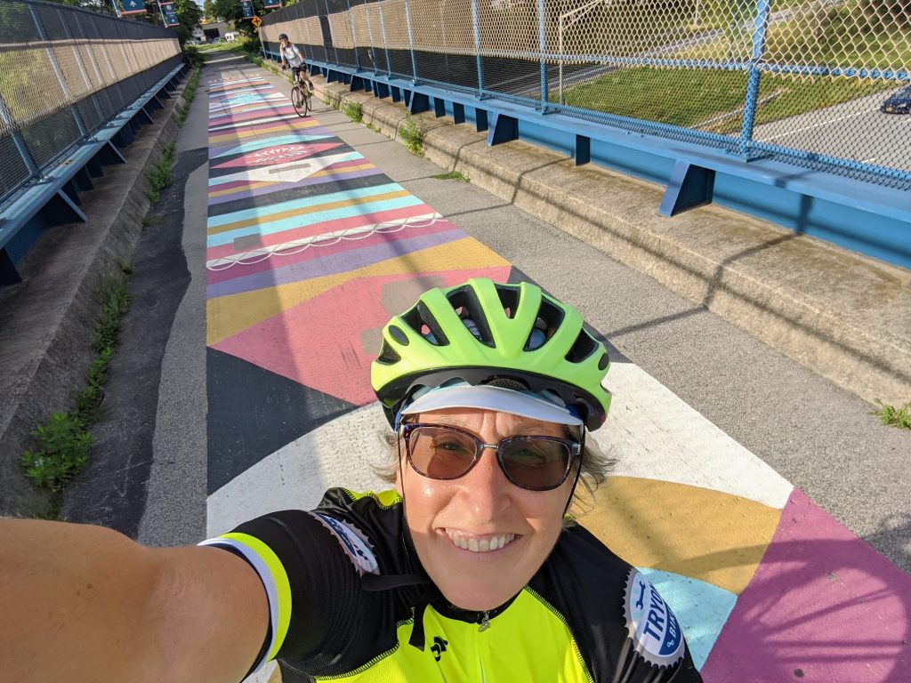
There are off road trails to explore as well. You can follow a dirt/stone trail along the east side of the river from Seneca Park Zoo all the way to the lake, which follows the old Windsor Beach Railroad line started in 1883 that traveled from the city’s Avenue E all the way north to Summerville. You can ride challenging single track trails along the west part of the bay in either Tryon Park or Irondequoit Bay Park West. Don’t forget the nicely paved pathways too! There’s one along the shore of Lake Ontario from the corner of Culver and Sweet Fern (right next to Parkside Diner) and extending to just across from Camp Eastman on the lake shore. The other one is Sea Breeze Dr along the northern section of 590 from Titus down to Culver Rd and Sea Breeze.
Nature/Water/Parks
You may not know this, but Irondequoit, by its very name of Iroquois origin, means “where the land meets the water.” And there’s just nothing like being close to water and natural spaces, is there? The views are beautiful and varied. Some of my personal favorites I’ve already mentioned, and there are smaller parks dotting all the neighborhoods for kids to enjoy too. A completely hidden gem is Densmore Creek Falls, accessible from the back parking lot of the Legacy at Cranberry Landing at the very eastern end of Norton before it crosses over 590 and drops down by the bay.
Food & Drink
I-Square has plenty of options for food and drink, and beautiful outdoor seating on the roof as well, so if you’re in the neighborhood you can cycle on over and enjoy! Right around I-Square you will also find the Cooper Deli, Titus Tavern and the Irondequoit Beer Company. At the very northern end of Clinton Ave there’s a little-known but exceptionally unique eating experience that awaits you called Atlas Eats, and it’s the best for a weekend breakfast. Another hidden treasure for you ice cream lovers would be Netsins Ice Cream Shop on Culver Parkway.
If you love to ride farther afield, and take a break from your spinning wheels along the way, our waterfront taverns abound. I love to make routes that include these special stops in the neighborhood for that. Summerville has Silk O’Loughlin’s (Olie’s). Sea Breeze has Marge’s Lakeside Inn (sit on the beach!), Bill Gray’s, Shamrock Jack’s Irish Pub, and Union Tavern (it’s haunted!). There’s Murph’s Irondequoit Pub, a neighborhood staple, now down by the O’Rorke bridge, and across the way take Marina Dr down to the end and you’ll find Schooner’s Riverside Pub, an open air only open in the summer fun kind of place.
Family Fun
You could plan a day of cycling with the kids in the small neighborhoods in Sea Breeze, stop by Parkside Diner, play a round of mini-golf next door at Whispering Pines, then head down to the Sea Breeze Pier and Beach. Need I say, Sea Breeze Amusement Park? Or ride the little neighborhoods off St. Paul Blvd. around Winona, and at its southernmost tip, take the sidewalk connecting to Maplehurst Rd, turn right and there’s paved access directly into the Seneca Park Zoo.
Routes You Might Enjoy
Feel free to use these as a starting point to create your own adventure!
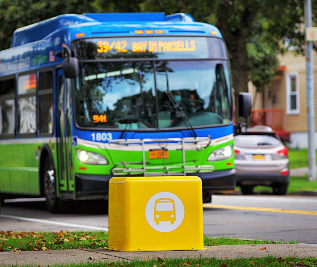
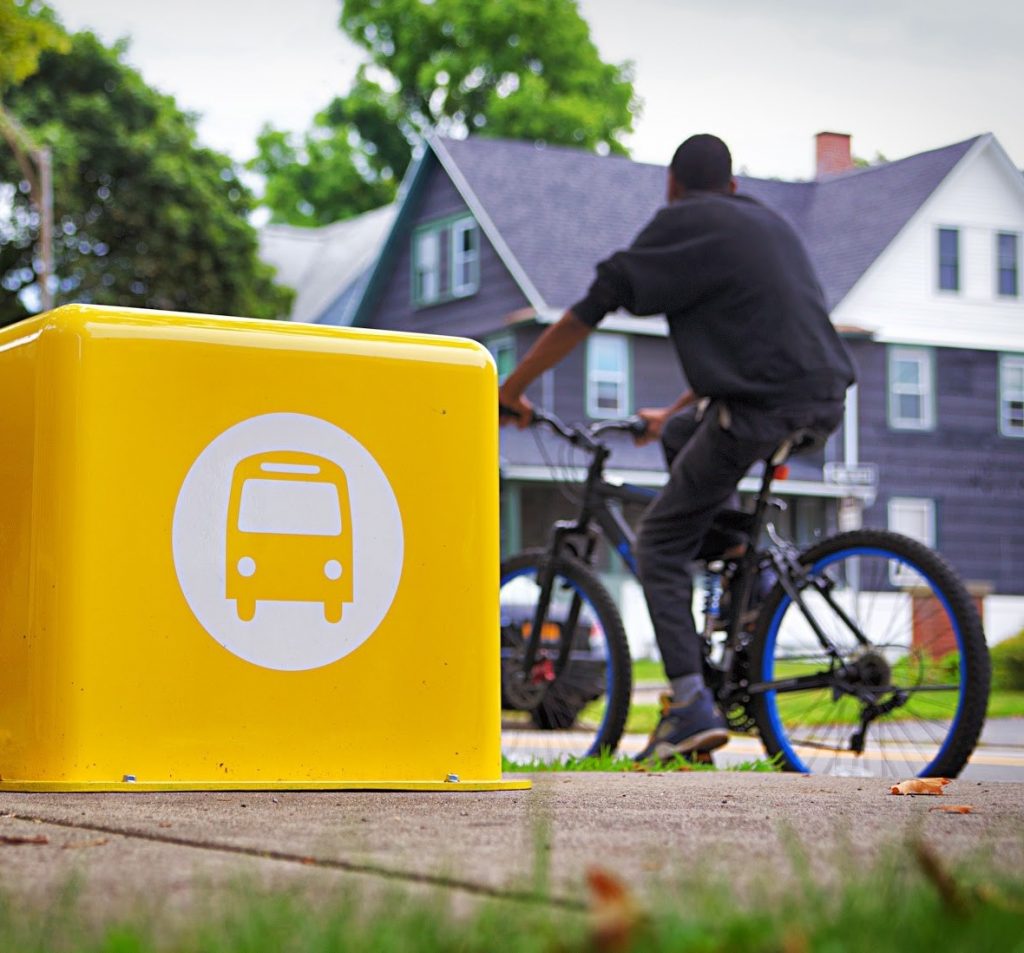
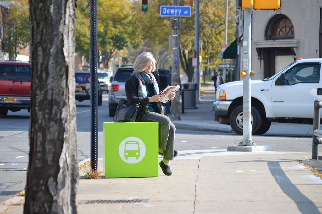
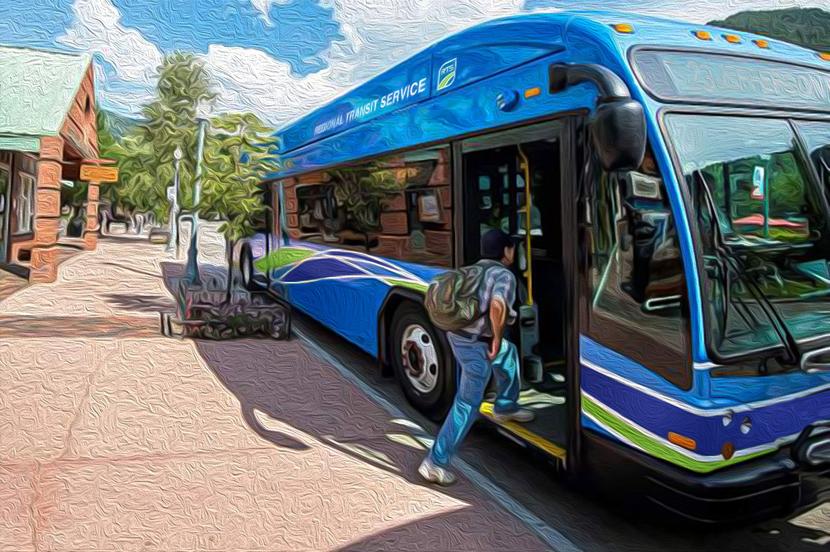
Next time you walk, ride or roll along Parsells, Lyell or Monroe Avenues, you’ll notice a bright new addition to the streetscape. This month, cubes made from fiberglass were installed at 5 bus stops along each of these corridors, offering RTS riders a respectable place to sit while they wait.
The City of Rochester and RTS have been tremendous partners on this project. Thanks especially to DES Commissioner Norm Jones and City Councilmember Mitch Gruber for championing the effort, along with City staff across many departments who worked hand-in-hand with us to see this to fruition. We also couldn’t have done it without our neighborhood partners in Beechwood, Lyell-Otis and Upper Monroe, or the funders that stepped up to contribute.
Cubes for Your Community
This is just the beginning! We hope the pilot project will lead to bus stop cubes in more Rochester neighborhoods and beyond. Reconnect Rochester will continue to work with RTS, local municipalities and community organizations throughout Monroe County to identify bus stops in the system that are well utilized but lack seating.
Would you like to see cubes at bus stops in YOUR neighborhood or community?Contact us and we’ll do our best to work with you to secure funding and make it happen.
Are you from outside the Monroe County area and interested in purchasing bus stop cubes for your town or city?Contact us and we’ll put you in touch with the manufacturer. Reconnect Rochester receives a sales commission that helps fuel our effort to put more bus stop cubes on the ground locally.
Why Are We Doing This Anyway?
Anyone who has ever used public transportation in Rochester is painfully aware of two things: At some point you will have to wait for your bus, and when you do, you will probably be standing.
For senior citizens, people with disabilities, and parents with young children, being made to stand for any length of time can be less than ideal. Even for those passengers who are physically capable of standing, having no place to sit while waiting on the side of a busy roadway can cause anxiety and discomfort.
Why is our bus system the only transportation mode that requires its passengers to stand while waiting for the service? The single biggest issue is the sheer scale of the system. There are thousands of bus stops in the RTS network, and the resources of the transit authority are already spread thin.
If this issue could be remedied, not only would we make the lives of current riders a little easier, but we might also encourage more people to use public transportation. This is why Reconnect Rochester has decided to make bus stop seating a priority for our community.
How Did This Project Come About?
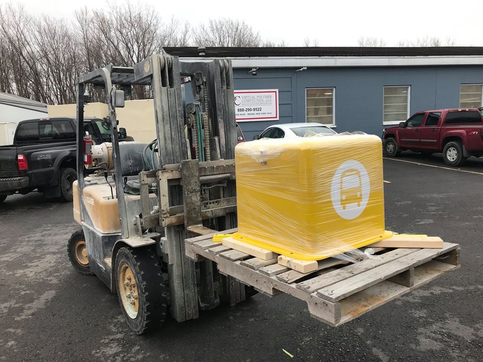
In 2017, after 3 years piloting seasonal bus stop cubes made from high-pressured wood, Reconnect Rochester set out to find a permanent, year-round amenity for bus riders. In our research, we came upon a local manufacturer of fiberglass — a nearly indestructible, weather resistant material that was perfect for the job! It took about three years of stops-and-starts to design and manufacture the fiberglass model that you see today.
To go further back in history and learn more about how the bus cube concept came to be, check out the Bus Cube Birth Story on our website.
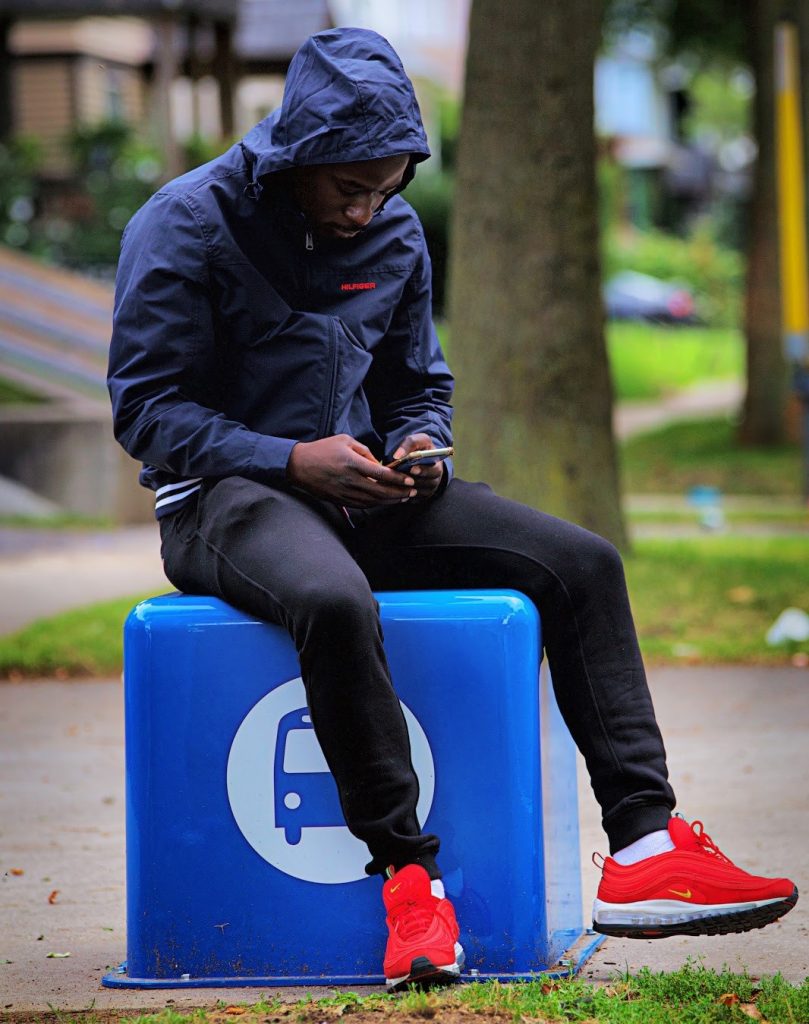
RTS rider enjoys our temporary, seasonal solution to the dearth of seating at local bus stops.
As we look back on 2019, we’re amazed at what we’ve been able to accomplish together this year. The highlights below are just a snapshot of all the good work we’ve been able to do, thanks to the financial support of Reconnect members, the passionate volunteers that make our programs and initiatives run, and so many others that engaged in our work in countless ways. Thanks to each and every one of you.
Sponsored a Cornell University Design Connect project to help the Brighton community create a vision for Monroe Ave., with an improved street design and streetscape that is more vibrant and safer for pedestrians and cyclists.
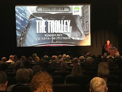
Hosted a packed Rochester Street Films screening of The Trolley that sparked community conversation about modern streetcars making a comeback in American life, and the history and future of streetcars in Rochester.
Gave transit riders a respectable place to sit at our 30+ seasonal bus stop cubes placed around the city. We also worked with a local fiberglass manufacturer to create a permanent cube design as a year-round solution, and have plans to get the first 15 cubes on the ground in spring 2020!
…And this doesn’t count the untold number of advocacy actions we take day in and day out to advocate for the things we all care about, like a robust public transportation system, streets that are safe for everyone, and a community that’s built to be multi-modal.
The community response was tremendous, and we thank all those who took the time to submit nominations! We received a total of 159 nominations for 31 locations in Monroe County.
The Steering Committee had a tough task to choose from so many quality submissions and deserving locations! A set of established judging criteria helped guide us through the selection process. Here we are, hard at work examining each and every submission:
So What’s the Good Word?
In the end, we selected the following locations for this year’s project:
N. Clinton Ave. in the El Camino neighborhood – WINNER
S. Clinton, S. Goodman & Henrietta St. – FINALIST
Monroe Ave. & Sutherland St. (Village of Pittsford) – FINALIST
The block of N. Clinton Ave. between Hoeltzer St. & Sullivan St. will be the project focus area
The North Clinton Ave. location presented the right mix of community support, evidence of safety concerns, and potential for a street re-design that would create real, transformative change for the community through our project. A Complete Streets Makeover will also be perfectly timed to dovetail with plans already underway for this corridor.
The Complete Streets Makeover will kick off with a community input session in June (facilitated by the Community Design Center) to hear from the residents of the El Camino neighborhood about their experiences and ideas. No one understands what it’s like to use our streets better than those who walk, bike, roll and ride along them everyday.
Last year’s community input session in the Beechwood neighborhood.
Based on feedback from this session, the complete streets design team at Stantec will draft conceptual design improvements of an improved streetscape. The design will be brought to life through a temporary on-street installation in September. We will rely on people power from the neighborhood community, and equipment from the Healthi Kids traffic calming library to lay down the temporary design on the street. Stay tuned for project updates as we go along!
What About the Finalists?
Our finalists won’t walk away empty-handed! The design team at Stantec will provide each of them with a conceptual drawing of street design improvements. The neighborhoods can use these illustrations as a launch pad for community discussion, and a tool to help advocate for changes that would make these streets safer for everyone
S. Clinton, S. Goodman & Henrietta St.Monroe Ave. & Sutherland St. (Village of Pittsford)
In this final installment of our Complete Streets Blog Series, guest author David Riley will highlight a sampling of intersections and trouble spots that were nominated for theComplete Streets Makeover project, and share his ideas for how they might be made safer for cyclists and pedestrians.
Back in May, we launched our Complete Streets Makeover project by asking the general public to help identify theintersections and trouble-spots where you live, work and play that could be redesigned to make them safer for everyone. We received over 90 nominations, and after a careful process to examine each and every submission, we selected the following locations:
As you are probably aware, RGRTA is exploring changes to the RTS fixed-route transit system in an effort to “better meet the evolving needs of the region.” The project, called Reimagine RTS, aims to improve transit service in Monroe County, including the City of Rochester. Over 11,000 individuals have participated in the process by sharing ideas with RTS via an online survey and many public meetings and the first draft was released last month.
After reviewing the draft and hearing input from many of you, Reconnect Rochester would like to formally share our assessment – including the parts we like, and a few things we’d like to see improved upon…Read more
If you recall, last fall RTS asked for the community’s help to reimagine our public transit system. Reconnect Rochester shared many of our recommendations and over 11,000 of you participated by sharing your own ideas with RTS via online survey or at one of countless public meetings. Well, today we’re dizzy with excitement as the first “Draft” proposal has finally been revealed…
As part of its new Comprehensive Plan, Rochester 2034, the City of Rochester is studying which major streets have the best potential for “transit supportive development” in Rochester. Transit supportive development encourages a mix of complementary activities and destinations (e.g., housing, work, shopping, services, and entertainment) along major streets and centers. This kind of development helps create compact, vibrant communities where it’s easier for people to walk, bike, and use public transit to get around. Read more
Last week RGRTA announced a plan to “Reimagine RTS.” Reconnect Rochester believes this is a once-in-a-lifetime opportunity for our community to get mass transportation right. We all have a stake in the success of our public transportation system and it is critical that RGRTA and its project team have access to thoughts and ideas from every demographic and every corner of our community. To help, we have compiled our ideas and recommendations, and we are asking you all to do the same.
But first, we need to understand how we got here.
Rochester’s public transportation network was originally designed to carry people between downtown and densely populated surrounding neighborhoods. As our residential population, commerce, and jobs spread outward with the adoption of the automobile, RGRTA attempted to follow this migration by extending service outward. With lower population densities in the suburbs, the stretched transit company found itself facing an impossible choice: expand service to reach fewer customers, or maintain its existing service area for a dwindling urban population.
After decades of attempting to do both, the quality of service in Monroe County has suffered. Those who rely on transit are underserved, and those who might choose to ride rather than drive do not. We hear complaints from riders about infrequent service, long trip times, perceived safety issues, and the need to walk great distances to reach their bus stop or final destination. Clearly, we need systemic changes to improve service and increase the viability of our public transit network.
RGRTA recognizes these issues and is now taking a bold step to design “a new transit system from the ground up.”
Our Top 5 Recommendations to Make Rochester Transit Great (again)
Reconnect Rochester has surveyed its members on how to improve Rochester’s public transit system to serve the greatest number of people. Our recommendations are prioritized below.
1. Make service more frequent and consistent.
Current routes and schedules are too complex and inconsistent. To build confidence and make people believe they will have a ride available when they need it:
Vehicles should run every 30 minutes or less throughout the entire system.
Vehicles should run every 15 minutes or less on key routes during peak hours.
Routes, schedules and frequencies should be consistent throughout the weekday and on weekends.
Vehicles should depart from the terminal on time.
Even spacing should be maintained between buses.
The number and placement of new bus stops should follow the recommendations outlined previously in the RTS Bus Stop Optimization Study (2014) to strike a balance between pedestrian accessibility and system performance.
Outlying routes or segments that cannot support 30 minute frequency (either with ridership or private sector funding) may need to be eliminated, or serious consideration should be given to servicing these areas by other means.
2. Make routes more direct.
Many routes currently have unnecessary turns and deviations, meaning most trips take much longer than they should. The current hub and spoke layout also makes it difficult to transfer between routes without going downtown. To improve efficiency and provide the fastest possible trip time:
Routes should be designed to take the most direct path between major destinations. Twists, turns and “zig-zags” should be eliminated.
Buses should not run into and through office complexes and strip mall parking lots. Instead, municipalities need to work to make sure transit access is provided by direct and convenient pedestrian access through a site to the edge of the public right of way.
It should be possible to switch (or transfer) between routes from any point in the network.
Adjacent routes should be placed within walking distance from each other and service staggered to make it easier for riders to switch from one bus to another on a nearby route.
Provisions should be made for other modes of travel at major bus stops or satellite hubs (i.e., ridesharing and bike share stations, safe and accessible pedestrian infrastructure, information/signage, etc.).
It should be possible to travel between the county’s four quadrants without transferring downtown.
Crosstown or orbital routes should be added near the perimeter of the city where radial routes diverge.
Work with other transit providers to make existing crosstown routes (e.g., U of R’s Orange Line) available for riders.
Work with the City and DOT to design streets that prioritize transit (as well as pedestrians and cyclists) over private motor vehicles.
Install curb extensions at transit stops (as opposed to curb cutouts) to eliminate time spent weaving in and out of traffic.
Optimize traffic signals to improve reliability by allowing buses to maintain a constant speed, and reducing time spent at red lights.
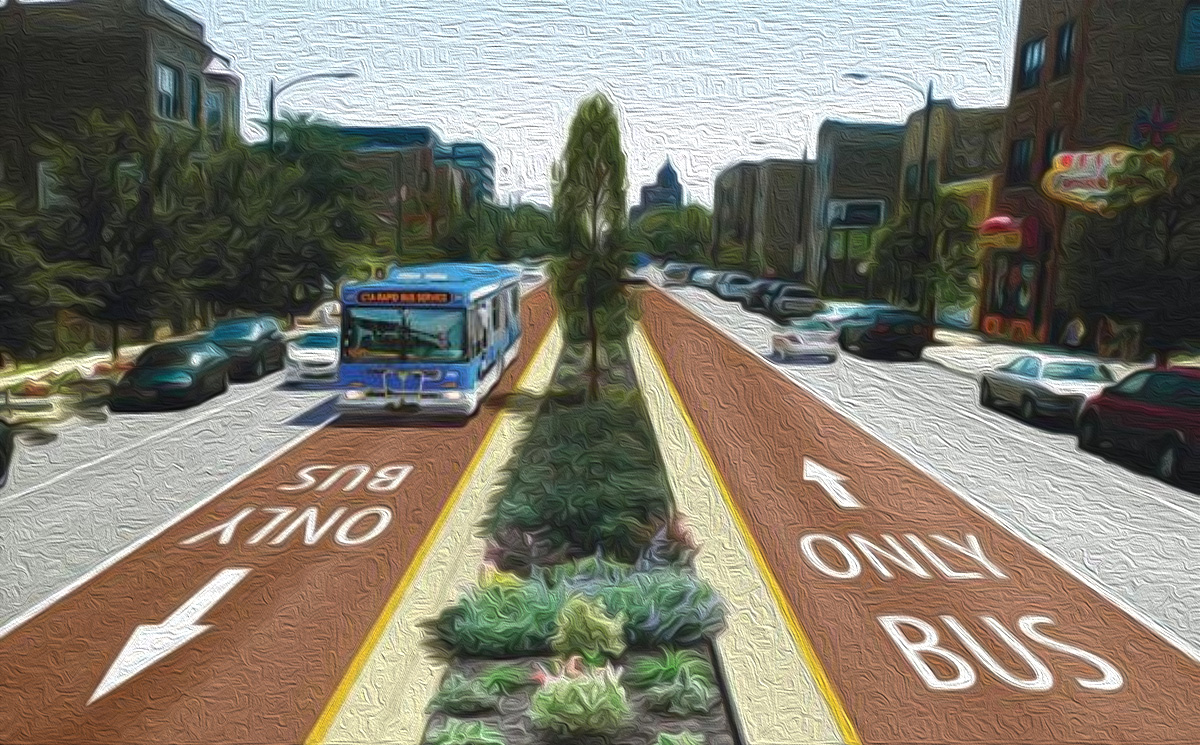
Utilize dedicated lanes to move buses more quickly through crowded streets.
3. Right-size the service.
Many routes receive high ridership near the core of the network, resulting in overcrowded, slow moving buses there and nearly empty buses for the remainder of the routes. To relieve overcrowding and improve service in high demand areas:
Some routes may require express and local access service.
Consider eliminating outlying routes or segments where demand is low.
Vehicles should be selected according to demand.
Heavily used routes within the core of Monroe County should be serviced by 40’ or larger vehicles, while lesser used routes could be serviced by vans or other systems altogether (i.e., ride-sharing).
Where necessary, transit vehicles should be outfitted to accommodate more bicycles.
4. Make transit accessible and easy to use.
In recent years RGRTA has added several systems and technologies that have made it easier and more enjoyable to use transit. These include the fully enclosed RTS Transit Center, fare kiosks, Tap & Go fare cards, digital signage, and a mobile trip planning app. The following recommendations would make RTS even easier to use and more welcoming to new customers:
Improve integration with other modes and transit systems.
Institute an integrated payment solution so that one “currency” can be used across a variety of transportation systems (i.e., one stored-value pass to pay for bus fare, rideshare, taxi, or bike share that could be replenished online or at a kiosk).
Include data from other transportation companies within the RTS mobile app.
Share data and synchronize service between other transit providers such as college bus systems, Amtrak, and intercity buses.
Work with municipal staff and land use boards in development review and site design. Employment locations, services, retail, and higher density residential development should occur within a half mile of transit corridors. The details of site design such as building placement and internal pedestrian circulation networks are critical in supporting transit.
A dynamic transit frequency map should be published for municipalities to evaluate whether transit is a realistic mobility option for a given development or not. There’s a huge difference in a site served by buses every 2 hours versus one served by buses every 20 minutes. Frequency information is not captured on a typical system route map (see for example these maps by Reconnect Rochester and this article by Jarrett Walker).
School routes (currently designated with an X) should not add complexity to the published schedules.
Provide basic amenities for transit riders at all bus stops.
Safe and accessible sidewalk connection from curb pick-up
Route map and information
Seating
Provide enhanced amenities for transit riders at heavily used stops and hubs.
Shelter
Trash receptacle
Bike rack
Heat
WiFi
Work with municipalities to enact a maintenance plan for all bus stops.
Trash pickup
Snow removal
Accountability
Provide riders with real-time information
Countdown clocks with real-time information should be installed at all major transit stops and hubs (i.e., URMC, colleges, Airport, Rochester Intermodal Station, Irondequoit Plaza, etc.).
Work with municipalities and property owners to display real-time information screens at highly visible locations such as schools, shopping centers, arenas, office and apartment buildings (i.e., TransitScreen).
Provide additional off-board and cash-free fare payment methods (i.e., kiosks at major transit stops where passengers can buy Tap & Go cards, mobile ticketing via the RTS app or a 3rd party app such as Token Transit, etc.).
Explore ways to allow boarding at both front and rear doors.
5. Stay competitive through innovation.
A business succeeds by staying ahead of the competition. Beyond the recommendations outlined in sections 1-4, it will be imperative for RTS to:
Continually monitor customer needs and local market conditions in order to identify areas for improvement, industry trends and opportunities to attract new customers.
Offer classes or seminars on “how to ride the bus.” Many people are reluctant to try the bus, in part, because they are unfamiliar with it.
Have a bike rack mock-up device so people can practice loading a bike into the rack without the pressure of a bus full of people watching.
Expand offerings by studying the feasibility of new systems and upgrades such as:
Fixed guideway and/or bus rapid transit on core routes
Smaller self-driving vehicles for local or on-demand service
Work with the City and County to manage land use in a way that complements service patterns. Future service can then be planned based on land use decisions.
Work with municipalities, key neighborhood groups, and large employers to establish Transportation Demand Management entities and co-promote public transit as a solution to congestion and costly parking.
Step up marketing efforts and always maintain a fresh image reflecting the unique selling points of RTS.
Develop example language/assistance for municipalities, event planners, retailers, employers etc. that highlight the ability to use transit to access the event. Too often events or meeting notices provide parking information without information about public transit. Rochester International Jazz Festival does a good job of this.
Share Your Suggestions
We hope our suggestions will give you a framework from which to craft your own thoughts for RTS. Please feel free to steal our list straight away. Or if you have ideas not mentioned above, we’d love to hear them in the comments section below.
We also urge you to attend the first public meeting for this project on October 25th from 6:00-7:30PM at the Brockport Metro Center. And don’t forget to visit www.myRTS.com/reimagine to submit your comments and stay updated on this important project over the next 12 months.
Moments ago RGRTA announced plans to study sweeping changes to the RTS (Monroe County) transit system. The effort is being called Reimagine RTS and the goal is to develop a set of recommendations to address the community’s mobility needs, increase transit ridership, and position RTS for long-term financial sustainability.


