We have identified an RGE gas pipeline that runs from a hill on the West Side of RIT’s campus (just South of the Red Barn) across East River Rd, across the river, across Scottsville Rd, and through cleared woods to the GVGreenway Trail.
This path has just the trajectory we might want in developing the RIT Tweenway, and the trees are already cleared. (The path is not surfaced.)
View tweenway Spur in a larger map
Here are some panoramas
The view from the hill to the West: http://farm3.static.flickr.com/2721/4309845639_f1e422dcce_o.jpg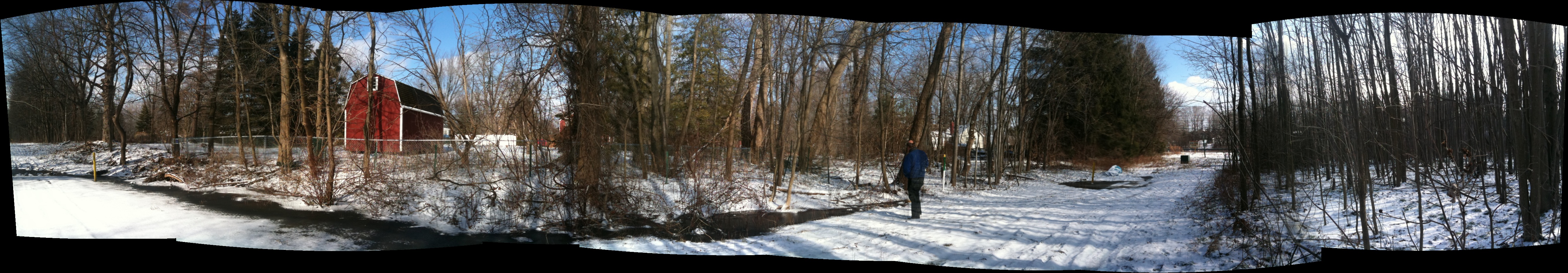
The view from Scottsville Rd East to RIT: http://farm5.static.flickr.com/4045/4309844619_70c0ddf04f_o.jpg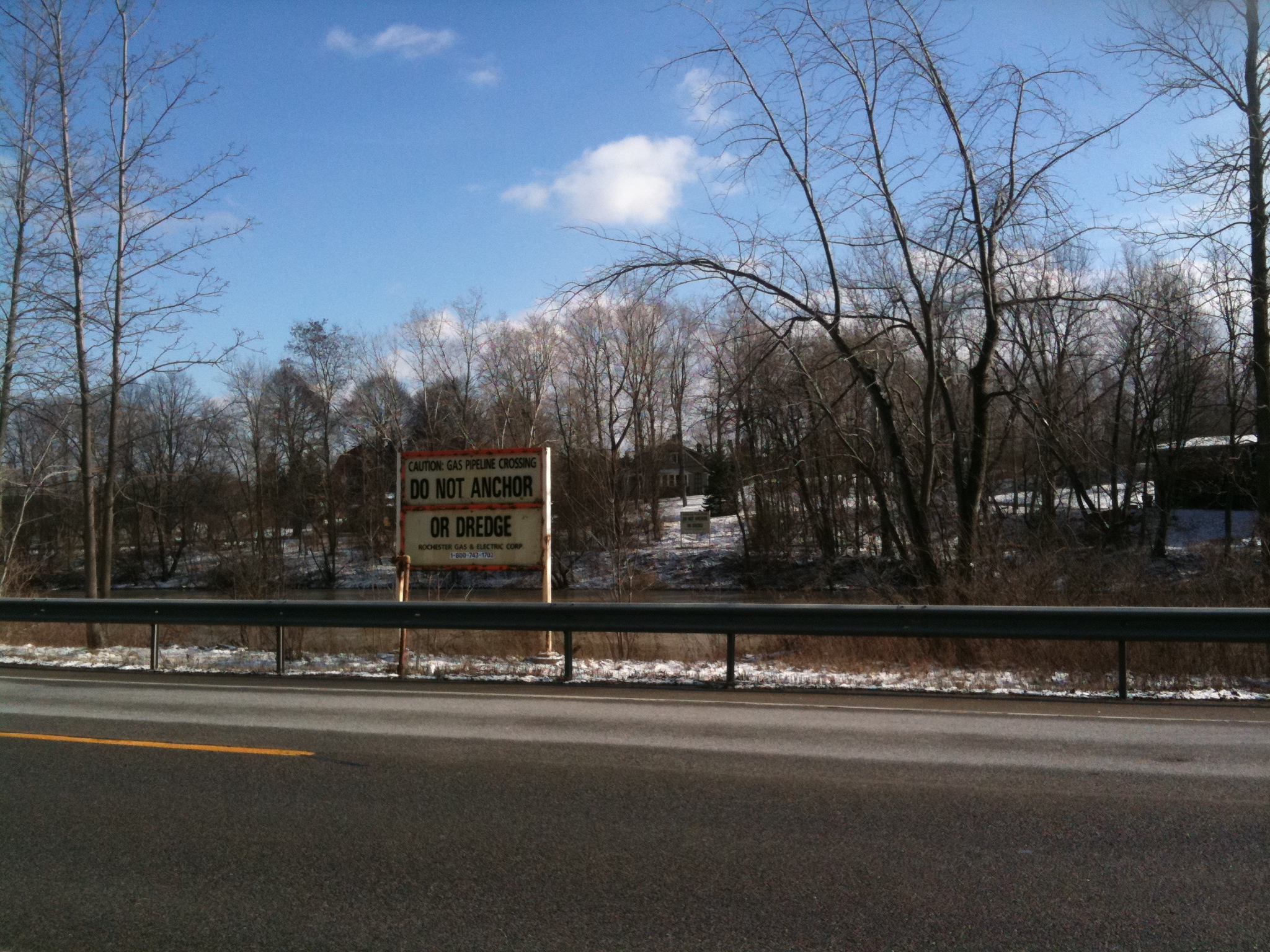
The view at the GVGreenway-Pipeline intersection (380 degrees) : http://farm3.static.flickr.com/2798/4338153998_0616943c66_o.jpg: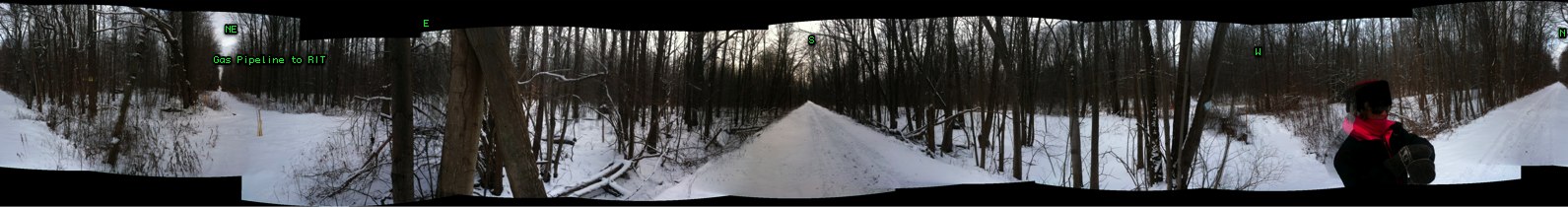
Let’s call the path that might be made from the pipeline the “Tweenway Spur” (assuming the cross-RIT bike trail is to be called the RIT Tweenway.)
The ideal long-range vision is for a cycle/pedestrian bridge from the hill on the RIT campus to the Tweenway Spur, without their having to touch down on the East River Rd, Scottsville Rd, or the River.
However, even without the Tweenway Bridge, this spur would provide a more intuitive, scenic and safer alternative route to the Ballantyne Bridge (and thence to RIT or Jefferson Road and the Lehigh Valley North Trail).