The Rochester area is famous for its 20-minute commute. For driving that is. Reconnect Rochester and the Rochester Cycling Alliance are excited to ask a different question in this blog series: Where can you get within 20 minutes on a bike?
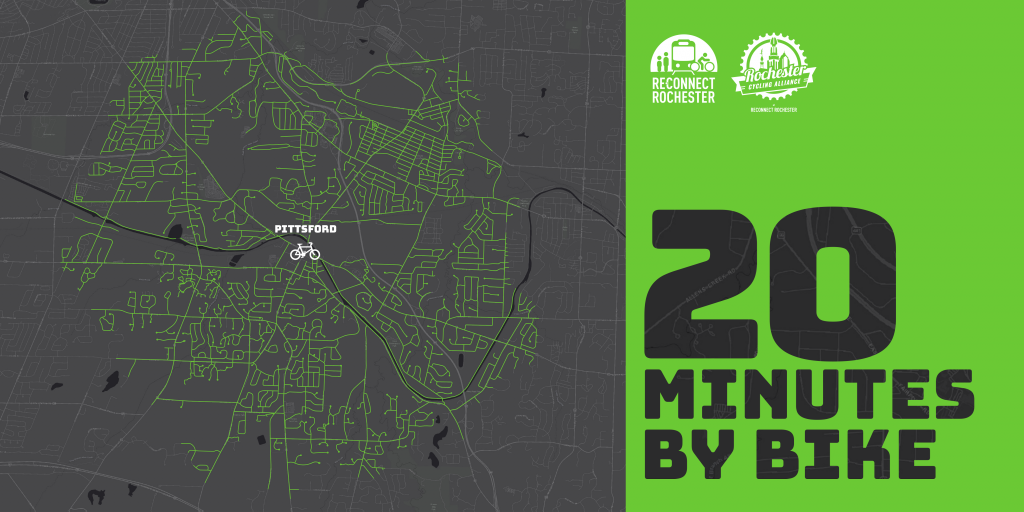
Presenting the third in a series of custom “bike shed maps.” For this next installment, we chose Four Corners in Pittsford Village and are showing how far out in every direction you can get on a bike at a casual but steady pace of 10 miles per hour. This means that if you live anywhere in this green area, you can get to Four Corners within 20ish minutes on a bike. Thanks again to Brendan Ryan and Mike Governale for their help putting these maps together for us.
To get us familiar with this green territory in Pittsford, here’s Flower City Family Cycling’s Brooke Fossey sharing her personal travel-by-bike experiences.
Introducing 20 Minutes by Bike Pittsford
You don’t have to be a cycling enthusiast to appreciate how connected Pittsford is. My humble hope is that after reading this, you’ll discover a new route available to you, and maybe you’ll pull out your bike for a trip that you’ve only considered accessible by car before. At the very end, I’ll share some tips that I hope will help you get started.
I’m struck by three things about this 20 Minutes Map:
-
- You can bike to the heart of the village—our Library, shops, restaurants, Bakery and Dairy—from pretty far away in just 20 minutes or less, including from East Rochester, Pittsford Plaza, two colleges, and many of our neighborhoods.
- We have been gifted, through good planning and leadership, with a great trail system that connects so much of Pittsford completely off the roads, including the Erie Canalway Trail and Town trails that connect cul-de-sac neighborhoods.
- We still have a long way to go to make major roads comfortable for most riders. We have to keep advocating for safety improvements on our major arterials. Although trail connections are great, direct routes should be viable and safe by bike – for everyone.
Take a look at the major attractions we have that are bikeable in the same length of time widely considered in Rochester to be the longest it takes to drive anywhere (20 minutes):
-
- Library
- Community/Recreation Center
- Village and Town Halls
- Main Street shops and restaurants
- Schoen Place shops, restaurants, and breweries
- Bushnell’s Basin shops and restaurants
- Pittsford Plaza shops and restaurants, including Wegmans
- Schools
- Doctor and dentist offices
- Banks
- Yoga, pilates, and the YMCA
- Hair salons
- Parks like Great Embankment, Thornell Farm Park, Kreag Rd Park
- Playgrounds
- Erie Canal
- East Rochester amenities, including restaurants, a pool and splashpad
- Nazareth and St. John Fisher colleges
That list is pretty incredible. Now, let’s break some of this down further.
Bike to your Books!
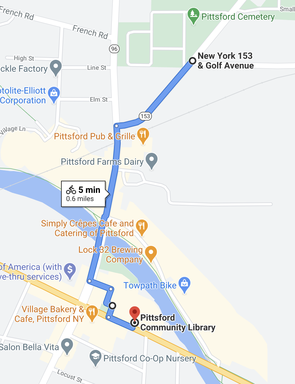
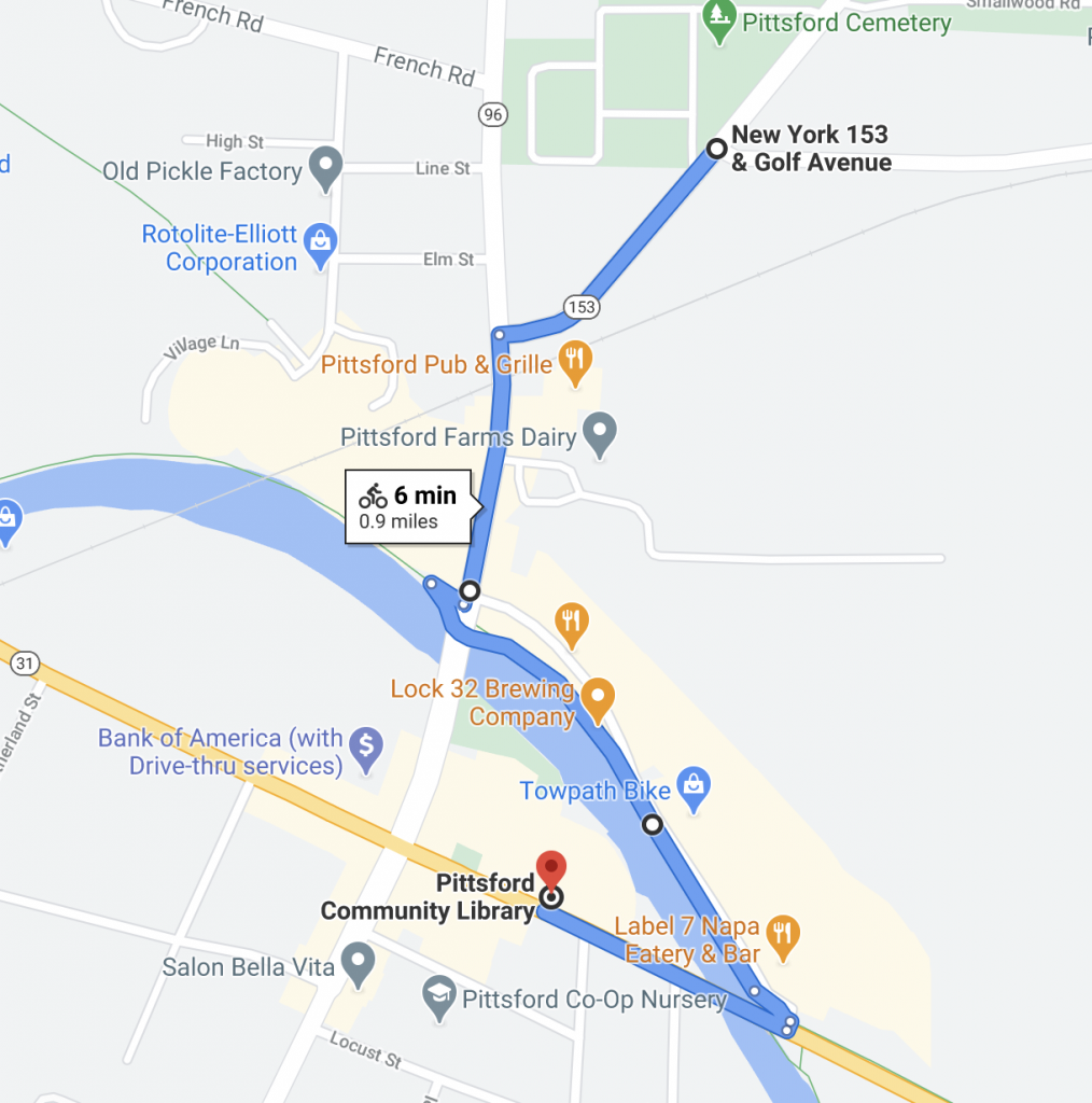
The Pittsford Community Library has not one, but two bike racks: one in front on State Street and one behind with an adjacent bike repair station. If you haven’t considered biking to the Library, strap on your backpack or grab your bike basket. You’ll feel great when you arrive and you’ll have the best parking spot there.

Let’s say you’re coming from one of the neighborhoods off Rt-96. You can take the sidewalk along Rt-96, cross at the light at South Street and take the quieter neighborhood roads right to the Library in 5 minutes by bike, 1 mile each way.

Coming from the other direction, Google will send you on the most direct path, on N. Main Street, and you can cut in through the parking lot. Or, take the quieter, but slightly longer, neighborhood route down Schoen Place. Sometimes going a little bit out of your way on your bike makes for a much more enjoyable and relaxing ride, until our main streets are made safe enough for everyone to feel comfortable riding on them. I’d probably take this longer but quieter route if I had my kids riding independently next to me. It would be a little longer, but on a bike, it’s not that noticeable, and it would be much less stressful.
*Note: State Street Bridge is closed for repairs until mid-July.
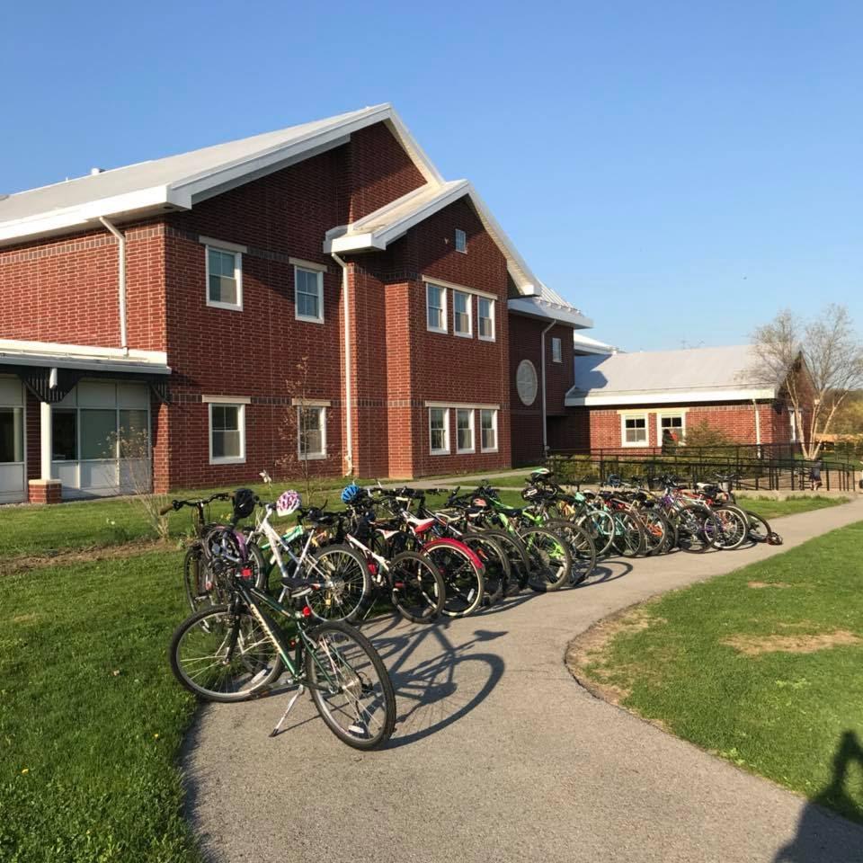
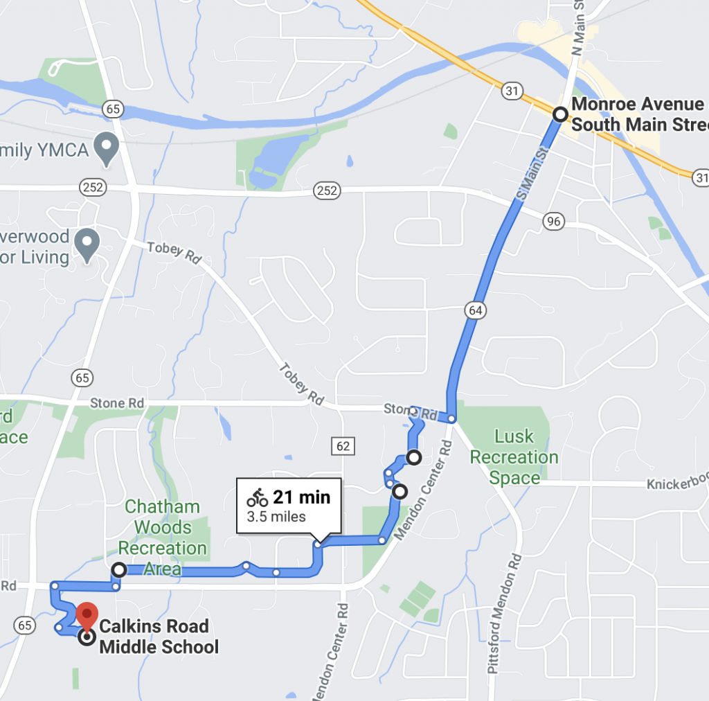
Middle School Mileage
A few of our friends who live in or near the village have middle-school age children who biked to Calkins Road Middle School. To many of us, that sounds a little scary, but there’s actually a sidewalk that connects all the way, and a trail system that connects cul-du-sacs and allows for riding on much quieter streets. Having route choices makes biking more accessible as each person can tailor their ride to their own comfort level. Biking to school has so many benefits: independence for teens, reduced congestion, transportation savings, and kids can arrive to school more awake and ready to learn. This is something I believe we should be actively encouraging as a community.

Many of Pittsford’s neighborhoods have walking and biking paths that connect cul-du-sacs with the next neighborhood without having to go out on the main road, and I’ve found that you can travel quite far on these side roads—if you know about them!

Groceries and Gears
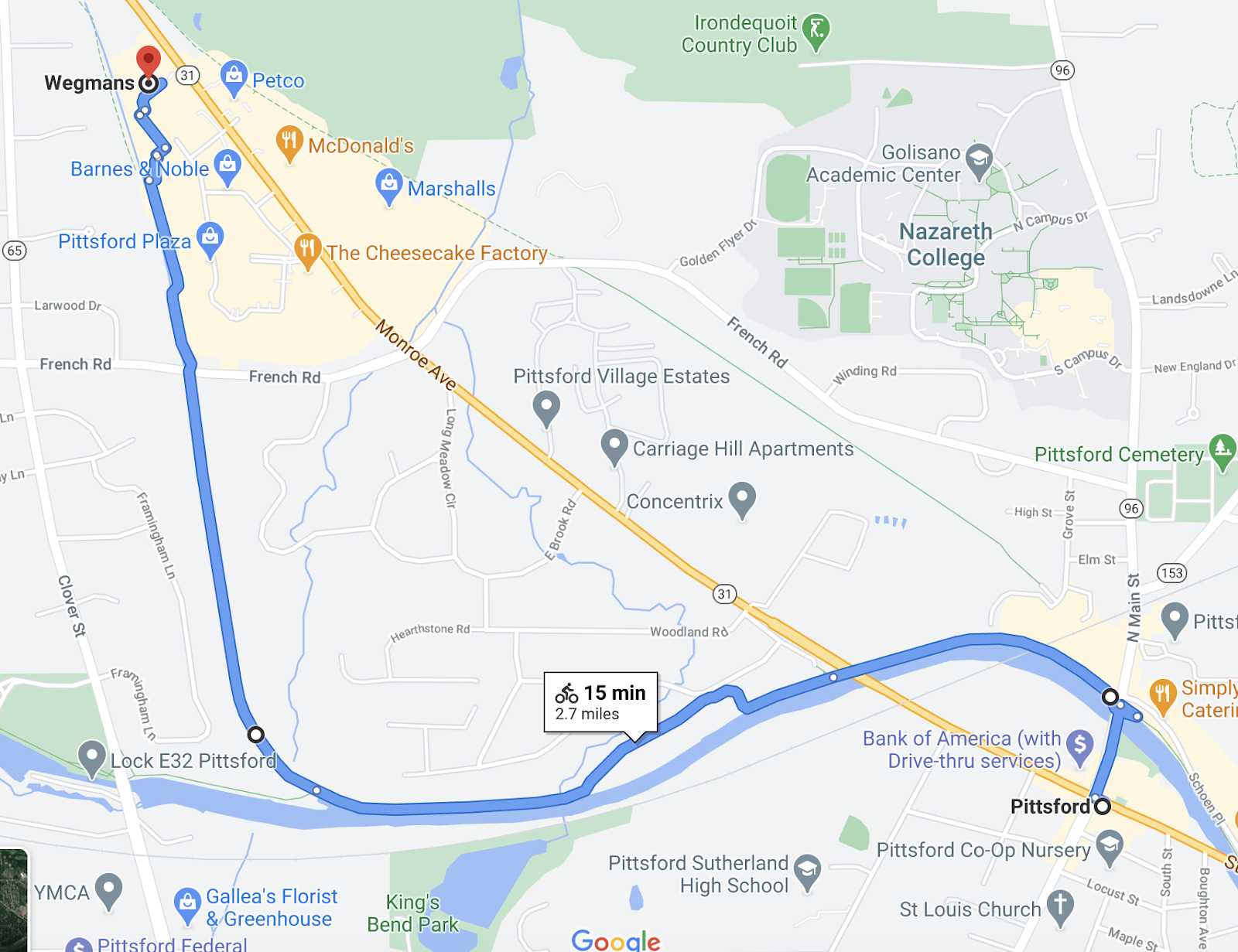
Getting groceries by bike requires a little more planning, but it is not only possible, it can be so rewarding. Do I wish there was a small grocery to pop into to grab a few things by bike a few times a week – heck yes. Is Wegmans by bike an option? Believe it or not, also heck yes. Maybe you can’t bring as much home as you would in your car, but you can actually haul quite a bit on your bike with panniers or just a large backpack. Plus you have the added benefits of exercise, parking right up next to the building, and—let’s not underestimate the badass factor. You’ll feel really proud of yourself. I’ve done this route myself, but my husband usually runs it weekly during three seasons using the trails to completely avoid Monroe Avenue.

The approved Active Transportation Plan calls for a multi-use trail along Monroe Avenue, but until that happens, did you know you can reach Wegmans completely on trails? Check it out:

This route uses the Auburn Trail, accessible behind the Pickle Factory. Unfortunately Google maps doesn’t show this connection. From the Four Corners, get on the Erie Canal towpath heading west, turn right on the turnoff near Pittsford DPW’s building, and hop on the Auburn Trail behind the Pickle Factory storage building. Cross to Wegmans at the light and cruise right into the parking lot, with bike parking on either side of the store.
Alternatively, you can come up on the west side of Wegmans taking the Erie Canal towpath farther west and coming down the ramp near the old Lock 62.
College Connections
Connecting young people to the village and giving them the option to get here without driving will help our local economy and give students more freedom. Nazareth has a great connection to the village, thanks to the new sidewalk installed by the Town this past year. St. John Fisher also has a straight shot on main roads. How can we encourage students to visit the village on foot or on bike, and how do we make that an attractive option?
What Does This Mean for YOU?
If you are even the slightest bit curious, I encourage you to try biking to your destination. You will arrive invigorated and pretty darn proud of yourself. You can do this! One trip builds on the next and pretty soon, it becomes a true option, and you start to ask: should we take the car or bike today?
Tips for Getting Started
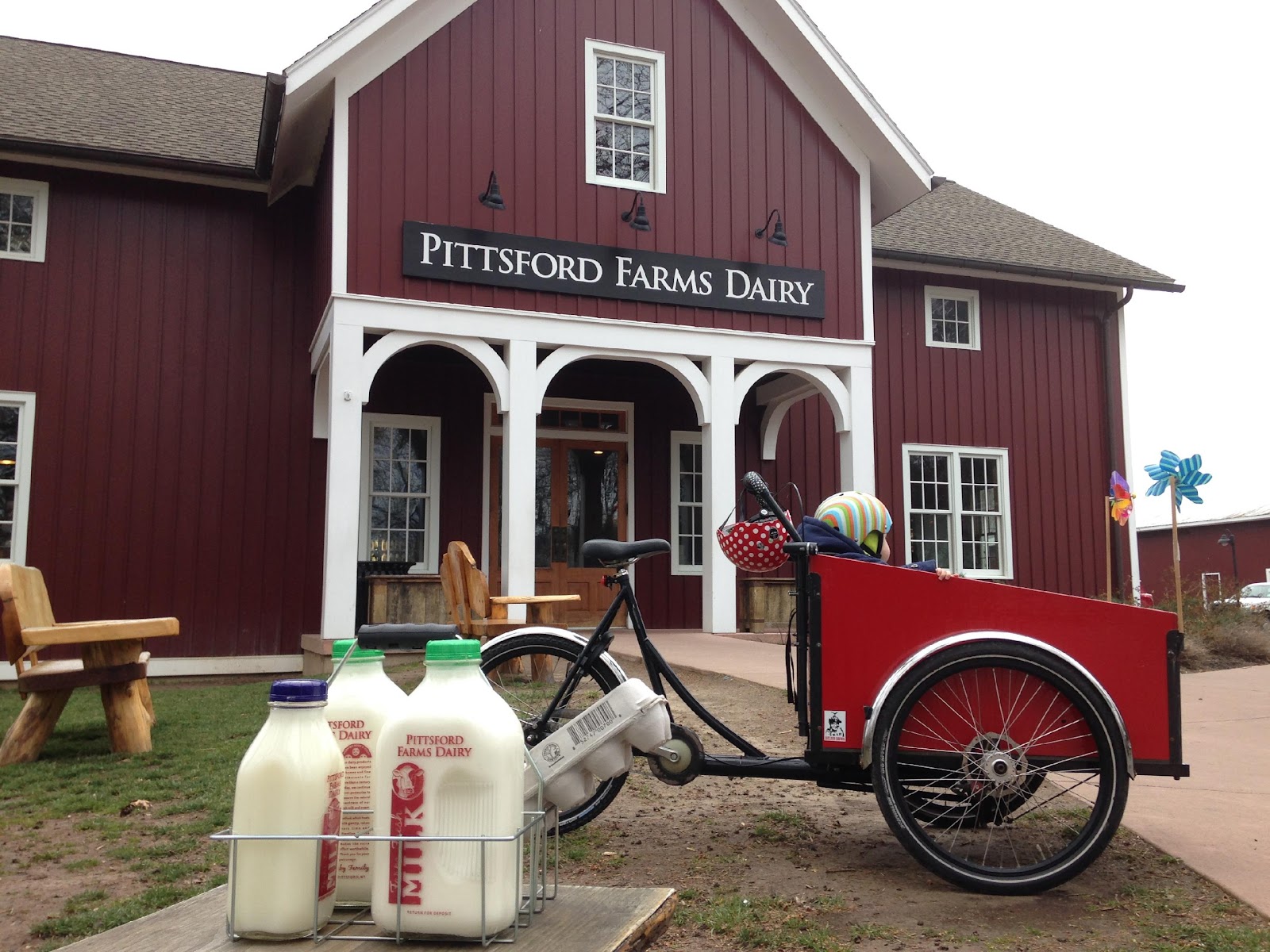
Short and easy destination. If you’re brand new to biking and want to give it a try, pick a destination no more than a mile away, and which will be low-stress to get there. Ex: Pittsford Dairy: access the canal path from your closest neighborhood spot and ride to N. Main Street, and then from there just a short distance to the Dairy. Grab your milk (or ice cream!), throw it in a backpack, and head back home. Once you master that, you’ll start to see that the world opens up to what you can reach just by the power of your own legs. It’s walking, only faster! Here are some great destinations to check out in the Village: Pittsford Dairy, Lock 32 Brewery, Copper Leaf Brewing, Simply Crepes, The Coal Tower, Village Bakery, Pittsford Library, Thirsty’s, Label 7, Olives, Aladdin’s, Breathe Yoga, BluHorn Tequilaria…the list goes on and on, so pick what interests you and go for it!
School run on a weekend. Try a school run one day – but do it on a weekend. Try it without the stress of getting there at a certain time, or rush hour traffic. Do the run and see how it is, and then when you do it for the first time on a school day, it’ll be so much easier. Pretty soon, your kids might start asking you to drop off or pick-up that way because they get more time with you and like moving their bodies before settling in at school.
Ride with other people. There are many biking groups around Rochester that do club rides. You can find one that suits your skill level and interest and ride with others. There’s a sense of camaraderie riding in a group, and you can learn from other people. Here’s a shameless plug for Flower City Family Cycling, a group I co-run that plans chill, social rides for families. All ages and abilities welcome, and we’d love to see you.
Wrapping Up
As this map shows, Pittsford has some amazing connectivity. But it also overstates connections we do have: many of the main arterials shown as straight shots through Pittsford are often not enjoyable by bike—they can even be downright stressful and scary, depending on the time of day. They will require a great deal more effort to improve the ride experience to encourage new riders.
The next step to making this 20-min map a reality for many people is to make the roads safer to bike on. That means lowering vehicle speeds, narrowing lanes, considering bike lanes or shared bike/walk trails, and educating the public on how to safely drive alongside someone on a bicycle.
Love the idea behind this. I’m an avid cyclist and encourage more functional cycling (errands, etc) in addition to riding for pleasure and exercise. As a point of caution, Wynd’s Woods trail is currently marked as a no bikes allowed trail, and I strongly encourage 1) respecting this signage 2) advocacy to allow cycling on the trail.
Love seeing Pittsford shine. Lived there in 1971