4 Comments

In Praise of the Improved Auburn Trail

By Jesse Peers, Cycling Manager at Reconnect Rochester

A Major Upgrade

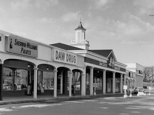
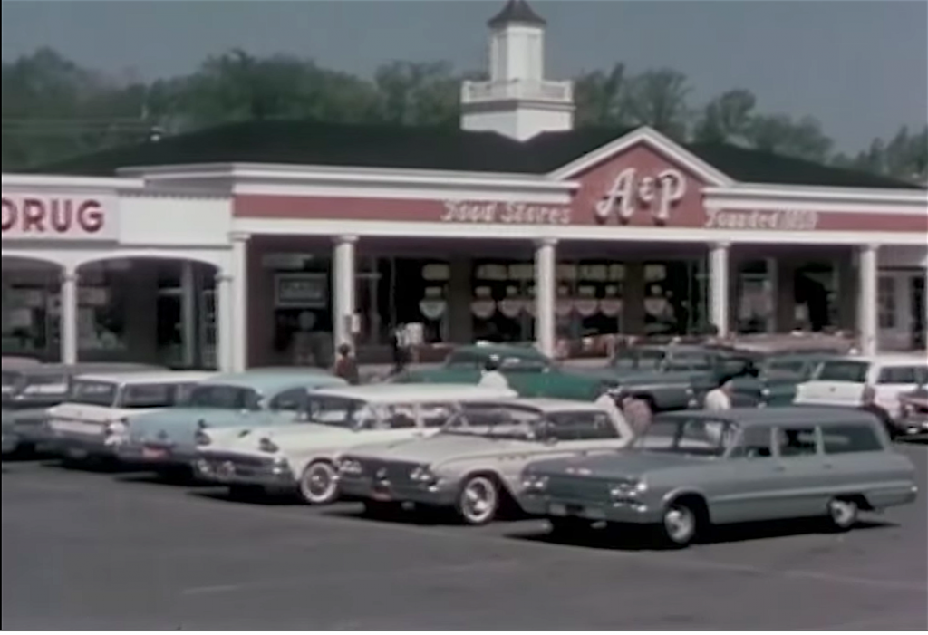
Perhaps no place in the Rochester area epitomizes post World War II car-oriented development and suburban sprawl like Pittsford Plaza. Though Monroe Avenue is on a bus line, it’s always been a difficult, time-consuming or intimidating destination to get to without a car.

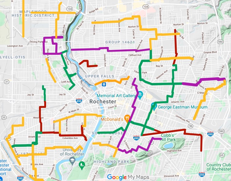
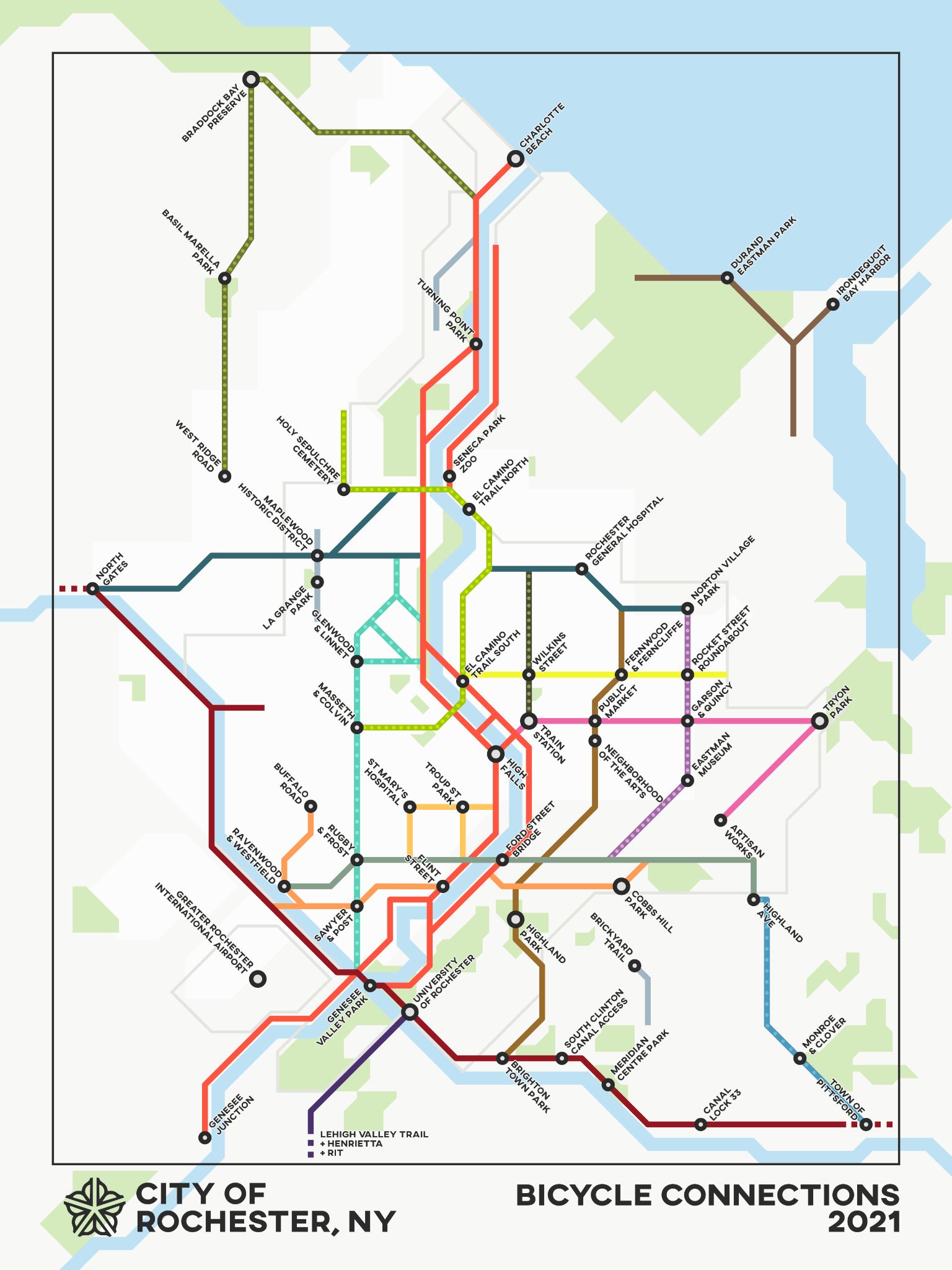
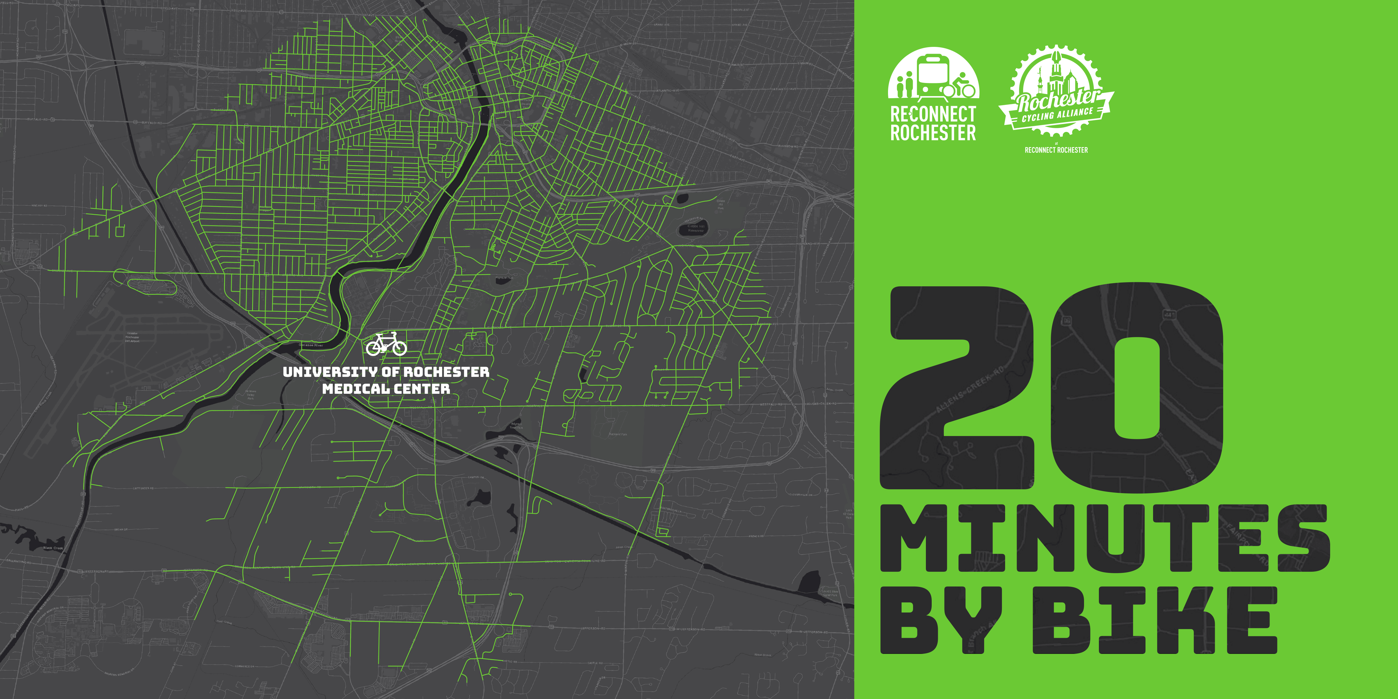
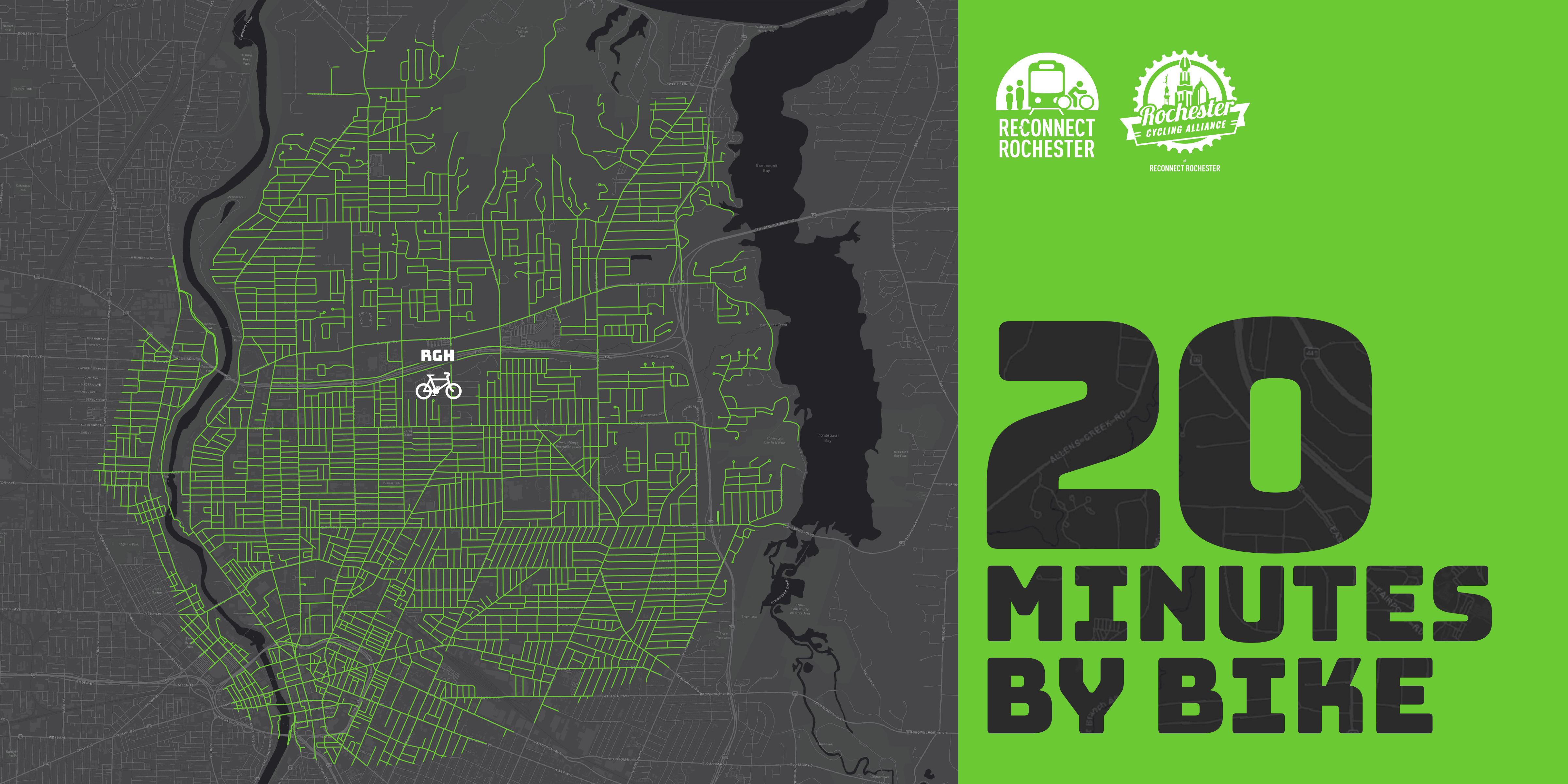
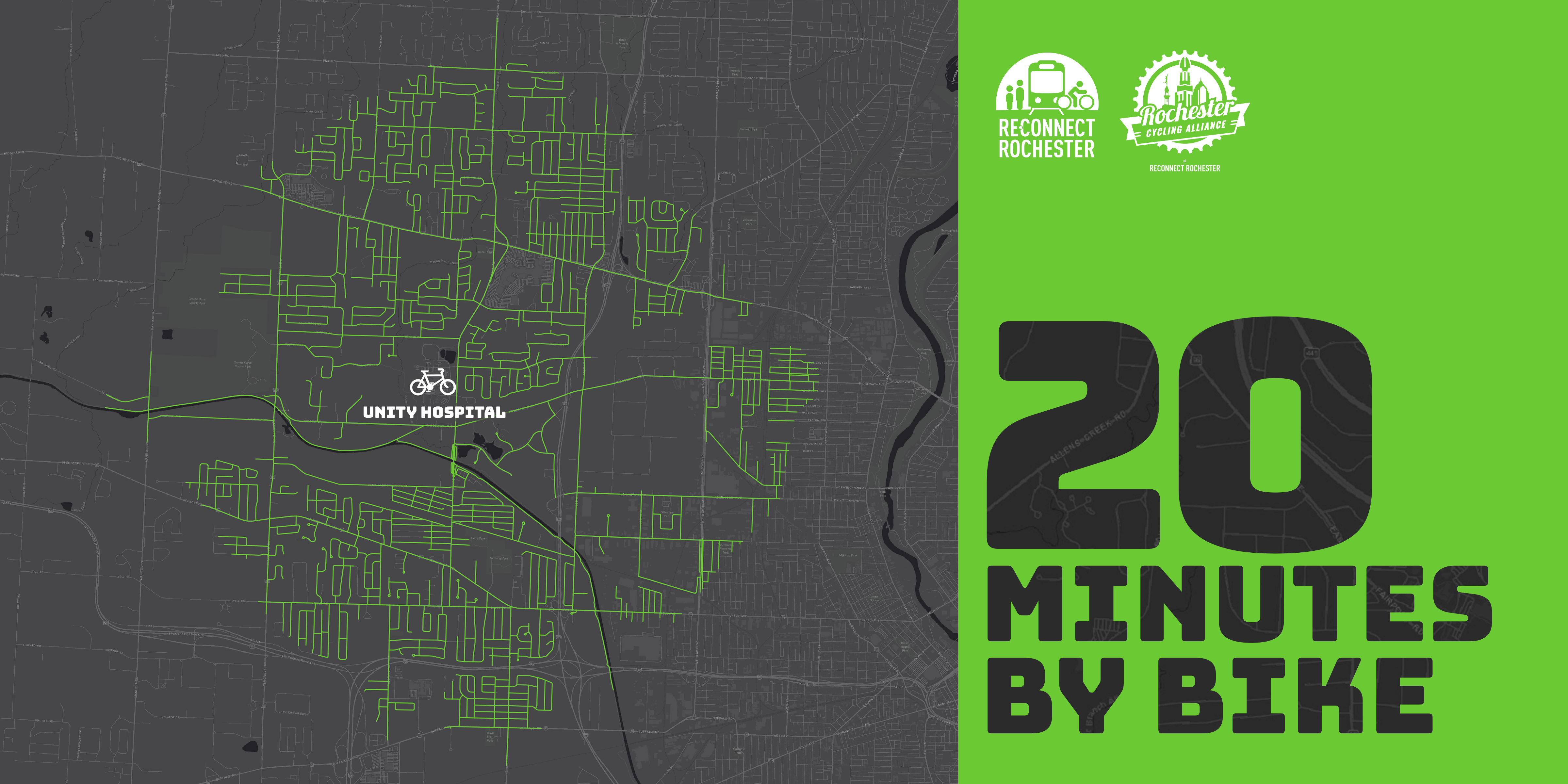
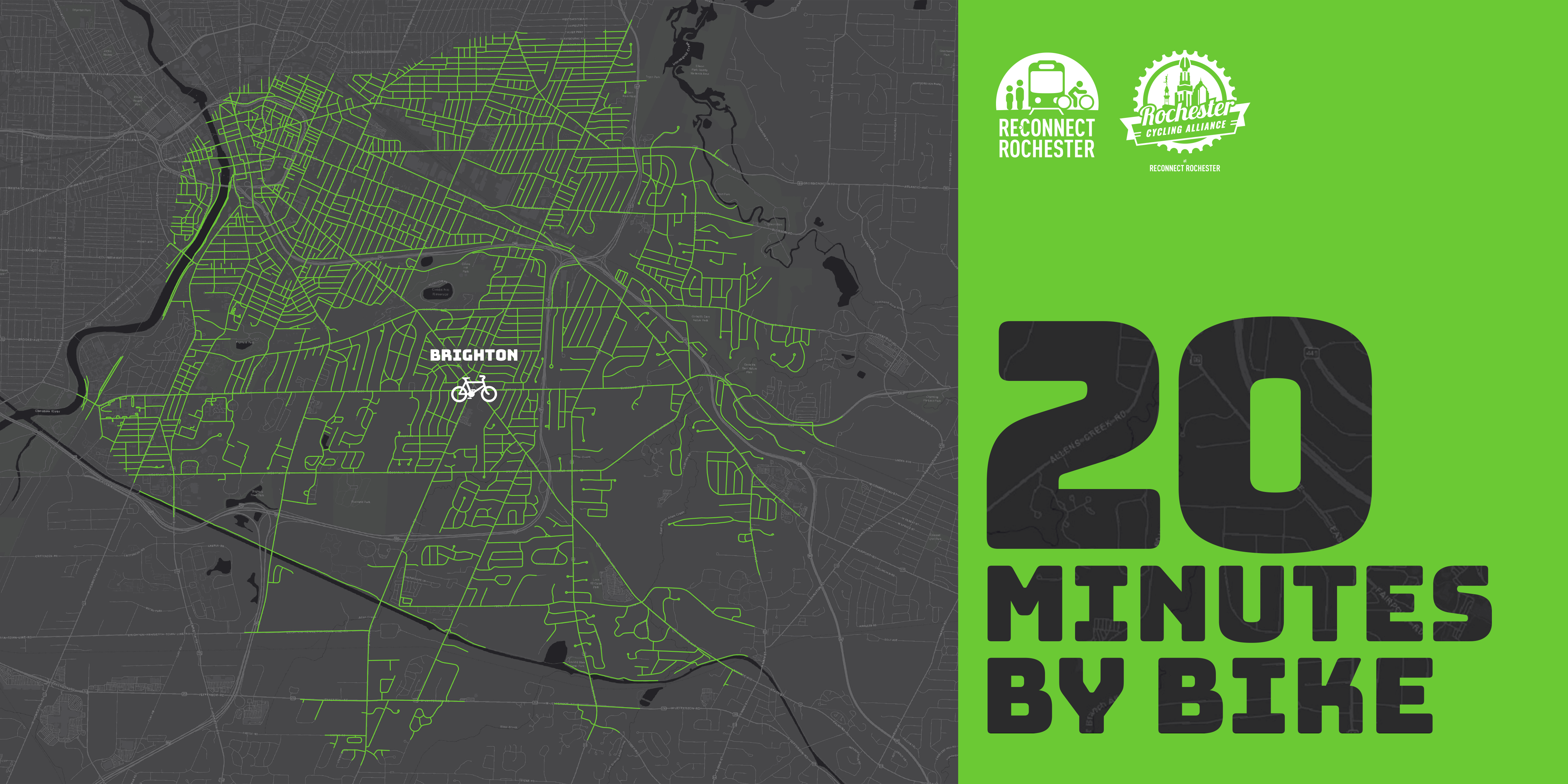
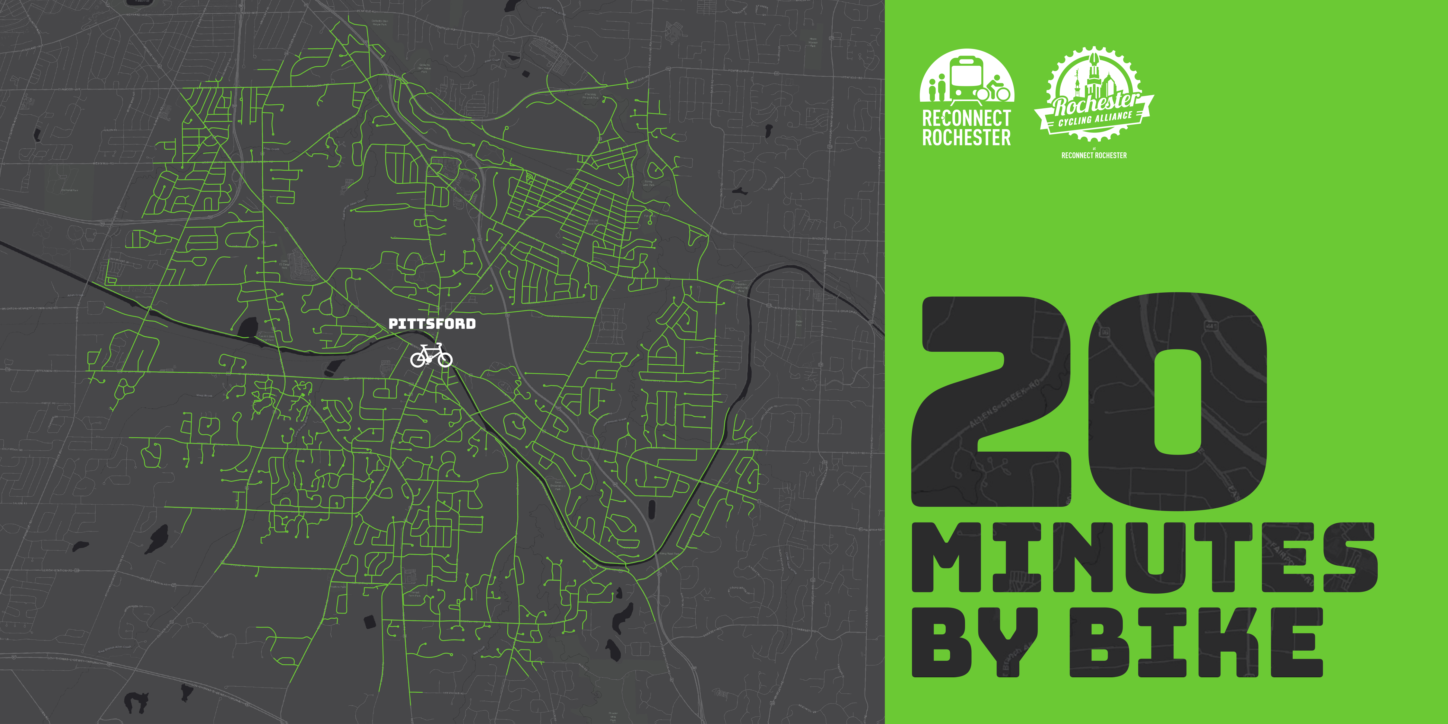
Several years ago I biked on the Auburn Trail to Pittsford Plaza and it was rough! The trail, a former rail corridor, was just too bumpy for most bikes. But with the recent improvements to the Auburn Trail, the plaza, its restaurants, shops, movie theatre, and of course places of employment are now quite accessible by bike! And because the start of the improved portion of the Auburn Trail is right next to one of the City’s Bike Boulevards (this connectivity was intentional), Pittsford Plaza is definitely bikeable from the City now. Once again, here’s Stefan Korfmacher’s stylized version of Rochester’s bike connections, only incorporating trails and bike boulevards.

Our Journey

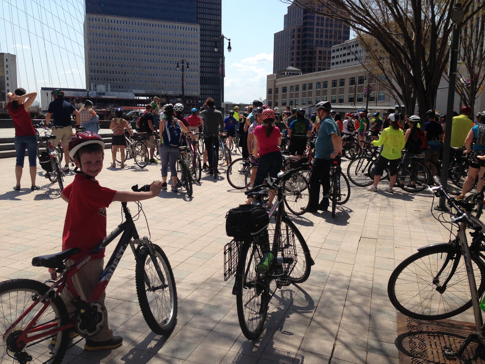
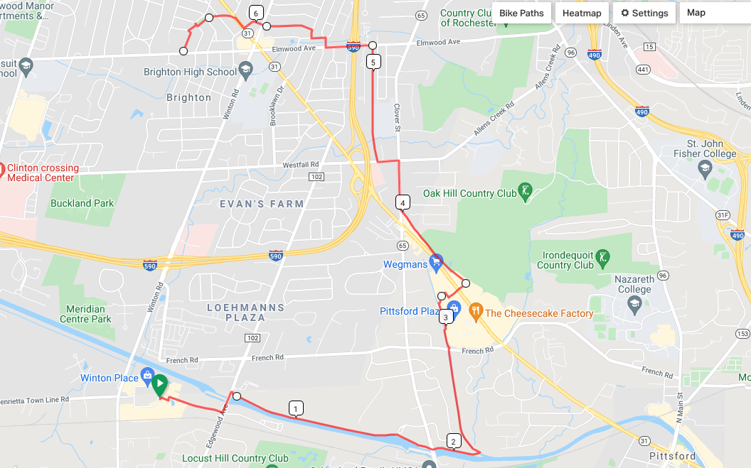
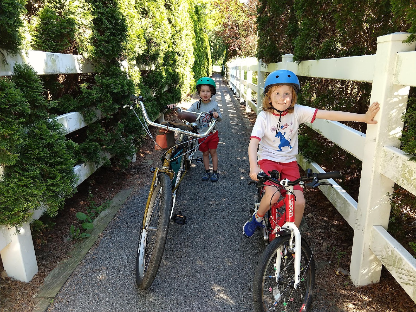
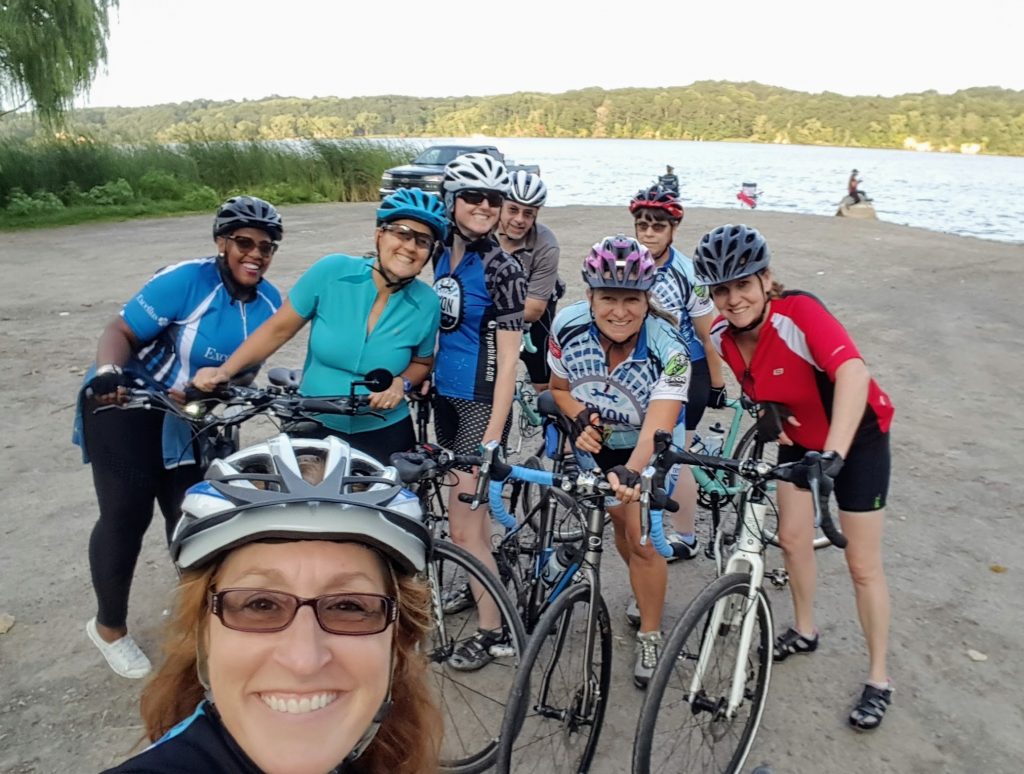
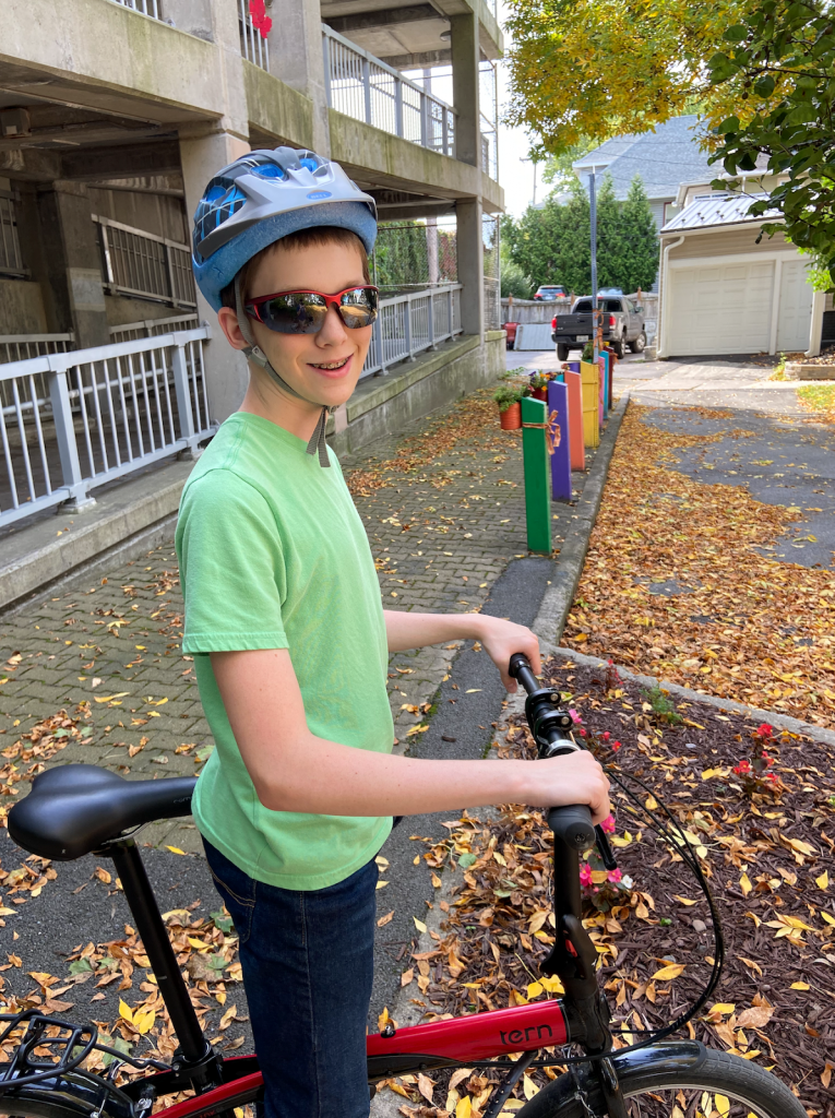
On a warm, sunny weekend in October, I convinced our kids, ages 14 and 11, to ride out to Pittsford Plaza with me. Of course I resorted to bribery; they knew some surprise at journey’s end would make it worth their while. Hint, hint, it rhymes with “Joe’s.”

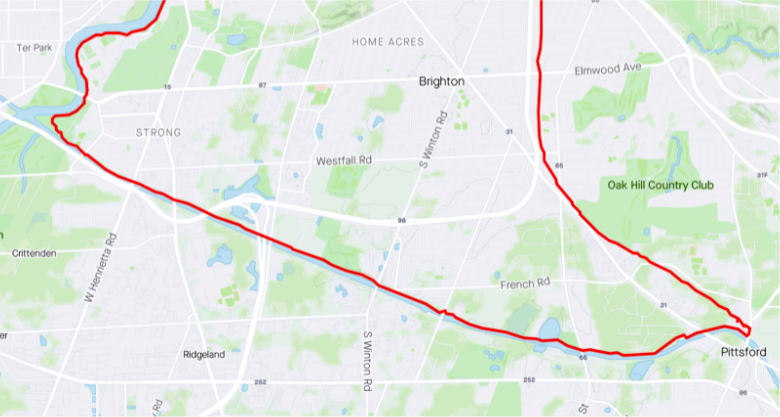
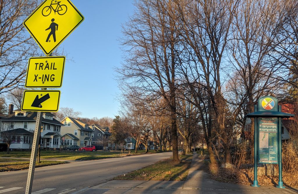
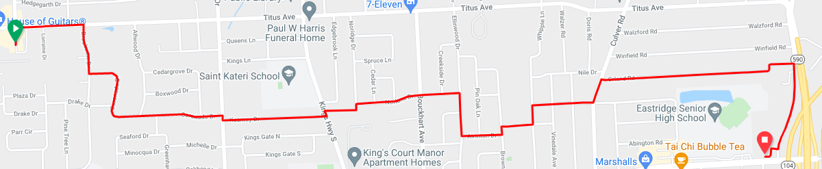
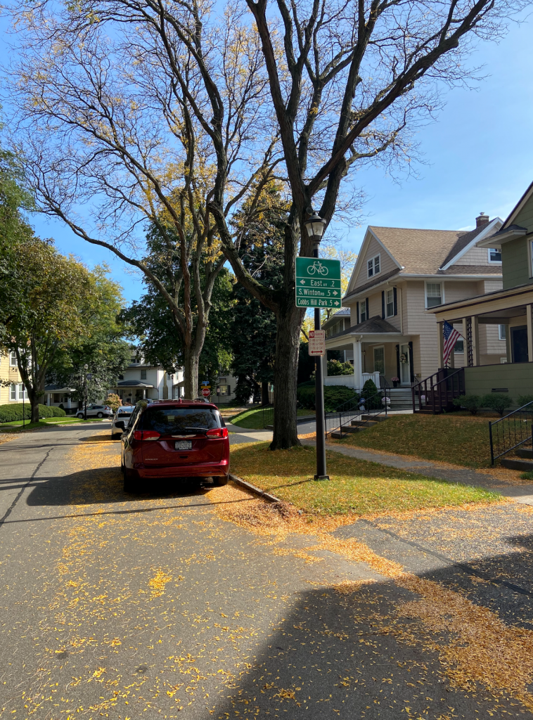
To begin, we biked from our home in North Winton Village to the ABC Streets neighborhood near Park Avenue. The City’s oldest Bike Boulevard is along Harvard Street and connects this neighborhood to Cobbs Hill via the bike/pedestrian bridge over 490. Bicycling along Rochester’s Bike Boulevards is a fun, relaxing experience. The traffic is sparse and slow due to the traffic bumps and the falling leaves on this day made it even better. Plus, regular signage helps cyclists find their way.

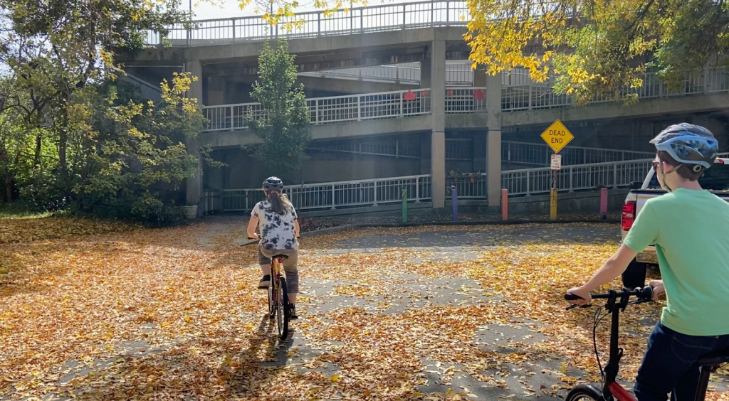
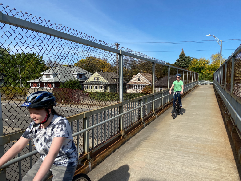
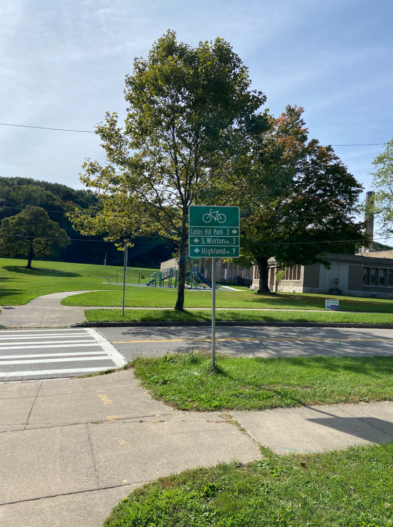
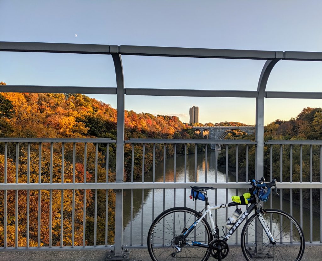
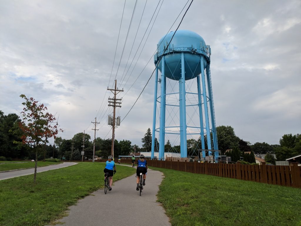
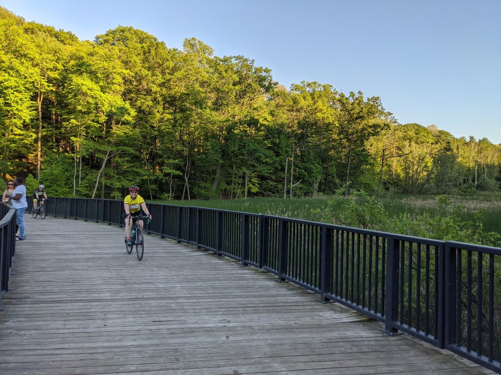
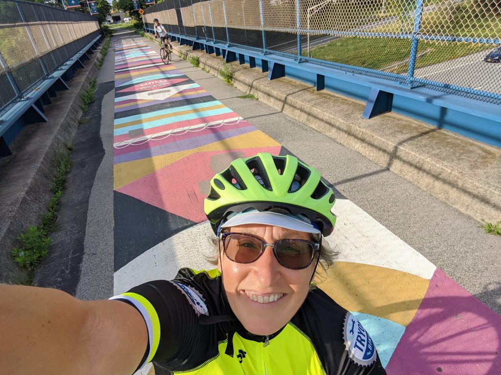
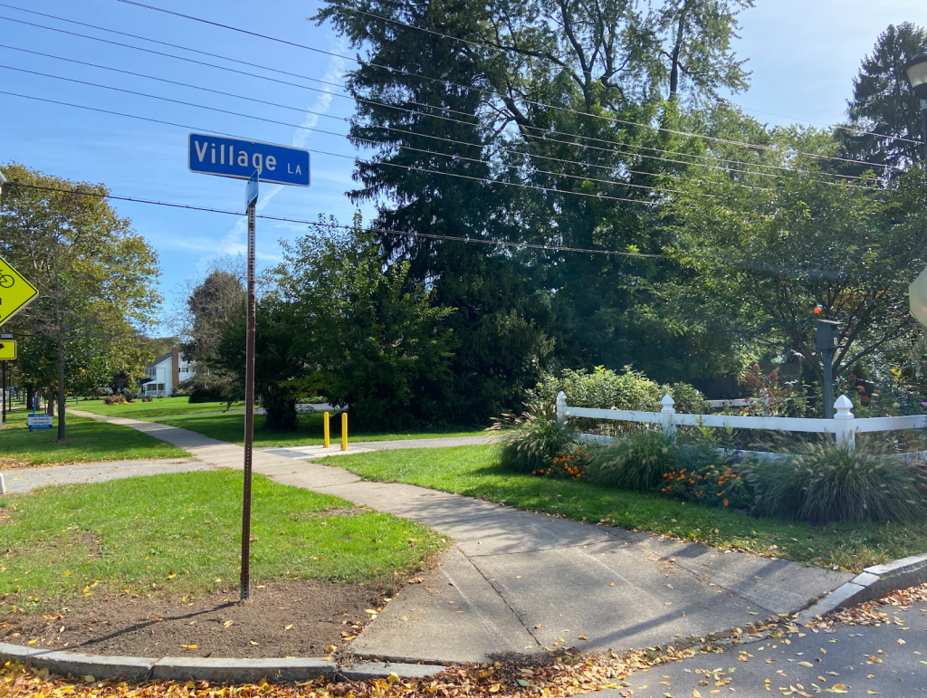
The pedestrian-bike bridge over 490 is so much fun! When you get to the other side, you can turn right to go to Cobbs Hill Park, Lake Riley, the dog park, and ball fields. The Rochester Chess Center is here, too, on Norris Drive. We went left on Hillside Avenue, which is another Bike Boulevard on a slow, comfortable, residential street. The boulevard continues past Winton and curves south, ending at Highland Avenue. This is where some brief on-street traffic negotiating is unavoidable. We had to take a left on Highland and bike just past 590. Even though there’s no bike infrastructure on Highland, the shoulder is plenty wide and comfortable and there wasn’t much traffic. When you’re on the other side of 590, the Auburn Trail begins just after Village Lane. The distance between the end of the comfortable Bike Boulevard and the Auburn Trail? 0.1 mile! Piece of cake.

More About the Trail

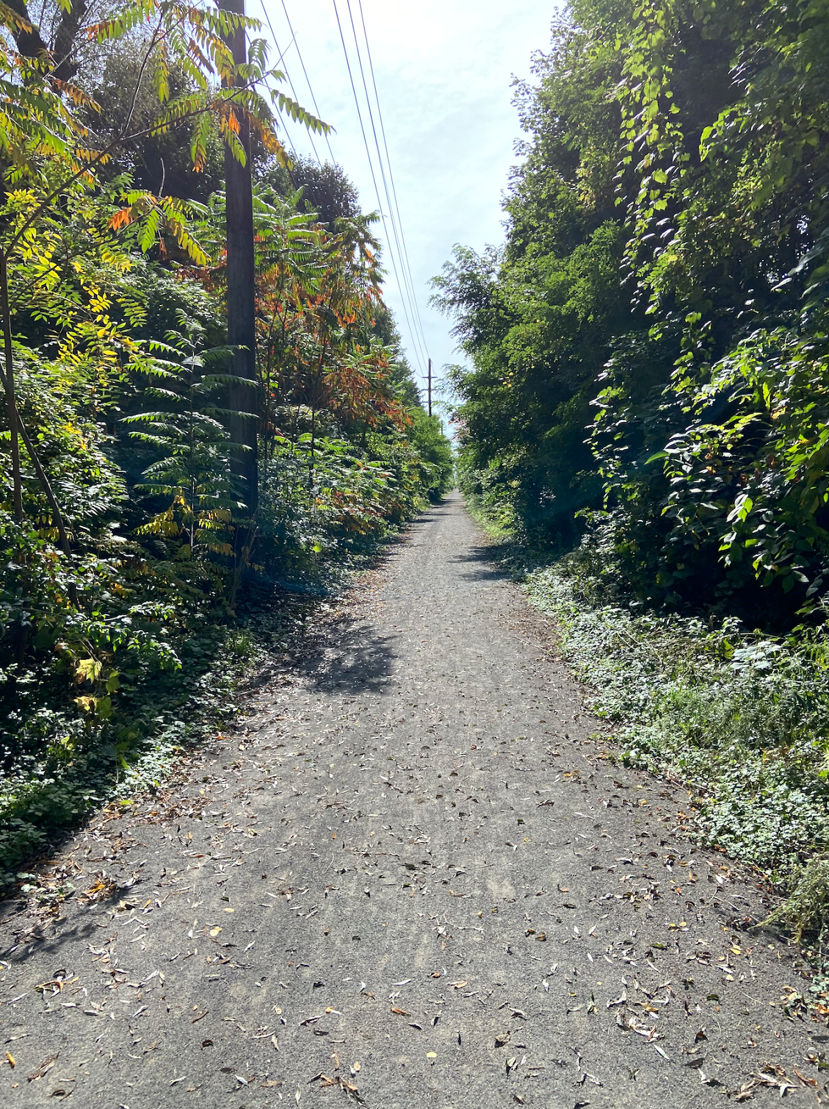
The Auburn Trail is a treasure! You bike past beautiful gardens, Council Rock Primary School, The Harley School, and the future site of Whole Foods. (TIP: As with all gravel riding, you’ll have an easier time and more stability by shifting into a lower gear on your bike so you can pedal faster.) The crossings at Elmwood, Allens Creek Road, and Clover were a breeze and motorists came to a stop every time to let us cross. A couple of the crossings feature Rectangular Rapid Flashing Beacons (RRFBs) to make crossing easier.

End of the Line (for us)

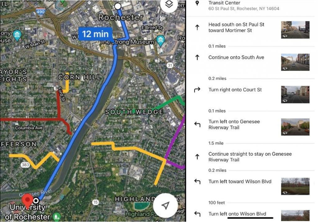
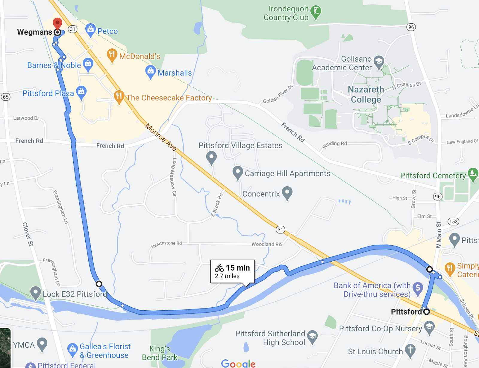
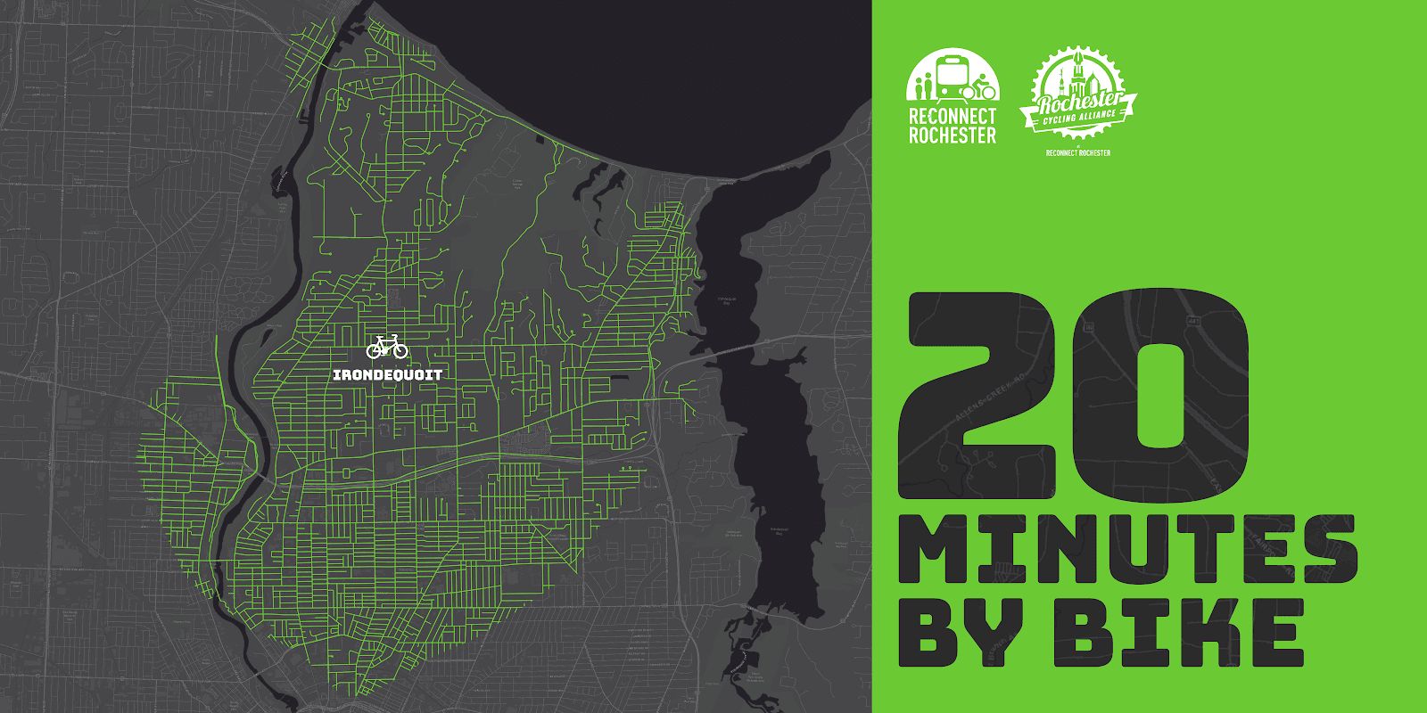
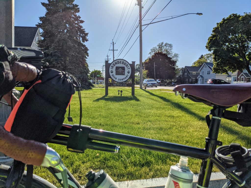
We ended our trip at Moe’s Southwest Grill, where we grabbed lunch. Our entire trip from North Winton Village to Moe’s was less than 6 miles, about 35 minutes of fun, comfortable cycling. (If you’re starting from the Colby Street bike/ped bridge in the ABC Streets neighborhood, the trip would be just 3.6 miles, about 20 minutes by bike). The property didn’t have a bike rack so we just locked up to some signage; not ideal but it works.

Less than ideal bike parking at Moe’s

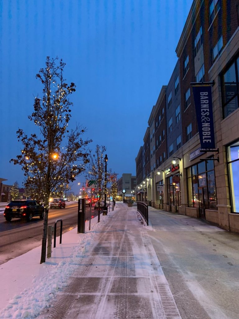
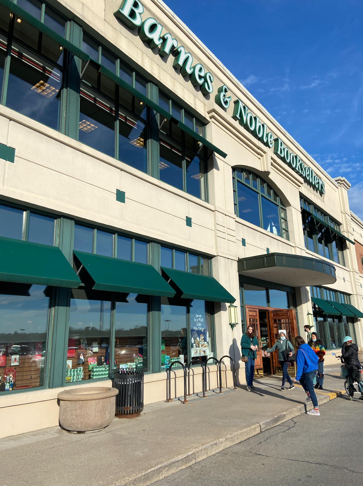
After some burritos and queso, we biked across the street, through one of the Monroe Ave intersections with a traffic light, to Pittsford Plaza and Barnes and Noble. B&N has bike racks right next to the front door. With a lot of eyes on the street and foot traffic, it’s a very safe place to lock up your bike.

Bike racks at Barnes & Noble

Thanks Rochester, Brighton, and Pittsford for making this bike trip so delightful!

Additional Notes:

  • Thank your Brighton and Pittsford leaders for this collaborative effort on the Auburn Trail.
  • Pittsford Plaza and its environs could certainly use more bike racks. Now that this popular destination is bikeable, it’s worth getting in touch with Wilmorite and politely requesting that more racks be installed throughout the plaza.
One of the few bike racks in Pittsford Plaza, at Trader Joe’s
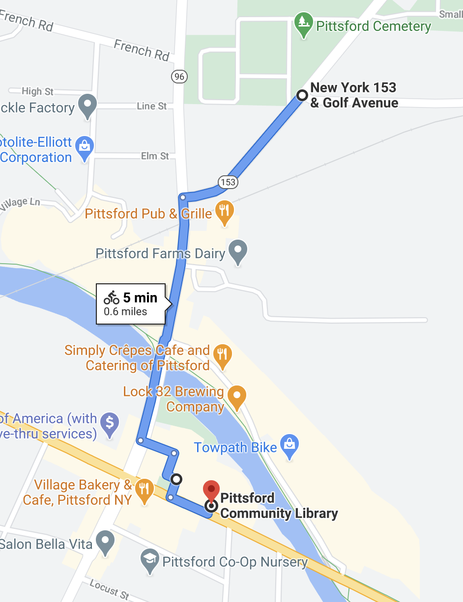
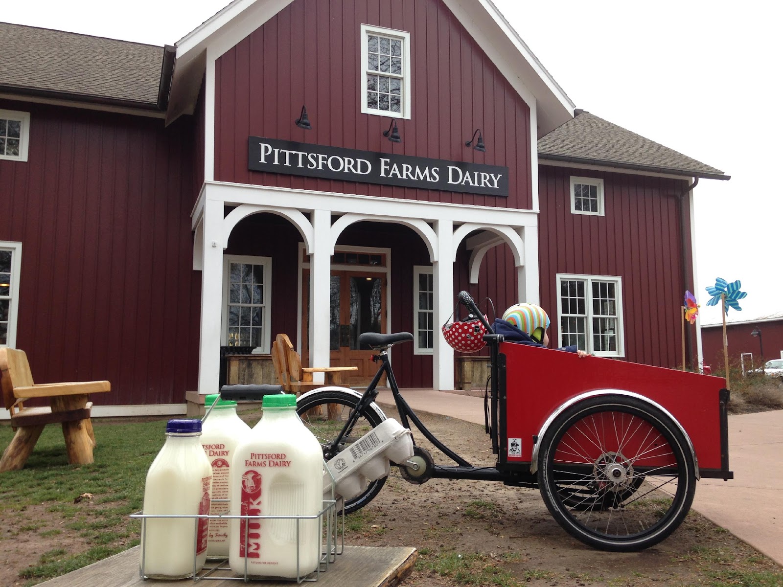
  • Though we stopped at Moe’s and Barnes & Noble, the Auburn Trail does continue all the way to 96 and the Pittsford Farms Dairy! The trail ceases to be crushed gravel and becomes a narrow dirt trail. But it’s absolutely bikeable if the ground isn’t soggy. No special bike required. For riders seeking a longer recreational ride, try: the Auburn Trail out to Pittsford > the Erie Canal Trail west to Genesee Valley Park > the Genesee Riverway Trail north up to downtown; it makes a wonderful triangle.
In 2022, we’ll feature more blogs like this – hoppable trips by bike. We hope it inspires you to leave your car at home for some trips and that you gain an appreciation for our budding bike network and trail system.
1 Comment

“Flower City Feeling Good” Summer Group Rides: Building Community & Learning Road Lessons Along the Way

By Jesse Peers, Cycling Manager at Reconnect Rochester

After taking a bike class in 2013 which made me much more comfortable biking around, in 2014 I adopted the bike as my primary mode of transportation. Since biking short distances was easy and fun, it wasn’t long before I wanted to ride with other people. In May 2015 I took our son and we went on our first group ride: a tour of public art as part of RoCo’s Ride It exhibit. Riding in such a large group was euphoric! I knew I wanted more.

That summer I started attending the weekly Unity Ride at Bulls Head Plaza, then in its first season. The people, the diversity of the crowd, and the Unity Ride’s message – cyclists coming together to stand for non-violence and community – kept me coming back each week. I also started attending the City’s Tuesday Guided Bike Tours sponsored by the Recreation Department. That’s how I got to know Richard DeSarra, who was leading those rides at the time. For decades, Richard was the godfather of all-things-cycling in Rochester. If there was anything happening related to bikes, he had his fingerprints all over it. Most notably, he cofounded the Rochester Cycling Alliance with Jon Schull and was instrumental in the creation of Rochester’s first Bicycle Master Plan.

Richard was a perfect bicycle tour guide. Not only was he a natural at herding a large group of cyclists across the city, but he just knew so much about local history, architecture and culture that anywhere we went, I’d learn something new. It was through those Rec Dept guided bike tours that I got to know Rochester by bike, particularly the Genesee Riverway Trail and other scenic locations.

Eventually Richard’s health started deteriorating and he wasn’t able to lead the tours anymore, though his advocacy and leadership continued until he passed away in 2019.

For several years, Oscar Wilson led the tours and did a great job growing the community. As with many things, the pandemic threw a wrench in those weekly tours and this year, the Recreation Department felt it was time for a reboot of sorts. The City reached out to Reconnect Rochester to see if we’d be interested in organizing and leading the weekly tours. We jumped at the unexpected opportunity and asked longtime collaborator Exercise Express and R Community Bikes to help.

We changed the night to Wednesdays and decided to use these fun community rides to familiarize residents with bike infrastructure, and to focus the tours on the newly expanded Bike Boulevard network.

For those unfamiliar with bike boulevards, they are a low-stress network of mostly residential side streets that parallel busy arterials. Traffic calming measures such as speed bumps are installed to slow down and even deter car traffic, so cyclists have a better experience. Over time, wayfinding signage will be added for cyclists. Until this year, Rochester barely had any Bike Boulevards. Many are probably familiar with the first in the area: the Harvard/Canterbury boulevard from Hillside Ave/Cobbs Hill to Monroe Ave.

In 2021, the City added 20 miles to the network! When you include the next phase of boulevards (the yellow routes above, which are absolutely cyclable now!), the future Running Track Bridge connection, and pre-existing trails, you end up with a bike network like this:

Thanks to Stefan Korfmacher for creating this stylized map for us to generate interest and discussion. Click here for a key.

Here is the best thing about the Bike Boulevards: They are Rochester’s first and up to this point only centrally planned bike network. Whereas bike infrastructure on arterials is too often done in piecemeal fashion “where feasible” with no overall view to connectivity, the Bike Boulevards are the first instance of Rochester zooming out and implementing a centrally coordinated plan to connect the city. As a result, from one end of a particular boulevard to the other, there are no gaps. Keep in mind these boulevards cross major, busy streets but for the most part avoid cycling along them.

It’s important to note that the City views these bike boulevards as complementary to, not substitutes for, on-street infrastructure on arterials. But the boulevards in large part can get you where you need to go within the city comfortably as long as you’re willing to go a little bit out of your way. Someday the network could expand to look like this.

Our hope over the summer was to build up bike traffic along this growing network ahead of time and amp up excitement for construction. We rode from a different Rec Center each week and each ride was about seven miles so it could be comparable in length to other community rides like the Unity Ride. Over the course of the series, we were able to show how these various routes connect with each other to form a usable network. Here are all of our different rides over the summer combined in one image.

Map courtesy of Bob Williams at Genesee Transportation Council

Great emphasis was put on the City’s north side, where not much bike infrastructure is present and where many Rec Centers were kept open during the pandemic due to the vital support they provide to their surrounding communities. Participants enjoyed riding along the east-west boulevards in this area that serve as wonderful alternatives to Norton, Clifford, and Bay.

Though we weren’t able to ride every boulevard this summer, you can see how these low-stress routes really do connect the City! From our marker campaign, we knew residents wanted an easier way to bike to the Zoo and to the Public Market. Well, this bike network delivers! The El Camino Trail, which you can get to via bike boulevards, ends at the Seneca Park Zoo and the Public Market is approachable via bike boulevards from all four directions!

The best part of the series was having participants ride through neighborhoods they had never seen before. Maplewood and 14621 just west of RGH got a lot of love. To my surprise, participants’ favorite ride was the longest one with the most hills! To wrap up the series, we stopped by Exercise Express, which is situated on the Ames Street bike boulevard, for some treats. Along with some group photos, here is some of the neat stuff we spotted along our journeys:

2 Comments

20 Minutes by Bike Blog Series: University of Rochester

The Rochester area is famous for its 20-minute commute. For driving that is. Reconnect Rochester and the Rochester Cycling Alliance are excited to ask a different question in this blog series: Where can you get within 20 minutes on a bike?

Presenting the sixth in a series of custom “bike shed maps.” For this next installment, we chose the University of Rochester Medical Center on Elmwood Avenue and are showing how far out in every direction you can get on a bike at a casual but steady pace of 10 miles per hour. This means that if you live anywhere in this green area, you can get to U of R within 20ish minutes on a bike or scooter. Thanks again to Brendan Ryan and Mike Governale for their help putting these maps together for us.

To get us familiar with this green territory surrounding the University of Rochester Medical Center (URMC), here’s Tracey Austin sharing her personal travel-by-bike experiences.


When I started commuting by bike 14 years ago, I didn’t realize how much ground a bike can cover in a short amount of time. And I’m not a fast rider! It was surprising to me that commuting by bike was almost as fast as driving my car to work. And when I started working at the University of Rochester, I was happy to find out I could save even more time and money on parking by biking to work.

Over the years, I have found that there is so much within reach while biking. There are many wonderful parts of Rochester within a very reasonable 20 minute ride to and from the University. Let me share with you a few of the discoveries I’ve made!

One of the best discoveries by far is that UR is only a 12-minute pedal away from the RTS Downtown Transit Center. Even better, this commute runs along the beautiful Genesee Riverway Trail! If you don’t have a bike or prefer not to bring one on the bus, you can rent a HOPR bike or scooter right at the Transit Center. Google Maps is a great navigating tool for this route. These photos show the Google Maps directions while also highlighting bike boulevards around the area. This is a very exciting prospective route for someone wanting to commute from a surrounding suburb who would rather take the bus for the first part of their trip.

I have driven my car to work only once since starting at UR. The annual parking pass can cost several hundred dollars on up. Also, UR has recently added a daily $5 occasional parking pass so you can just pay for the days you are not able to walk or bike. Not only do I love not paying for parking, but I’ve realized that I could save time by biking to work once I account for time spent walking or shuttling from my assigned parking lot!  This is definitely worth testing out to see if it may work for you, even if only in the warmer months of the year.

There’s no doubt UR is a hot spot for bikes! When Pace/Zagster was in our region, UR had the most utilized bikeshare station of the entire network. Now with 3 new HOPR hubs on our campuses, we are well on our way to being another great connection point—not only for students and employees, but for anyone needing to rent a bike in the area.

Having my bike at work adds convenience during the day, too: if I have to leave for a meeting, I don’t have to walk all the way to a car in a distant parking lot; my bike is parked right outside my office at an easily accessible rack. And I can go for a leisurely ride on my lunch break, because I am close to both the Genesee Riverway Trail and the Erie Canal Trail. These scenic trails also provide great commuting options and a way to get off the busy surrounding streets.

Speaking of lunch, taking the pedestrian bridge from River Campus over to the 19th Ward gives cyclists 10 minute access to Brooks Landing. Expand your horizons beyond just College Town! If you have 20 minutes, you can make it all the way downtown, to Corn Hill Landing, Fuego Coffee, the Foodlink Café at the Central Public Library, and more. And taking South Ave toward Rochester City Center lands cyclists in the South Wedge for any number of restaurant choices. And that’s just if you head north from UR!

Heading south you can easily reach the border of Henrietta and all the stores and restaurants at Park Point. Take the Lehigh Valley Trail (a superhighway for bikes!) from the South Lot and follow it all the way down to Brighton Henrietta Town Line Rd. From there you can easily head on over to RIT or down Jefferson Rd as well. This gives you so many awesome connection points to cut commuting time and stay off the major roadways.

Genesee Valley Park is also directly south of the River Campus and is a great access point: to the Canal Trail and all points west, plus the Greenway Trail, which can open even more commuting options for people in Scottsville and Henrietta (that would sometimes work out to be over 20 minutes, though).

Heading east from URMC, you can easily make it to 12 Corners in Brighton and all the parks in between. Highland Park is a mere 10 minutes by bike from anywhere at UR, and taking a short detour through Mt. Hope Cemetery offers a peaceful route coming from any direction.

The Memorial Art Gallery and surrounding Neighborhood of the Arts can easily be accessed by biking north on the Genesee River Trail on the east side of the river up to the Genesee Gateway Park where you can exit the trail and immediately cross Mt Hope Ave and be on Alexander St, taking that all the way to University Ave! Make a right on University and the MAG is one block up on the left.

 A similar distance to the Susan B. Anthony House neighborhood on the west side of the river can easily be achieved straight up Jefferson Ave from the Riverview Apartments on the river trail west. Not to mention all of the streets of housing that can be accessed in the 19th Ward from two pedestrian bridges and the Ford Street Bridge! 

The UR shuttle service is also a great resource for bike commuters since all of the shuttles have bike racks on the front. So if you are an employee or student and you live Downtown near Eastman School of Music, in the 19th Ward, or Southwedge you have access to a shuttle right in your neighborhood. Check out the shuttle schedules on the transportation website to see if you could even bike to a shuttle stop and then hitch a ride the rest of the way to work/school.

There are many other points you can reach from UR in 20 min by bike, some of which are:

    • Southwest YMCA
    • Parcel 5
    • Eastman School of Music
    • Downtown Rochester
    • Greater Rochester International Airport
    • Frontier Field
    • MCC
    • Brighton Town Park

Free covered bike parking on Library Rd on River campus, more of these solar-lit covered bike parking shelters to come!

If you’re pedaling to work, you can keep your bicycle safe and secure at one of our fully enclosed bike stations. The bike stations are located on the ground level of the hospital’s ramp garage, with one at Jackson Drive and the other at East Drive. Both bike stations offer:

    • 24/7 access
    • space saver bike racks
    • security cameras
    • weather-protection
    • self-service bike repair stations

For $40 per year, bike commuters can purchase a permit to either bike station which offers:

Permits for the bike stations can be purchased through the Transportation and Parking Management Center at 70 Goler House during regular business hours or at the Parking Office inside the main hospital garage after business hours. Appointments are now required if you are visiting the Parking Management office in person. Book an appointment online using the online appointment reservation form. For more information, please contact the Parking Management Center at 585-275-4524.


Newly renovated Jackson Drive Bike Cage:

East Drive Bike Cage:

No Comments

20 Minutes by Bike Blog Series: Rochester General Hospital Map (+ a Bonus)

The Rochester area is famous for its 20-minute commute. For driving that is. Reconnect Rochester and the Rochester Cycling Alliance are excited to ask a different question in this blog series: Where can you get within 20 minutes on a bike?


Presenting the fifth in a series of custom “bike shed maps.” For this next installment, we chose Rochester General Hospital (RGH) and are showing how far out in every direction you can get on a bike at a casual but steady pace of 10 miles per hour. This means that if you live anywhere in this green area, you can get to RGH within 20ish minutes on a bike or scooter. Thanks again to Brendan Ryan and Mike Governale for their help putting these maps together for us.

To get us familiar with this green territory surrounding RGH, here’s Dr. Gerald Gacioch sharing his personal travel-by-bike experiences.

I am a doctor at RGH and have been biking to work for the past 15ish years. I am not comfortable riding before sunrise or after sunset (despite bright lights and neon clothing) so my bike to work season is usually late-April to mid-September. There is really nothing like the feeling I get when my workday starts with a ride instead of the usual car commute on 490 (cycling is sort of a cross between Rocky running up the library stairs and a tranquil Zen master). I live on the border of Pittsford and Fairport. My route is Rt 31 to Schoen Place to Rt 96 past Nazareth to Fisher, left onto East Ave (GREAT new bike lane!) to University to Culver to Norton and Portland. The whole way is very safe and now has a bike lane almost the entire route.

Lessons Learned

Here are some of the lessons I have learned from now hundreds of days of bike commuting:

    • Pick a safe route. I tested out several routes when I started biking to work on a Sunday when roads were pretty quiet. I have used the same route since then and I now know the timing of the lights, where the potholes are, where people drive weirdly, etc.
    • Check out an e-bike. Still a great workout when you want it to be, but lots of fun to blast up a hill with little effort sometimes. I can cut 10-15 minutes off my commute when on the e-bike.
    • Enjoy the ride and be in the moment.

Rochester’s Bicycle Boulevards

One of the best things that Rochester has to offer in terms of bikeability is its ongoing Bicycle Boulevards implementation. Back in 2015, the City identified priority routes that could be used by cyclists to navigate the city. This year the City is implementing 20 miles of this network! Bike Boulevards are mostly residential side streets that parallel busy, sometimes intimidating roads. Over time, traffic calming measures like speed humps will be installed to slow down or even deter car traffic along these corridors, keeping the experience as comfortable as possible for cyclists of all ages and abilities. Wayfinding signage will also be added to help cyclists navigate. One of the best kept cycling secrets in Rochester is that you can use these routes now, even if they haven’t been technically converted to Bike Boulevards yet. See the purple dotted routes below.

As always, no quality level or amount of bike infrastructure will ever alleviate the need to have some basic traffic-negotiating skills under your belt. Sometimes biking on a major road is unavoidable for a block or two, and even if you stick to comfortable Bike Boulevards, you’ll still have to cross major streets. So stick to these general principles and if you want to get more comfortable and confident on your bike, take one of Reconnect Rochester’s classes sometime.

Biking (or scooting) to RGH along Bike Boulevards from the South, you get your own easy, private entrance to the complex! Northaven Terrace is a dead-end street for cars. But on your bicycle, just open the gate at the end and you’re there.

The Routes

This trip along low traffic, residential bike boulevards from North Winton Village is 3.6 miles (21 minutes by bike):

Here is a route biking (or scooting!) from the downtown Transit Center to RGH, primarily along Bike Boulevards. This is 3.3 miles, under 20 minutes! (TIP: Thomas Street, a great connection for cyclists wanting to avoid Joseph and Hudson Avenues, is one way between Upper Falls Boulevard and Clifford Avenue, so use the sidewalk for that brief section.)

Biking to RGH from the north above 104 is a little more challenging. Unless you can use the El Camino Trail to cross 104, as seen below, you’ll have to bike on Carter Street or Portland Avenue to approach the complex (Seneca Avenue is a less stressful alternative).

When you arrive on the campus, there are currently three places to lock your bike:

    1. Carter St Garage, where there is a locked bike cage (to gain access to it you go to the Parking Office located right in the garage near the entrance to the hospital).
    2. Portland Ave Garage, where there are bike racks next to security (stationed 24/7).
    3. Near the Emergency Department, where there are also bike racks.

RGH will soon be placing more bike racks by the main entrance. Cyclists can look forward to this custom bike rack in the shape of a stethoscope!


Bonus!

As a bonus, we’re throwing in a bike shed map of Rochester Regional’s other primary campus, Unity Hospital on the west side. Though outside the 20-minute scope for most people, Unity is approachable via the Erie Canal Trail from Spencerport, Gates, and the 19th Ward. It’s also not far from the City’s Maplewood Historic District. To get to Unity from Maplewood, we recommend taking Ridgeway to Latona to Welland, which takes you straight to the Unity entrance. Stay tuned for developments on the Eastman Trail, which will parallel Ridgeway Avenue. As you can see below, there are plans to connect these west side trails and we’re excited for that connectivity!

4 Comments

20 Minutes by Bike Blog Series: Brighton Map

The Rochester area is famous for its 20-minute commute. For driving that is. Reconnect Rochester and the Rochester Cycling Alliance are excited to ask a different question in this blog series: Where can you get within 20 minutes on a bike?


Presenting the fourth in a series of custom “bike shed maps.” For this next installment, we chose Twelve Corners in Brighton and are showing how far out in every direction you can get on a bike at a casual but steady pace of 10 miles per hour. This means that if you live anywhere in this green area, you can get to Twelve Corners within 20ish minutes on a bike. Thanks again to Brendan Ryan and Mike Governale for their help putting these maps together for us.

To get us familiar with this green territory in Brighton, here’s WomanTours’ Jackie Marchand sharing her personal travel-by-bike experiences.

One of the many things I love most about living in Brighton is its bikeability. It seems I can ride my bike to nearly everywhere I need or want to go. You’d think with more than 50 years of living here that I’d be able to find my way around without Google’s help. However, it’s become a game. Do I know my community better than my phone does? Can I find a safer, quieter and prettier way to bike to my destination than Google can? Or will it surprise me and show me a hidden bike trail?

Yesterday, I had a breakfast meeting at Morgan’s Cereal Bar on East Avenue. I used the bike feature on the Google Maps app and it sent me down Monroe Avenue. That wasn’t bad because it has a bike lane. Then I was supposed to turn down Alexander, but I knew there was a beautiful new bike path on Union Street. I went one block further than Google recommended and reveled in cycling the former Inner Loop on my way to East Ave.

I left my house ten minutes earlier than if I’d driven, and managed to complete a 20-minute bike ride before breakfast. The best part of all was that while others had to pay the meter, my parking was free!

When I grocery shopped at Tops last week, my phone sent me straight down Elmwood Avenue for one mile to the store. I always avoid cycling down Elmwood Avenue, as the lanes are too narrow for both a car and a bike. Fortunately, that could change in the future. There are plans to extend the Elmwood Avenue cycletrack from South Avenue to 12 Corners, which will be fantastic but is still years away.

For now, I have to find my own safer way. I know there’s a small trail behind Temple B’rith Kodesh to quiet Ashley Drive. At the end of Ashley, another trail connects to Brandywine and then another short trail connects to Lac De Ville into the Tops parking lot. I arrived at Tops in 15 minutes by cycling only one block on Elmwood Avenue. Google – 0, Jackie – 2. 

Last weekend, I wanted bagels from Bagel Land at 12 Corners, the cornerstone of Brighton. In addition to the fastest route straight down Elmwood Avenue, Google offered me the longer but better route through side streets to the back of the plaza. There was even a bike rack waiting for me. It took one minute longer but was well worth it. Thanks Google.

It’s actually pretty easy to navigate around 12 Corners using the small side streets to avoid the tight busy intersections. If traffic is low though, I’ll choose to cycle through it rather than around it. All the stoplights keep vehicles moving slowly.

Now that the Auburn Trail is improved, my favorite after-office ride is to the Pittsford Wegmans on my way home. Google actually found this route for me. My office is just over the Brighton/Henrietta line and an easy half-mile to the Canal Trail. After a mile on the trail, I linked to the unpaved Railroad Loop Trail that took me behind Pittsford Plaza all the way to Wegmans. Google even told me how long it would take – just 18 minutes. Google – 2, Jackie – 2.

After shopping, I crossed Monroe Avenue to hop on the Auburn Trail. Google didn’t know about this trail yet – it’s that new. I exited the trail at Elmwood Avenue and then meandered some calm streets through quiet neighborhoods to my house. It felt safe and relaxing. When was the last time you called a trip to Wegmans relaxing?! 

In search of some comfortable biking clothes last week, I googled the bike route to Sierra Trading Post from my office. Most of the 16-minute trip to the store was on roads, but there were shoulders and the traffic was light, so I felt safe. Google even knew to take me around the back of the stores where the loading docks were to avoid the busy parking lot. Surprise – there was a bike rack waiting for me in front of the store! Google – 3, Jackie – 3. 

Examining the ride home after shopping, I learned that my phone wanted me to take the Canal Trail to the Brighton Town Park, but from there Google failed me. It was sending me on Westfall to South Clinton to Elmwood Avenue for a total of two miles on busy thoroughfares. 

When I zoomed in, I saw that there was a small path connecting Westfall to Schilling Lane in a small residential neighborhood. It allowed me to cut out the hilly intersection at Westfall and S. Clinton and cycle nearly the entire two miles on a mix of quiet roads and paths. Admittedly, I probably wouldn’t have found the trail without Google, so I gave us each a point. Google – 4, Jackie – 4.

Finally, I already knew that the two newest trails in Brighton are not recognized by Google as bicycling routes. The one-mile long Brickyard Trail recently celebrated its fifth anniversary and connects Westfall and Elmwood Avenues. It’s a stroll through wetlands where I’ve regularly spotted foxes, turtles, owls and turkeys. The Highland Crossing Trail is less than two years old and also connects Westfall and Elmwood Avenues, but then continues north through Highland Park, ending at the Genesee Riverway Trail. Its highlight is an elevated boardwalk through a forest.

Jackie on the Highland Crossing Trail

The two trails are my favorite place to go when I don’t have anywhere I need to be. I tried the loop the other day, incorporating a couple calm bike boulevards that Google suggested. So I gave Google two points for the bike boulevards, and myself a point for each trail. Google – 5, Me – 5. I’m going to have to keep cycling so I can get ahead!

2 Comments

20 Minutes by Bike Blog Series: Pittsford Map

The Rochester area is famous for its 20-minute commute. For driving that is. Reconnect Rochester and the Rochester Cycling Alliance are excited to ask a different question in this blog series: Where can you get within 20 minutes on a bike?


Presenting the third in a series of custom “bike shed maps.” For this next installment, we chose Four Corners in Pittsford Village and are showing how far out in every direction you can get on a bike at a casual but steady pace of 10 miles per hour. This means that if you live anywhere in this green area, you can get to Four Corners within 20ish minutes on a bike. Thanks again to Brendan Ryan and Mike Governale for their help putting these maps together for us.

To get us familiar with this green territory in Pittsford, here’s Flower City Family Cycling’s Brooke Fossey sharing her personal travel-by-bike experiences.

Introducing 20 Minutes by Bike Pittsford

You don’t have to be a cycling enthusiast to appreciate how connected Pittsford is. My humble hope is that after reading this, you’ll discover a new route available to you, and maybe you’ll pull out your bike for a trip that you’ve only considered accessible by car before. At the very end, I’ll share some tips that I hope will help you get started. 

48110148487_669dba10b5_o.jpg

I’m struck by three things about this 20 Minutes Map:

    1. You can bike to the heart of the village—our Library, shops, restaurants, Bakery and Dairy—from pretty far away in just 20 minutes or less, including from East Rochester, Pittsford Plaza, two colleges, and many of our neighborhoods. 
    2. We have been gifted, through good planning and leadership, with a great trail system that connects so much of Pittsford completely off the roads, including the Erie Canalway Trail and Town trails that connect cul-de-sac neighborhoods.
    3. We still have a long way to go to make major roads comfortable for most riders. We have to keep advocating for safety improvements on our major arterials. Although trail connections are great, direct routes should be viable and safe by bike – for everyone.

Take a look at the major attractions we have that are bikeable in the same length of time widely considered in Rochester to be the longest it takes to drive anywhere (20 minutes):

    • Library
    • Community/Recreation Center
    • Village and Town Halls
    • Main Street shops and restaurants
    • Schoen Place shops, restaurants, and breweries
    • Bushnell’s Basin shops and restaurants
    • Pittsford Plaza shops and restaurants, including Wegmans
    • Schools
    • Doctor and dentist offices
    • Banks
    • Yoga, pilates, and the YMCA
    • Hair salons
    • Parks like Great Embankment, Thornell Farm Park, Kreag Rd Park
    • Playgrounds
    • Erie Canal
    • East Rochester amenities, including restaurants, a pool and splashpad
    • Nazareth and St. John Fisher colleges

That list is pretty incredible. Now, let’s break some of this down further. 

Bike to your Books! 

The Pittsford Community Library has not one, but two bike racks: one in front on State Street and one behind with an adjacent bike repair station. If you haven’t considered biking to the Library, strap on your backpack or grab your bike basket. You’ll feel great when you arrive and you’ll have the best parking spot there. 

35777049031_f042db6766_o.jpg
Pittsford Community Library bike parking

Let’s say you’re coming from one of the neighborhoods off Rt-96. You can take the sidewalk along Rt-96, cross at the light at South Street and take the quieter neighborhood roads right to the Library in 5 minutes by bike, 1 mile each way. 

Screen Shot 2021-02-10 at 11.10.13 AM.png

Coming from the other direction, Google will send you on the most direct path, on N. Main Street, and you can cut in through the parking lot. Or, take the quieter, but slightly longer, neighborhood route down Schoen Place. Sometimes going a little bit out of your way on your bike makes for a much more enjoyable and relaxing ride, until our main streets are made safe enough for everyone to feel comfortable riding on them. I’d probably take this longer but quieter route if I had my kids riding independently next to me. It would be a little longer, but on a bike, it’s not that noticeable, and it would be much less stressful. 

*Note: State Street Bridge is closed for repairs until mid-July.

Middle School Mileage

A few of our friends who live in or near the village have middle-school age children who biked to Calkins Road Middle School. To many of us, that sounds a little scary, but there’s actually a sidewalk that connects all the way, and a trail system that connects cul-du-sacs and allows for riding on much quieter streets. Having route choices makes biking more accessible as each person can tailor their ride to their own comfort level. Biking to school has so many benefits: independence for teens, reduced congestion, transportation savings, and kids can arrive to school more awake and ready to learn. This is something I believe we should be actively encouraging as a community. 

32105750_1999652596734556_7492071836528672768_n.jpg
Calkins Road Middle School bike racks are packed on Bike to School Day

Many of Pittsford’s neighborhoods have walking and biking paths that connect cul-du-sacs with the next neighborhood without having to go out on the main road, and I’ve found that you can travel quite far on these side roads—if you know about them! 

50055540776_462214809f_o.jpg
Trail connection between Crestview Dr and the Jefferson Road School grounds
48110146237_c4b02e7756_o.jpg
Neighborhood walk/bike connection between Stonegate Ln and the Pittsford Community Center

Groceries and Gears

Getting groceries by bike requires a little more planning, but it is not only possible, it can be so rewarding. Do I wish there was a small grocery to pop into to grab a few things by bike a few times a week – heck yes. Is Wegmans by bike an option? Believe it or not, also heck yes. Maybe you can’t bring as much home as you would in your car, but you can actually haul quite a bit on your bike with panniers or just a large backpack. Plus you have the added benefits of exercise, parking right up next to the building, and—let’s not underestimate the badass factor. You’ll feel really proud of yourself. I’ve done this route myself, but my husband usually runs it weekly during three seasons using the trails to completely avoid Monroe Avenue. 

IMG_20200714_211008133.jpg
Hefty Wegmans haul via bike

The approved Active Transportation Plan calls for a multi-use trail along Monroe Avenue, but until that happens, did you know you can reach Wegmans completely on trails? Check it out: 

Screen Shot 2021-02-14 at 10.15.22 AM.png

This route uses the Auburn Trail, accessible behind the Pickle Factory. Unfortunately Google maps doesn’t show this connection. From the Four Corners, get on the Erie Canal towpath heading west, turn right on the turnoff near Pittsford DPW’s building, and hop on the Auburn Trail behind the Pickle Factory storage building. Cross to Wegmans at the light and cruise right into the parking lot, with bike parking on either side of the store. 

Alternatively, you can come up on the west side of Wegmans taking the Erie Canal towpath farther west and coming down the ramp near the old Lock 62. 

Screen Shot 2021-02-14 at 10.16.02 AM.png

College Connections

Connecting young people to the village and giving them the option to get here without driving will help our local economy and give students more freedom. Nazareth has a great connection to the village, thanks to the new sidewalk installed by the Town this past year. St. John Fisher also has a straight shot on main roads. How can we encourage students to visit the village on foot or on bike, and how do we make that an attractive option? 

What Does This Mean for YOU?

If you are even the slightest bit curious, I encourage you to try biking to your destination. You will arrive invigorated and pretty darn proud of yourself. You can do this! One trip builds on the next and pretty soon, it becomes a true option, and you start to ask: should we take the car or bike today? 

33450641684_992960b5c3_o.jpg

Tips for Getting Started

Short and easy destination. If you’re brand new to biking and want to give it a try, pick a destination no more than a mile away, and which will be low-stress to get there. Ex: Pittsford Dairy: access the canal path from your closest neighborhood spot and ride to N. Main Street, and then from there just a short distance to the Dairy. Grab your milk (or ice cream!), throw it in a backpack, and head back home. Once you master that, you’ll start to see that the world opens up to what you can reach just by the power of your own legs. It’s walking, only faster! Here are some great destinations to check out in the Village: Pittsford Dairy, Lock 32 Brewery, Copper Leaf Brewing, Simply Crepes, The Coal Tower, Village Bakery, Pittsford Library, Thirsty’s, Label 7, Olives, Aladdin’s, Breathe Yoga, BluHorn Tequilaria…the list goes on and on, so pick what interests you and go for it! 

School run on a weekend. Try a school run one day – but do it on a weekend. Try it without the stress of getting there at a certain time, or rush hour traffic. Do the run and see how it is, and then when you do it for the first time on a school day, it’ll be so much easier. Pretty soon, your kids might start asking you to drop off or pick-up that way because they get more time with you and like moving their bodies before settling in at school.

Ride with other people. There are many biking groups around Rochester that do club rides. You can find one that suits your skill level and interest and ride with others. There’s a sense of camaraderie riding in a group, and you can learn from other people. Here’s a shameless plug for Flower City Family Cycling, a group I co-run that plans chill, social rides for families. All ages and abilities welcome, and we’d love to see you.  

Wrapping Up

As this map shows, Pittsford has some amazing connectivity. But it also overstates connections we do have: many of the main arterials shown as straight shots through Pittsford are often not enjoyable by bike—they can even be downright stressful and scary, depending on the time of day. They will require a great deal more effort to improve the ride experience to encourage new riders. 

The next step to making this 20-min map a reality for many people is to make the roads safer to bike on. That means lowering vehicle speeds, narrowing lanes, considering bike lanes or shared bike/walk trails, and educating the public on how to safely drive alongside someone on a bicycle.

2 Comments

20 Minutes by Bike Blog Series: Irondequoit Map

The Rochester area is famous for its 20-minute commute. For driving that is. Reconnect Rochester and the Rochester Cycling Alliance are excited to ask a different question in this blog series: Where can you get within 20 minutes on a bike?


Presenting the second in a series of custom “bike shed maps.” For this next installment, we chose Irondequoit’s “central square” – I-Square – and are showing how far out in every direction you can get on a bike at a casual but steady pace of 10 miles per hour. This means that if you live anywhere in this green area, you can get to I-Square within 20ish minutes on a bike. Thanks again to Brendan Ryan and Mike Governale for their help putting these maps together for us.

To get us familiar with this green territory in Irondequoit, here’s Pam Rogers sharing her personal travel-by-bike experiences.

Introduction

I’m so excited to share with you my personal recommendations for cycling in my favorite area of Rochester, which also happens to be my local neighborhood! Forgive me if it turns out to be an homage to Irondequoit, but it’s my way of letting you know all the best reasons to find yourself cycling here.

If you’re looking for places to ride, no matter what kind of cycling you enjoy, you’ll find something to love here in Irondequoit. It’s full of hills and flats, roads and trails, natural beauty, local history, family fun, and great places to stop and rest for food and drink. Whatever you’re looking for, it can be found between the shores of the Genesee River, Lake Ontario, and Irondequoit Bay!

How To Ride Here

The best route into town are as follows:

  • From the Northwest – the LOSP trail that follows along the parkway is the best, and it drops you out right by Pattonwood Dr and will take you over the river and into Irondequoit.
  • From the Southwest city environs – come on up St Paul St and then hop on the El Camino Trail that begins at Scrantom St and takes you north all the way up to Navarre Rd and across from the Zoo entrance – you’ll love the old railroad bridge that takes you over 104 without worry
  • From the Northeast – Well, when the swing bridge is available it’s easy peasy, but when it’s not you’ll need to approach from the south of the Bay and come around by way of Empire Blvd. Yes, busy with traffic and a very challenging hill to climb – bail out as soon as you can, on Orchard Park Blvd, if you don’t mind a few more hills to climb with a bay view, and then follow Bay Shore Blvd to get you to Ridge Rd and turn right at Kane Dr before it ever gets busy, that will take you right up to Sea Breeze Dr!
  • From the Southeast – The only way to get over the 104 expressway is to take Culver Rd but there are plenty of side streets to stay on south of it, and just north you can turn right on Brower Rd and cut through the neighborhood to come out on Ridge at Walnut Park, then quick jog over to Kane Dr to get to Sea Breeze Dr.

All Roads Lead To/From I-Square!

If you live in Irondequoit, you know our town’s “central square” is now I-Square. It was developed with a vision, to not only improve quality of life for town residents, but also to be a role model for green, environmentally responsible and energy efficient building projects. It’s a destination unto itself with restaurants, rooftop gardens and dining, outdoor amphitheatre, the Imaginarium, Art Gallery and Science Center. 

From here, it will take you less than 20 minutes to ride in any direction and find our other local treasures. West to the zoo and the river, north to the lake, east to the bay, and all wonderful tree-lined neighborhood streets along the way. When riding in town, and you must cross busy intersections, it’s safest to pick the crossroads with lights. For example, riding in northern neighborhoods divided by Hudson Ave, you can cross safely at the light using Brookview Dr to Diane Park.

You can find steep hills, nice flats, and occasional rollers. You’ll find most of the steep hills along the shores of Irondequoit Bay. There are serene and quiet neighborhoods tucked away in all corners of town: check out Rock Beach Rd off Lakeshore Blvd in the North, follow Winona off St Paul Blvd, or discover Huntington Hills nestled up against Durand Eastman Park by taking Pine Valley Rd to Wisner, and be sure to take a fun ride down Hoffman Rd behind the Irondequoit Cemetery to the end where it stops at a trail you can take through the Durand Eastman Golf Course. There, you’ll find an old hidden road overgrown with weeds that you can ride from Kings Hwy N, where Horseshoe Rd stops being a maintained road, and you can ride it along the northern edge of the golf course, across the creek, and back up to Lakeshore Blvd.

There are off road trails to explore as well. You can follow a dirt/stone trail along the east side of the river from Seneca Park Zoo all the way to the lake, which follows the old Windsor Beach Railroad line started in 1883 that traveled from the city’s Avenue E all the way north to Summerville. You can ride challenging single track trails along the west part of the bay in either Tryon Park or Irondequoit Bay Park West. Don’t forget the nicely paved pathways too! There’s one along the shore of Lake Ontario from the corner of Culver and Sweet Fern (right next to Parkside Diner) and extending to just across from Camp Eastman on the lake shore. The other one is Sea Breeze Dr along the northern section of 590 from Titus down to Culver Rd and Sea Breeze.  

Nature/Water/Parks

You may not know this, but Irondequoit, by its very name of Iroquois origin, means “where the land meets the water.” And there’s just nothing like being close to water and natural spaces, is there? The views are beautiful and varied. Some of my personal favorites I’ve already mentioned, and there are smaller parks dotting all the neighborhoods for kids to enjoy too.  A completely hidden gem is Densmore Creek Falls, accessible from the back parking lot of the Legacy at Cranberry Landing at the very eastern end of Norton before it crosses over 590 and drops down by the bay.

Food & Drink

I-Square has plenty of options for food and drink, and beautiful outdoor seating on the roof as well, so if you’re in the neighborhood you can cycle on over and enjoy! Right around I-Square you will also find the Cooper Deli, Titus Tavern and the Irondequoit Beer Company.  At the very northern end of Clinton Ave there’s a little-known but exceptionally unique eating experience that awaits you called Atlas Eats, and it’s the best for a weekend breakfast. Another hidden treasure for you ice cream lovers would be Netsins Ice Cream Shop on Culver Parkway.

If you love to ride farther afield, and take a break from your spinning wheels along the way, our waterfront taverns abound. I love to make routes that include these special stops in the neighborhood for that. Summerville has Silk O’Loughlin’s (Olie’s). Sea Breeze has Marge’s Lakeside Inn (sit on the beach!), Bill Gray’s, Shamrock Jack’s Irish Pub, and Union Tavern (it’s haunted!).  There’s Murph’s Irondequoit Pub, a neighborhood staple, now down by the O’Rorke bridge, and across the way take Marina Dr down to the end and you’ll find Schooner’s Riverside Pub, an open air only open in the summer fun kind of place.

Family Fun

You could plan a day of cycling with the kids in the small neighborhoods in Sea Breeze, stop by Parkside Diner, play a round of mini-golf next door at Whispering Pines, then head down to the Sea Breeze Pier and Beach. Need I say, Sea Breeze Amusement Park? Or ride the little neighborhoods off St. Paul Blvd. around Winona, and at its southernmost tip, take the sidewalk connecting to Maplehurst Rd, turn right and there’s paved access directly into the Seneca Park Zoo.

Routes You Might Enjoy

Feel free to use these as a starting point to create your own adventure!

I-Square to Aman’s Farm Market 3.5 miles see the RWGPS map here.

I-Square to Sea Breeze – 5.6 miles – see the RWGPS map here.

I-Square to Seneca Park Zoo – 2.4 miles – see the RWGPS map here.

I-Square to Parkside Diner and Whispering Pines 5.6 miles – see the RWGPS map here.

I-Square to Stutson Bridge Plaza and Riverside 3.2 miles see the RWGPS map here.

Town Tour from I-Square – 15 miles – see the RWGPS map here.

Map

Description automatically generated

Irondequoit Gravel Growler Beer Ride – 25 miles – see the RWGPS map here.

Map

Description automatically generated
1 Comment

ROC Cycling: Knowing Our Weaknesses, Building On Our Strengths

by Jesse Peers, Cycling Coordinator at Reconnect Rochester

When I saw the trailer for Why We Cycle years ago, I instantly knew how special this film was. Finally someone had made a gorgeous film about the myriad of reasons why people all over the world choose to traverse their communities by bike. I’m glad we were able to screen the documentary for a Rochester Street Films event in September 2020 and use it as a springboard to discuss local values and goals.

If you haven’t seen the film or weren’t able to take part in our panel discussion, watch them here.

Rent (or buy) the film

Watch our panel discussion

As our moderator, Mona Seghatoleslami, wrapped up the great discussion that evening, she said, rightly so, that “this is just the beginning of a lot of things.” Let’s examine several takeaways from the film itself, the chat amongst viewers, and our panel discussion, and where we go from here.

Culture at Large

Some participants felt our screening of this Dutch film was too lofty and dreamy. In terms of culture-at-large, we agree. Comparing the Netherlands and ROC is apples to oranges. Dutch culture is indeed vastly different! The Netherlands prides itself on having an egalitarian society, in which they strive for everyone to be shown respect. If you haven’t noticed, the U.S. has much room to improve in this regard to say the least. But that doesn’t mean we have to overturn societal values before we can become a more equitable community in terms of mobility, though that won’t keep us from trying. Other cities of all sizes surpassing Rochester in the national bike rankings proves this.

Being Vigilant and Showing Up

Our panelists made clear that to attain better bike infrastructure, it takes being involved in the process, showing up at meetings (even virtual ones these days) and organizing ourselves. As the old adage goes, “if you don’t do politics, politics will do you.” If the bike community was under the impression that after the adoption of the 2034 Plan, which encourages implementation of “complete streets” designs that accommodate ALL modes of travel, that this would happen overnight with no need for continued advocacy, we were mistaken (see State Street).

One of the words that was spoken over and over during our panel discussion, particularly from Brighton’s Robin Wilt, was “demand.” Just as the Dutch rose up in the 1970s to demand safer road conditions and greater accountability, the active mobility community is going to have to demand safer streets that are designed for all modes of travel, not just cars. We have to keep our leaders accountable to the 2034 Plan, remind them of their values and goals, and when opportunities arise, vote for leaders who stand behind this progressive, multimodal vision.

The Rochester Cycling Alliance (RCA) does our best to get the word out about public input sessions and other advocacy opportunities. Please make sure you’re on our mailing list and take those opportunities to provide input.

Rochester’s not a bad biking city!

There were varying opinions held by viewers about Rochester’s bikeability — some negative, some positive. Let’s look at the bright side first and identify some of Rochester’s advantages participants took note of in the chat: We are blessed to have the Genesee Riverway Trail, Erie Canal Trail, and an abundance of water and stellar public parks in our community. People pay a lot of money to come from all over the world to Cycle the Erie and we have free access nearby! Overall Rochester is pretty flat, which makes getting somewhere by bike less arduous. And the average city resident has a 4.1-mile commute to work, a journey that can be done by bike at a casual pace in less than 25 minutes.

As several people pointed out in the chat, Rochester has an impressive bike culture for a city of our size. There’s a wide variety of groups with different riding styles, and open-invite group rides take place most evenings during the riding season.

Rochester was awarded a bronze level status as a Bike-Friendly City by the League of American Bicyclists in 2012, 2016 and 2020. That’s not bad! A bronze status means we’re on the right track. Yes, there is a lot to be improved if we want to reach silver or gold, but we are a decent biking city already. In fact, I firmly believe Rochester could become the best biking city in the Great Lakes. It’s more within reach for us than other cities due to the advantages noted above. I know many people who are already of the opinion that Rochester is one of the #BikeLife’s greatest secrets. There are affordable neighborhoods within a 15-minute ride of downtown where car-free living is absolutely attainable. If biking on busy, main thoroughfares isn’t your thing (we don’t blame you!), often there are parallel side streets through residential neighborhoods that will get you to your destination in a timely, less stressful way. If you want to get more comfortable on your bike, consider signing up for one of our on-bike classes sometime.

Our Biggest Weakness: Not Zooming Out

Yes, Rochester is making progress in expanding our bike infrastructure. But there was a consensus on participants in the chat that the current process doesn’t work. As it is now, bike infrastructure is installed “where possible” along small, segment-by-segment stretches. Each self-contained project is overseen by a different design firm and it’s apparent there is no overall network vision guiding this process along predetermined priority routes. Because of this, we get a piecemeal, patchwork result where you can bike on one street for several miles and encounter bike lanes, sharrows or nothing at all.

Even the gorgeous cycletrack along Union Street got knocked pretty hard during our chat: It sure is pretty, but what’s it supposed to do? It doesn’t go anywhere and, as bidirectional cycletracks on one side of the street often do, it creates awkward transitions for those on bike.

“There’s a consensus emerging in the bike world that it’s more about quality of bike infrastructure than quantity (how many miles of bike lanes doesn’t matter as much as how safe & stress-free those miles are).” ~Brent Toderian

Furthermore, though the City is chipping away at its Bike Master Plan, albeit in small, often disconnected pieces, the suburbs for the most part have yet to get on board. Cyclists might be somewhat comfortable on some city streets with bike infrastructure and lower speed limits, but once they cross the city line into surrounding towns, that infrastructure disappears too much of the time.

Instead of a city full of bike lanes which are uncomfortable for most residents, we need to focus on less mileage but higher quality (protected!) bike lanes along strategic routes. Rochester and Monroe County could also use a more top-down “let it be!” approach when it comes to a usable bike network.

“The fast implementation of projects proved to be far more effective than the traditional model of attempting to achieve near unanimity on projects even when you already have consensus that the status quo doesn’t work. Efforts to reach an idealized consensus have resulted in years of indecision, inaction, and paralysis-by-analysis.” ~Streetfight (Sadik-Khan and Solomonow)

Getting local leaders out of their cars

This next topic brought up by participants is probably unrealistic, but holy moly would it move the needle like nothing else! (And it was discussed on September 12th): Getting elected officials, engineers and planners out of their cars. I suspect that many people in our governments and design firms who design and approve bike infrastructure, may never use that bike infrastructure themselves. If officials had to bike solo in rush hour through every segment of infrastructure they approved, we’d likely see very different bike infrastructure.

“In my perfect world, anyone working on bicycle infrastructure or planning should be handed a bicycle and told to ride it in their city for a month…That would certainly force the issue in the minds of the inexperienced or skeptical. We have been thinking car-first for decades, and that worked out pretty well for motorists and the engineers who cater to them. Now it’s time to switch it up.” ~Copenhagenize (Colville-Andersen)

More than a quarter of Rochesterians don’t drive everywhere, either by need or by choice. How incredible would it be for elected officials to show solidarity with their constituents and get around town a quarter of the time without their cars?

“When I look around the world at the growing list of cities that are once again taking the bicycle seriously, I can identify one primary factor: political leadership. Advocates and activists continue to do their part, pushing from the bottom upward. At the end of the day, though, it seems that policymakers exercising top-down leadership are the catalysts for real change…Politicians may notice…a personal brand boost when they take matters to the next level.” ~Copenhagenize (Colville-Andersen)

Representing All

Finally, panelist Mitch Gruber urged Rochester’s active mobility and bike community to do a better job of outreach to neighborhoods that don’t look like us – of listening to people who use their bikes in different ways than we do. This is something Reconnect Rochester is committed to working on. Our recent signing of the Greater Rochester Black Agenda Group’s statement that Racism is a Public Health Crisis was only a start.

Going into 2021, join us in being vocal about the benefits of biking to elected officials, stay tuned for advocacy opportunities, and join us for one of our workshops and cyclist gatherings in 2021.

Want to join the RCA email list to stay abreast of these opportunities? Drop me a note at jesse@reconnectrochester.org and request to be added!

No Comments

Pave and Plow: The Next Standard For American Trails

Written by Arian Horbovetz and originally published on The Urban Phoenix blog

I’m pleasantly surprised with the amount of trail creation that is occurring across the United States. Urban paths, trails from former railroad beds, and neighborhood connectors… people are hungrier than ever to explore a new pedestrian or cycling experience. And for those like me, the ever-growing network of trails that can potentially remove us from the dangers of automobile encounters is so incredibly vital.

But as always, I’m going to challenge our townships, counties and cities to think bigger. I’m not spitting in the face of real progress, I’m asking everyone, especially in our denser communities, to consider two standards with regard to trail creation, use and maintenance going forward.

Pave Your Trails

I am so proud of my home city of Rochester and the surrounding towns for making trail creation a priority. There are so many new trails that have popped up in our area, and it’s truly a testament to a handful of amazing people with great vision for healthy recreational use and sustainable transportation. But most of these new trails are unpaved “cinder paths.” While cheaper to construct, they are far less convenient for thin-tire bikes such as road bikes and fix-geared bikes. Furthermore, the new rage of electric micro-mobility (e-scooters, e-skateboards, etc.) has the potential to change the way we move about our communities. But most of these vehicles have small, hard, unforgiving wheels that perform poorly on unpaved surfaces.

For many who are reading this, the response to the sentence above may very well be “GOOD!” The pushback against electric micro-mobility is substantial. But my take is that anything that gets Americans out of their cars is positive. If you want to retain young people in your community, allow for the recreational and practical proliferation of electric micro-mobility. Build for a community that welcomes as many forms of transportation as possible. Only then will a mobility-progressive future be possible.

Plow Your Trails

This is a message specifically directed at northern states that receive significant snowfall. Creating trails that are unusable for 4-5 months during a year is, frankly, a denial of the potential for trails to be year-round public resources for transportation and community health.

Paved trails can be plowed easily, providing local residents a year-round outlet for exercise and safe mobility. In the Greater Rochester New York area, the Empire State Trail (Erie Canalway Trail) is partially paved, but goes unplowed during the harsh winters that can see upwards of 100 inches of snow. The brand new Highland Crossing Trail, which I happily take every day to get to work, is unpaved and unplowed, forcing me onto the busy streets on my bike during the winter months. Again, I appreciate my local governments for being proactive in creating a community resource. I do, however, blame a century of one-dimensional transportation prioritization in the United States that has created the belief that the only way to practically access jobs and resources in our community is via the automobile, the most exclusive, unsustainable and individualistic form of transportation available.

If we truly acknowledged the importance of inclusive mobility, we would readily pave and plow all of our trails, new and old. But as of now, we as a culture would rather see trail creation as a seasonal recreational nicety instead of a legitimate year-round alternative transportation solution. This must change with regard to the future of mobility in our country.