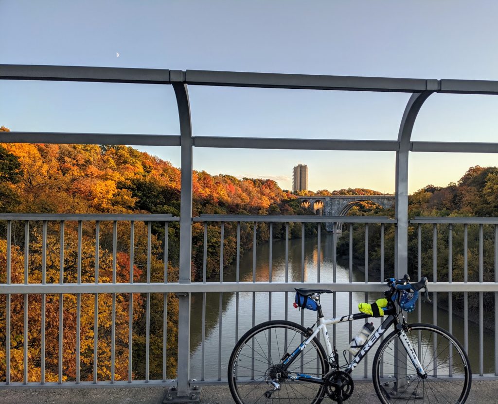
By: Joe Osgood
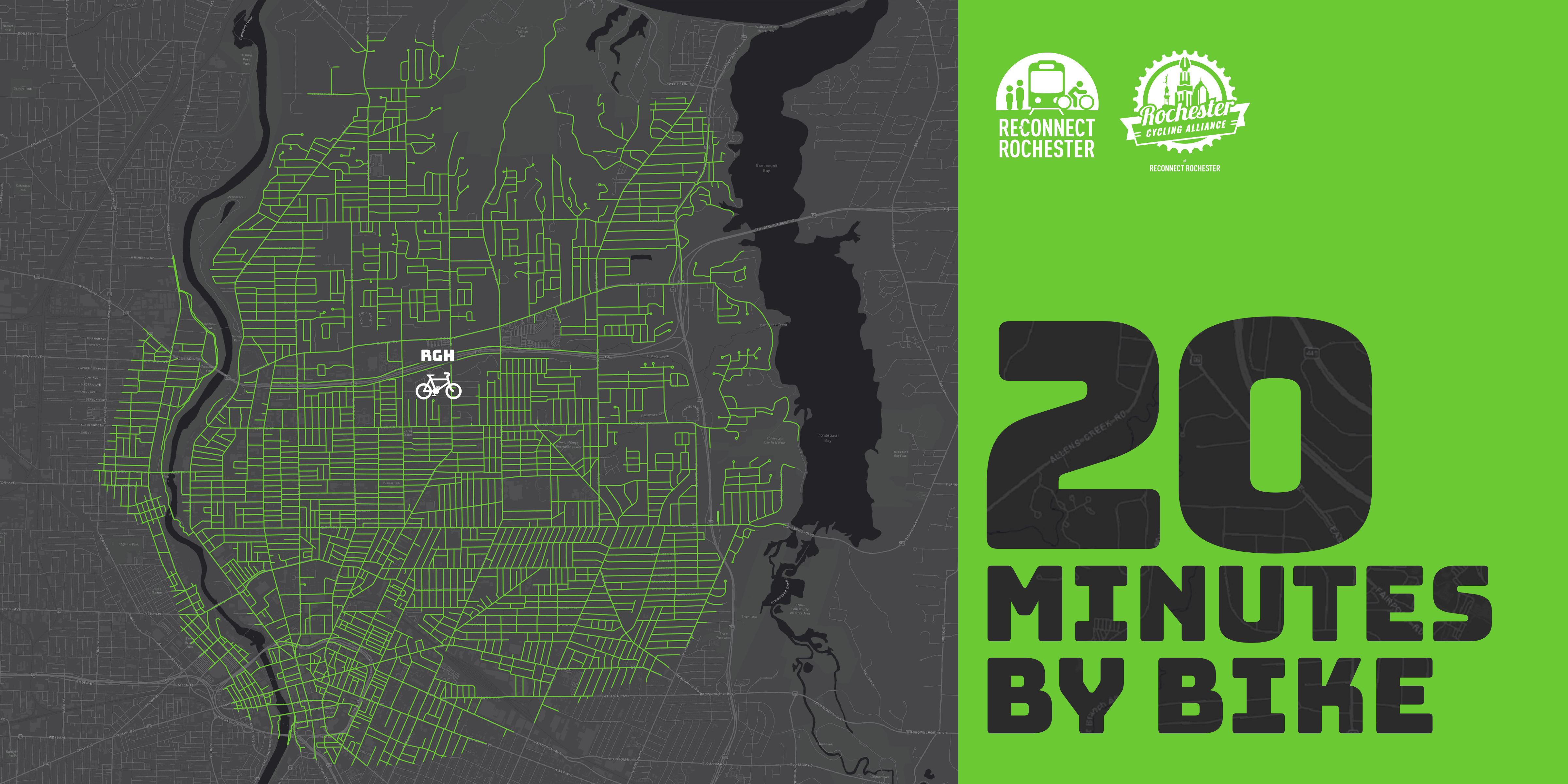
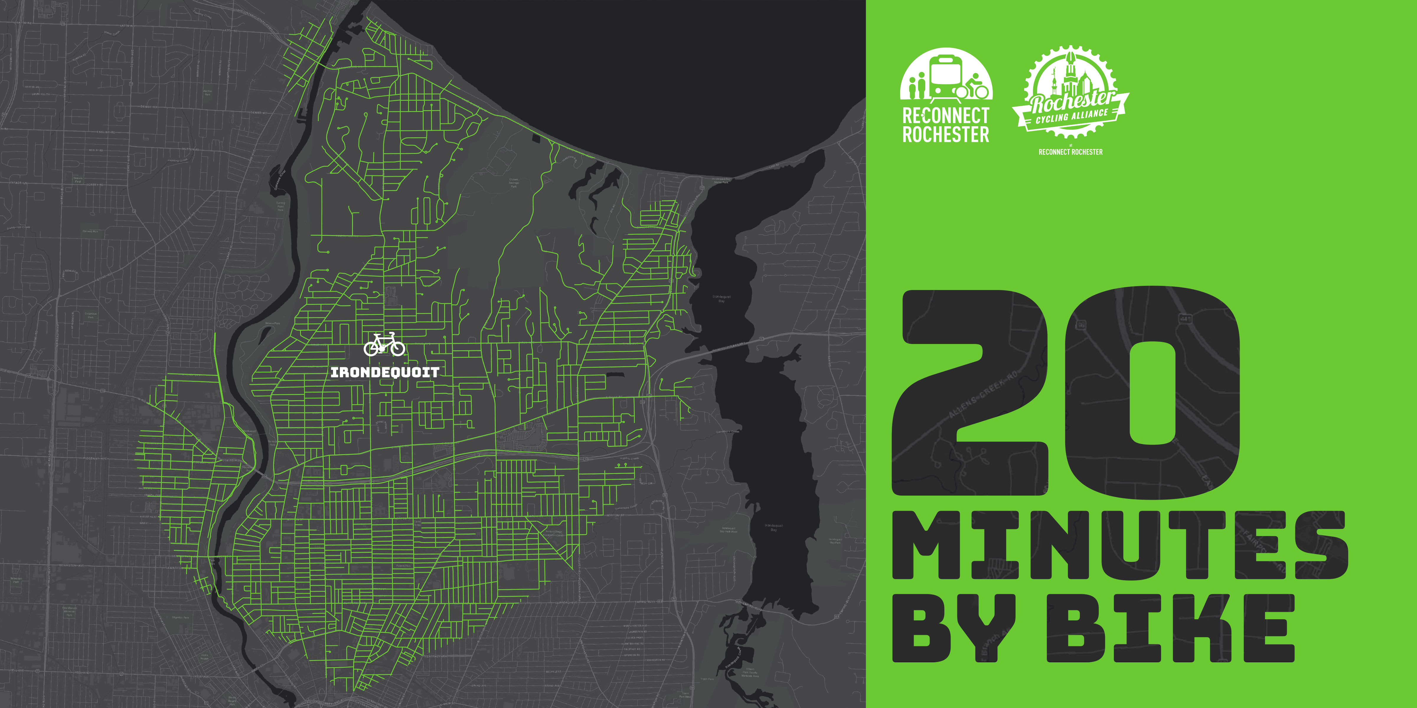
The Rochester area is famous for its 20-minute commute. For driving that is. Reconnect Rochester is excited to ask a different question in this blog series: Where can you get within 20 minutes on a bike?
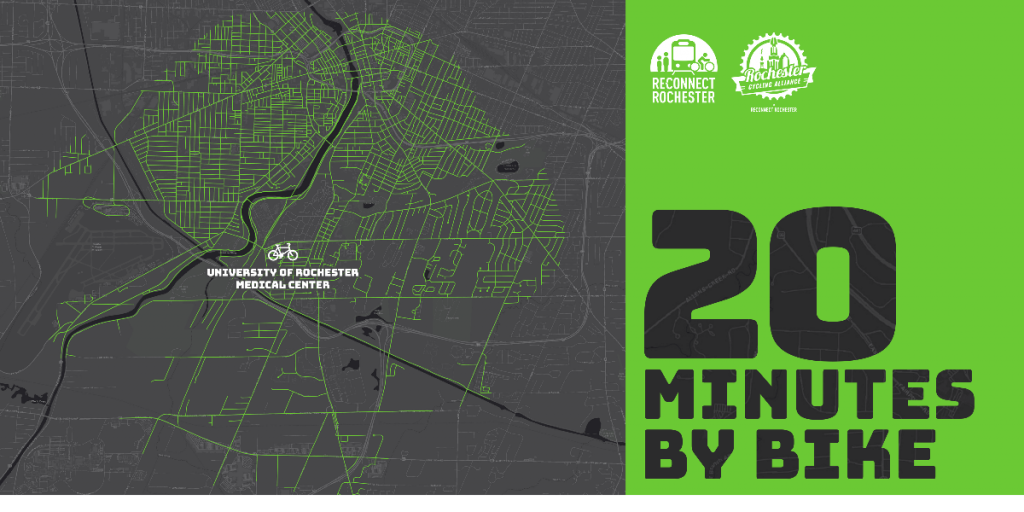
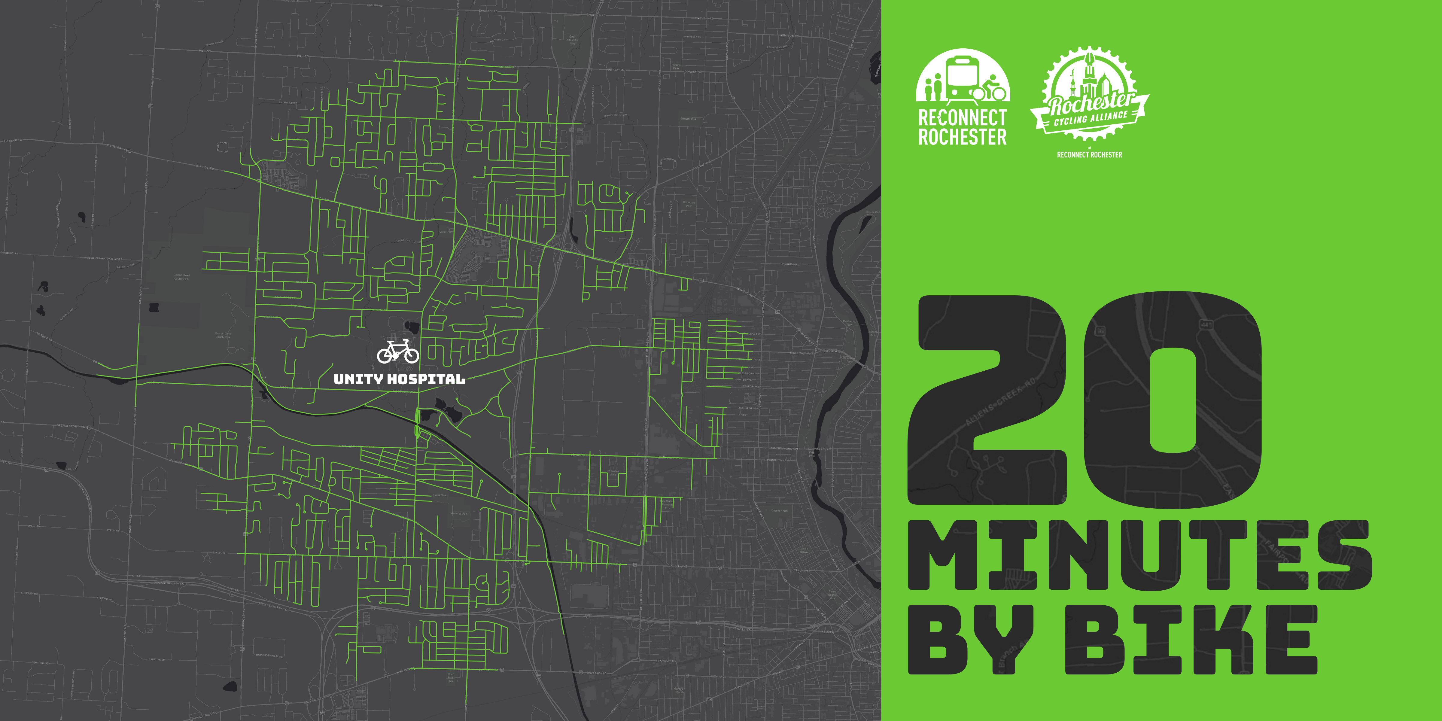
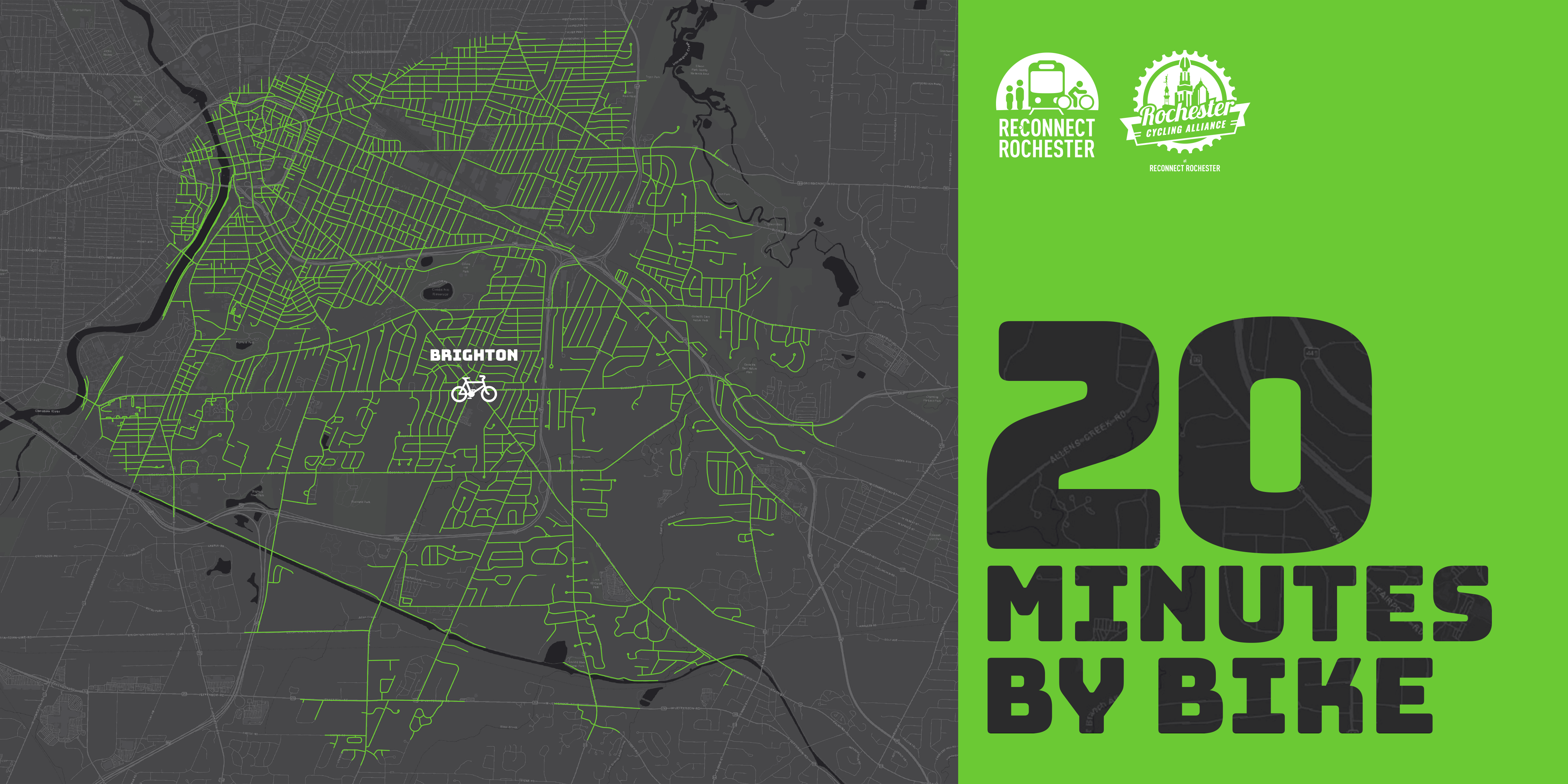
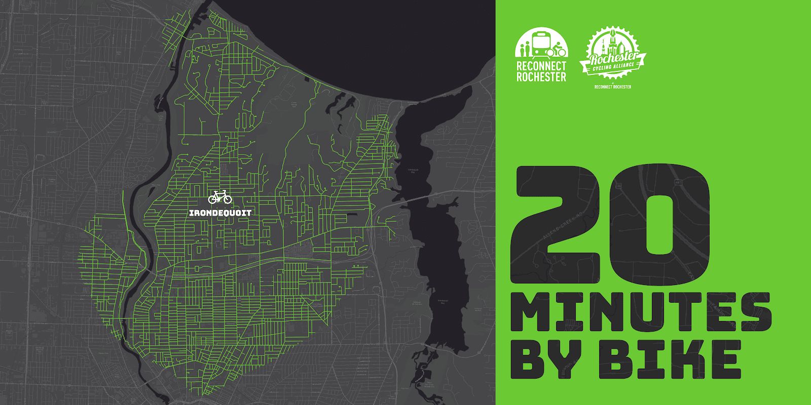
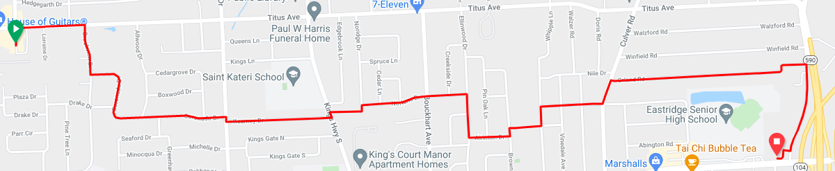
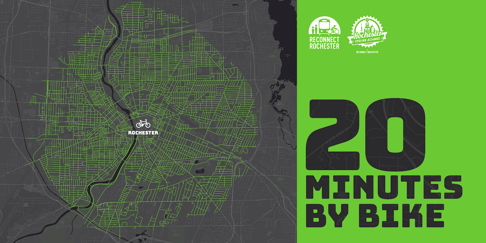
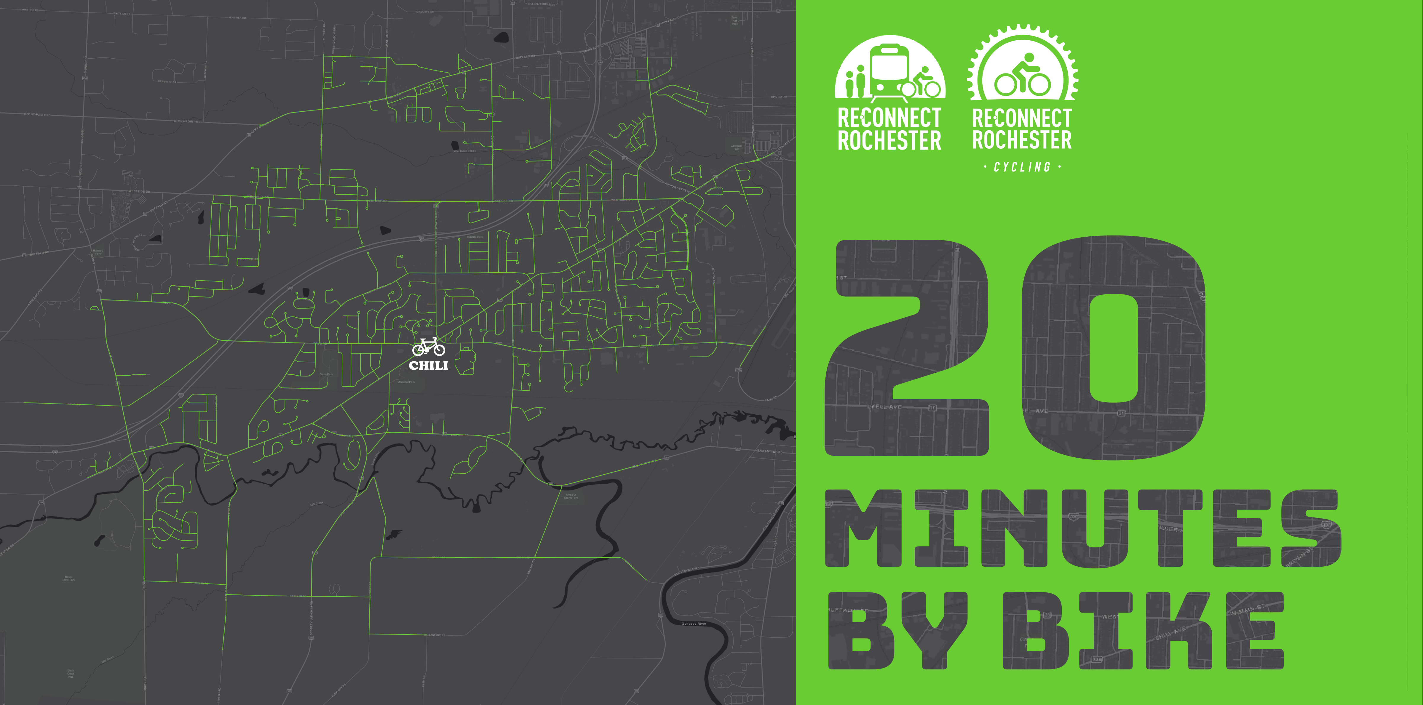
Presenting the seventh in a series of custom “bike shed maps.” For this next installment, we chose where Chili Avenue, Paul Road and Chili-Coldwater Road come together in Chili and are showing how far out in every direction you can get on a bike at a casual but steady pace of 10 miles per hour. This means that if you live anywhere in this green area, you can get to that intersection & its stores/workplaces within 20ish minutes on a bike. Thanks again to Brendan Ryan for his help putting this map together for us.
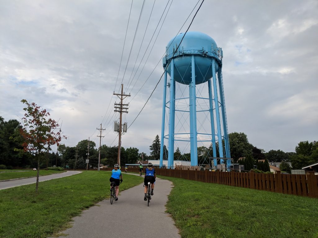
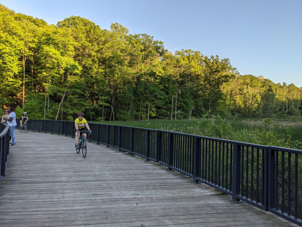
To get us familiar with this green territory in Chili, here’s Joe Osgood sharing his personal travel-by-bike experiences.
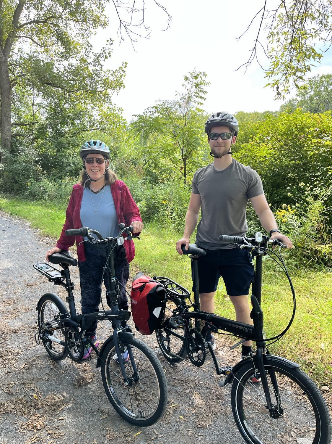
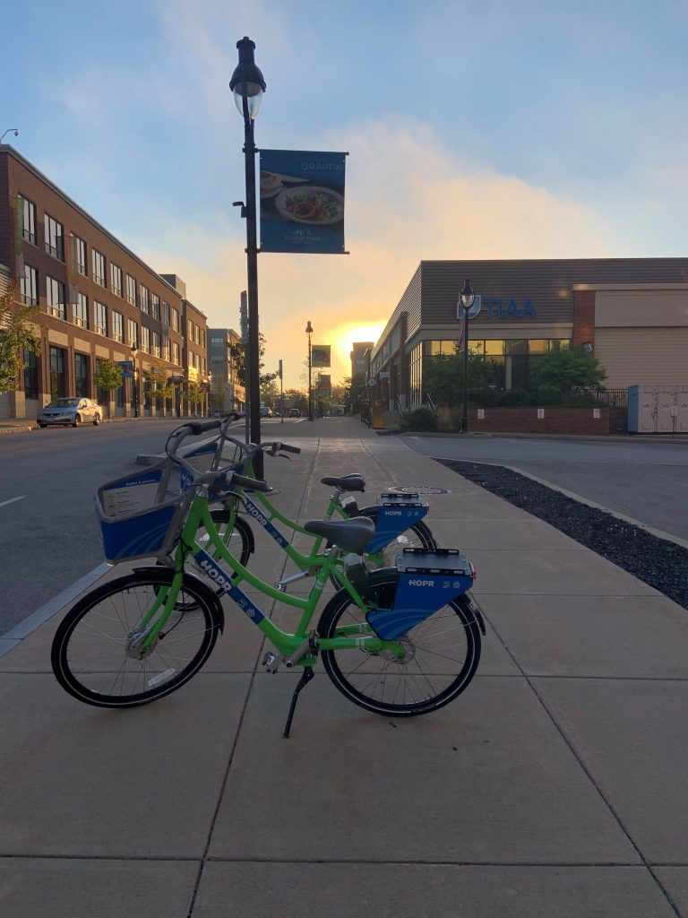
In 2022, I started “returning to the office” after a period of working remotely during the pandemic. I already lived a reasonable bike ride from work, so I decided to try bike commuting regularly. I soon found myself investing in some quality panniers – Ortlieb panniers are worth the price – for both work-commuting and getting groceries.
As time has passed, I’ve evolved from a fair-weather commuter, to a rain-rider, to eventually getting studded bike tires for the winter – which I highly recommend! At this point, I’ve been living “car-lite” – tending to lean towards biking as my transportation choice unless there is some reason not to (such as time/distance or dangerous conditions). There are quite a few destinations around Chili I can reach in about a 20 minute bike ride, and I’m able to find routes that have minimal car traffic. I’ll share some of those routes below.
Chili Center
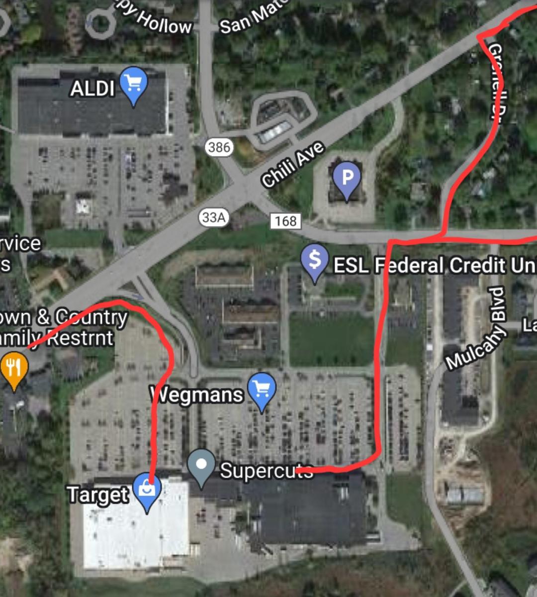
The Chili Wegmans is here, as well as Aldi and Target, and lots more. If you’re approaching from the east or northeast, the best way to approach Wegmans is to sneak in the Paul Rd entrance. It’s less busy than the Chili-Paul intersection, and you get closer to the bike rack between the pharmacy entrance and the main entrance (by the bottle return).
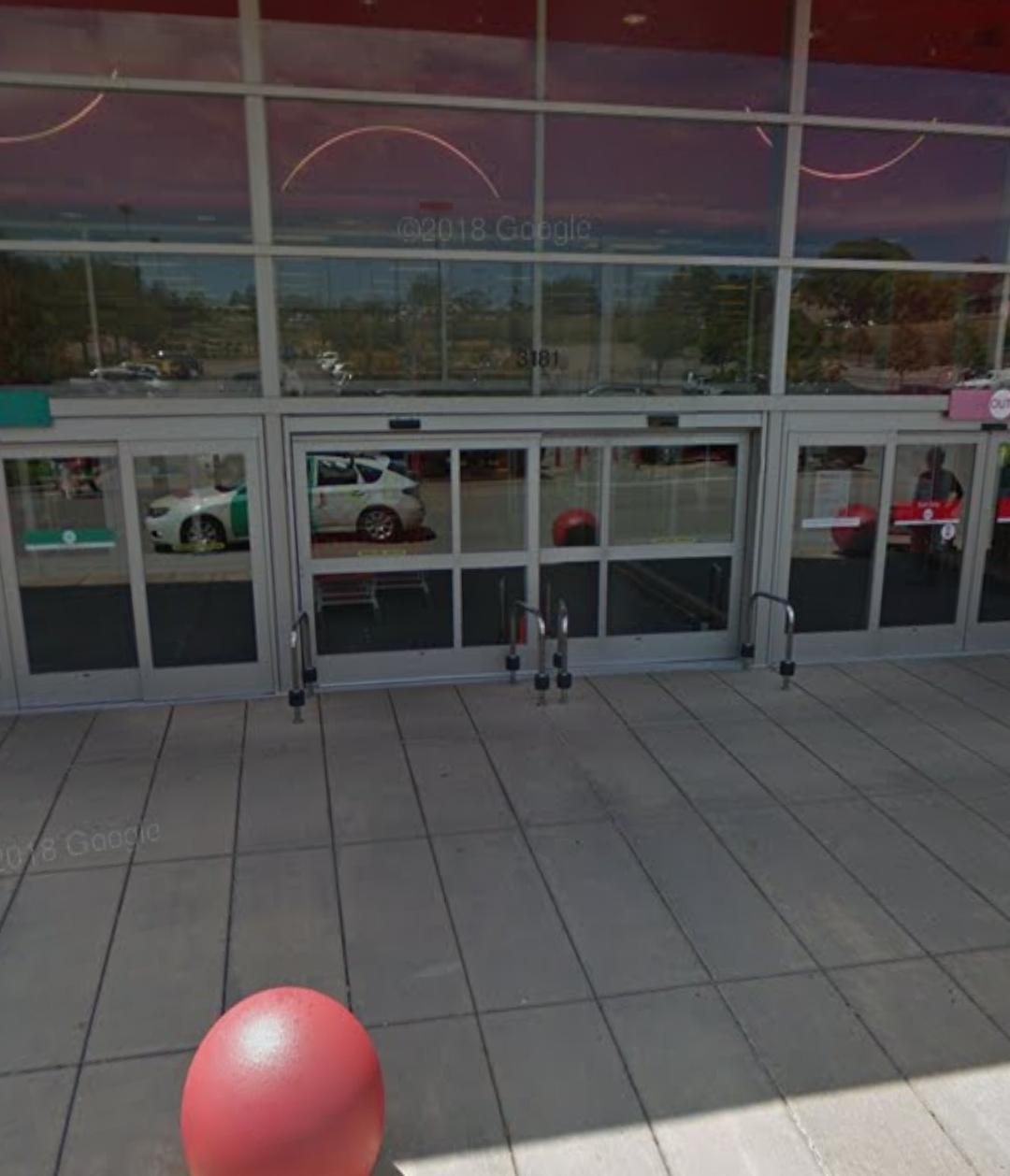
If you’re approaching from the west, you can take the sidewalk next to the car entrance down into the Target lot. These metal bars by the entrance to Target are probably meant for herding shopping carts inside, but they also make a great object to lock your bike to. Bike “parking spots” are often more convenient than car parking spots!
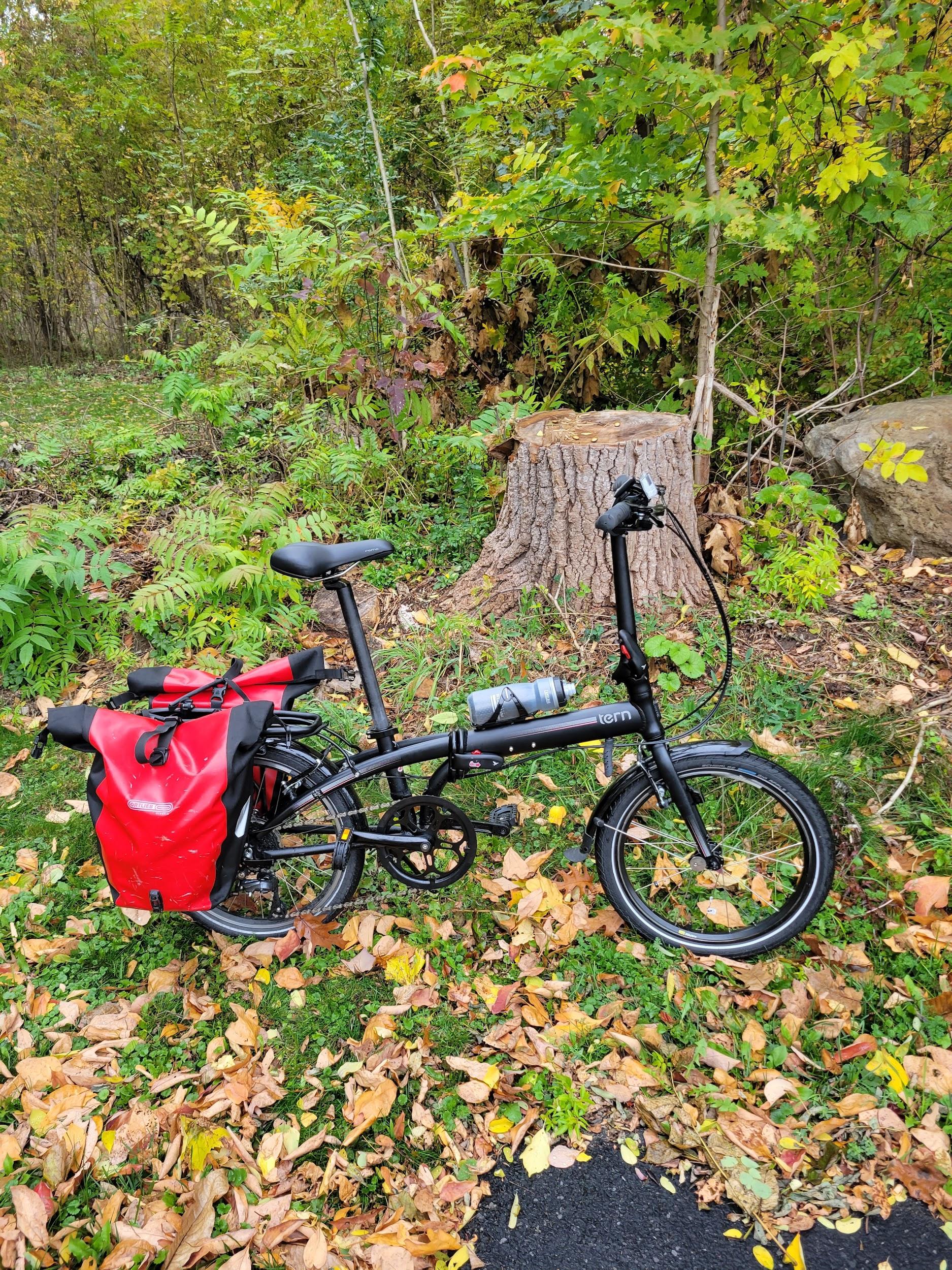
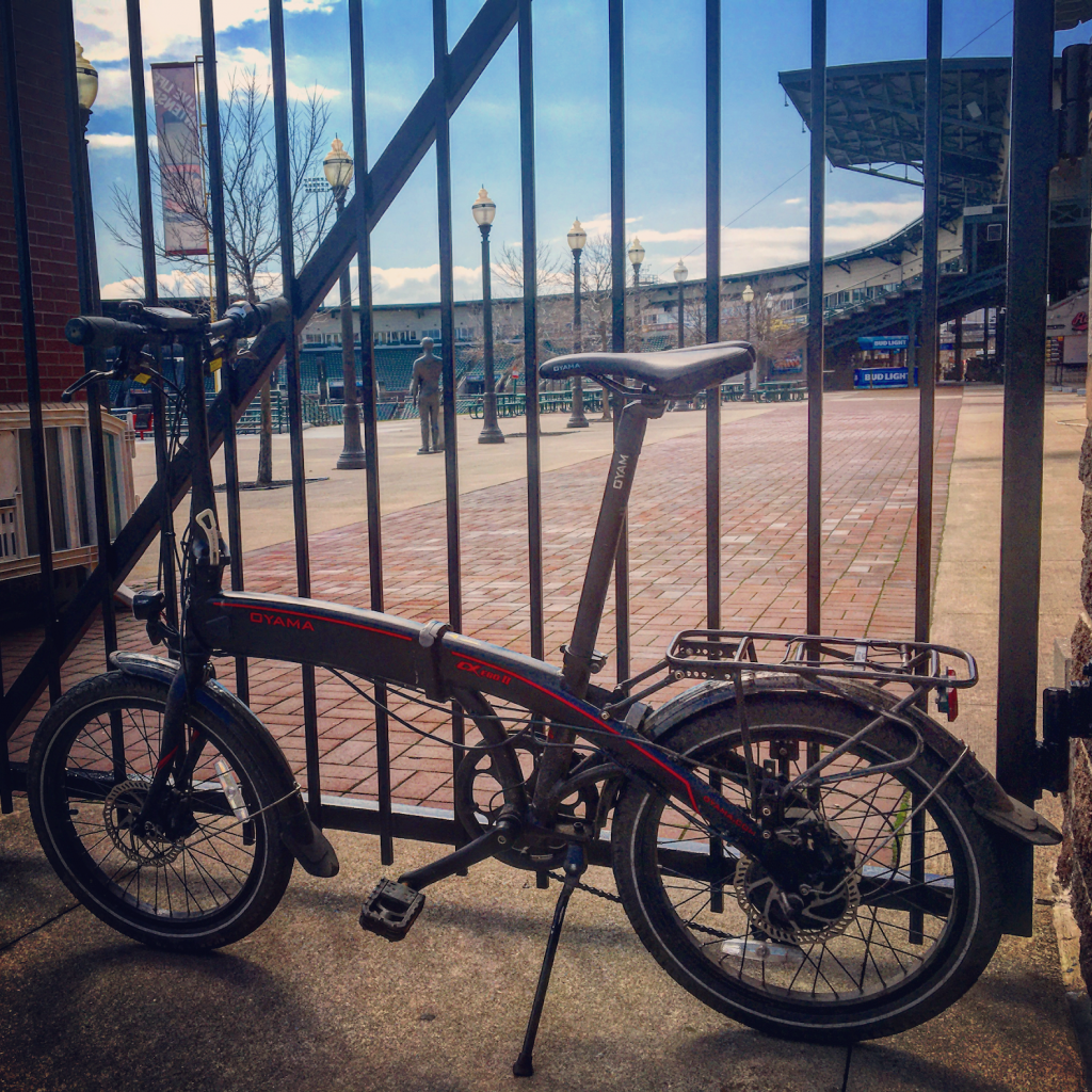
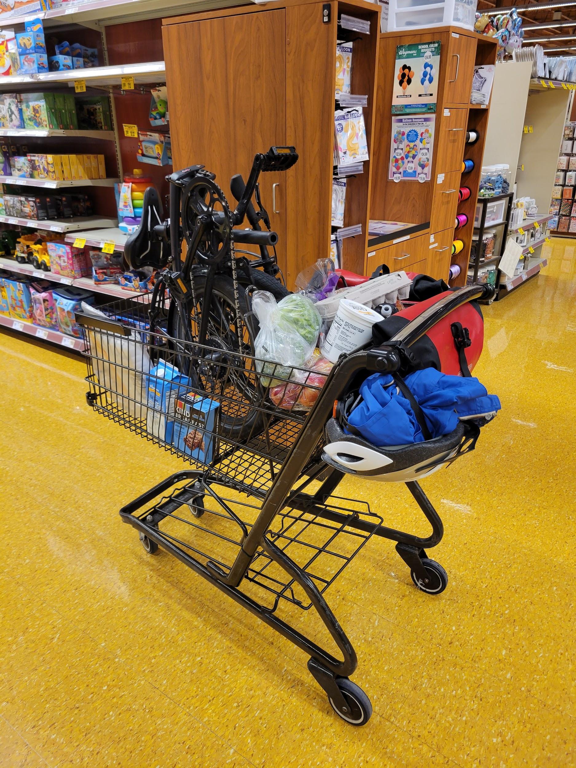
Or, skip the bike rack altogether and get yourself a folding bike you can take inside with you. I got a Tern Link D8 from Bert’s Bikes a few months ago and it has served me well so far. My Ortlieb panniers work fine with the rear rack. I recently installed the Tern Transit Rack so I can wheel it around while folded – a worthwhile investment.
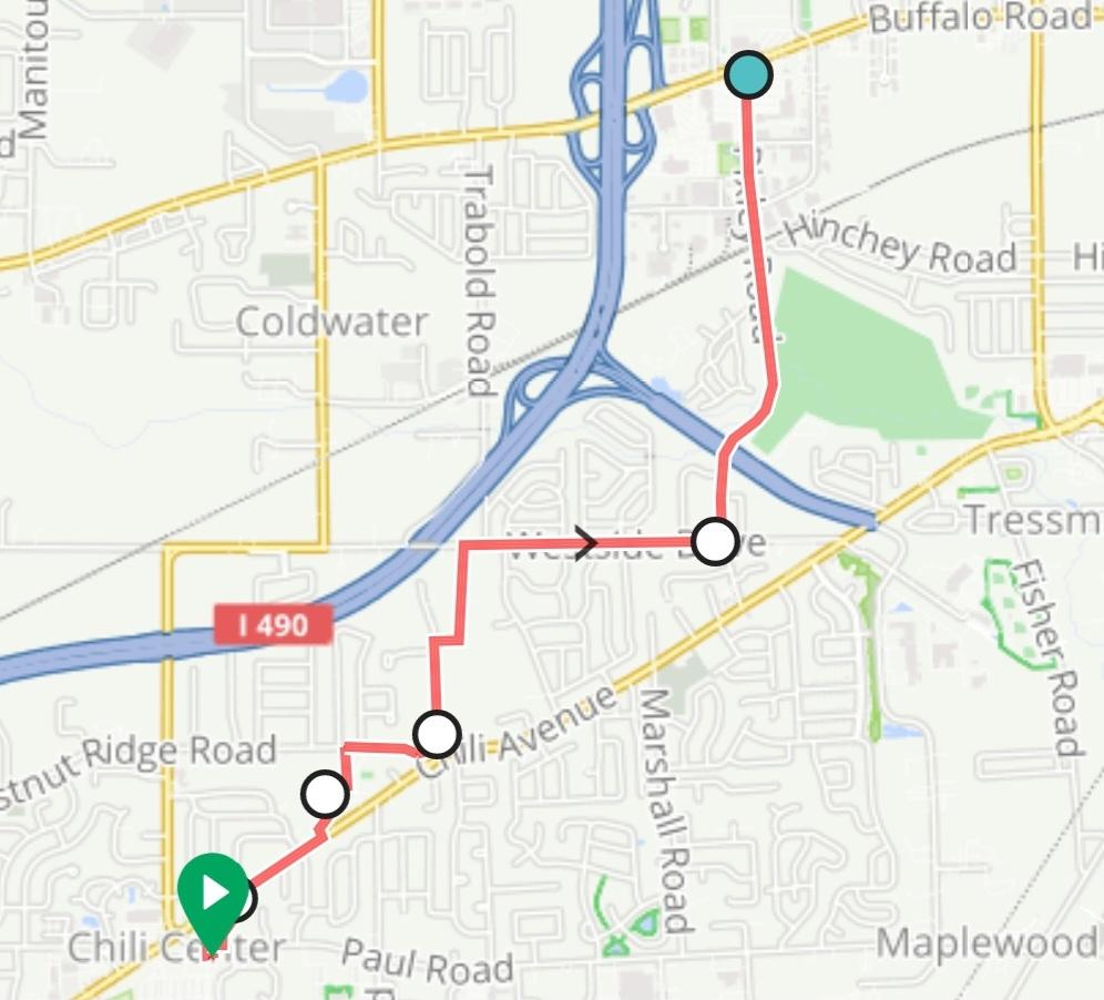
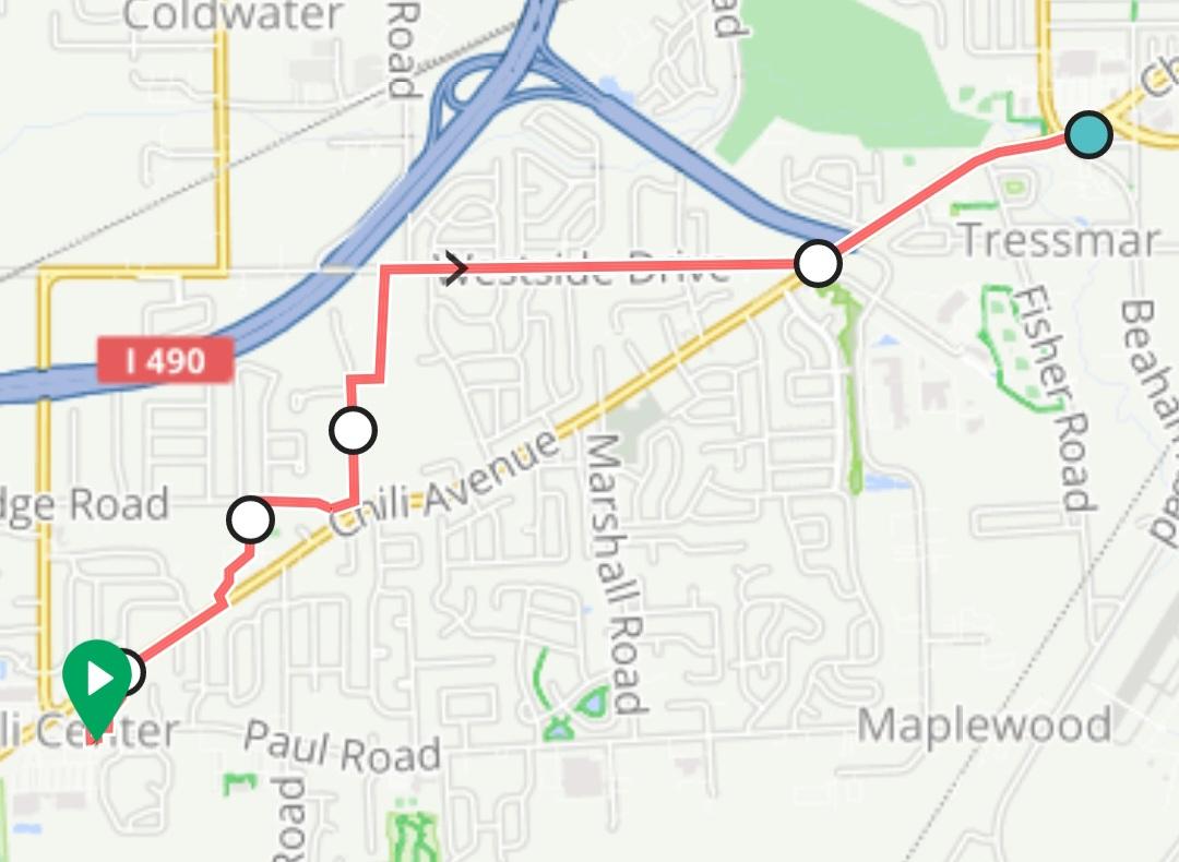
Rochester Tech Park
The Rochester Tech Park used to be busy back in the day, but now it has very little car traffic and is actually great for biking – inside the Tech Park, that is. Unfortunately, the Tech Park is surrounded by “stroads”: Buffalo, Manitou, Elmgrove, and Rt 531. Rt 531 is a highway that forms a geographical barrier comparable to a river – Elmgrove and Manitou being the only nearby bridges crossing it.
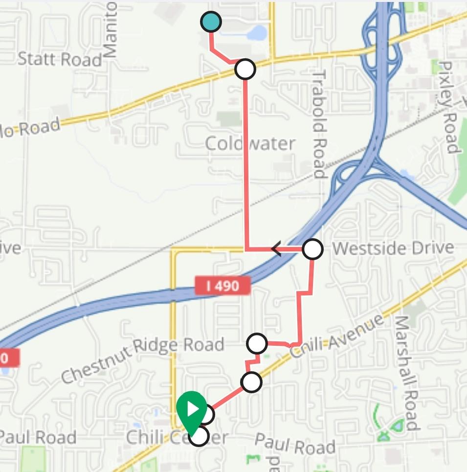
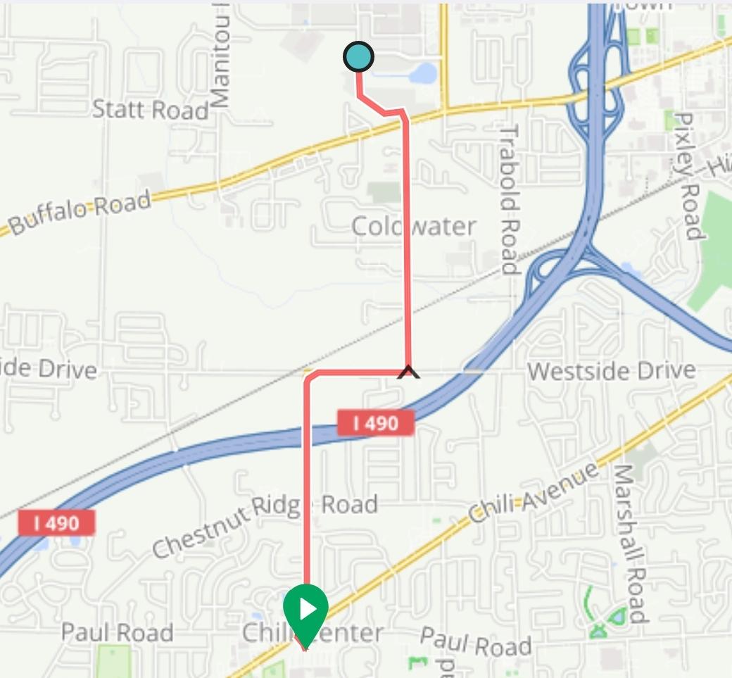
The best way to get into the Tech Park by bike is to cross the busy “stroads” at a traffic light, particularly the one at Coldwater Rd. While Coldwater Rd has a moderate amount of traffic, it also has a decent-sized shoulder for most of its length.
To get to Coldwater Rd from Chili Center, most cars take Chili Center Coldwater Rd. While this is the shortest way, it’s also the busiest.
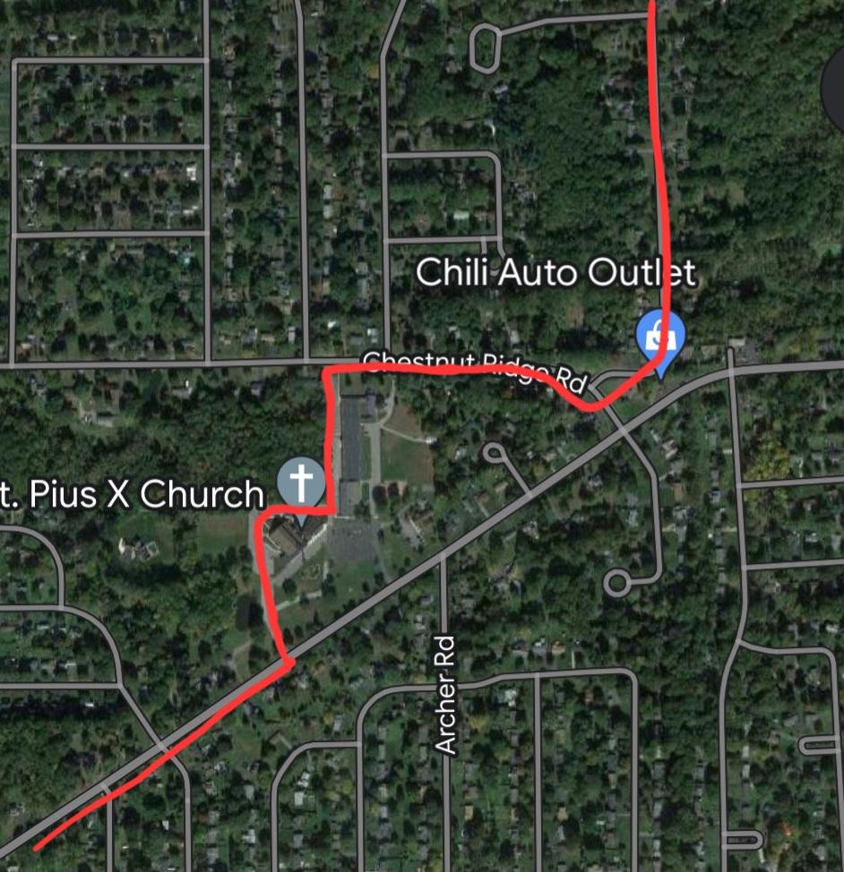
A much better option is to take the Paul Rd exit from Wegmans and immediately turn onto Grenell Dr. Go down Chili Ave briefly before turning into the St Pius X church parking lot, which connects to Chestnut Ridge Rd. Then take Fenton Rd to Westside Dr and finally onto Coldwater. It does make the trip 4 miles instead of 3.5, but it’s well worth it to be on quieter roads.
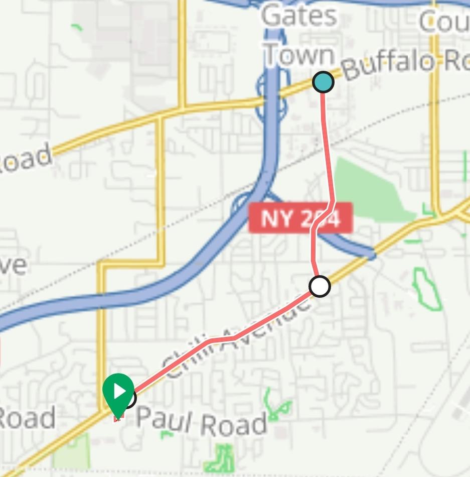
Buffalo Road Tops
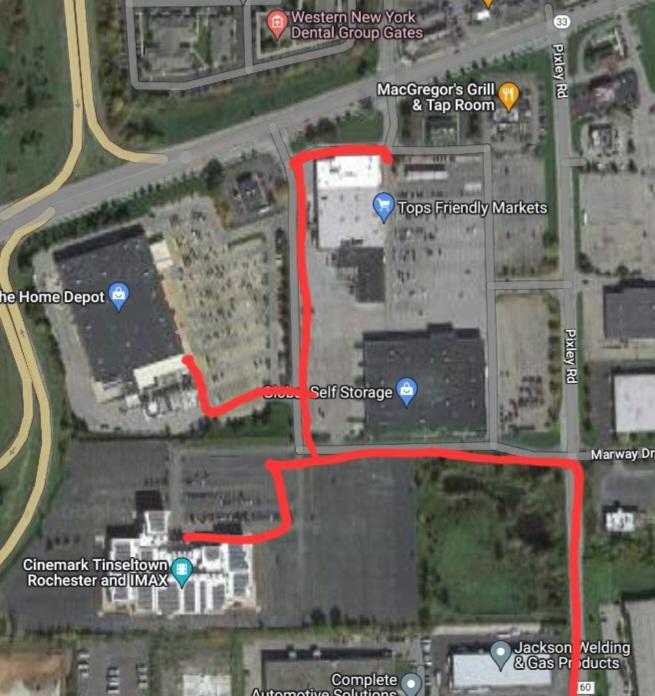
The Buffalo Rd plazas on the other side of 490 have businesses like Tops, Home Depot, and Tinseltown.
Buffalo Rd here is an archetypical “stroad” – high traffic volume moving at dangerously high speeds. The least-stressful way to approach these plazas is via Pixley Rd. While Pixley Rd has a fair amount of traffic, it only has 3 lanes of car traffic instead of 6. It also has a wide shoulder for biking.
To get to Pixley, you could take Chili Ave. An alternative is to go through the parking lot of St Pius X church, as described above, and use Fenton to get to Westside Dr. Westside Dr has less car traffic than Chili Ave. Going the Westside Dr route adds an extra half mile to the trip (4.3 miles vs 3.9 miles).
Chili Walmart
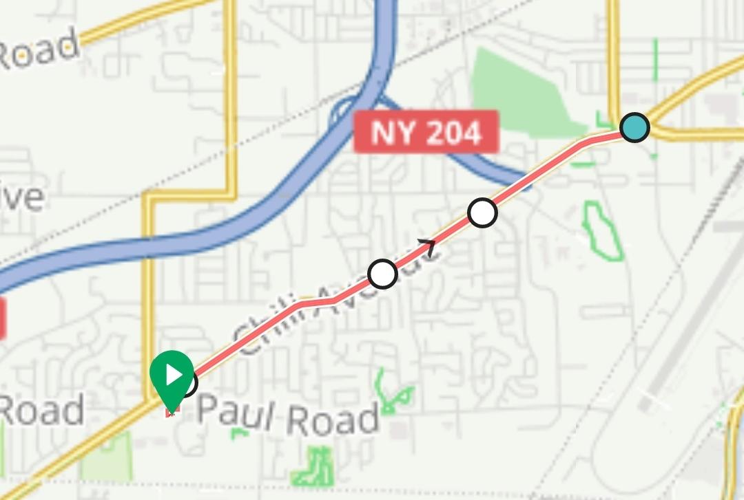
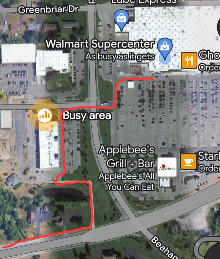
The obvious way to get to Walmart from Chili Center is to take Chili Ave. As mentioned above, Chili Ave is okay for biking – at least between Grenell Dr and the intersection with Westside Dr. You could choose to take Fenton Rd and Westside Dr here, but that will add an extra half mile to the trip (4 miles vs 3.6).
Whichever way you go, you will eventually have to take Chili Ave east of the Westside Dr intersection. East of this intersection, Chili Ave becomes a much busier “stroad”. The sidewalks are the best option when biking this stretch of Chili Ave.
At some point, you will want to get to the sidewalk on the north side of the road. There is a sidewalk branching off this one that goes to Westgate Park, and you can take that sidewalk to avoid some busy intersections. Safely cross Howard Rd at a light, and you’ll arrive at Walmart.
Note: Last I checked, Walmart’s bike rack was rusted out and not trustworthy. Ensure you lock your bike to a secure object. I usually use the fence by the garden center.
City of Rochester
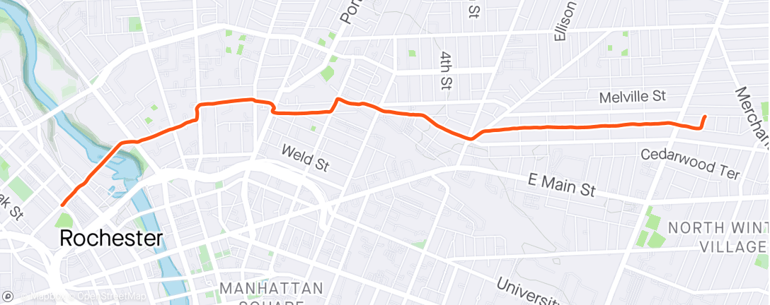
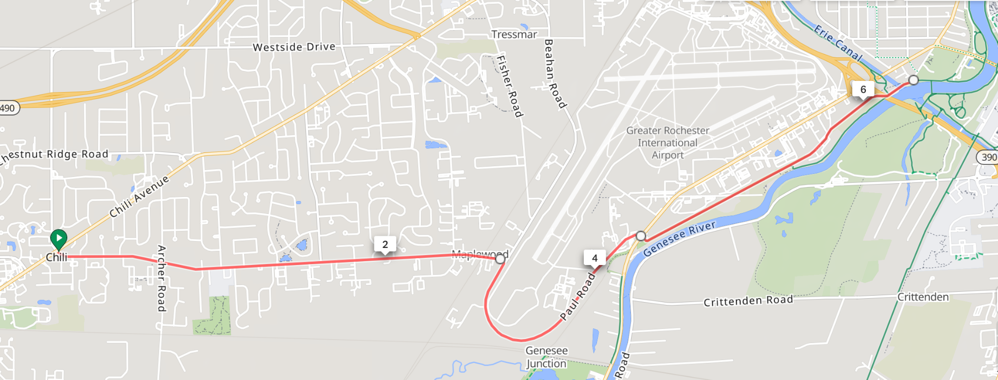
While outside of the 20-minute range, I will occasionally do longer rides into the city or across town. Usually such a route involves getting to the Erie Canal trail. Here’s two lower-stress routes to get there.
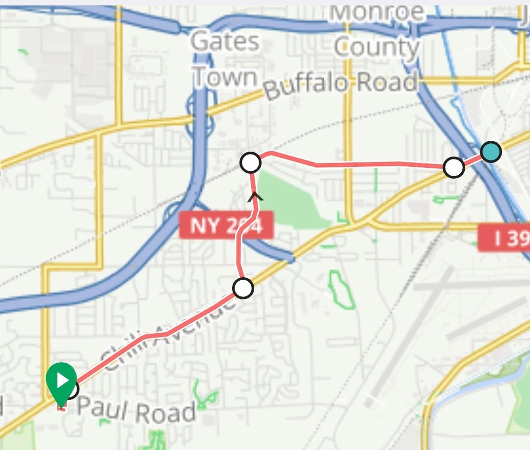
One option would be Chili Ave to Pixley to Hinchey. This route avoids the more stressful stretch of Chili Ave between Westside Dr and the Canal. Use caution on the last ¼ of a mile of this route when you are back on Chili Ave, as there are multiple slip lanes and busy intersections to cross. Once you get on the Canal trail, you can easily head east towards Genesee Valley Park and take a bike trail from there.
Another option is to take Paul Rd to the airport and then pick up the bike trail that parallels Scottsville Rd. Between Chili Center and the airport, Paul Rd is fairly quiet. It’s a little busier around the southern tip of the airport. The crosswalk at Paul Rd and Scottsville Rd was recently improved for better pedestrian safety. And the bike trail along Scottsville Rd is very pleasant to ride, between the river and trees (and the fire safety training grounds!).
Happy cycling!