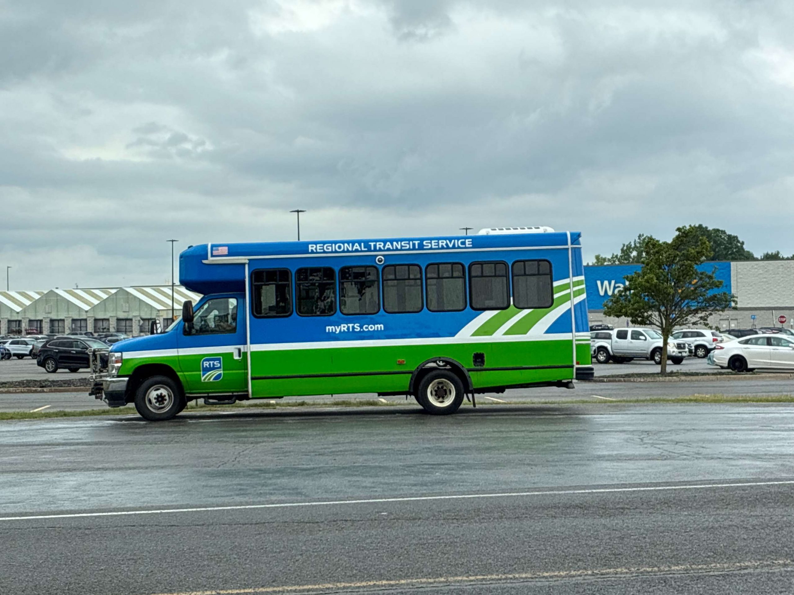
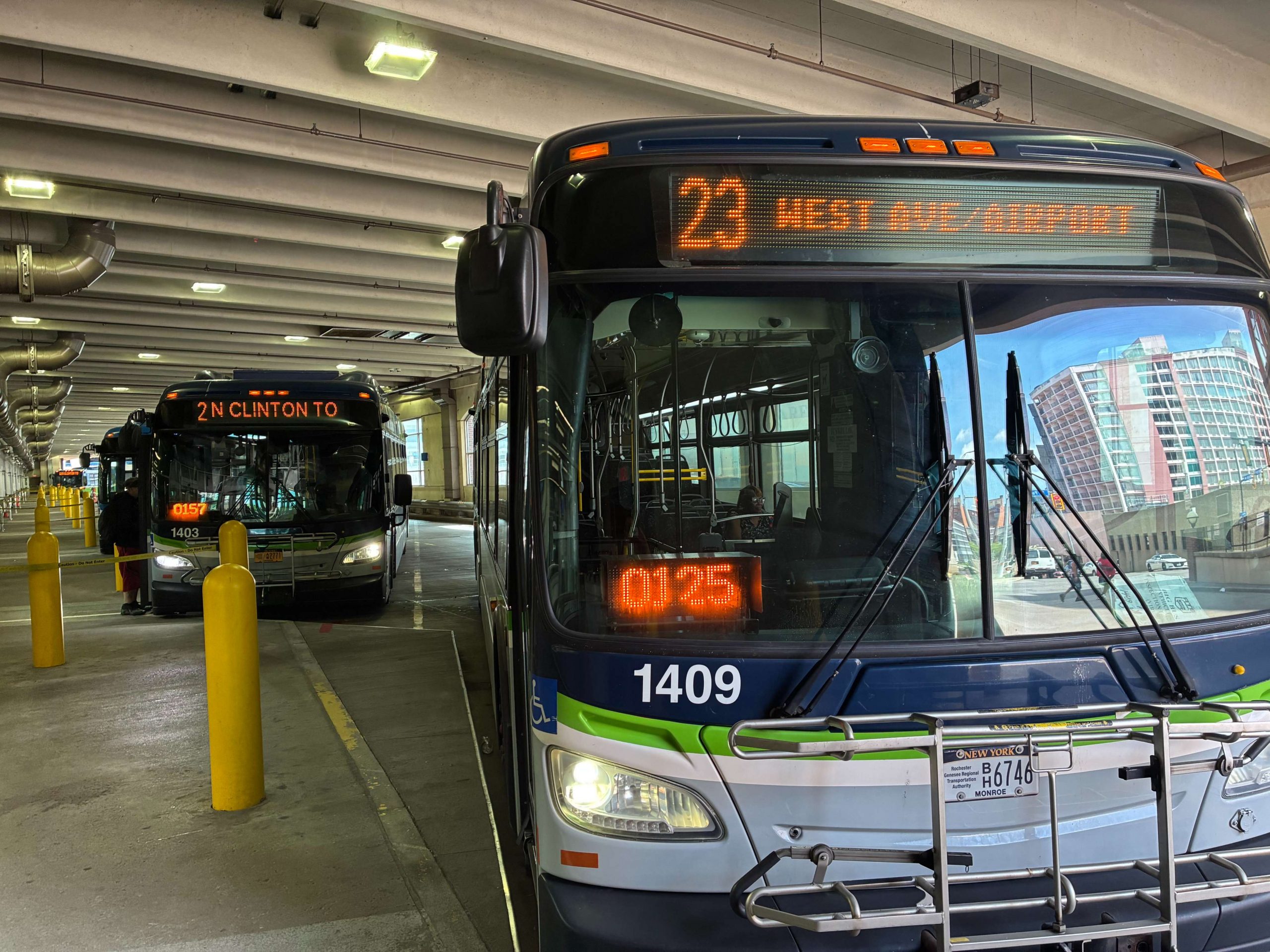
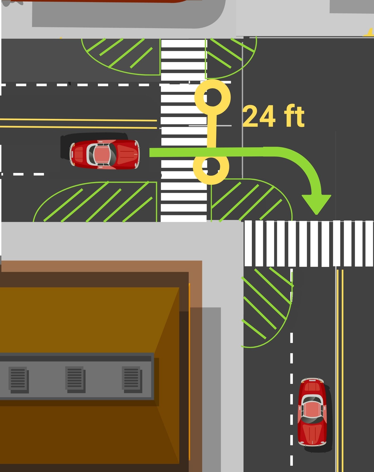
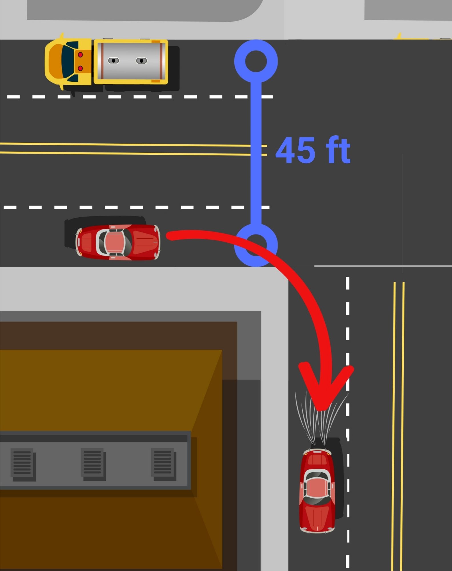
The Problem: Large portions of Monroe County will not have any public transportation evenings and weekends
We are alarmed by RTS’s cuts to the On Demand service in the evenings and weekends, effectively stranding residents who rely on this service to access jobs and retail across Monroe County’s suburbs.
For residents in Greece, Henrietta, Irondequoit and other On Demand zones, trips are being restricted to banker’s hours, not hours when people need to get to retail jobs or can spend time grocery shopping. These cuts further exacerbate the declining quality of RTS’s suburban service. In our view, the changes implemented last year made using the On Demand service harder for residents with the introduction of ‘virtual stops’ and restrictive cancellation policies, not to mention more costly with substantial fare increases.
City of Rochester residents who connect to On Demand from RTS’s core service area to access jobs will now be forced to find alternative, typically more expensive, options to commute in the evenings and weekends. Residents may even suffer job loss, and certainly future job opportunities involving weekends or B shifts.
These cuts further exacerbate the declining quality of RTS’s suburban service.
This Will Affect Job Access
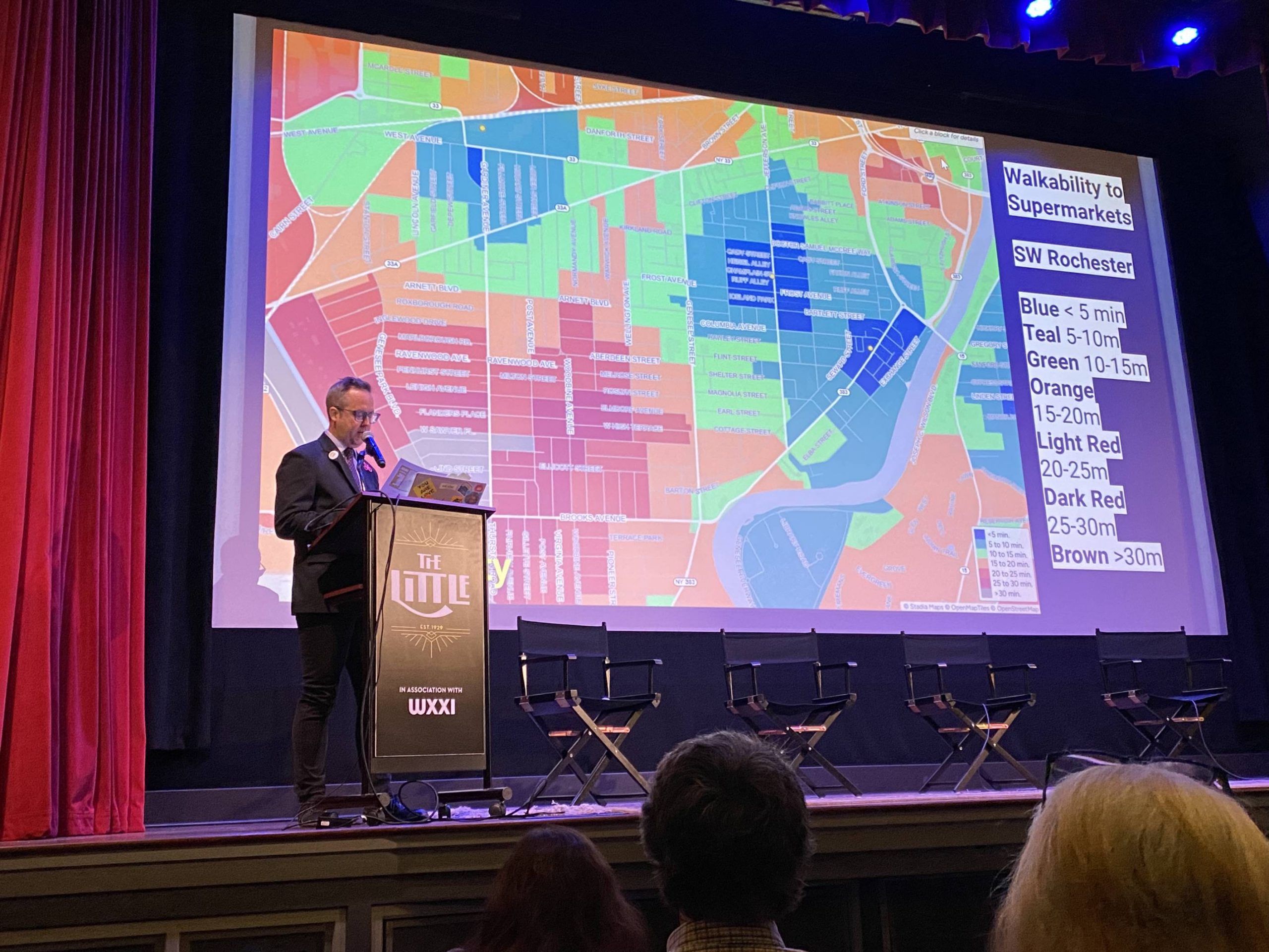
According to our 2018 report examining job access in Monroe County, jobs have sprawled out significantly from the City of Rochester to surrounding suburbs, particularly low-middle wage jobs that are increasingly located in job centers like Henrietta and Greece. More recent US Census data shows a continuing trend, with a 10% decline in job sites located within the city of Rochester from 51% in 2002, to 41% in 2022. The further dilution of public transportation service in the suburban mobility zones, effectively cuts off transit dependent Rochester residents from job opportunities, especially now those with any weekend or weeknight shift hours.
These cuts emphasize the need for New York State to fully fund transit in Monroe County. Since the pandemic, funding needs have not kept pace with the costs to run transit across upstate New York.
RGRTA and our peer upstate transit authorities need operating funding increases that keep pace with real costs of running their systems, as well as dedicated revenues to maintain and expand the transit service we need and deserve. With 12% of households in Monroe County and 24% in the City of Rochester without access to a personal vehicle, it is critical that Albany invests in a transportation system that gives people access to get where they need to go without a car, and essential that our transit system is fully funded in the next state budget.
In the meantime, we have strongly urged RTS, since last year’s On Demand changes, to explore returning to a fixed route service in the mobility zones that would offer better reliability to riders.
What Can We Do?
If you are concerned about the impact of these changes, and the state of public transportation in general, we urge you to immediately contact RTS and your state representatives to share how these cuts impact your life.
RTS Public Information Officer Tom Brede Work: (585) 654-0730 Mobile: (585) 489-4661 tbrede@myRTS.com
We are also hosting an event this Thursday night at 6:30 pm to discuss how we can win a better bus system for Rochester, precisely because the system is at risk for further cuts if we don’t act as a community to invest in public transportation. We’re inviting you to get involved to discuss your role in getting heard by policymakers to demand a robust bus system that connects people to jobs, healthcare, education, childcare and groceries.
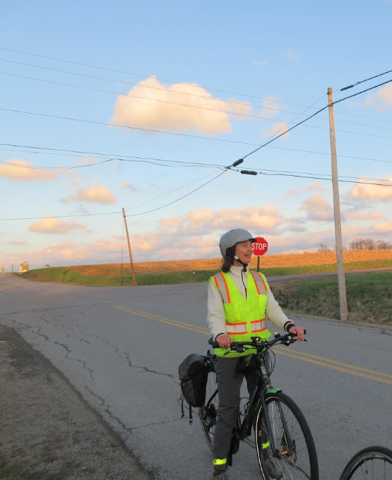
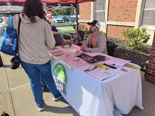
You may be familiar with our Car Lite blog series profiling Rochesterarians who live with little dependence (but not NO dependence) on a car. But every so often we come across someone living entirely car free. Read about Libby’s life without a car below. We hope these stories inspire you to try out a car-lite lifestyle!
I’ve Never Had a Driver’s License And I Don’t Want One
By Libby Linn:
I have been car free my entire life. Growing up downstate I never felt any urgency to get a driver’s license. When my classmates turned sixteen, they couldn’t wait to learn to drive. I felt the opposite. My family car had a manual transmission, and without someone available to teach me, learning felt like a hurdle I wasn’t interested in clearing. I planned to stay in cities where public transportation already existed. A car simply wasn’t part of the future I imagined.
Cars always made me anxious. Then, in 2007, my brother was killed in a car crash that wasn’t his fault. That was the last straw. It’s been almost twenty years and I still have no desire to own a car.
Living near NYC and then abroad in Europe, I saw how transit can easily work for residents. When you have frequent service you don’t need to plan your trip ahead of time and you can still get around without much trouble. Transit wasn’t viewed as something people used only because they couldn’t afford a car, it was simply how people got around. I wish we thought about transit that way here.
People assume being car-free means giving something up. In some ways, it does. I sacrifice some convenience but I save so much money. I don’t buy gas. I don’t pay for insurance. I don’t pay for maintenance, repairs, parking tickets, registration, inspections, or car payments. To me, owning a car sounds expensive and exhausting. People don’t seem to understand the economic toll this takes, it blows my mind.
When I moved to Rochester in September 2020 for a job I found that RTS is not the quality I’m used to but it mostly works for me and what I need. I’ve intentionally centralized almost all of my healthcare near Alexander Park so I can ride the Park Avenue bus and walk the final few blocks to my appointments. My therapist meets with me online. Walmart delivers my groceries.
Despite its shortcomings, I believe RTS deserves more investment. How else can it get better?
When I look for work, I first ask whether it’s within walking distance or accessible by a single bus (usually bus 10 or 41). I’ve had two previous jobs in College Town because the 41 made them practical. I’m starting a hospitality course at the Rochester Educational Opportunity Center, something made possible because the Route 10 gets me there. I’d love to work in a hotel, which means I apply only to hotels I can reasonably reach by transit or on foot. The Strathallan became one of those opportunities simply because I can walk there.
To get to my church on South Winton, I ride the 10 as far as East Avenue Wegmans, then walk the rest of the way over the hill. I love Route 41 because it travels across the city without requiring a trip downtown, connecting neighborhoods directly. Recently I covered an event at Artisan Church near Highland Park. I walked from my apartment on Park Avenue to Goodman Street, caught the Route 41 Crosstown bus, got off near Clinton, and walked the rest of the way. I’m a big walker. I like that it keeps me healthy. Walking to catch a bus doesn’t bother me; it’s just part of my routine.
My biggest frustration isn’t riding the bus. It’s where the bus doesn’t go. Rochester’s buses often require riders to funnel through downtown before reaching another destination. Some places depend on RTS On Demand, but I don’t find that system convenient enough to rely on. I could easily work in retail, I just can’t realistically get to Eastview Mall. Despite its shortcomings, I believe RTS deserves more investment. How else can it get better?
I only use Uber as an absolute last resort. For special events, I’m happy to carpool if that’s an option but if I can’t make it then I just won’t go. This is a lifestyle choice that I’m comfortable with because I don’t feel safe driving. Honestly, I have trouble feeling safe in Rochester as a pedestrian too. I walk around a lot and see people flying through red lights. Drivers seem careless. I don’t love walking through it but you’ll never find me driving.
There are other people in my building like me. People may be surprised to hear how many of us are car free in Rochester. I’m not waiting until I can afford a car. I’m choosing not to own one. And despite the challenges, I wouldn’t have it any other way.
At Reconnect, we’re inspired by the stories of people in our community, like Lorie Reilly, Charles Rubin, and Josie McClary, who are passionate about living a car lite or car free lifestyle. If you want to support our work and make it easier for others to go car lite please donate and sign up for Mobility Action Alerts to stay in the loop with opportunities of how to advocate for safer streets and transportation options.
Let us know if you want to share your mobility story! What’s in it for you? The intrinsic reward of knowing you’ve inspired others, and a free t-shirt from our online shop! Contact Chaz to submit your story.
You may be familiar with our Car Lite blog series profiling Rochesterarians who live with little dependence (but not NO dependence) on a car. But every so often we come across someone living entirely car free. Read about Lorie’s journey without a car for more than a decade below. We hope these stories inspire you to try out a car-lite lifestyle!
I’ve Lived in Rochester for 16 Years without a Car
By Lorie Reilly:
I was living in Boston, MA sixteen years ago when I sold my car and decided to adopt a car free lifestyle. When I moved to Rochester in 2022, I wanted to bring that lifestyle with me, but I didn’t know how that would pan out in a smaller city with limited transit options and much lower density.
While living in Boston, I had learned to tailor my life to the places I could get to without a car, to feel confident cycling on city streets, and to embrace being outside in all kinds of weather. I had the fitness level required to move about under my own steam, and I was fortunate enough to have a job that had transitioned to being fully remote during the pandemic. These were the skills and circumstances that I was counting on to help me transition from Boston to Rochester without a car.
1) Did my car free lifestyle survive the move from Boston to Rochester?
Yes, definitely!
Here are the key factors for making this a successful experience for me:
Finding an apartment in a neighborhood that has commerical, financial, and medical resources all within walking and biking distance–this is THE primary ingredient, and it’s one of the reasons why mixed-use neighborhoods are so important.
Learning about the bike boulevards and off-road trails that circumvent the busier roads
Bicycle repair shops within walking/biking distance
Learning how to change my own flats at a workshop offered by the Rochester Bicycling Club
A transit system that takes me to places further afield
Having another friend who is car free–he gives me tips about gear and routes and inspires me.
2) Have I wavered on being car free since moving to Rochester?
Not one bit. I’m as firmly committed as ever to life without a car. I honestly feel lucky to be able to walk and cycle everywhere. I’ve never liked sitting in a car and seeing the world from a small window while stuck, immobilized, in a position that hurts my back and cramps my legs. I enjoy taking my time to get somewhere while noticing babies in strollers, ants on the sidewalk, snow on branches, birds building nests, and more, so much more. When I look at the world from a car, I feel separated from the sensory experiences of where I am, as if I’m viewing it all through a TV screen (PS: I don’t have one of those, either).
3) Can I get to everything I need/want to get to?
NEED: Yes! When I moved here, I had a checklist of things I needed to be able to get to within my walking/cycling radius (food shopping, pharmacy, doctor’s office, bank, fitness center, library, farmers market, train station, etc.), and I was lucky enough to find a location that checked all the boxes.
WANT: When you live a car free life, you learn to think differently about where you want to go. I live within a smaller radius than a typical car owner, but I have discovered the pleasures of living deeply within my 10-20 mile radius, and this gives me a wonderful sense of being rooted in the community. Instead of waking up on a Saturday and planning a day trip to a location 120 miles away, I’m content to plan an afternoon at Cobbs Hill or the Rochester Contemporary Art Center. It’s kind of like the refrain of that song “love the one you’re with”–you find the joy where you are rather than chasing it over the next horizon. And Rochester has a LOT of local joy to offer.
4) Does it take longer to get places?
Yes, but when walking or biking, 90% of the joy is in the journey–moving my body, seeing and interacting with what’s around me, savoring the fresh air and the big skies overhead. Going on an errand becomes an adventure as well as a work-out, and I never need to worry about parking. Not using a personal vehicle puts a limit on the number of places I can go in one day and the number of things I can carry, but for someone trying to live in the slow lane and travel more lightly, these are good things.
5) Which of my car-free adventures in Rochester has raised the most eyebrows?
Walking home six miles from the airport
Dropping off electronic waste from the back of my bike at the drive-thru EcoPark
Walking to the post office when it was 2 degrees outside
6) What are some of the most interesting things I’ve hauled on the back of my bike?
A large new rug from a rug store
A new guitar from Pittsford Plaza
A pot of lentil soup for a potluck supper
A small table found curbside
7) What about the winter?
When the roads are icy or snow-covered, I rely on walking to get where I need to go. I bundle up, strap some spikes onto the bottom of my boots, and then plunge out into whatever winter weather awaits. I love the feeling of getting my body warmed up through brisk activity in cold temperatures. It’s like having my own little portable furnace inside my coat. And then of course, coming home to a warm house feels heavenly. Rochester has a wide variety of ever-changing weather, and I use each flavor as an exercise in mindful awareness, of waking up to what it’s like to be alive: “Ahhh, this is the feeling of spring rain on my face.”
8) Biggest car-free travel adventures while living in Rochester?
Taking the Greyhound bus to Buffalo to see an art exhibit at the AKG Art museum.
Taking the train to Montreal to see my daughter–which involved staying overnight in a closet-sized AirBnB in Toronto to catch the connecting train the next morning.
Discovering like-minded people via Reconnect Rochester
Having folks call out a friendly greeting from their front porch even though I’m quite removed from them as I bike in the street or walk on the sidewalk. (That never happened in Boston!)
A clerk thanking me for riding my bike to the store
10) Why do I do it? When I first sold my car, it was part of a list of changes I made to reduce my carbon footprint, but since then, I have discovered so many benefits to living without a car:
Being out in the fresh air and getting lots of exercise
Saving a TON of money
Avoiding all the logistical hassles and stresses involved with owning and driving a car
Enjoying the challenge of figuring out how to get places–it’s a fun puzzle for me
Living a hyper-local life which has deepened my relationship to where I live
Moving mindfully and intentionally as I go places
Having a reduced number of choices to make–that small radius I mentioned above–which can be liberating
Exchanging smiles, greetings, and conversations with people I encounter
Stopping to enjoy the unexpected things I find as I walk or bike places.
People often think that I’m living a life of hardship and sacrifice–but I feel very fortunate to be living without a car. For me, living car free is an integral part of living my best life.
If any of this sounds like something you might want to try, start by simply replacing a small number of trips per week with an alternative mode of transportation. See how it goes, experiment, and discover what interesting adventures might await you!
At Reconnect, we’re inspired by the stories of people in our community, like Charles Rubin, Leverett Copeland, and Josie McClary, who are passionate about living a car lite or car free lifestyle. If you want to support our work and make it easier for others to go car lite please donate and sign up for Mobility Action Alerts to stay in the loop with opportunities of how to advocate for safer streets and transportation options.
Let us know if you want to share your mobility story! What’s in it for you? The intrinsic reward of knowing you’ve inspired others, and a free t-shirt from our online shop! Contact Chaz to submit your story.
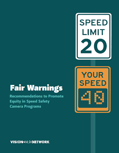
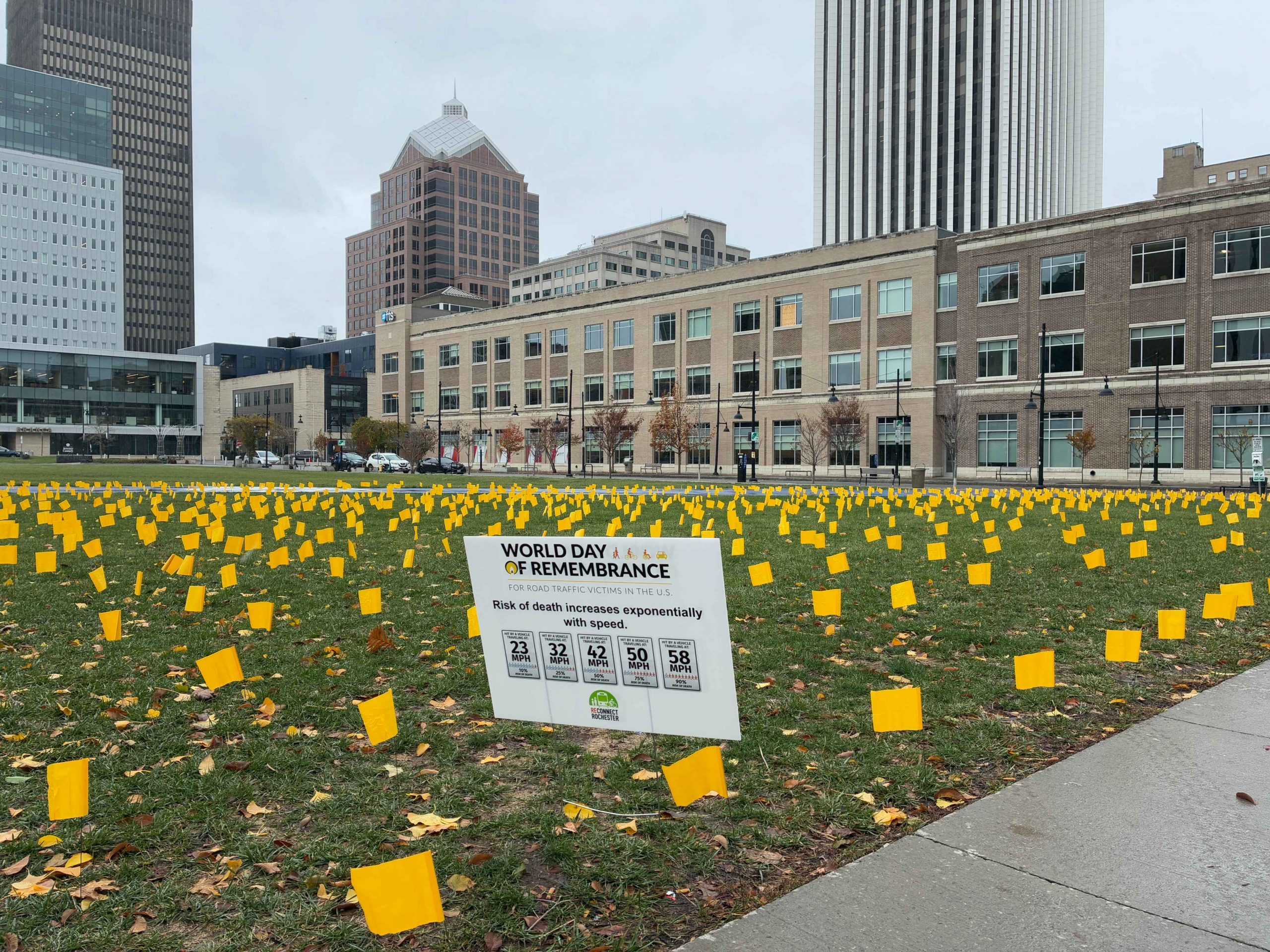
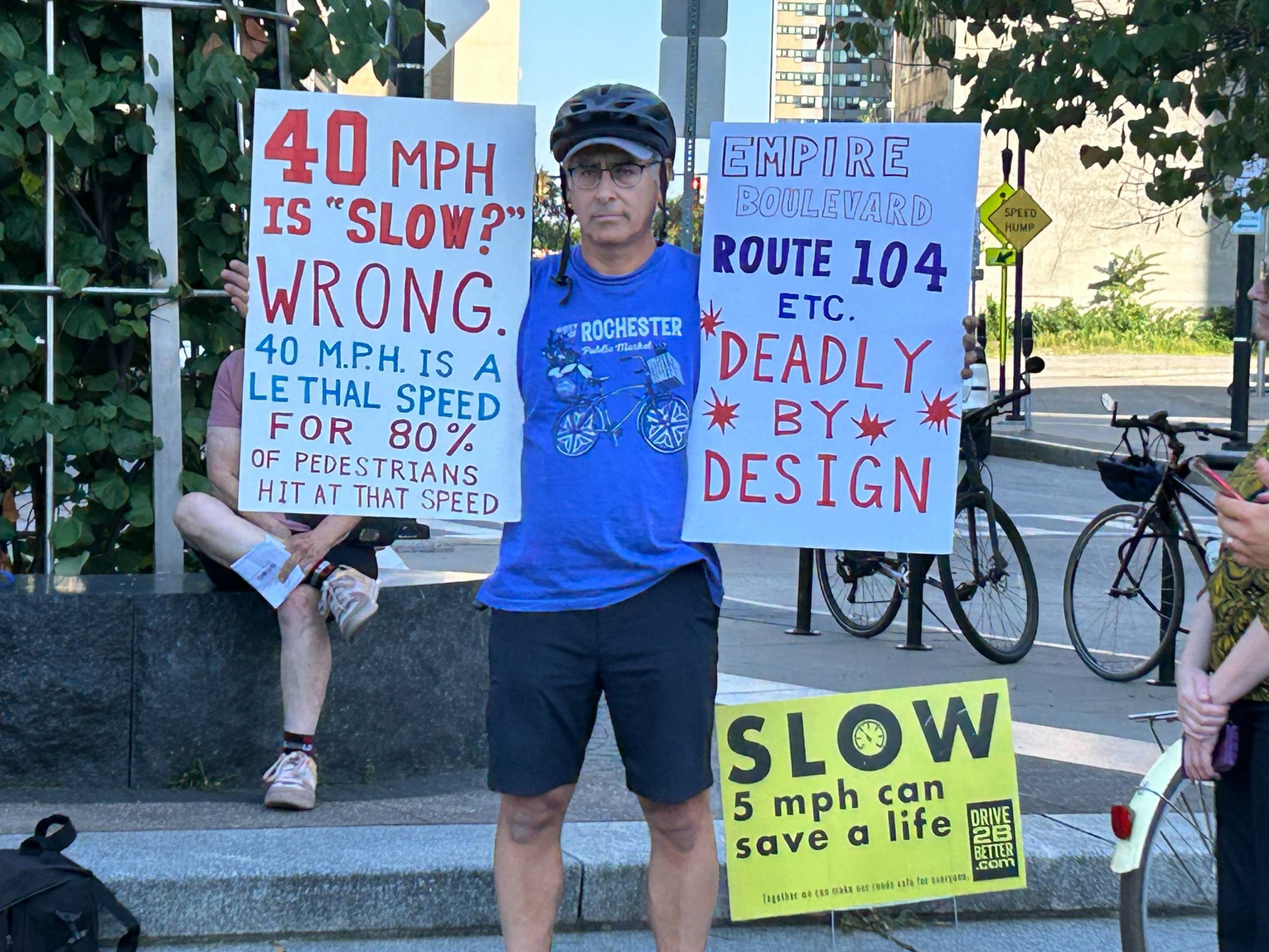
Automated traffic enforcement programs have expanded in New York State in recent years thanks to better technology and their demonstrated ability to reduce traffic crashes and hold drivers accountable for reckless driving. Safe streets advocates across New York have called for continued and expanded camera programs because they have been shown to be effective at saving lives.
As a member of the ROC Vision Zero task force, Reconnect Rochester has championed taking a holistic approach to traffic safety, one that includes multiple solutions: placing a high priority on infrastructure changes to the built environment, lowering the city speed limit to 25 MPH, and educating drivers on safer driving. Along the way, we have been centering the perspectives of people who walk, bike and take transit, including the 24% of Rochester households who don’t have access to a personal vehicle.
The safe systems approach that underpins Vision Zero recognizes that enforcement has a role to play in curbing traffic fatalities. At Reconnect Rochester, we have centered the word “accountability”, and specifically, accountability for drivers who are operating a large, heavy machine with the ability to seriously injure and kill people. Accountability that would, if done correctly, create a change in driver behaviors so that speeding, red light running, and ignoring pedestrians in crosswalks no longer figure into Rochester’s driving culture.
According to data cited by AARP, speeding is involved in approximately 29% of motor vehicle fatalities, while 28% of deaths at signalized intersections result from running red lights. In 2023, these behaviors accounted for 11,775 speeding-related fatalities and 1,086 red-light running deaths. According to analysis by New York Families for Safe Streets just 1% of vehicles in New York State get more than 6 automated camera violations per year (where the technology is currently deployed) suggesting very, very few drivers are racking up automated tickets and putting their community in danger. This is good news because what we need is behavior change, not punishment.
The City is now asking residents to weigh in on what would make an automated safety camera program equitable, fair and effective at curbing unlawful driving. It’s essential that community voice is centered in this process, and we hope you will engage and share what you think would be fair and equitable ways to roll it out.
As we’ve worked through Reconnect’s perspective, we have relied heavily on Vision Zero Network’sFair Warnings: Recommendations to Promote Equity in Speed Safety Camera Programs to learn from other cities about what did not prove effective or equitable in the roll out of camera programs elsewhere. As the report states, “Speed safety camera programs — when well designed, operated and monitored — are effective at deterring people from speeding, thereby reducing crashes overall and lessening the severity of injuries when crashes occur. They are widely used internationally and in more than 240 communities in the United States.” However, in the context of a transportation system and community like Rochester, with longtime structural inequities based on race and economic status, equitable roll out and operation deserves our dedicated attention.
This current community input effort is critical to involve voices from neighborhoods that are most affected by traffic crashes to have a say in how the program is set up. Based on lessons from other cities, we believe Rochester can avoid unfair pitfalls by:
Finding an equitable pattern of distributing cameras so that enforcement isn’t concentrated in certain areas of the city, but every neighborhood has some degree of enforcement.
Ensuring that all funds collected by the program go, after program expenses, back to the ROC Vision Zero program to enhance traffic safety in our neighborhoods.
Giving residents the opportunity to challenge tickets, review the video evidence, and appeal for alternatives to payment, if necessary.
Providing transparent data sharing on tickets issued, locations, and revenues.
Since Rochester has to follow New York State precedent, some of this is set in statute. For example, tickets start at 11 miles an hour over the posted speed limit, which we hope Rochester sets at 25 MPH citywide by the end of 2026 and the maximum ticket is $50 per violation. No additional fees can be imposed. A 2021 law change meant that camera violations can’t result in points on the license and are a civil penalty against the vehicle owner, so no license suspension is possible. Drivers can still drive to work.
Some advocates have asked: “Why shouldn’t we focus on the highest-injury roadways and not put cameras where there are lower injuries and fatalities?” We followed that logic with the City’s red light camera program a decade ago, and that resulted in placing cameras almost exclusively in neighborhoods with the highest concentration of traffic fatalities, which also corresponds with the neighborhoods with the highest concentrations of poverty and black and brown residents. We believe a citywide approach would be more equitable and ensure a wholesale change in driver behavior.
As Reconnect Rochester has grown over the years, we’ve gotten better and better at getting residents engaged during the public input process for road projects. We get the word out about public meetings and open houses. (Subscribe to our Mobility Action Alerts!) We post the proposed designs on social media, encouraging residents to submit feedback. We equip the public with potential talking points. We encourage folks to show up in droves to meetings to outnumber the naysayers (it really makes a difference!). We’ve even started using petitions folks can easily and quickly sign onto.
As one City Hall staffer told us years ago, “Bike advocacy is changing the way street design is conducted in Rochester.”
But after the last public meeting where the “final design” is unveiled (after which sometimes changes are made), things go silent. After construction is completed, there are rarely ribbon cuttings or press events. No parties or celebratory rides where residents are invited to bike it with City staff. People just happen upon new infrastructure on their own. No mechanism is in place either for the City to receive feedback about their work.
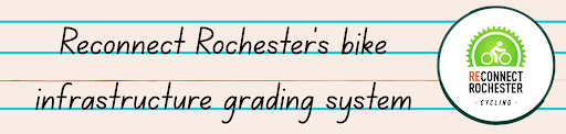
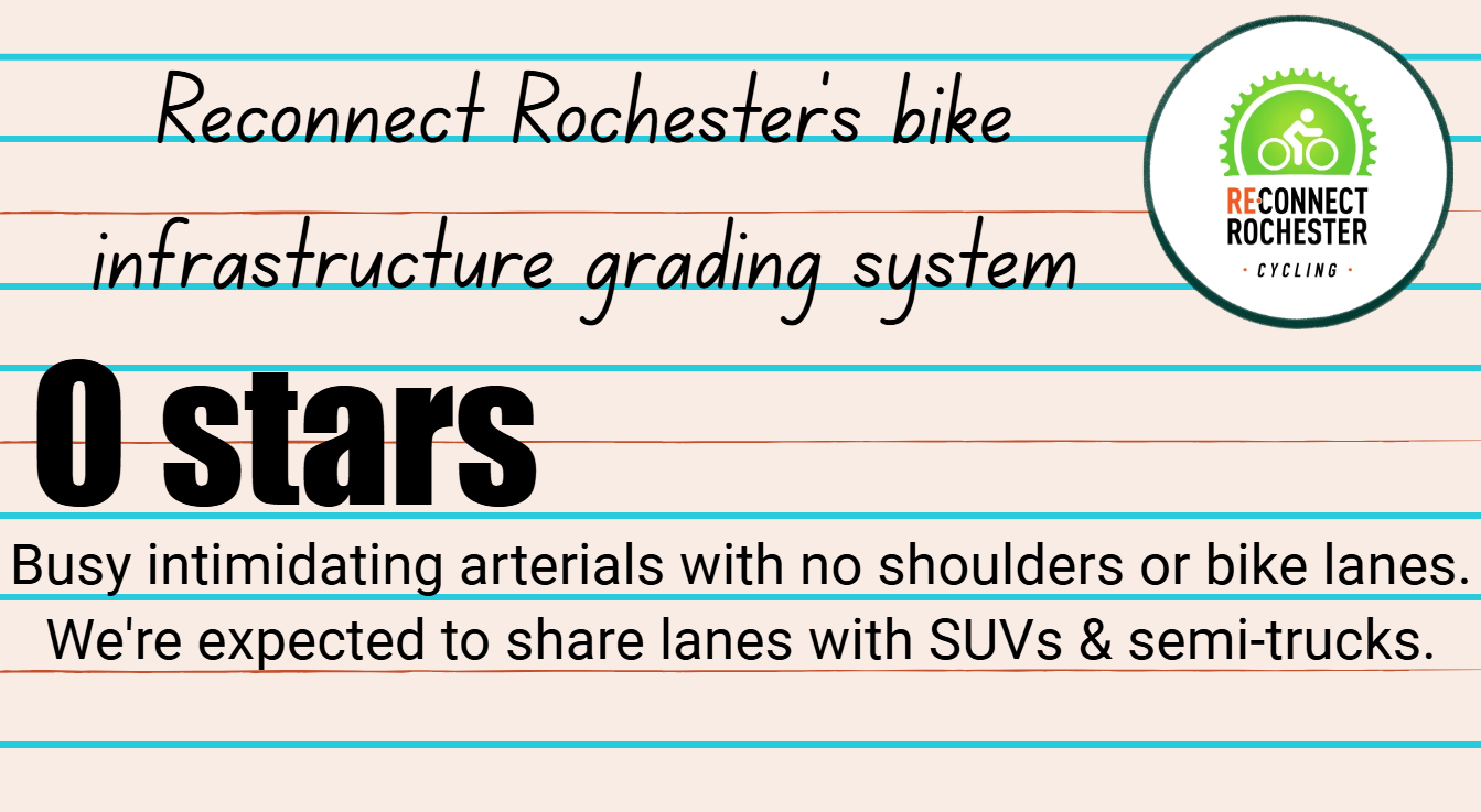
Reconnect Rochester thought it was time for a simple grading system for completed road projects; a means by which residents can assess a new segment’s bike-friendliness and grade various styles of bike infrastructure in different contexts.
But first…
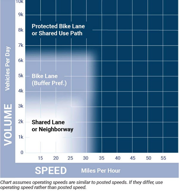
Before we dive in, however, I need to briefly address a common refrain we’ve heard over the years: “If it’s not a protected bike lane, it’s not worth riding in,” and its cousin: “Paint isn’t infrastructure.”
Reconnect Rochester just doesn’t believe that. No one will deny that protected bike lanes are safer, attract more ridership and generate more bike trips. That, of course, is what we’re after! But we must acknowledge too that CONTEXT MATTERS and that the outcome sometimes depends on whether a road project is a rare reconstruction or standard milling & repaving project. A conventional painted bike lane on a road with low traffic volumes and slow motorist speeds is rideable for many people. On the other hand, a conventional painted bike lane on a road with high traffic volumes and high motorist speeds isn’t rideable for many people. Furthermore, as we’ve noted before, “Though not all bike riders will be comfortable riding along bike boulevards, most people find them manageable, even pleasant to bike along.”
Notice the popularly-used diagram above is about *perceived* safety, not actual safety. Motorists drifting into shoulders/bike lanes and hitting cyclists is very, very rare. On the other hand, motorists hit sidewalk-riding cyclists everyday.
Even the most progressive bicycle planners from Europe contend: With 25mph speeds, “painting a lane is an acceptable solution. When speeds hit 30mph, it’s time for hard separation from motorized vehicles.” Once vehicle speeds reach “43mph or higher, there is only one goal: getting cyclists as far away as possible from motorized traffic.”
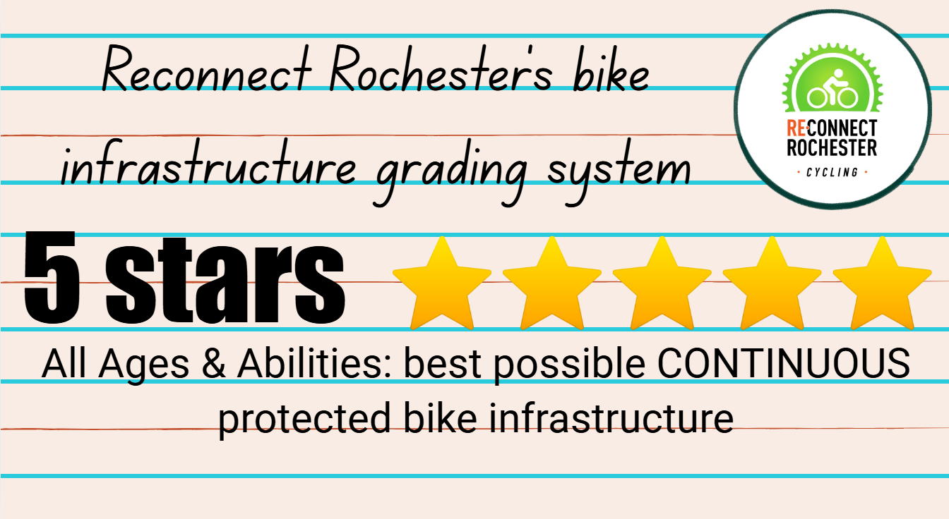
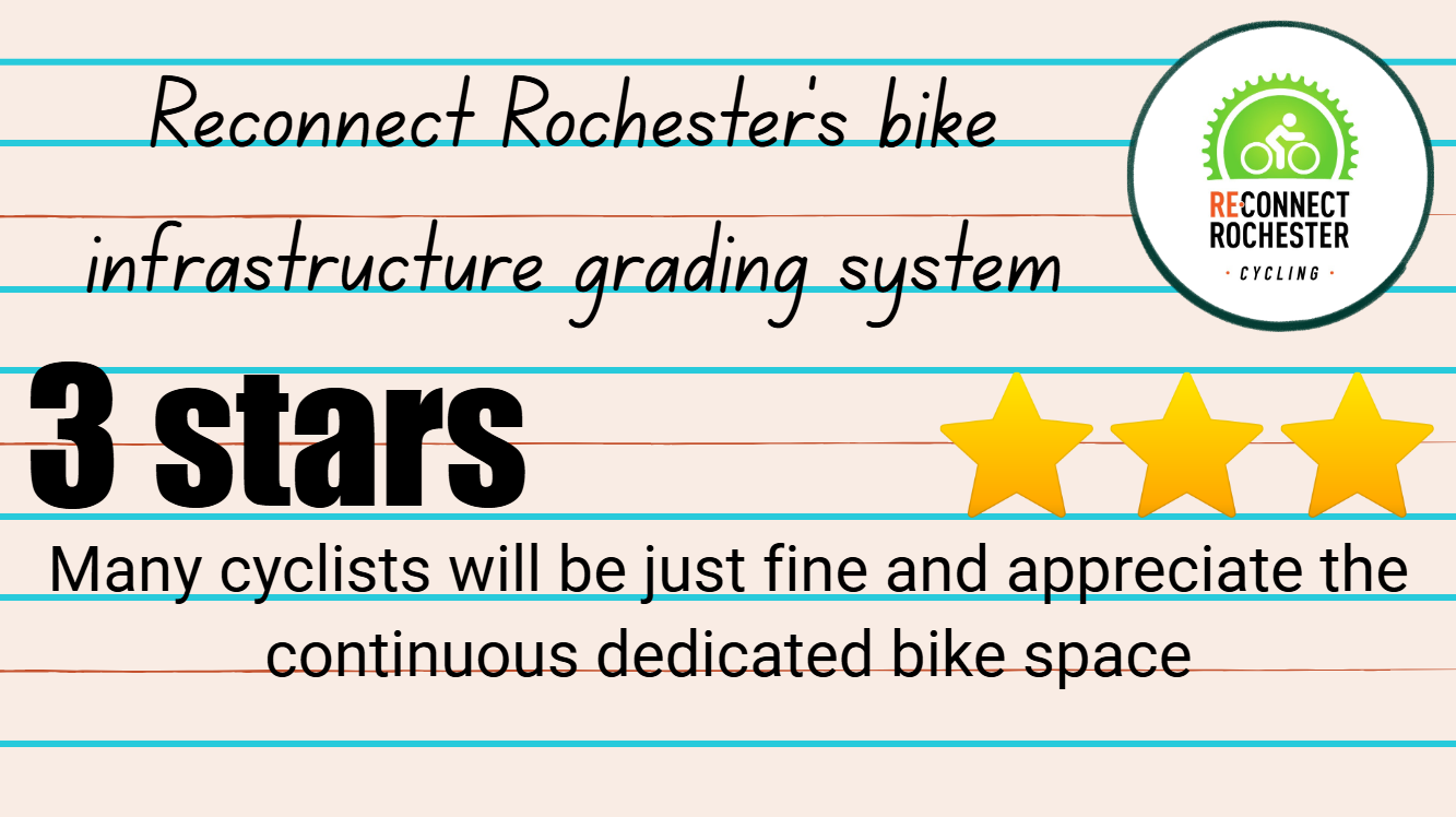
Reconnect Rochester’s grading system
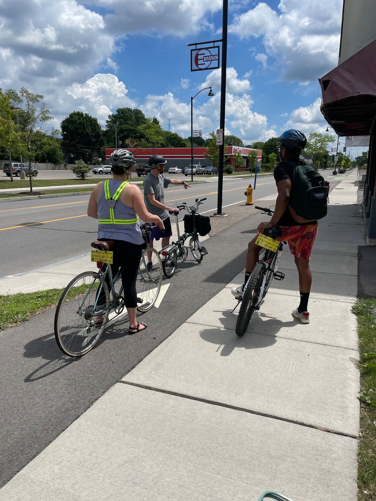
Everyone’s experience and degree of comfort along various bike facilities is different. And that’s okay. We’re proud to present Reconnect Rochester’s custom grading system below, along with penultimate examples for each tier in my opinion. If you’d grade these examples differently, that’s fine, indeed expected. That’s why we’re grading each project collectively and taking the average.
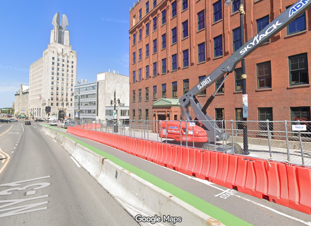
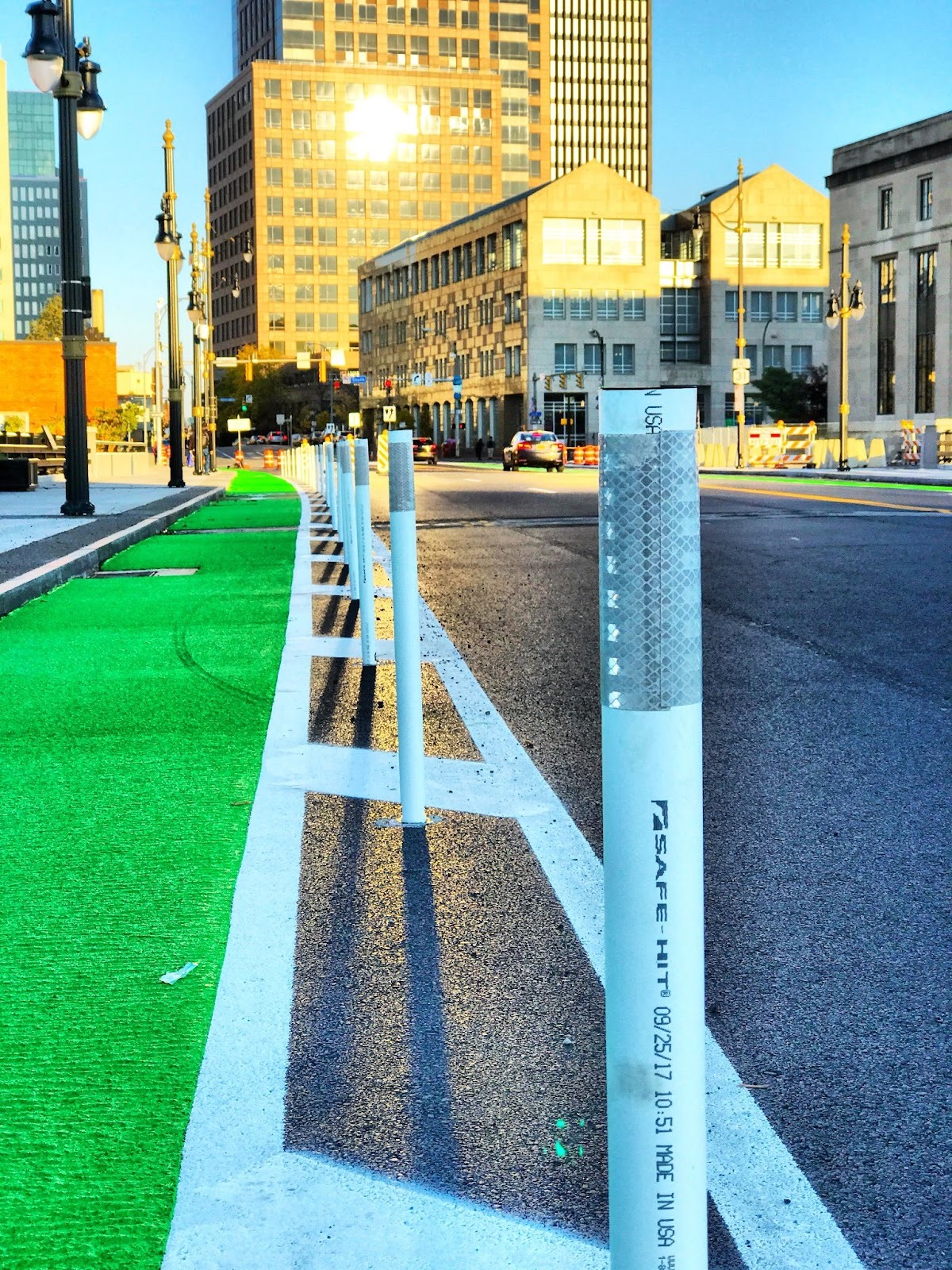
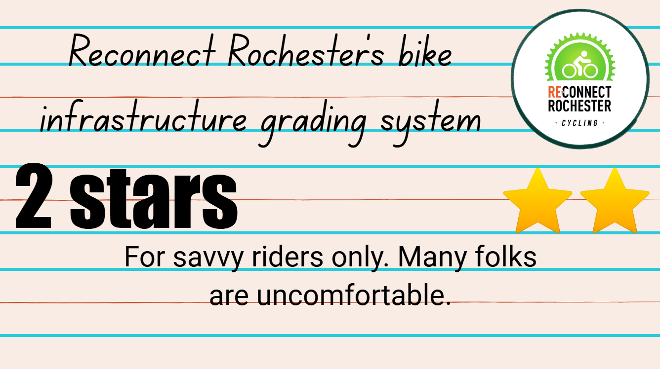
In my view, with the exception of trails, 5-Star Bike Infrastructure in Rochester is rare. But we do get something every once in a while.
Google Maps shot of the temporary Jersey Barrier protected bike lane we had in 2022
The flex posts Broad Street used to have before they were put away for the season & lost, courtesy of The Urban Phoenix
North Chestnut Street, the way it used to be before its seasonal flex posts were lost
The South Ave raised cycle track (by Highland Bowl), a place where that treatment works since development is sparser
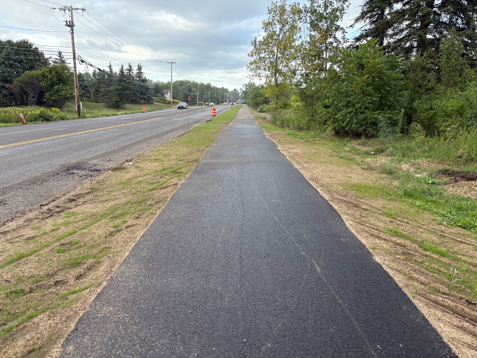
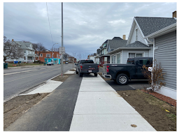
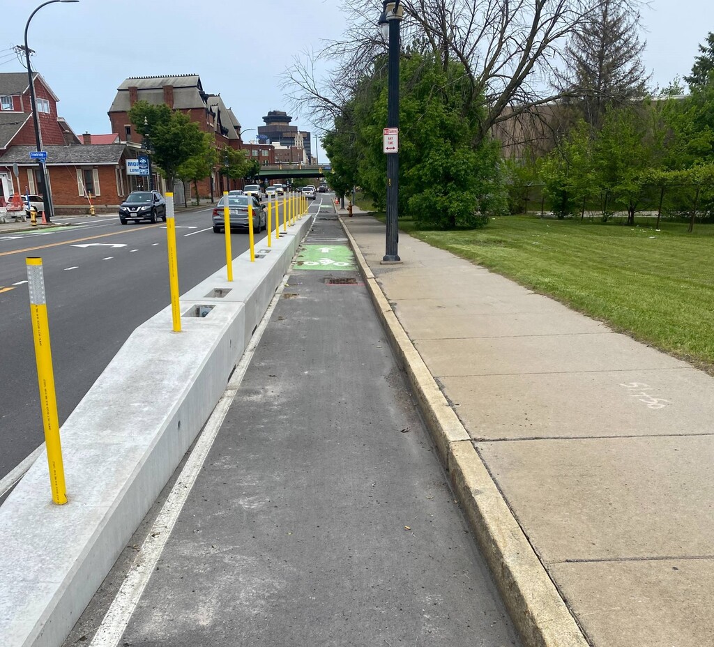
The new side path along East River Road in Henrietta works very well in this context. Well done Monroe County DOT!
Three shots of the raised cycle track on East Main Street between Goodman & Culver
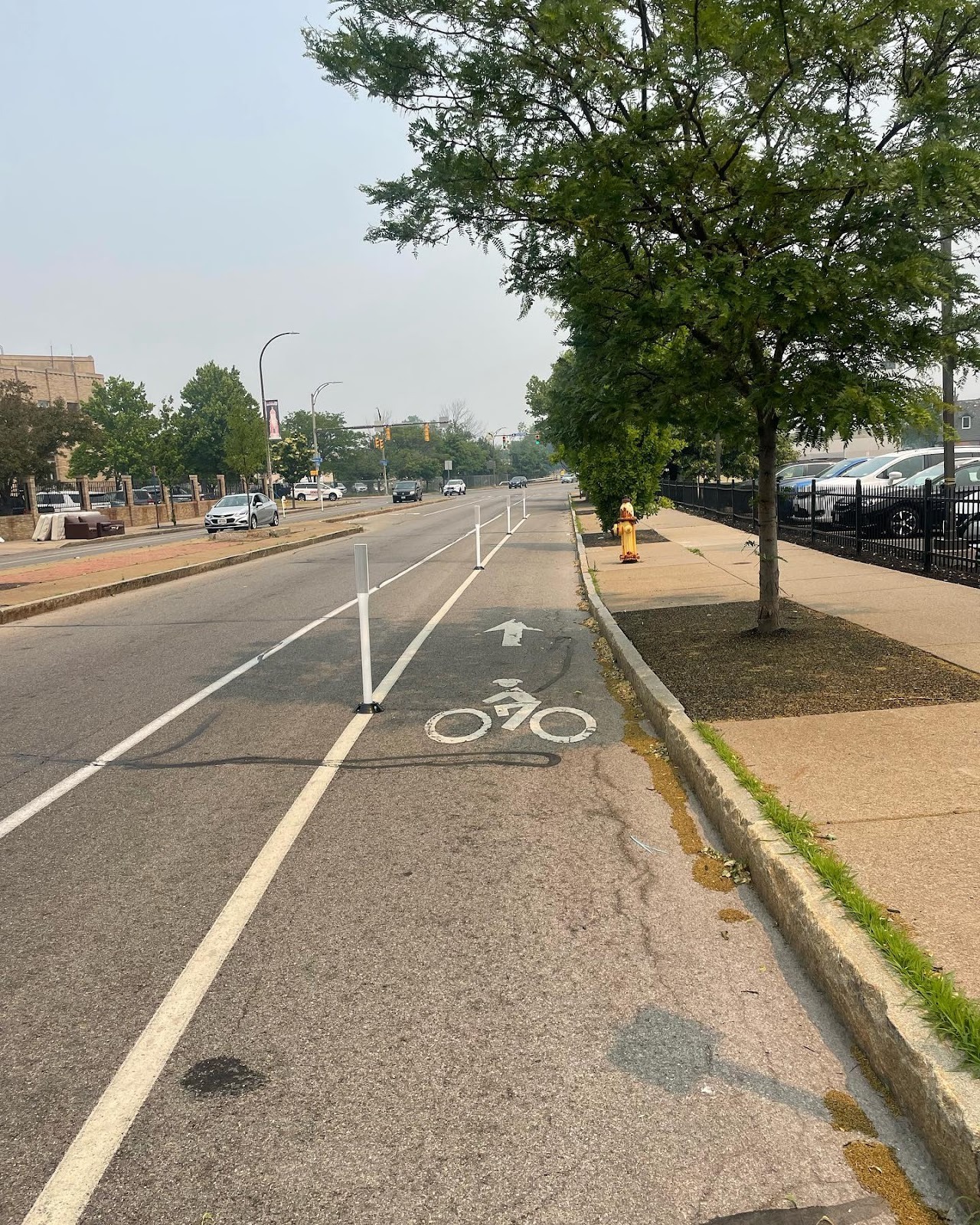
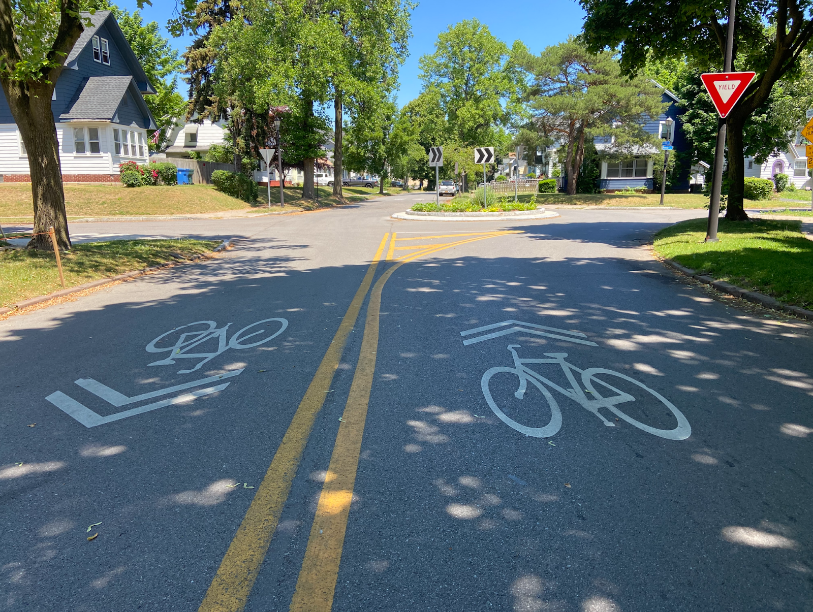
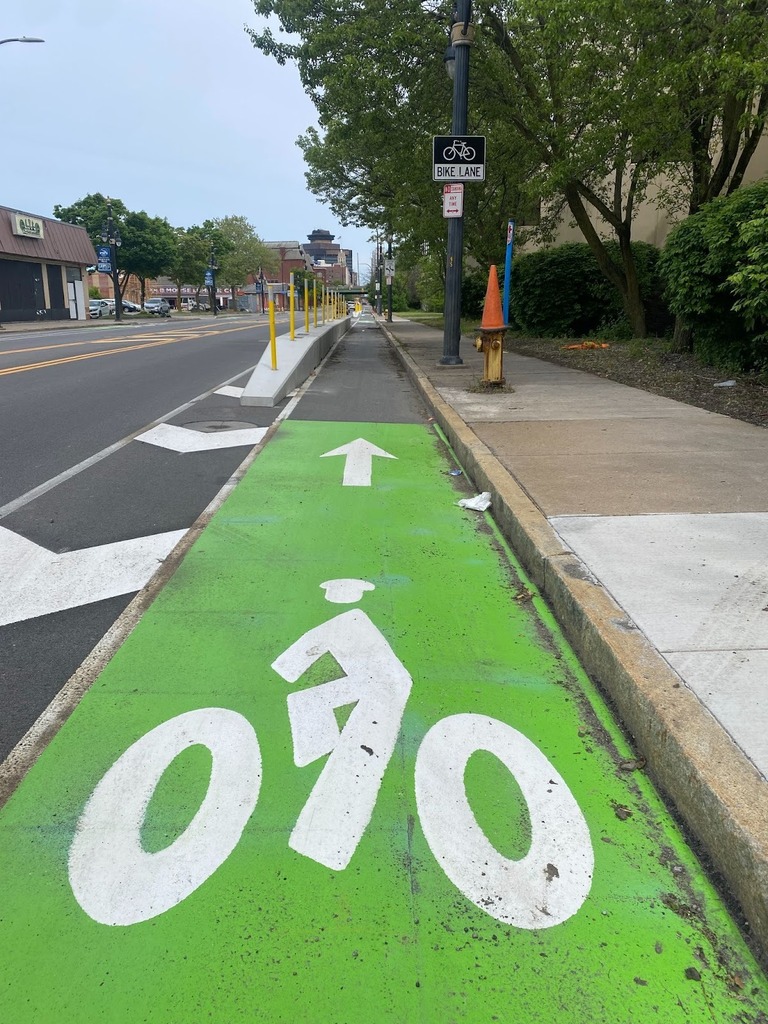
For the most part, when there’s one motor vehicle lane in each direction and conventional bike lanes on each side (and traffic isn’t too bad), I’m giving it 3 stars. Bike boulevards too.
Conventional bike lane Downtown on Andrews Street outside Harro East
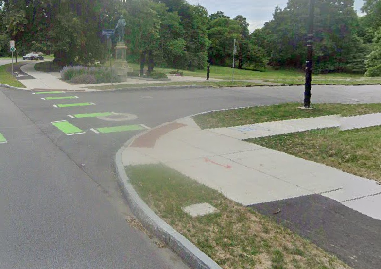
Bike Boulevard roundabout in the Homestead Heights neighborhood of Rochester
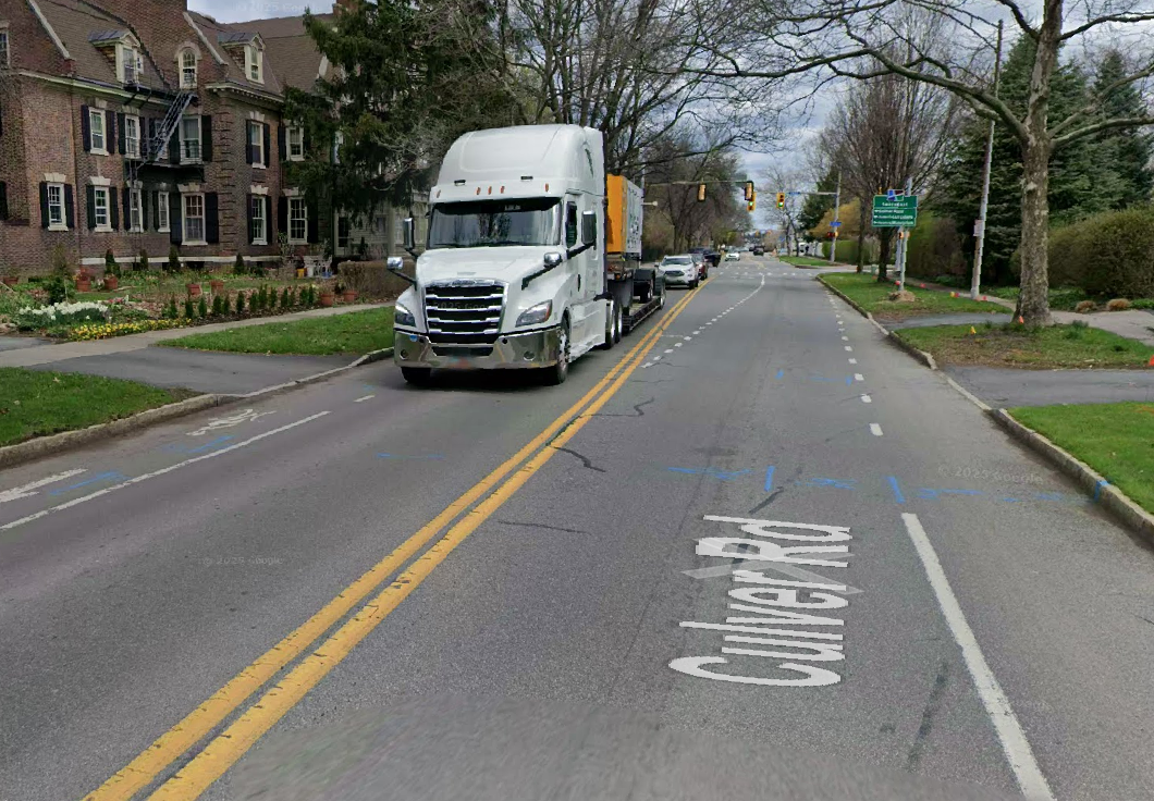
When there are brief bike lane disappearances or when a continuous lane is next to multi-lane traffic in an urban context, that’s 2 stars. As an experienced cyclist, I can bike these just fine but definitely see why others are turned off.
Disappearing bike lanes on Culver Rd approaching Park Ave & East Ave
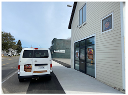
Bike Lane on East Main Street between Union & Goodman (by the Auditorium & Armory)
Something is better than nothing. But my heart goes out to anyone having to use this.
Bike Lane on Jefferson Road in Henrietta
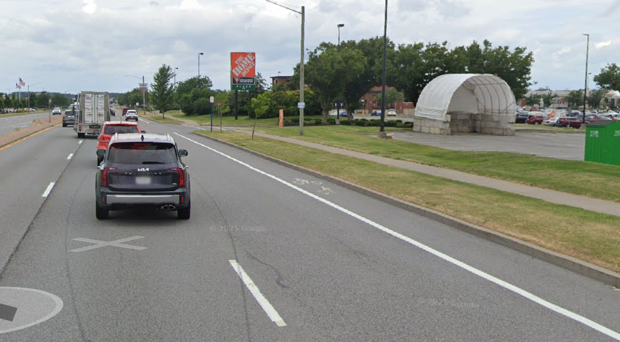
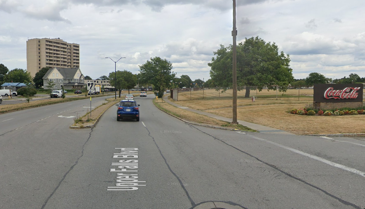
I avoid these like the plague. Rochester’s most dangerous roads look like this.
Upper Falls Boulevard in Rochester
We need your help!
Over the course of the peak 2026 riding season, one by one over 2.5-week stretches, we’re going to ask those that are comfortable to ride these recently completed (2023-25) road projects once in each direction, preferably on your own, and tell us your grade for each completed stretch. (Spend some money at a local business while you’re at it, telling them you appreciate bike lanes!) We’ll take the average grade for each project and communicate that to City Hall. Hopefully this feedback will move the needle towards infrastructure that gets more residents on bikes and generates more bike trips.
Ride each of the following stretches and submit your grade whenever you want. For social media purposes, however, we’re focusing on each road project for a 2.5-week period – just to ramp up ridership and attention.
The main goal of curb extensions is to slow down turning vehicles by narrowing the space available and shorten the distance that pedestrians have to interact with cars in the road. Following the installations, more than two-thirds of survey respondents said they felt safer crossing at these intersections. Perceptions of safety emerged as the strongest indicator from last year’s project that the improvements are making a difference while adding a splash of creativity to downtown Rochester.
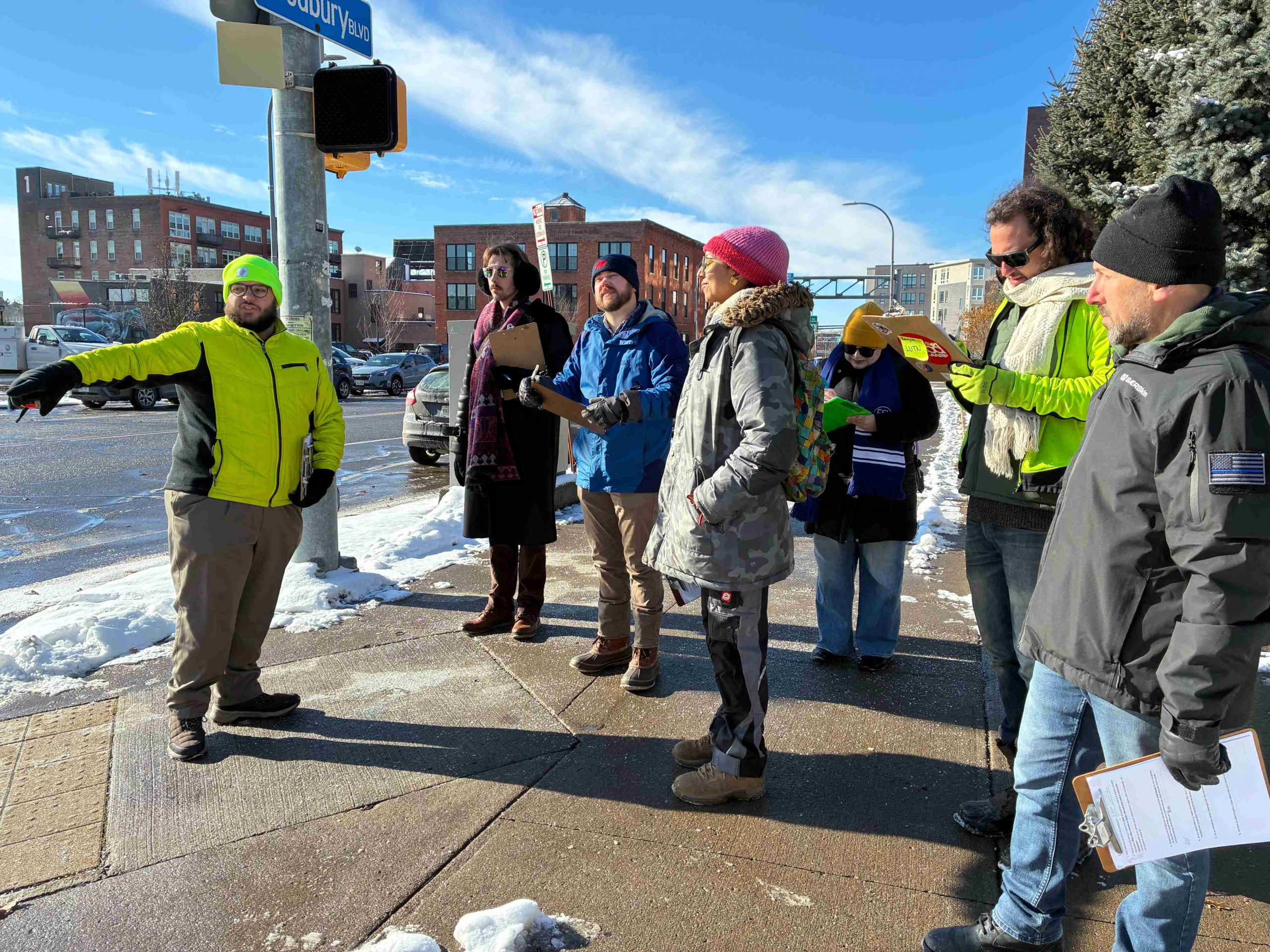
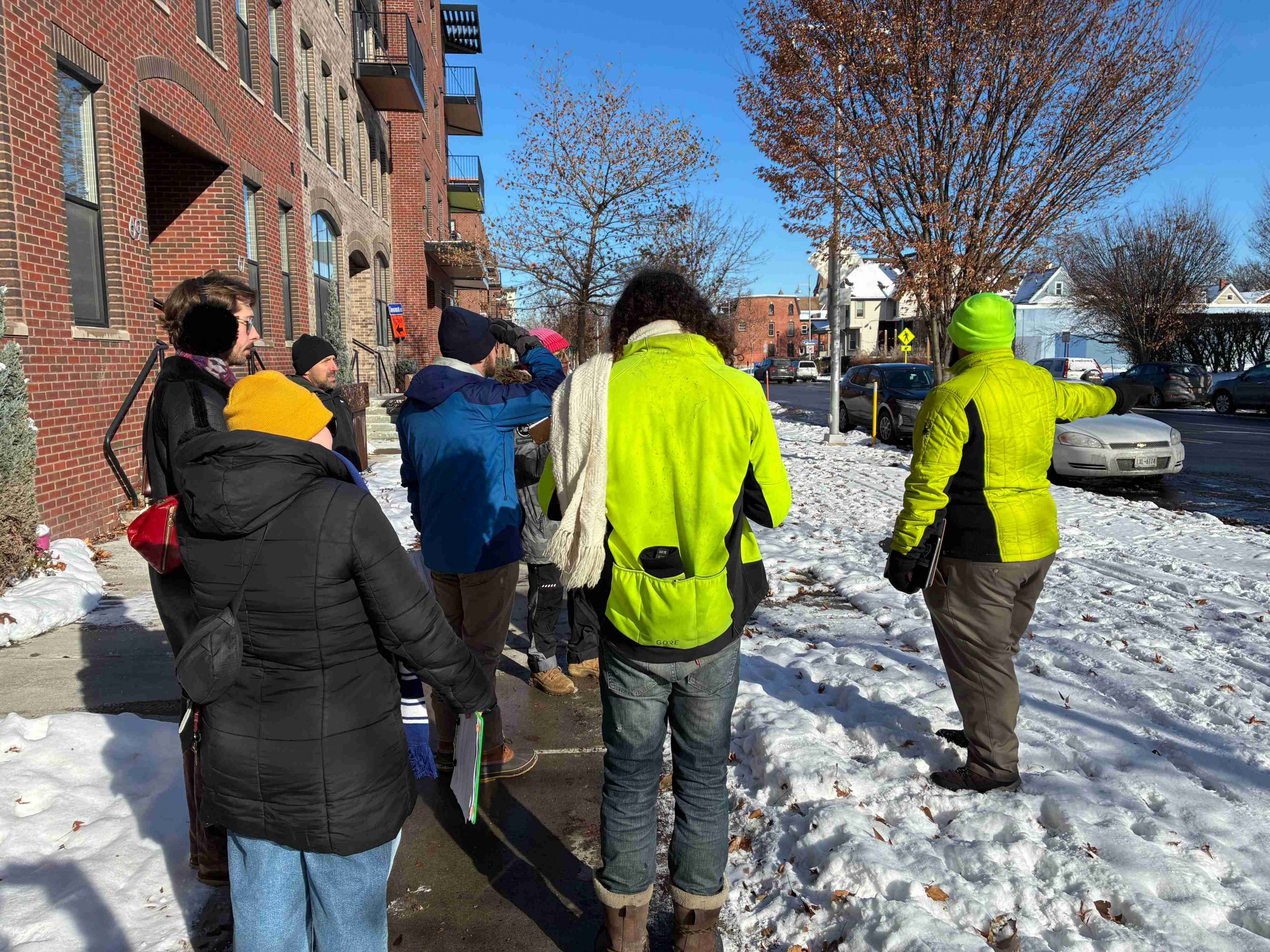
Using lessons learned from last year’s debut of the project, our Community Advisory Committee (CAC) met again in late 2025 to walk through downtown and assess potential locations for the next two installations. As we explored the streets together, we discussed areas with safety concerns and places with the greatest potential for improvement. We also considered pedestrian and vehicle traffic, along with proximity to busy downtown spaces.
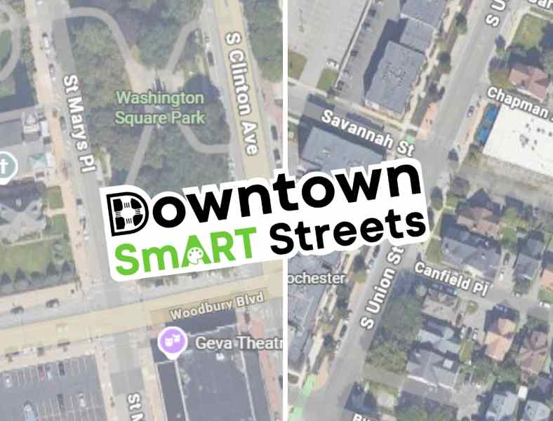
Without Further Ado, Our Selections!
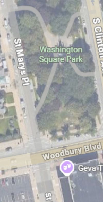
Woodbury Blvd & St Mary’s Place
And
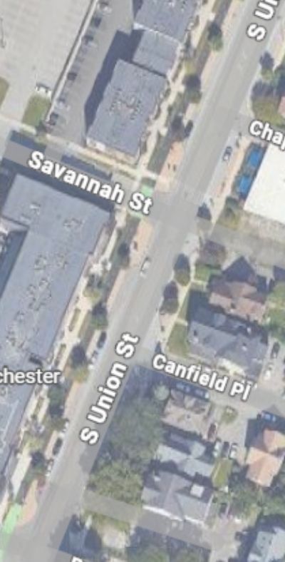
S. Union, Savannah, & Canfield Place
Why Woodbury Blvd & St Mary’s Place?
Woodbury and St. Mary’s offers a clear opportunity to redesign the streetscape and better allocate space. Plus three of the four corners of this intersection are home to Washington Square Park, Geva Theatre, and St Mary’s Catholic Church; with all the various programs that draw people to those places.You can also find Fuego Coffee just a hop skip away. This project will create a more comfortable crossing for the many visitors and downtown residents who pass through the area on foot.
Why S. Union, Savannah, & Canfield Place?
While we love the Union Street cycle track, this long, unsignalized, stretch of road offers little to deter high driver speeds. In turn, residents of S Union Street apartments, Strong Museum of Play visitors, as well as customers walking or rolling to places like Spotted Octopus, Fattey Beer Co, or Nerdvana, often struggle to find safe gaps in traffic when crossing.
These concerns became even more urgent after a tragic hit-and-run pedestrian fatality in June 2025. A driver hit 70 year old Henry “Hank” Brown, long time doorman at Salinger’s, while he was crossing S. Union walking home from work. This tragedy was a factor in including Canfield intersection where Hank was hit and killed, in the project area. While the west side of the intersection already has a substantial bump-out, the east side could be improved to harden daylighting zones and prevent illegal parking.
Next Steps…
The design team at GPI is creating renderings to redesign the project area for a safer and smarter street. Renderings for both locations will be reviewed by Rochester’s Traffic Control Board. Once the street safety design and artwork for the murals receive proper approval, we will gear up to bring these concepts to reality this spring/early summer!
We need volunteers for this project! Want to help us paint?! Reach out to project manager, Lourdes Sharp (Lourdes@ReconnectRochester.org, 585-210-9716) to explore opportunities.
We will also be updating the paint and reinstalling the delineator posts for both of our 2025 installations at E. Main & Gibbs Street and Broad and Fitzhugh! Have you visited one of these installations from last year? Let us know what you think!
As winter loosens its grip on Rochester, I’m eager to get outside and enjoy the sunlight of longer days. Many of my cherished fair-weather memories share a common thread: the terrace and the plaza. Internationally, outdoor drinking and dining are cultural institutions. Town squares and city streets around the world are packed with tables. The air is filled with the sounds of conversation and the smell of fresh food. City planners and community members are intentional about creating safe, calm oases within the urban context to eat, drink, walk, and socialize.
Sadly, this experience is not the norm in our city. With so much of our public realm surrendered to travel lanes and parking spaces, there is little space left for people. Even downtown and in entertainment districts like Park Ave, cars are prioritized while humans are pushed to the margins. Where outdoor seating is available at all, it often encroaches onto already too-narrow sidewalks, creating conflicts between diners and pedestrians. And if you can find outdoor seating, it is frequently located within just a few feet of high-speed car traffic, with all the accompanying noise and fumes.
While I see this situation as a tragedy, defenders of the status quo insist that allocating valuable urban space for outdoor dining and recreation is pointless in a city like Rochester which is gripped by snow and ice for 3-4 months of the year. While on the surface this argument sounds logical, our neighbors to the north see things differently.
City streets around the world are packed with tables. The air is filled with the sounds of conversation and the smell of fresh food…in our city if you can find outdoor seating, it is frequently located within just a few feet of high-speed car traffic with all the accompanying noise and fumes.
Every year during the winter months, the city of Montreal, Quebec is pummeled by an average of 83 inches of snow, with average temperatures below 20 degrees Fahrenheit. To put it in perspective, that is almost as much snow as we get in Rochester with a lower average temperature! But rather than basing decisions about urban space for the whole year on the coldest three months, Montreal has a different philosophy. Every summer, they open up some of their most vibrant city streets for walking, biking, and outdoor dining. Local artists and community members are called in to beautify their thoroughfares with planters, murals, and street furniture.
Despite our smaller population, I think this is something we could emulate in Rochester; perhaps from the beginning of the Jazz Festival in June to the end of the Fringe Festival in September. Partnerships could be created with these festivals, as well as other events and local businesses, to active the newly available public space. Here are my nominations for Rochester Open Streets.
Gibbs Street between Main Street and East Ave:
Located directly in the middle of the Eastman School of Music campus, this is area is the closest thing that the prestigious college has to a “quad.” A pedestrianized Gibbs Street would act as an extension of the existing pocket park on the corner of Main and create enough space for small outdoor concerts. It would also allow expanded outdoor seating for Java’s Café, Ludwig’s Center Stage Café, and Max Chophouse; all of which front onto this section of Gibbs.
Elm Street and Cortland Street at Parcel 5:
Parcel 5 has been growing in popularity as a venue for events and public gatherings; however, Elm and Cortland currently separate it from the nearby pedestrianized areas of Midtown Commons and The Grove to the southeast. Pedestrianizing these two streets would connect existing assets into a proper public square with the capacity for larger community events. It would also provide additional outdoor dining capacity for Branca, Patron Saint, and the food trucks that frequently set up shop in the area.
Park Avenue from Berkeley Street to Culver Road:
This stretch of Park Ave is home to many beloved restaurants and cafes. While I would love to see the entire length of Park Ave receive the Open Streets treatment, this section is the most obvious and least disruptive. RTS service could be shifted to East Ave during the window. Alternatively, a 12-foot span in the center of the roadway could be left unobstructed to create a temporary transit mall. This intervention would truly bring the corridor to life during some of its most vibrant months.
Which of these locations would you most like to see receive an Open Streets treatment? Is there another location in the City of Rochester you would like to see temporarily or permanently pedestrianized? Let us know!
After weeks of collectively feeling underwhelmed by the City’s snow management, we welcome the time of year when Rochesterians bundle up for early spring walks and rides! Up until last week, a lot of our public right of way was icy and unrideable, but kudos to everyone (City and private property owners) who cleared their paths and sidewalks to make the melt go faster.
Below are a few highlights from the last few weeks in our Advocacy Team’s work!
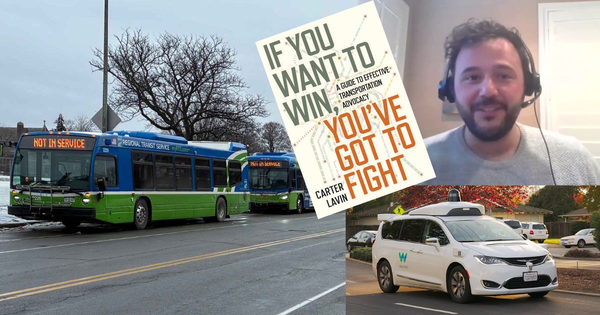
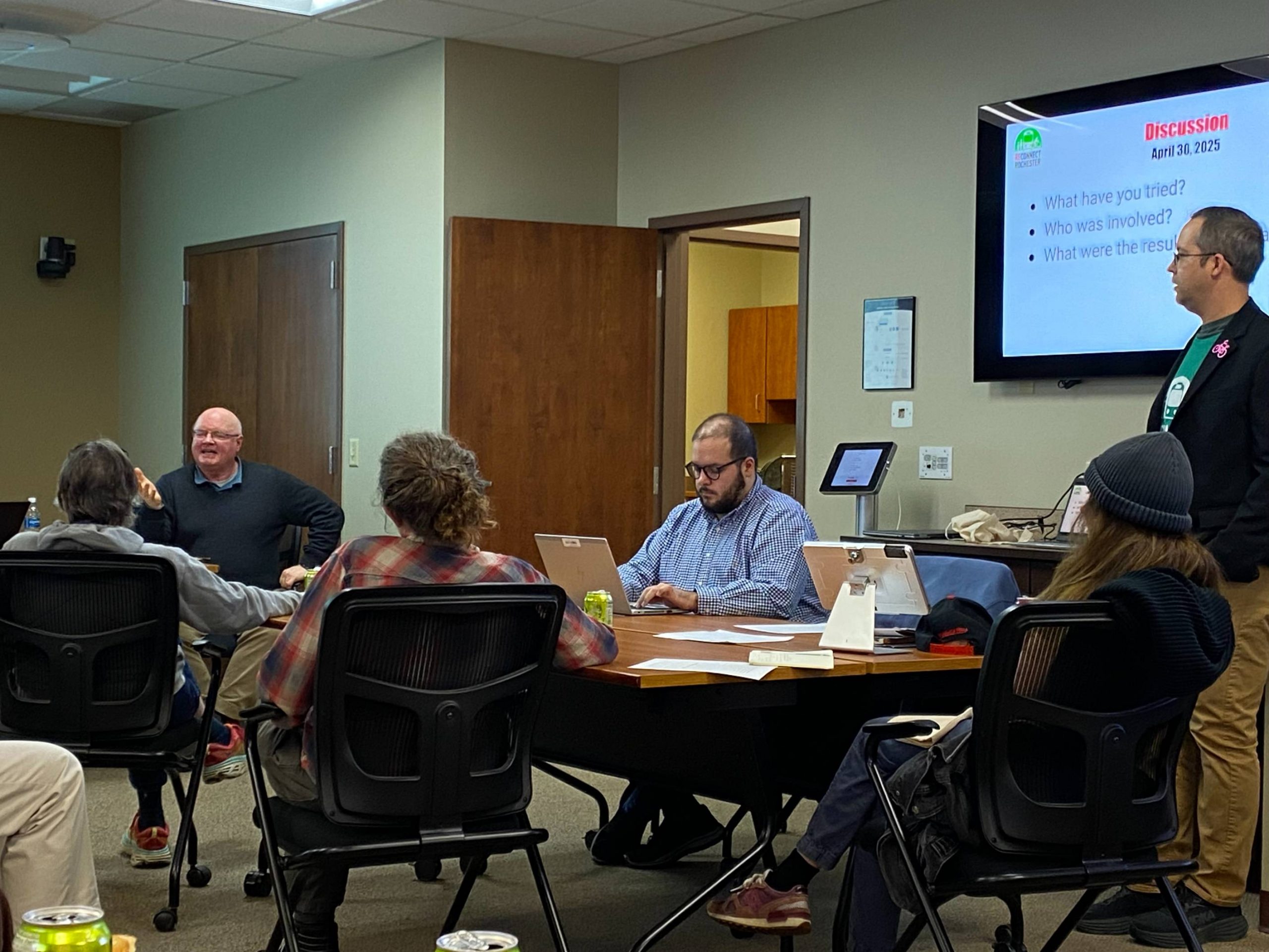
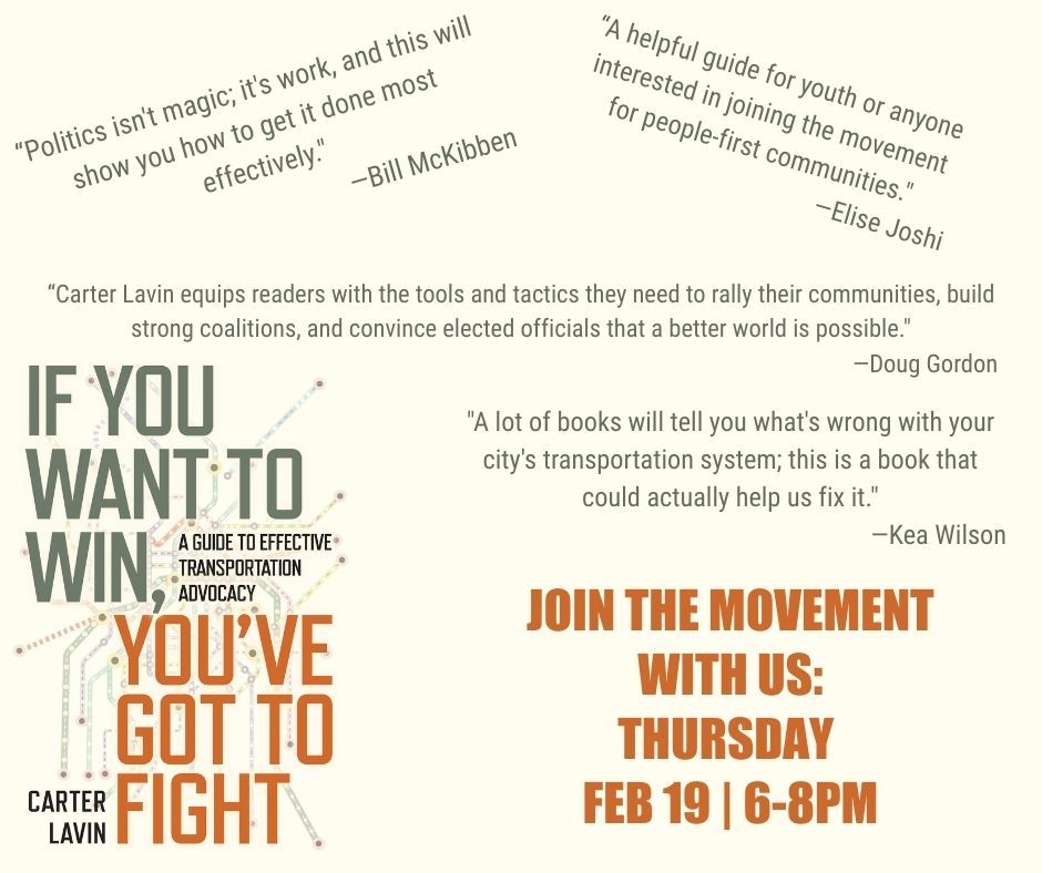
We held our second community conversation of 2026 with Carter Lavin, author of If You Want to Win, You’ve Got to Fight. If you missed it, watch the recording here and buy Carter’s book! We also launched the Reconnect Rochester Road Project Advocacy Toolkit, outlining some of the most useful things we’ve learned while doing road project advocacy. Take a look and give us your feedback so we can improve the usefulness of the information.
Better Buses for Rochester
Transit Awareness Month in February saw a flurry of activity. We mobilized a joint letter with RMAPI, Climate Solutions Accelerator and Healthi Kids on transit funding, attended a legislative breakfast in Albany with the State Legislature Transportation Chairs, met with lawmakers to share support for DMV Surcharge, and put out the third edition of the Voices of Transit series. To better understand RTS’s funding crunch, read the Beacon’s great overview.
Supporting Crash Victims
As a follow up, we installed a Ghost Bike in 2025 for Jerome Blocker and his family members have been active advocates with Reconnect since then. The driver of the vehicle that struck and killed Blocker, then left the scene, was sentenced this week.
Coming up next:
Reconnect Rochester is getting ready to fly to DC for the League of American Bicyclists Summit and we will be lobbying on capital hill for funding to multimodal transportation projects in the next transportation reauthorization bill!
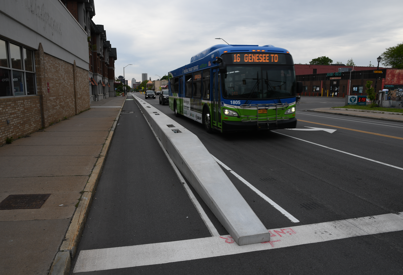
The City of Rochester installed its first raised cycle track on Lake Avenue in 2016 beside St. Bernard’s Seminary and the Holy Sepulchre/Riverside Cemeteries. Since then, raised cycle tracks and doublewide sidewalk “trails” such as the Eastman Trail along Ridgeway, have become the City’s go-to protected bike infrastructure. Raised cycle tracks and “trails” like Eastman are separated from the street and “above” the curb next to the sidewalk. Our friend The Urban Phoenix has done a great job examining these and his thoughts are a great complement to what follows.
Bike and scooter riders of all ages and abilities tend to be comfortable on those cycle tracks and this is great! Reconnect Rochester’s historical preference for most City streets, however, hasbeen for protected bike lanes in the street – the gold standard we see in great cycling communities who really grow their ridership. Well-designed raised cycle tracks have their place in some settings, especially for suburban higher speed roads, which we’ll get into in a future blog post.
Rochester’s Union Street cycle track (“above” & outside the street at sidewalk level)
If Rochester’s ideal Bike Spine Network is composed primarily of cycle tracks constructed during very rare, very expensive Reconstruction projects, we won’t have the Bike Spine Network in 100 years.
Rochester installed some protected bike lanes with bollards/posts on Broad Street and Chestnut ~2017. The bike community was excited, expecting those to be the forerunners of many. But the bollards/posts went missing, we never saw any more protected bike lanes and started seeing a regular dose of raised cycle tracks next to the sidewalk instead. There are 8 recently completed or in-design projects with cycle tracks. Some cyclists have grown concerned that City Hall has developed a raised-cycle-tracks-or-nothing philosophy when it comes to protected bike infrastructure. Fortunately, that seems to be changing. More on that in a bit.
The primary drawback of raised cycle tracks is cost: They’re typically only feasible during rare Reconstruction projects, which come along (if you’re lucky) once a lifetime to a given stretch of road. If Rochester’s ideal Bike Spine Network is composed primarily of cycle tracks constructed during very rare, very expensive Reconstruction projects, we won’t have the Bike Spine Network in 100 years. This goes against the recommendations and spirit of the City’s 2023 Active Transportation Plan, which urges concentrating political will on achieving that Bike Spine Network in the near term.
Luckily there is a cheaper way to build the bike spine: The lower hanging fruit when it comes to bike infrastructure is cheaper, routine preventative maintenance (resurfacing) projects, which roll along every few years and allow for space reallocation between curbs. This is where protected in-street bike lanes become possible, provided the design allocates the space to the bike lane.
This is also where things get thorny: We’d contend that there’s often room for protected bike lanes on many roads. But there’s often not room for both protected bike lanes and on-street parking. This trade-off and elephant in the room can’t be ignored. Along those proposed spines, the safety and comfort of vulnerable road users must override free on-street parking, especially in light of safety initiatives like ROC Vision Zero. If a City reconstruction project comes along to widen a road and enable both on-street parking and protected bike infrastructure, great. Safety above all in the meantime.
For the above reasons, these two tenets hold true:
Sidewalk level cycle tracks don’t require confronting bad driver behavior and take more money and time.
Protected bike space in the street confronts driver habits (like illegal parking and speeding) and is cheaper and faster to implement.
Other concerns about raised cycle tracks
Cycle tracks might subtly convey to motorists that cyclists shouldn’t ride in the road. Raise your hand if you’ve been yelled at by a motorist to “get out of the street” and “ride on the sidewalk.” Cycle tracks feed this thinking and are seen by some as bowing to car-dominance. Great cycling cities challenge that car-dominance.
So many cyclist crashes in Rochester involve sidewalk-riding cyclists. Raised cycle tracks are not much different than sidewalk-riding and they open riders up to some very common motorist mistakes, especially locally. Motorists pulling out of driveways and parking lots tend to pull right into the sidewalk/cycle track area as they wait for a break in traffic. (They’re required by law to come to a complete stop *before* the sidewalk and only creep up for a better view once they know it’s clear. Very few drivers do this). Bike riders in protected bike lanes are more visible and predictable in the street than they are outside the street.
Raise your hand if you’ve been yelled at by a motorist to “get out of the street” and “ride on the sidewalk.” Cycle tracks feed this thinking and are seen by some as bowing to car-dominance.
The line between sidewalk and cycle track have blurred in recent Rochester projects, which is concerning. See the new doublewide sidewalk on University, the shared path on State Street by MCC and the way cyclists are supposed to go up on the Culver sidewalk now over 490.
Cycle tracks, especially bidirectional ones on one side of the street, often create awkward, unintuitive, inconvenient, sometimes scary transitions when they end abruptly or switch sides of the road. See Elmwood/East Drive or Union/University for examples. (When regular bike lanes end, you just keep going straight).
Though this has gotten better, Rochester has a less-than-stellar record when it comes to curb cuts and smooth transitions for raised cycle tracks. Constant curb cut riding isn’t required when riding in the road.
As the cycle track on East Main Street has taught us, if a resident has multiple cars parked in their driveway, the cycle track is blocked and unusable. Garbage cans, hot dog stands, anything really – can make cycle tracks unusable.
Though Rochester doesn’t clear its bike lanes of snow (they’ve got a plan for (studying) that), at least the responsibility for keeping roadway travel space is clear: the owner of the road. With cycle tracks, it’s ambiguous who should clear the snow. Property owners are responsible for clearing sidewalks of snow, but not the cycle track right next to the sidewalk.
In sum, Reconnect Rochester would love to see more in-street protected bike lanes. They really drive up ridership, create less conflicts, and it’s the cheaper, faster way to realize the City’s vision. We’re excited for the City’s upcoming Protected Bicycle Lanes Demonstration Project, which will “trial a number of semi-permanent barriers…that can be left out during the winter season. These barriers will be evaluated on cost, their ability to create safe cycling infrastructure, their resilience to snow plowing, and their ease of maintenance.” These demo protected bike lanes are expected in 2027 on St Paul, State Street, Ford Street and East Avenue.
For a taste of what’s in store, check out the new protected bike lane segments on West Main Street! This seasonal barrier should be reinstalled in April.
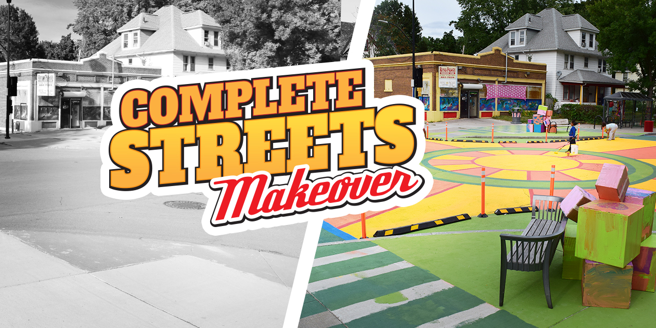
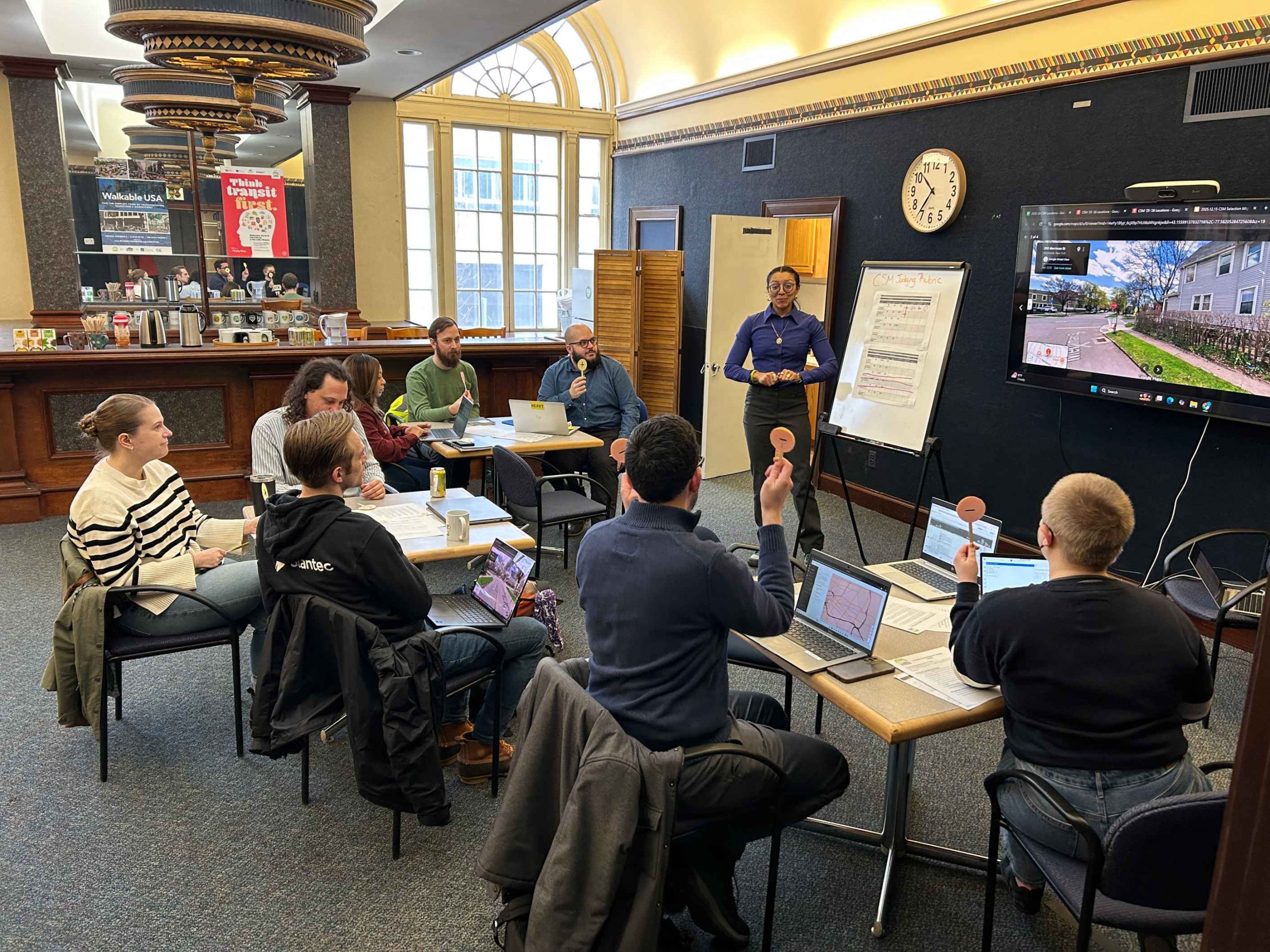
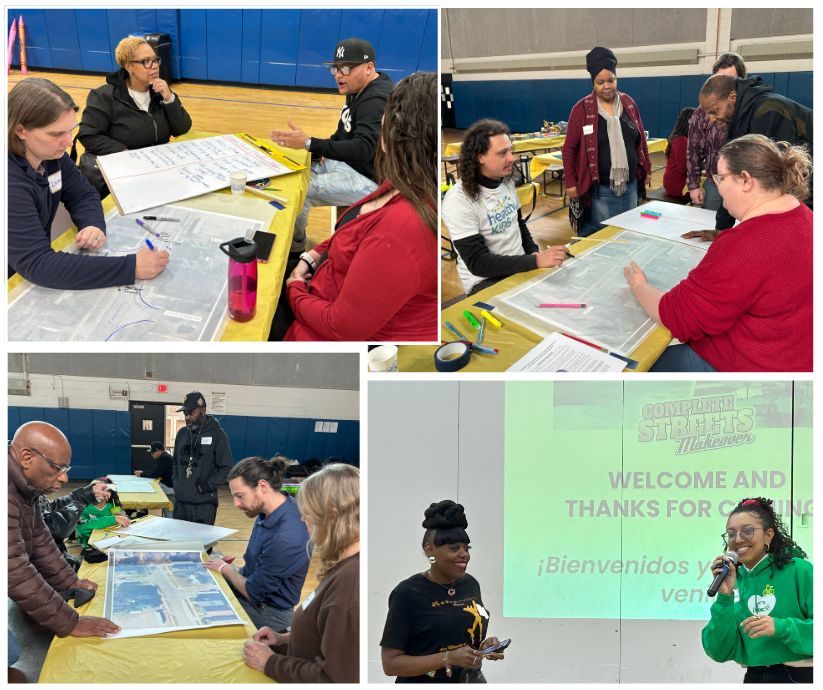
Reconnect Rochester’s Complete Streets Makeover project transforms a neighborhood intersection through a temporary installation designed to make it safer for everyone passing through, whether on bike, on foot, or in a car. We selected the winning location for our 6th project from a pool of 48 trouble spots that community members identified as places in your daily travels where you don’t feel comfortable walking or biking. After carefully evaluating each location using established criteria, such as safety concerns and design improvement potential, our Program Steering Committee held a popsicle stick voting session and landed on this year’s winner!
(Drumroll please…)
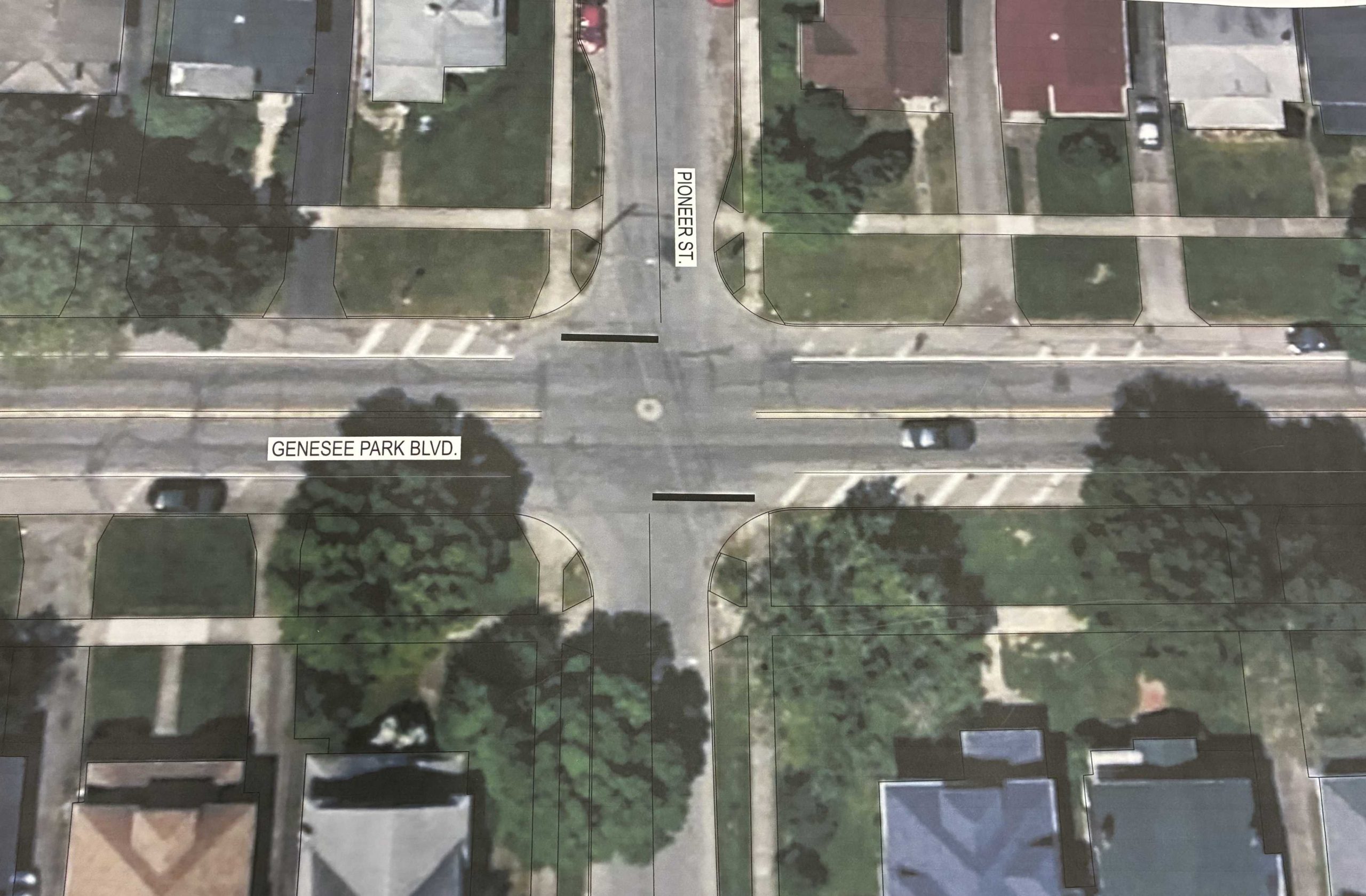
Genesee Park Blvd & Pioneer St in the 19th Ward neighborhood!
Genesee Park Blvd & Pioneer St sees a high number of crashes under normal conditions but a recent detour has exacerbated the issue. With the detour recently removed and traffic flows returning to normal conditions, residents have since raised real safety concerns traveling through the intersection.
While pedestrian crashes have been less frequent than vehicle collisions, drivers failing to yield the right of way has led to residents feeling unsafe. Some report that they take a longer route to bike or walk to Genesee Valley Park because it feels safer than passing through this intersection. Genesee Park Blvd & Pioneer St sits just steps from the Empire State Trail and Genesee Riverway Trail, where people regularly walk, run, and bike. Its proximity to University of Rochester off campus student housing and School #53 leads many students and families to rely on this intersection on a daily basis.
This intersection also has extra road space to work with, and the layout presents strong potential for design improvements. Plus, Rochester is planning a reconstruction of Genesee Park Blvd in 2032 which creates an opportunity to test safer street design on a temporary basis. Through data collection, we can evaluate what works for all road users and center community voice to help inform the permanent redesign.
Next Steps…
We’ll hold a Community Workshop in March to gain insight from the residents of the 19th Ward about the enhancements they would like in the intersection. No one understands what it’s like to use our streets better than those who walk, bike, roll, and ride along them everyday.
Complete Streets Makeover Community Workshop in 2025
Our friends on the complete streets design team at Stantec will use community input from the workshop to create conceptual design enhancements of an improved streetscape. We’ll then see these concepts transform into reality through a temporary on-street installation in May. This transformation is only possible through the input and support of neighborhood residents coming out to help with the installation. Keep a look out for updates along the way!
*Community Partners
The Complete Streets Makeover of Genesee Park Blvd & Pioneer St is a collaborative venture with the following community partners:
Is there an intersection or trouble spot in your daily travels where you don’t feel safe to walk or bike? Nominate it for our next Complete Streets Makeover project!FILL OUT OUR NOMINATION FORM.
People power this movement for more transportation options and a vibrant community – through riding, walking and raising your voice. Your voice can make a difference speaking to your municipal, county, state and federal leaders to get improvements made to your street, bike lanes and sidewalks in your community.
This toolkit is a compilation of everything we’ve found useful and important in understanding different road projects, national trends and local plans to enhance our multimodal transportation network! It contains links to other partner resources that go deep into all aspects of safe road designs for all users – from kids to seniors and every ability in between.
Why is this important to Reconnect?
All of us on staff are residents and advocates. None of us have degrees in urban planning or traffic engineering. We’re self-taught and we have lived experiences riding the bus, a bike, and walking. We all decided at a certain point that this was a topic we wanted to learn more about, and joined with others to identify a project we wanted to fight for.
In advocacy, there’s a ladder of engagement and we want more residents to be engaged, knowledgeable and powerful in advocating for their neighborhood’s needs. That means having access to the same information, resources and frameworks that we have. It’s fine if you want to trust us and copy the talking points from Mobility Action Alerts, but we also think it’s important to share the knowledge and inspiration while we advocate.
We want to hear your perspectives
Whether you spend time with this guide or not, we always want to hear from you about local projects. Send your thoughts and ideas to our email. Our input to the City, County, State and Federal partners should always be grounded in your feedback.
An invitation
Our blog and social media are great ways to share an idea you’ve had for your community. Write up a 300-500 word post with original pictures and share them with Reconnect and we’ll work with you to get your idea out there. We’ve previously featured ideas about High Falls that might get real treatments in upcoming projects, visions of Bus Rapid Transit on Lake Ave, and proposals for a mixed-use trail on the east side of Irondequoit.
Car Lite Rochester is a blog series that highlights the stories of Rochesterians living a car-lite lifestyle. The term “car lite” encompasses a variety of multimodal transportation lifestyles, featuring little dependence (but not NO dependence) on a car. It typically looks like sharing one car within a household or only using a car when absolutely necessary.
So, we hope you’ll continue to follow along. Maybe you will be inspired to join our bloggers in living a car-lite lifestyle!
Let me start by saying that I’ve never driven a car. I was born with a condition called optic atrophy (an underdeveloped optic nerve) which has rendered my eyesight poor at best. I’m not blind but operating a motor vehicle, plane or anything that moves fast is likely not a good idea. It mostly affects my ability to see things at a distance. Often I can’t read street signs unless they are directly in front of me and, at night, that can be a problem too.
That doesn’t mean that I’m immobile. At 71, I’m an avid bicyclist, love to walk and get deep pleasure navigating mass transit offerings – even when they seem designed to defeat the most intrepid traveller. I take distinct pride in getting places and doing things that sceptics claim should be impossible. I’ve biked from Jerusalem to Eilat in Israel and from Pittsburgh to Easton in Pennsylvania. My inconvenience is lessened by being married to a woman who is an excellent driver. I try my best not to rely on her for all of my travel needs.
My wife and I moved to Brighton several months ago. We had been living in Hoboken, New Jersey; a paradise for the carless (and a massive Vision Zero success story!). For those that have never been, it’s a city that in its one square mile contains every possible service you could need. Great shopping, restaurants, entertainment, schools, medical facilities, churches and synagogues, artist studios and galleries, gyms and lots of green space. Transit was a dream with NJ Transit buses and trains, bikeshare, light rail, even a ferry to New York City in easy striking distance.
So why would we leave for the wilds of western New York? That damn word affordability. In 8 years our rent had risen over 50% and there was no end in sight. Buying a home was not a viable option either as 2 bedroom apartments in our area were starting at $1M. Living In Rochester, we estimated, would bring down our housing costs by 80%. On our visit to scope things out, we found a rich and welcoming environment. So far this has all proven to be true and more.
The transit landscape that we arrived to in Monroe County, though, has been less than paradise-like. We are walking distance to a Tops, a dollar store, Starbucks, the post office and a wonderful Korean fast food spot. We are serviced by the #12 South Clinton bus line, giving us easy access to downtown and with the 50 cent senior fare makes me just want to take it for fun.
We love to walk and in our first weeks, ventured from our home on treks to the Public Market, Neighborhood of the Arts and Highland Park. It was encouraging to be able to navigate the city so easily on foot. We were delighted that every destination that we put into the GPS when we did decide to use the car seemed to be 9 minutes away.
While the temps remained above freezing all was well; even biking was a viable option for me. Then the winter set in for real with icy sidewalks, temps in the teens (and lower who knew?) and snowbanks everywhere.
At the end of December, while out on a walk after a snowfall, my wife slipped and fractured her wrist. Unfortunately, it was her dominant hand. Fortunately, no surgery was required but driving for the next 6 weeks and perhaps longer was not an option. She was hesitant to venture out with her arm in a cast and the sidewalks still snow covered. This created a whole new dimension to our car lite existence
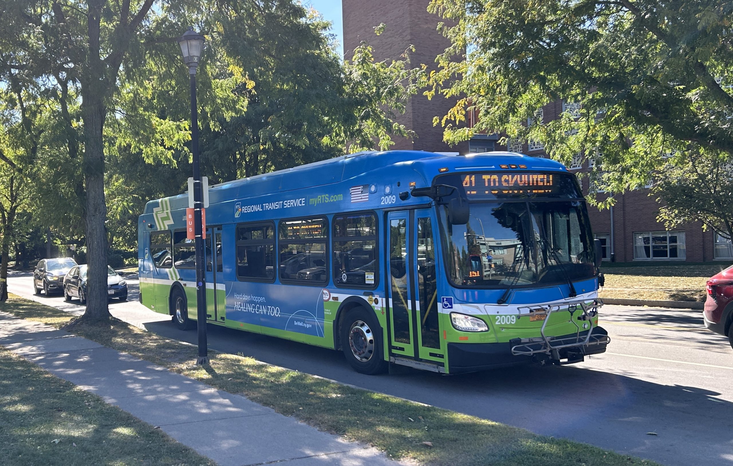
I am fortunate that my employer, an international NGO, allows me to work from home. I travel to NYC once a month for a full day of meetings with my colleagues. Every part of this journey is do-able by public transit except from my home. Sure, RTS offers service but their own trip planner says the trip will take 1 hour and 20 minutes with switching buses at the Transit Center. A rideshare will take 11 minutes. My employer will graciously cover the expense.
In NYC, the transit ecosphere I am most familiar with, It’s a fool’s errand to drive to the airport. There is almost always traffic, the fees to park are more like a ransom and, if you know your way around, mass transit is the smarter choice. Note that this option isn’t widely publicized. There’s an airport bus from Newark for $18 but I can get you to midtown in the same time for $4.50. Just travel light!
On our transit journey in Rochester we’ve needed to become more patient. The cast will soon come off, my wife will regain the confidence to take long walks (and make more frequent use of those crampons) and the temps will eventually rise. In the Scandinavian countries they have a concept called hygge which is translated to a cozy, contented mood that folks adopt during the winter months. They wear warm comfortable clothes, surround themselves with the things they love and hunker down. There are only six more weeks of winter according to the groundhog.
Still, I am out there every day. My neighbors have commented to me that they admire my trekking on foot to the grocery store and my morning runs on frigid days. They have suggested that they will join me when things warm up.
Rochester and its environs are full of places that I’m going to explore; George Eastman House, the Genesee Valley Trail system, the Strong Museum of Play to name a few and I’m determined to do it car free and I’m determined to convince my family and friends to join me. I’ve always felt that I’ve wanted to live my life as an exclamation, not an explanation. I want to model the behavior I expect in others. That’s why you’ll see me at the bus stop, tooling along in my bike when I can find the proper gloves and checking out every walking trail. I’m sure I’ll have company.
At Reconnect, we’re inspired by the stories of people in our community, like Leverett Copeland, Josie McClary, and Jasmine Burley who are passionate about living a car lite or car free lifestyle. If you want to support our work and make it easier for others to go car lite please donate and sign up for Mobility Action Alerts to stay in the loop with opportunities of how to advocate for safer streets and transportation options.
Let us know if you want to share your mobility story! What’s in it for you? The intrinsic reward of knowing you’ve inspired others, and a free t-shirt from our online shop! Contact Chaz to submit your story.
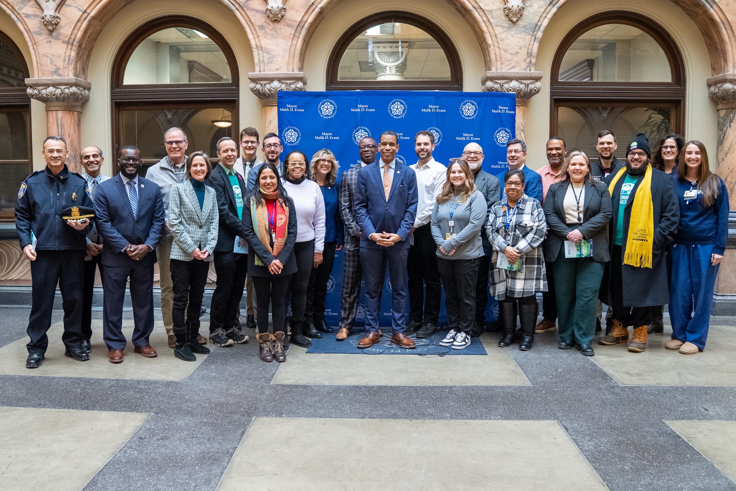
The Advocacy Team has kicked off 2026 with a slate of meetings with our local leaders to advocate for the things you care about: safer streets, more bike infrastructure, and places that feel safe to walk in.
City of Rochester Mayor Evans & New Vision Zero Report
We should lower the speed limit to 25 MPH in the City of Rochester as soon as possible. The Mayor confirmed the City is moving forward with this change, as reflected in the ROC Vision Zero report.
The City can establish more quick-build mechanisms to quickly respond to traffic safety concerns, build confidence in ROC Vision Zero, and try new approaches to multimodal safety.
We are committed to working together with the City’s Vision Zero task force to help bring national examples from Pittsburgh, Portland, Sacramento and even small municipalities like Keyport, NJ to the table.
We also followed up with Mayor Evans about the building of the Intermodal Station Bus Terminal Phase 2, which NYSDOT has funds to build and Amtrak has responsibility to operate. We understand they are working behind the scenes on several issues, but we are also advocating to NYSDOT in Albany to press forward on the design of the station.
Last week, the City also released its first ROC Vision Zero report to the community. It contains a ton of useful information about what the City, partners and community stakeholders, including Reconnect Rochester, have been doing on the initiative over the past year. We’re excited about the year ahead because the report outlines several tangible projects that residents will start to see in their communities, like protected bike lanes, pedestrian enhancements, new bus amenities, and slower speeds. Driver accountability will also take center stage this spring with more public engagement around how drivers who break the law speeding or running red lights should be held accountable.
County Executive Bello Check-In
Monroe County government has been leading the charge to encourage Active Transportation Planning, expanding how community members can report traffic concerns, and to plan for sustainability. During our meeting with CE Bello, we emphasized that now we need to amp up implementation of active transportation. Towns and Villages in Monroe County have some local roads, some county roads and some state roads, and the county maintains 664 centerline miles of roads. The CATP calls for building out a network of bike lanes, but the county budget only envisions 4 miles of bike lanes per year and 10 miles of shoulder widening to make it more suitable for biking and walking per year. At that rate, we won’t have a connected network for a very very long time! Some of the town roads are state roads, which is why we’ve put so much emphasis on building a movement for safer state roads.
For example, upcoming projects like Monroe Avenue in Brighton are state projects, and so we need those to also include active transportation features…speaking of which!
Monroe Avenue Public Meeting and Follow-up
Finally, we mobilized advocates to speak up at the Monroe Avenue project public meeting on Jan. 20th. NYSDOT officials heard from Reconnecters who are Britonians and everyone else who just likes to visit Brighton’s businesses by bike, by bus or on foot. As a follow-up to that meeting, we are calling on our advocates to send Action Network emails to the NYSDOT project managers to keep up the pressure. We have a meeting with the new Regional Director of NYSDOT Region 4 in early February where we’ll keep echoing our call for safer state roads.
Coming up next:
We’re launching Voices of Transit soon with a push for transit equity and state funding to RTS
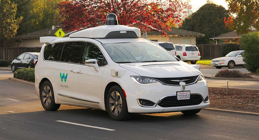
Currently, the Governor’s budget proposes to allow for-hire Autonomous Vehicle (AV) operation in New York State outside of NYC. The proposal leaves licensing and regulatory decisions to the DMV. A scaled AV deployment could nearly double vehicle miles traveled, reduce transit ridership by three quarters, and hinder emergency response operations. We encourage the legislature to act with caution and ensure the following nuances are clearly addressed:
Allow municipalities a say in managing their streets: The Governor’s proposal requires a demonstration of local support as defined by the commissioner of the DMV. The NYS legislature should define public support to be in the form of a municipal resolution by the local governmental body (Town Board, Village Board, County Legislature, City Council) and these bodies should be explicitly allowed to create incentive zones, exclusion zones, and other regulations tailored to local needs to address transit deserts, congestion, and other specific local issues.
Transparent data collection & public release: The NYS Legislature should require that metrics including but not limited to disengagements, traffic violations, mileage, incidents involving vulnerable road users, all crashes, and video of crashes should be reported to New York State and posted publicly. Transparency will allow lawmakers, advocates, and academics the opportunity to evaluate the AV pilot program and build trust with the public.
Time-limited process which requires reauthorization: We support the NYS Legislature requiring a licensing and reauthorization process which evaluates safety traffic control, traffic enforcement, the local workforce, and emergency services.
AV operators must be held accountable: Law enforcement must be able to issue tickets to AVs which violate vehicle and traffic laws.The Governor’s proposal says vehicles must remain compliant with traffic law but does not provide a framework to incentivize safe operation.
Remote operator oversight: The NYS Legislature should require that remote AV operators working with vehicles driving on New York’s roadways have a driver’s licence valid in New York State. Companies should be required to disclose training procedures and regulators should establish specific requirements to ensure operators have enough remote operators to respond to their fleet in an emergency.
New York should learn from municipalities across the country, and address these issues proactively:
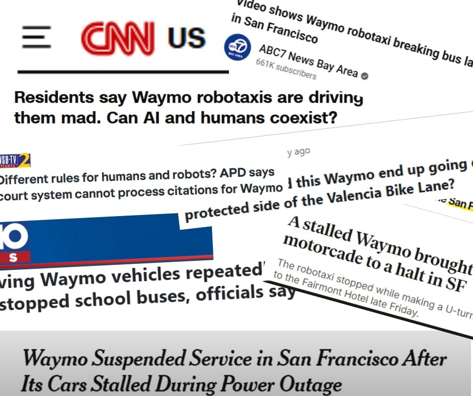
San Francisco has seen a number of dangerous and illegal behaviors by Waymo vehicles including stopping in bus and bike lanes, making illegal u-turns, and recently, the entire fleet stopped working while on the road during a blackout (12/25).
In Atlanta, local police officials have complained that there is no process for citing AVs for behaviors that warrant a citation for a human driver(5/25).
In Austin, Waymo vehicles have repeatedly failed to stop for school buses, putting children in danger (12/25).
In Santa Monica, like in the majority of localities, local officials have officially stated that their hands are completely tied to response to resident requests for policy fixes (6/25).
Help us push for a smarter AV deployment in New York! Use the form below to customize a letter to your representatives!
Car Lite Rochester is a blog series that highlights the stories of Rochesterians living a car-lite lifestyle. The term “car lite” encompasses a variety of multimodal transportation lifestyles, featuring little dependence (but not NO dependence) on a car. It typically looks like sharing one car within a household or only using a car when absolutely necessary.
So, we hope you’ll continue to follow along. Maybe you will be inspired to join our bloggers in living a car-lite lifestyle!
Embracing Community: 20 Years Car Lite In Rochester
By Leverett “Coach” Copeland:
My family and I arrived in Rochester, NY in the fall of 2005 without a car. We would walk or take RTS to travel around the city and use taxis for groceries. In the 20 years we have resided here in Rochester we only owned a vehicle for 2 years. As a whole we have been car lite most of our Rochester residence.
Having a more comprehensive transportation service like RTS has made it possible to travel to places outside my community and region. Although it is difficult when the weather is either very hot or very cold, because of no shelter or comforts, the transit system in Rochester is very reliable, consistent, and appreciated.
The main reason that we do not use a vehicle is that financially it creates an issue. We could afford the opportunity but with the creation of transportation services like Lyft or Uber, plus stores delivering groceries and food, we enjoy the car lite life. Being car lite helps me familiarize myself with my community and my neighbors. I have the opportunity to build better relationships and my social environment, which improves my health and well being.
Although there are some challenges, such as weather, being car lite has many more positive instances and rewards. Walking through my community, rather than driving, has me more attuned to my neighbors and businesses. I am able to advocate for the community with deeper insight and empathy. It also increases my ability to communicate and represent to those in power what the community desires and needs.
I’m grateful for the Complete Streets Makeover project that Reconnect Rochester did at Avenue D and Hollenbeck last year. It’s good that we worked to make the street safer from reckless driving but also came together to make it happen. I think the biggest thing is that the community feels acknowledged and something was done to meet a need. They have pride in the fact that someone cared enough to try and slow traffic down for their kids and beautify the intersection. We really need it. I think this is the beginning of turning Rochester around – where it’s not as violent but it’s more vibrant
Photo by De’Jon Washington
As for my future being car lite, I believe I will continue and do not see any reason to change. Having a vehicle is nice but for my mental and physical health, as well as community awareness, being car lite is how I will continue. I am able to serve on various committees and boards as well as volunteer and serve in many capacities and being car lite has not diminished my abilities or access.
At Reconnect, we’re inspired by the stories of people in our community, like Josie McClary, Jasmine Burley, and Karen Nozik who are passionate about living a car-lite or car-free lifestyle. If you want to support our work and make it easier for others to go Car-Lite please donate and sign up for Mobility Action Alerts to stay in the loop with opportunities of how to advocate for safer streets and transportation options.
Let us know if you want to share your mobility story! What’s in it for you? The intrinsic reward of knowing you’ve inspired others, and a free t-shirt from our online shop! Contact Chaz to submit your story.
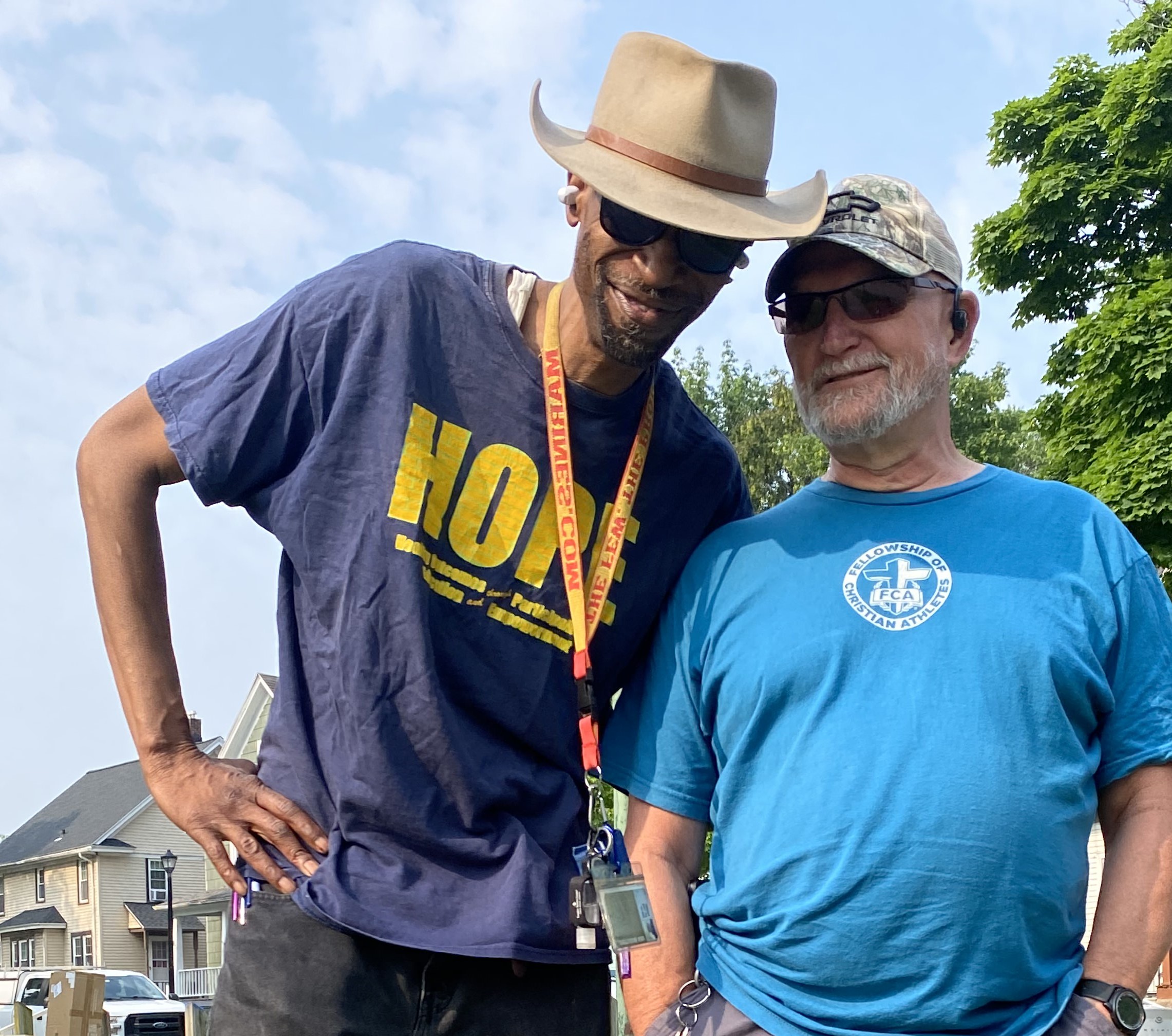
Cody Donahue didn’t grow up with freedom of movement. His childhood stretched along a thin ribbon of rural highway in Oregon’s Willamette Valley — a Walmart, a decimated downtown, and three miles of empty road between home and anything else. “I didn’t have much transportation freedom in my youth,” he says. Bikes came late. Driving later. Independence arrived only in fragments.
He carried that mindset into adulthood: When work calls, a car is the simpler solution. He believed that for years” with “for years, the car was the only option to get around in rural Oregon.”
Then he moved abroad, first to France for study abroad and then to West Africa to work for a nonprofit.
In Dakar, he discovered a city humming without car dominance. People moved through dense streets by foot, bike, taxis, and informal buses called “Ndiaga Ndiayes”, an ecosystem built on proximity rather than horsepower. “Only the very rich had their own car. You could get anywhere by other means. It was a different way of moving,” he recalls.
That realization reshaped his sense of what mobility could be.
Today, as Co-Executive Director of Reconnect Rochester, Donahue channels that revelation into the city he now calls home. He chains errands, bikes to work, hops the 17 bus when the weather turns. Simplicity is the point. Connection is the ethos.
Rethinking the Urban Core
Ask Donahue what Rochester could look like without political or financial constraints, and he doesn’t leap into fantasy. He points to a real project already unfolding: the Inner Loop North redesign.
“We’re actually getting the opportunity to do this,” he says. “The project will replace a sunken, underutilized highway that disconnects neighborhoods with a neighborhood scale street grid. We’re not advocating to eliminate roads — but to create spaces where people can feel comfortable walking and biking with their families. ”
The plan envisions creating 22 acres of new development parcels in the heart of the city, with calm, tree-lined neighborhood streets, restored parks, integrated walking and cycling infrastructure, and connections to the future High Falls State Park. Each section of the 1.5 mile stretch can be somewhat different, but Donahue is excited about the possibility for mixed-use, dense development, and ground-floor businesses around our transit hubs. “We can build up around our Intermodal Station while also expanding its footprint to be the hub for intercity buses,” said Donahue of a project that has state funding and will run in parallel to the Inner Loop North redevelopment.
“This whole area is going to be a lot more vibrant and connected,” Donahue says. “The uncomfortable truth about the Inner Loop is that it was designed to bring people from the suburbs to work and then back home. It wasn’t built for city residents. This project corrects that.”
The state has already secured $100 million for construction. While timelines may shift, bidding is set for September 2027, construction begins in April 2028, and completion is projected for October 2030. Parcel development will follow over the subsequent years, reshaping not just infrastructure but the way people live and move in Rochester.
The Hidden Curriculum of Movement
“Reconnect Rochester now offers everything from ‘Getting Back on Your Bike’ workshops to school safety lessons, winter cycling training, commuter programs, and hands-on Smart Cycling classes,” Donahue says. As he scales that range — from fifth graders to downtown workers — patterns emerge.
“We’re really invested in bike education because kids should have it,” he says. “When they don’t, they develop unsafe habits and carry them into adulthood. That contributes to crashes.” Nearly half the time, the cyclist triggers the crash — not necessarily because they’re reckless, but because no one ever taught them the proper way to ride.
That lack of training intersects with a fragmented bike map.
“We have cycling infrastructure gaps we’re trying to close. The bike lane map looks like someone threw spaghetti at a wall,” he says. “Our Mind the Gap competition helps identify the highest priority connections for the city and the county to make for a comfortable bike network.”
Residents want comfort, predictability, and physical protection. That requires real design: barriers in the street, well-placed cycle tracks, infrastructure that doesn’t force riders onto sidewalks.
Culture plays a role too. Donahue and his team work with employers to add bike parking, secure racks through the city, or negotiate indoor, secure bike storage with landlords. A new downtown lunchtime learning series reaches commuters who may have never imagined biking to work. They hope to reach downtown companies with lunch and learns next year to show downtown workers just how fast and easy it is to bike to work in the Central Business District of Rochester. In May, Reconnect will again host bike to work day to reach new commuters.
Then, there is the matter of our snowy winters. “The world doesn’t shut down in the winter,” Donahue says. “I drive more, but I also take the bus more. Some fat tire bikes handle snow better. And we continue to push the city to clear main bike routes. The City has committed to studying enhanced winter maintenance, so we’re making progress.”
True cultural change, though, requires leadership.
“We’d like to see more of a culture of property owners taking responsibility for clearing sidewalks,” he says. “Madison, Wisconsin has a great approach. It’s just a different civic culture when it comes to tending to the snow.”
A Concerning Trend and an Urgent Response
The national context is grim. Pedestrian fatalities in the U.S. have risen 75% since 2010. Locally, Monroe County averages 12 walking or biking deaths per year, and 2025 has already exceeded this average at 13 as of December.
“We must do better,” Donahue says. “These are preventable losses.”
To shift that trajectory, on-street demonstration projects matter. In 2025, Reconnect Rochester launched Downtown SmART Streets, inspired by Washington, D.C. ‘s Arts in the Right of Way program. Seasonal curb-extension murals function as both art and traffic-calming infrastructure, beautifying streets while protecting people.
The 25 MPH Shift and the Politics Around It
Rochester has embraced ambitious mobility goals, Vision Zero, safer arterials, expanded bike networks, but serious injuries and deaths continue to rise.
Donahue is clear about the most actionable fix: lower the citywide speed limit to 25 miles per hour.
A municipal lawyer working with Reconnect Rochester produced a comparative analysis: Boston and Seattle implemented the reduction; Providence did not. Even without added enforcement, the cities that lowered the limit saw reductions in speeds, crash rates, and fatalities. Albany is now seeing monthly declines as well.
“The bottom line is that these programs reduce fatalities,” Donahue says. “This is our guiding star. Slower speeds save people walking to the bus, cyclists, kids — everyone.”
He insists that driver accountability must be part of the solution.
“We can stop those who have no regard for people,” he says. New York State is considering legislation to require the worst repeat speeders to drive with speed governors — devices that physically prevent them from exceeding safe limits. “These policies work.”
And the stakes are bigger than traffic engineering. “We’ve backed ourselves into a societal corner where parents don’t feel comfortable letting their kids walk down the street.”
Where Expertise Lives: Complete Streets in Action
The Avenue D & Hollenbeck Complete Streets Makeover crystallized a principle Donahue now calls non-negotiable: lived experience is expertise.
“It was our fifth complete street makeover — what we call the quadfecta, one in each quadrant before returning to the Northeast,” he says. “We sourced nominations citywide. One thing we learned from the Arnett Boulevard project is that some roads are classified by the state to prioritize vehicular traffic. So our makeovers are now looking at the most local road you can get to reduce the restrictions on what we can do.”
The neighborhood’s R-Center staff had been clamoring for improvements. Their knowledge shaped the project’s design: temporary installations, seasonal centerline flex posts, and monitored interventions. “All summer and fall, not one post needed to be replaced due to damage,” Donahue notes. “We’re conducting a traffic study on speed and turning to evaluate the effectiveness. We plan on doing new installations in new locations over the next three years.”
Complementing these interventions is a design rendering prize, offering a professionally engineered visualization to a neighborhood free of charge. Monroe Avenue in Brighton received one in 2019, now actively used in state-level advocacy to enhance safety and create more vibrant public space.
Downtown, the SmART Streets initiative extends this philosophy: seasonal curb-extension murals at East Main and Gibbs, Broad and Fitzhugh, with more to come, reinforcing walkability through public art. The work demonstrates how neighborhood input and tactical design combine to reduce risk and foster a safer, more inviting urban environment.
Influence, Advocacy, and Evolving Beliefs
Donahue’s campaigns- Intermodal Station expansion, suburban walk audits-highlight a key lesson about New York transportation politics: advocacy matters.
“I would point to a common thread: resident voices,” he says. Promoting density and mixed-use development brings daily amenities closer to homes, reducing car dependence and improving safety.
“The NIMBY contingent is usually a vocal minority,” Donahue notes. “We’re trying to promote YIMBY: yes in my backyard. Call your local officials. Tell them you want sidewalks, bike lanes, transit, more mixed use neighborhood amenities.”
A recent candidate questionnaire across several towns showed majority support for safer streets. Those elected embraced these changes. “We want people showing up to public meetings,” Donahue says. “It makes a difference.”
Reflecting on his early advocacy, he admits a lesson learned: “Early in my career, I thought there was one right way to do things. But there isn’t. It’s important to realize we can reach the same conclusions through different methods. Live the experience of the people you’re making policies about. If you’re making bus policies, take the bus for a month. We become extremely fragmented in our lived experiences. It’s not obvious we’ll reach the same conclusion, but you have to identify your values and fight for them.”
A City Rewoven
Donahue’s path arcs from a rural upbringing to a global awakening to a Rochester in transition. Throughout, one conviction anchors him: every person deserves to move safely, freely, and with dignity.
He thinks of Dakar, where movement was communal. He thinks of Highway 20 in Oregon, where mobility required horsepower. And he looks at Rochester — slowly, collaboratively reimagining itself.
Rochester is being reweaved. Not just the roads. The relationships.
And for a city once carved apart to speed commuters, that may be the most transformative redesign of all.
The term “car lite” encompasses a variety of multimodal transportation lifestyles, featuring little dependence (but not NO dependence) on a car. It typically looks like sharing one car within a household or only using a car when absolutely necessary.
Simplicity and Saving – Two Motivations for Being Car-Lite
By Cody Donahue:
As the holiday season ramps up, I am probably with the majority of Americans when I say that I’d really like to save more money while still fully celebrating our holiday traditions. Over the years, the holidays seem to start earlier and earlier and the expectations of giving and getting keep inflating. As does cost: Bloomberg found that inflation and tariffs are driving up costs for just about every category of holiday giving. Sorry family, it’s socks for everyone!
While many of us are stressed and anxious about the gift and food budget, let’s throw the overwhelming cost of car ownership into the mix. For years, we have reported on the AAA’s cost of car ownership, but I just recently saw USA Today’s report that put car ownership in the perspective of “The American Dream.” To achieve the “American dream” of owning a new car, a dream shared by 72% of Americans, you’ll have to spend $900,346 over your lifetime in 2025, up from $811,440 a year ago. By comparison, a lifetime of homeownership costs $957,594, up from $929,955 in 2024.
Amazingly, car ownership roughly costs the same as raising two children and sending them to college. In a place like Rochester, it’s incredibly hard to have young kids and not drive one or sometimes two cars. And if you can’t afford cars, you probably have no other choice than to use the bus or rely on other people whether those are good options or not.
If you have kids, live in Greece, can’t get to a grocery store without hitting 390, and your place of work is in Henrietta, then car-free rankings and weeks without driving just probably feel out of reach.
Political talk in New York State will continue to emphasize “affordability” throughout the next state election cycle in 2026, and I for one would like to see “affordable” applied to transportation choices differently. Transportation choices that are created from state investments in all modes of transportation can pay off in numerous ways, but let’s start with money first: according to an RMI analysis, NY state could save households an average of $3,750 per year (fuel, maintenance, and depreciation) by putting money into programs that would reduce vehicle miles traveled (VMT) by 20% per-capita.
There are lots of ways to reduce VMT, including but not limited to investing in the bus system, adding safe and continuous bike lanes, sidewalks and making land use choices that place daily destinations in neighborhoods. $3,750 is a lot more than any rebate program any politician has talked about or implemented.
Beyond the monetary savings, affordable transportation choices would also create societal savings: by avoiding car crashes, 593 lives on average per year could be saved in the state. By increasing active lifestyles and avoiding bike/ped crashes, you could save 4,294 lives in NY state. Finally, 53 lives could be saved by reducing air pollution on average per year in New York State. Avoiding having to pay for something because it didn’t happen in the first place seems like a great approach to me.
Reconnect Rochester recently challenged folks to try going car-free or car-lite for a week, and we heard a lot of positive feedback if your lifestyle lined up to having a shorter commute (1 bus ride or 1 bike ride) or you lived in a place where getting to the store was as easy as walking. We also heard the feedback from folks for whom this doesn’t work as well – people who have young kids, people who live in one suburb and work in another suburb, people who have no grocery stores in their neighborhood, or people whose bus commute would exceed 45 min when they could drive the same distance alone in their car in 10 min.
A national storage unit company recently published a listicle about the best cities to be car-optional that ranked Rochester as 9th in the country, one place higher than Portland, OR! While I’d be really happy to believe that all of Rochester’s hard work has paid off and we’re a fantastic place to live car-free, I would caution that this is only true for certain people.
If you’re an able-bodied, city resident who enjoys the average 4.1 mile commute, you have a direct bus route, you are a practiced cyclist or you have the time to walk, this probably rings true. If you have kids, live in Greece, can’t get to a grocery store without hitting 390, and your place of work is in Henrietta, then car-free rankings and weeks without driving just probably feel out of reach. But that doesn’t mean those people don’t want more of their life to be car-optional. The point for me is that people should have more options, our policy choices should expand those options, and at the end of the day those options make household life more affordable.
Photo: John Paul Corona
Is there a way to make car-optional living more attractive for more residents? I recently re-read Voluntary Simplicity by Duane Elgin and in it, he emphasizes that for those of us privileged to have choices, we can choose simpler ways of living that promote personal, community and global sustainability, while also saving money. For example:
While easier said than done in this housing market, choosing a place of work that is accessible by public transit or biking. As Mr. Money Mustache commented over a decade ago, car commuting costs a lot more than gas.
If the option is available, working remotely a few times a week to avoid the time and cost of commuting.
Chaining trips together so you get your groceries, pharmacy and other shopping done together or on the way home from work one day.
Choosing simple or free recreational activities within your local area that involve active lifestyles, greenspace, public libraries, and community building activities.
At Reconnect Rochester we love getting out into the community to talk about our work. This summer we gave presentations, tabled all over Monroe County, and held hundreds of conversations about mobility with supporters, skeptics, and everything in between. Among the skeptics there were a few topics that came up so often we thought it would be helpful to list them out in a blog post along with our perspective.
People on bicycles make everyone less safe.
When a cyclist is riding recklessly they are overwhelmingly just a danger to themselves. Yet the 47 deaths and more than 5,000 injuries that happen on our streets every year in Monroe County always involve cars. It is all of our responsibility to keep each other safe, but drivers have a bigger responsibility given their capacity to do harm to people and property. This is why we advocate for and implement complete streets designs on our roadways to slow down cars.
Bicycle education is a cornerstone of our work at Reconnect Rochester via our On Bike Smart Cycling Classes, Bike Education Programs, and Our Weekly Rides. Many school districts do not provide bike safety classes despite the state requirements. This leads to many kids who don’t learn the safe and legal way to ride. We aim to teach riders how to safely interact with traffic and be predictable in order to make all of us safer. A study found that nearly every road user will admit to breaking the law, though with cyclists it is often to keep themselves safe while drivers will be more likely to break the law to save time.
RTS isn’t safe.
There are millions of RTS bus trips every year in Monroe County. Less than a half percent of reported crimes take place on an RTS bus or at the Transit Center. As Misha Manjuran Oberoi wrote recently for the Democrat and Chronicle, “that’s fewer than the number of crimes reported at both schools, hospitals, bars and more.”
If risk factor is your main concern, you’re much more likely to be involved in one of the 14,000+ vehicle crashes that happen every year than you are to be in danger on the RTS buses. RTS is a great community resource and we encourage everyone to try to incorporate it into their lives when possible. The more of us who use RTS, the more it will be prioritized in transportation funding which will improve frequency and make it a more convenient option.
What about people with disabilities? How are they supposed to get around without a car?
There are many disabilities that make biking or taking the bus challenging or even impossible. At the same time, many people have disabilities that prevent them from driving but still allow them to live independently. We want to ensure that anyone who cannot drive (or anyone who just doesn’t want to) is able to move freely throughout our community. Our board member, Steve Roll, shared a powerful story about this in a blog post. After a seizure left him unable to drive for six months, biking and public transit became essential tools for maintaining his independence.
Furthermore, we have encountered many people in wheelchairs who appreciate our focus on safe streets. Our current car-centric infrastructure that relegates pedestrians to cramped sidewalks with heaved segments and poorly placed curb cuts is challenging for anyone to navigate. It is especially difficult if you are vision impaired, use a walker or rollator, or are in a wheelchair. We actually had someone put one of our Bicycle License Plates on the back of his wheelchair so he could feel safer when he is somewhere without a sidewalk (which, sadly, is true for too many of our roads). And—disabled or not—parents pushing strollers encounter the very same struggles! When we design streets for pedestrians, everyone benefits.
Why can’t you help me get a protected bike lane on my street? It’s just one street!
Many roads fall under different jurisdictions and require approval at the county or even state level to change. We encourage you to sign up for our Mobility Action Alerts to keep you informed on upcoming street projects and receive talking points to advocate for safe streets. We really need support at public meetings! This is where most of the changes happen.
Lastly, while protected bike lanes are great, there isn’t always space for them without drastic redesigns which aren’t always a viable option. Check out our ROC Easy Bike Map and utilize Rochester’s Bicycle Boulevard network when looking for low stress bike routes that minimize your interaction with cars.
You need to control those Veo e-scooters and you need to get them out of the middle of the sidewalk.
We support expanding transportation options for everyone, and Veo is a great choice for short trips around the city. You can grab one, ride to your destination, park it, and move on with your day unencumbered. More mobility options mean more freedom. We showcase Veo to educate people on their mobility options but we aren’t affiliated with the company and have no ability to modify their system.
Unfortunately we agree there are too many unsafe behaviors on Veo e-scooters, we have been advocating to the city and Veo to require safety education in their onboarding.
We also advise users to follow Veo’s parking rules which means out of pedestrian walkways with the kickstand engaged. We have encouraged Veo to go to a model which prevents users from parking in the middle of the sidewalk.
What’s the point of bike lanes if no one bikes in the winter?
No one is making you drive! Stop trying to make things harder for drivers just trying to get around.
It is worth noting that we are not anti-car. Cars are an effective tool for the right job but not every trip for every individual. Our work is focused on ensuring there are options for Monroe County residents beyond driving. Transportation options mean freedom. Freedom to choose the way you move through your day and shape the life you want to live. We deserve a transportation system with safe, connected bike routes, frequent bus service, AND roads that work for those who choose to drive.
Many people are not aware of the amount of subsidies that go into road construction and maintenance as well as gas prices; not to mention the amount of valuable public space we have ceded to storing private vehicles in the form of ample free parking. Our institutions do a lot to encourage driving and very little to encourage other modes of transportation despite the evidence that it’s cheaper to maintain road infrastructure and can improve congestion.
We are not necessarily trying to make things harder for drivers. We are pushing our leaders to consider options beyond the car when designing our communities going forward. The fact that many neighborhoods don’t have sidewalks, many roads don’t have bike lanes, and our buses only run once an hour on weekends make alternatives to driving very challenging for the 26% of city households and 12% of county households without access to a personal vehicle. When we make it easier to get around without a car, we can remove congestion, reduce collisions, and make travel easier for everyone including drivers.
You only care about bikes. What about us bus riders?
Reconnect Rochester is a multimodal advocacy organization – we have members who ride the bus every day. Transit is a big part of Reconnect’s history, including the ROC Transit Day celebration and a lot of advocacy around Reimagine RTS. We are involved in the city’s bus stop improvement project to improve amenities at hundreds of bus stops around the city. This summer we rallied RTS on-demand riders to push back on the service changes. Regrettably we were largely unsuccessful, but we will continue to advocate for better service and amenities for RTS riders at every opportunity.
A lot of transit advocacy is directed to the state and federal government so that they fund our system. On a state level our Voices of Transit program (email us at info@reconnectrochester.org if you want to participate!) tells the human stories of RTS riders to our legislators to encourage transit funding beyond car infrastructure. We are part of the New Yorkers for Transportation Equity statewide coalition, advocating for increased transit funding to improve RTS bus frequency and coverage.
We hope these answers shed light on any questions you may have about Reconnect Rochester and our work. We welcome community voice and dialogue and it’s important to us that we continue to push for change that benefits all of us! If you like what we do, we encourage you to subscribe to our email list, follow us on Facebook, Instagram, Twitter, or Bluesky, attend one of our engagement breakfast events, and donate to support the cause!
Hello Reconnect Advocates! We’re entering December with a renewed energy to start planning our 2026 activities at Reconnect Rochester and reflecting on our 2025 work. We’ve heard from you that you’d like more frequent updates about the issues we asked you to advocate on. Below are some happenings from the summer and early fall around key issues that Reconnect is following:
Rochester Intermodal Station Phase II Project to add bus amenities
It’s been about 18 months since your advocacy led to Rochester being awarded $18 million in the state budget to build the bus station addition to the current train station. The project is somewhat complicated – Amtrak owns the facility, but NYSDOT built it originally and NYSDOT was given the funds. At the same time, the city is undertaking a massive Inner Loop North project across the street from the facility with a lot of changes planned to the road network. We have been in touch with Amtrak & NYSDOT to urge the kickoff of this project and to keep local stakeholders involved in the planning process so we can fully realize the vision of the intermodal station. In the meantime, we are also working with the bus companies to explore ways to improve the experience of waiting for the bus in Rochester. We successfully advocated for the city to install a simmie seat and we’re trying to get additional seating at the stop.
Keep Us Safe on State Roads Campaign
You showed up to ride to Parcel 5 to call on New York State officials to keep us safe on state roads and since then we’ve been busy continuing this advocacy. For those of you who couldn’t attend, the NYS Department of Transportation sent this statement for us to read at the event, which unfortunately didn’t give them the opportunity to see the mass of cyclists who came out to push for safer state roads. Since the event, 311 people signed a letter calling on start officials to invest in safe state road infrastructure for people walking and biking and taking transit! Behind the scenes, we’ve continued to advocate for multimodal changes to Empire Boulevard, Monroe Avenue, West Henrietta Rd. and Lake Avenue. Brighton’s Town Supervisor highlighted the strong prospect that Monroe Avenue would get a road diet, and with the right lane configuration, we could even get 5’ bike lanes on both sides. We need to keep encouraging this kind of thinking for the future.
The broader effort around 25 MPH communities applies to all the suburban towns and villages that are eligible to lower their speed limits to 25 MPH on locally-controlled roads. GTC held a regional traffic safety summit during which we exposed local leaders to the 25 MPH local law and examples in our own region that have made the switch. If you live in a suburban town or village, reach out to your decision makers to tell them you support this!
Federal Headwinds – Transportation Reauthorization
Finally, federal headwinds have continued to be strong all year, but they’re about to heat up for transportation. The surface transportation bill is up for reauthorization and will have a huge impact on local projects. Genesee St, for example, was reconstructed this past year with funds from the Bipartisan Infrastructure Law, the current transportation bill. Just over the past 3 weeks, we’ve heard reports from the House Transportation and Infrastructure Committee that “walking and biking infrastructure” are not important federal priorities and there was a threat (later backtracked) to zero out public transportation funding. The Chair, Rep. Graves (R-Mo) gave an interview in which he said:
It’s going to be a traditional highway bill. That means building roads and bridges, laying asphalt, pouring concrete. We’re not going to be spending money on murals and train stations or bike paths or walking paths. We’re going to spend money on traditional infrastructure — that’s roads and bridges.
Street project meetings slowed down in the fall. Since August, we’ve submitted inputs on Seneca Ave, Broadway/S. Union, and N. Clinton. We previously submitted comments on Bull’s Head, which is getting finalized soon.
In 2023, 40,990 people died from car crashes in the U.S and more than 2.7 million people went to emergency rooms for injuries. Monroe County alone sees an average of 47 deaths and 5,000 injuries each year. To honor these lives, Reconnect Rochester hosted a local event for the World Day of Remembrance on Sunday, November 16th, 2025 where we called on leaders across Monroe County to set safe speeds on local streets.
Josie McClary is a safe streets advocate, a Reconnect Rochester Board Member, and someone with a personal connection to road violence. She wrote this eulogy to commemorate the event.
Today we come together to honor the lives lost and the families forever changed by road crashes. For many of us, this day is deeply personal.
For me, it’s about my beloved, Ryan Grantham Jr. His life was full of joy and promise- and losing him changed my life and my grandson’s life forever.
That loss became my reason to advocate. It’s my WHY!- I believe our streets should connect us, not endanger us.
Every name we say today represents a story, a future, and a community left to carry their memory. We owe it to them – and to one another- to turn our grief into purpose.
We can do this by designing safer streets, slowing down, and listening to those who have lived with this pain.
Safety should never be a privilege – it should be a promise.
So as we reflect, let’s also commit to act – to speak up, to slow down, and to keep pushing until every person in Rochester can walk, ride, or drive home safely.
To the survivors – your strength matters!
To the families – your love and advocacy matters!
And to those we have lost – your memory guides us forward!
May our reflections lead us to change.
May our voices lead to action
And may our city and county continue to rise – together – in honor of those we lost!