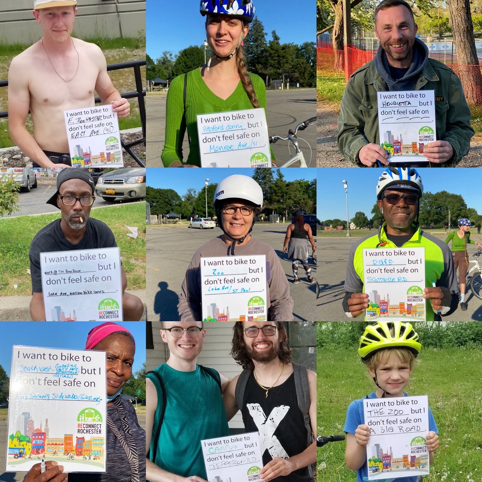
In Rochester, bike riders have a lot to be grateful for: world-class trails, an average commute of 4.1-miles across mostly flat terrain, and a vibrant bike community. Something we need to work on, however, is the lack of connectivity in our bike network. Too often, road projects are done in a piecemeal fashion and little attention is paid to overall connectivity.

The new regional bike map from the Genesee Transportation Council shows just how fragmented our local bike network is. (Note: the map doesn’t consider sharrows on arterials as bike infrastructure). Reconnect Rochester wants to see continuous, non-interrupted, low-stress bicycle routes. As the City and County gear up for their Active Transportation Plans this year, we are advocating for “a fully connected spine of high-comfort bikeways” that can be built upon for years to come. When gaps are filled, ridership will increase and Rochester can eventually “level up” from bronze to silver in the rankings of Bike Friendly Communities.
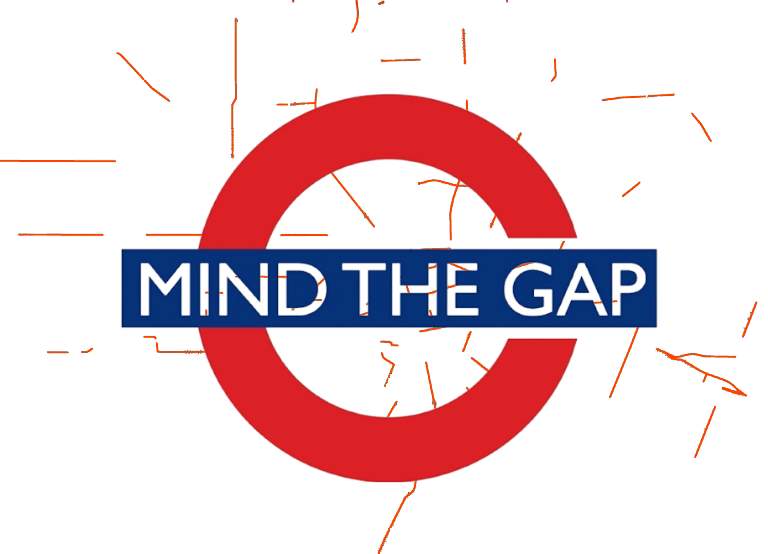
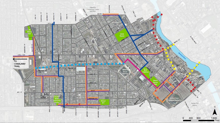
With that in mind: Reconnect Rochester, in a play on words, is proud to present the first annual Mind The Gap vote campaign! We took a look and identified ten of the most obvious gaps in our bike network that, if filled, would be a huge connectivity improvement.
Here’s where you come in, ROC cyclists. We want your vote! Take a look below at the locations we’ve nominated this year and tell us which gaps you think are the most important to fill.
The gap that receives the most votes will be declared the winner and Reconnect Rochester will give this segment special attention with our advocacy efforts. Specifically, we’ll approach the relevant municipality with our community support evidence in hand to make the case that it is a crucial gap to fill.
Some quick notes:
-
- You’ll be able to cast votes for three gaps.
- Think we missed something? There’s a fill-in-the-blank option that will help us with nominations for future years’ contests.
- We didn’t nominate the Genesee Riverway Trail through downtown. The City is well aware of this obvious gap and through the ROC the Riverway initiative, is addressing it segment-by-segment as funding becomes available. (Someday we will have a continuous riverway trail through downtown to High Falls!)
- Ideal nominations have somewhat comfortable biking on each end with a relatively short, awkward, or uncomfortable gap in the middle that can hopefully be remedied to have an enormous impact for a great number of riders.
(Ready to vote before reading on? We like the enthusiasm! Click here.)
Without further ado, here are this year’s nominations:
- EAST MAIN STREET BETWEEN UNION STREET AND DOWNTOWN The bike lanes between Union and Goodman are okay, though clearly not what was envisioned during the 2015 E. Main & Market District Plan. The cycletracks under construction further east between Goodman and Culver will be a huge step up. But once cyclists from the east side approach Union, reaching downtown is quite stressful due to the awkward 490 turn-off. Cyclists have to move left in the bike lane just as motorists next to them merge right to get on the Inner Loop. This weak spot – an intimidating tenth of a mile! – deters cyclists from what could otherwise be a decent bike corridor. Jurisdiction: City of Rochester

- ST. PAUL STREET FROM DOWNTOWN TO BREWER STREET Though there are bike lanes for much of this stretch, the Genesee Riverway Trail deserves better: Protected bike lanes on St. Paul Street from downtown to Brewer Street (or a tad bit further to Carthage Drive for those who don’t want to descend into the gorge only to ride back up), would open up this pride of Rochester to cyclists of all ages and abilities. As it is now, some bravery is required on St. Paul. This stretch is only one mile! Once cyclists reach Brewer Street, there’s comfortable biking up to Ontario Beach Park. Jurisdiction: City of Rochester

- WEST MAIN STREET FROM DOWNTOWN TO BULLS HEAD PLAZA Since 2015, Rochester cyclists have biked to Bulls Head Plaza on West Main Street to participate in the weekly Unity Rides. Though the ride itself is joyous and comfortable thanks to the escort, getting there is often a stressful experience. At the moment, there’s no bike infrastructure on West Main and motorist speeds are very high. From downtown to Bulls Head Plaza is only 7/10 of a mile! Fixing this stretch would also make biking to Susan B. Anthony house and Nick Tahou’s easier. Jurisdiction: NYS DOT

- MONROE AVENUE FROM CANTERBURY ROAD TO DOWNTOWN The City’s first bike boulevard was installed along Canterbury Road in 2015 to help cyclists approach downtown from Brighton and the southeast side. But once Canterbury ends at Monroe Ave, cyclists are forced to constantly meander left and right, in and out of bike lanes and sharrows all the way to Chestnut Street downtown. This stretch is only one mile. Jurisdiction: NYS DOT

- THE APPROACH TO MONROE COMMUNITY COLLEGE (HENRIETTA CAMPUS) Monroe Community College, our area’s largest institute of learning, is very uncomfortable to get to by bike. Though bike lanes have been installed on East Henrietta Road from Westfall south to 390, the bridge over 390 is terrifying. Students, faculty and staff approaching MCC from the north deserve a better approach. Jurisdiction: NYS DOT

- STATE STREET FROM ANDREWS STREET TO MORRIE SILVER WAY Trust us. Biking to Frontier Field is the best way to get to a Red Wings game. There’s ample, free bike parking right next to the gates and security guards are there the entire time – a huge deterrent to bike theft. When the game ends, you unlock your bike and ride. You’ll likely be most of the way home before those who drove get out of the congested parking lots nearby. Andrews Street is a wonderful east to west thoroughfare for cyclists, but once you get to State Street, you’re immediately uncomfortable. Steve Carter and Red Wings fans deserve better. The short stretch is only 3/10 of a mile! Jurisdiction: City of Rochester


- “THE JOSANA TRAIL” A critical connection the City intends to make someday is between the Colvin Street bike boulevard and the soccer stadium, where the Plymouth bike boulevard continues north all the way to Kodak Park. This is especially important as this area sees the most cyclist-motorist collisions. The intended connection is via the abandoned railroad tracks and would be called the JOSANA Trail. Things always get complicated when CSX is involved, but if this gap wins the contest, perhaps it’ll give the City a sense of urgency in acquiring right of way and finding the funding to implement the planning work that’s already done. This segment of the trail is only a half mile. Jurisdiction: CSX (City of Rochester in the process of purchasing)

- THE APPROACH TO EAST AVENUE WEGMANS Biking to the East Avenue Wegmans and locking up your bike next to the front doors is often way more convenient than driving there and searching for a parking space. But Wegmans could certainly be more approachable by bike on each side. From the southwest, cyclists can bike along the comfortable Canterbury/Harvard bike boulevard to Colby Street. But once you get to East Avenue, that short 1/10 of a mile to Wegmans is quite busy. Surely something can be done in this area too to better connect the Harvard/Colby bike boulevard and Wegmans to the future bike boulevard across from Artisan Works on Marion Street that’ll go all the way up to Tryon Park. Jurisdiction: NYS DOT (East Avenue) and City of Rochester (Winton and Blossom)

- UNION STREET FROM EAST MAIN STREET TO THE PUBLIC MARKET Riders of all ages and abilities enjoy the new Union Street cycletrack, but its shortcoming is that it’s too short and doesn’t connect anywhere. Though no doubt it’ll extend and curve northwest someday as part of the Inner Loop North transformation, it would make a huge difference if dedicated bike infrastructure continued a half mile north to the Public Market. We know from our marker campaign that the market is a popular desired destination by bike, but that short stretch of Union Street north of Main is intimidating. Jurisdiction: City of Rochester

- ELMWOOD AVENUE FROM THE CITY LINE TO 12 CORNERS Rochester’s second cycletrack was installed along Elmwood Ave in 2020 to connect the University of Rochester Campus to College Town. In 2022 and ‘23, the cycletrack will be extended to the Highland Crossing multi-use Trail just across from the Al Sigl Center. In June 2021, it appeared that the further extension of the multi-use trail along Elmwood all the way to Twelve Corners was a sure thing, but the project has since stalled and it’s uncertain whether it’ll proceed. Brighton residents definitely deserve this low-stress bike connection to Rochester’s largest employment hub. Jurisdiction: Monroe County DOT

So, what do you think?
p.s. We got some of our ideas from you with the informal polling we’ve done around town. Thanks for sharing!

I often use Canterbury St. from Harvard Culver, onto Monroe Ave, but, avoid Monroe to downtown via Wilcox St. (across from Blessed Sacrament) to Richards to Boardman St. to Pearl Street, to Alexander Street, across Sears parking lot to Union, then Union (great bike lanes!) to Broad St. or East Ave.
Thanks for this survey. I feel like Rochester has made great gains in accommodating active transportation since 2015. Today I noticed a new flashing crosswalk at Linden and S. Goodman. It would be good to have the same to cross Mount Hope Ave (in front of the Distillery) into cemetery main entrance. That’s pretty seems pretty treacherous to wing and lots of cyclists and pedestrians cross there.
The Irondequoit Bay Outlet needs to be bike-able 100% of the time. Improvements should be made between the IBOB and Bay Road in Webster also.