

As the peak riding season closes, it’s time to present the final grades for Rochester’s recent bike infrastructure projects, as seen by everyday cyclists from around Rochester! Thanks so much to everyone who heeded the call and rode these stretches in 2026, submitting simple grades and comments afterwards.
The City of Rochester needs this kind of feedback on its investments as it builds out its Bike Spine Network and implements its wider Active Transportation Plan. Evaluation and learning is a critical part of every project so it can be improved for the next time. Hopefully they’ll take residents’ experiences into consideration for future projects.
For those that are new to the grading scheme, head here for the particulars. Our simple grading system is as follows.


For roads considered part of the City’s Bike Spine Network, which is supposed to be rideable for all ages and abilities, the aim should be 5 stars whenever one of those roads is worked on; safety for vulnerable road users over everything else (parking). Though they should shoot for the best possible multimodal design on projects for other roads, especially the supportive corridors, bike riders can realistically expect 3 stars (conventional bike lanes, hopefully seamless) for non-spine arterials. This was a major emphasis of the Active Transportation Plan: In terms of bike infrastructure investments, don’t treat all road projects the same. Concentrate political will & focus investments, creating a minimum grid of protected bike facilities criss-crossing the city. (Stantec & Toole are at work presently on a plan for how the city can attain this spine network sooner rather than later).
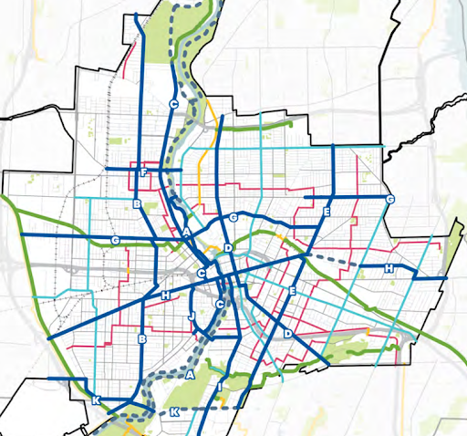
Excerpt from Rochester’s Active Transportation Plan Bike Spine Network in dark blue, Supportive Corridors in light blue, Bike Boulevards in pink, Trails in yellow
Here we must acknowledge, as we did in April, that more than one thing can be true at the same time: Conventional bike lanes in the right context aren’t as dangerous as they appear. (Reconnect Rochester doesn’t agree with the blanket sentiment “If it’s not a protected bike lane, it’s not worth riding in,” and its cousins: “Paint isn’t infrastructure” and “All conventional bikes lanes are bicycle gutters.”) As we’ve said repeatedly, CONTEXT MATTERS. However, we simultaneously acknowledge that conventional bike lanes don’t result in a whole lot of ridership – anywhere in the world. And ridership is what we’re after.

So as we dive into Rochester’s final crowdsourced grades, it wasn’t a surprise to us that Rochester residents echo the feelings of people throughout time all over the world. Another important note: it was people who were already moderately comfortable riding around doing the grading. The not-yet-riding masses would undoubtedly grade each project lower than our audience – all the more reason to aim higher when planning and installing bike infrastructure.
Of the 13 various road segments that residents rode and analyzed, only 3 got a minimum of 3 stars, meaning the bike community deems them rideable for most people on bikes:
Click a grade below to see how it received the grade.
Genesee Street 3.9 stars
Genesee Street
(Spine B in the all ages & abilities Bike Spine Network)
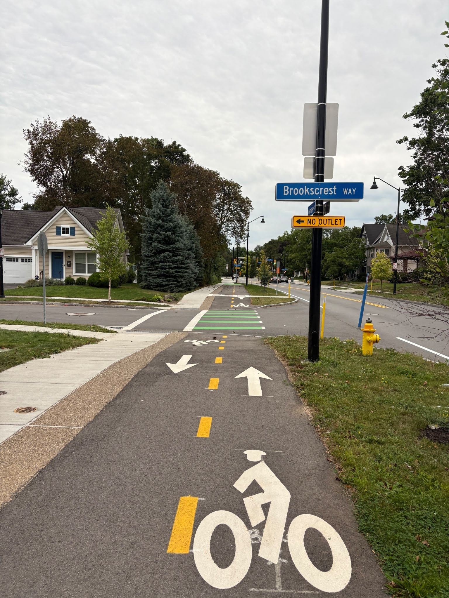
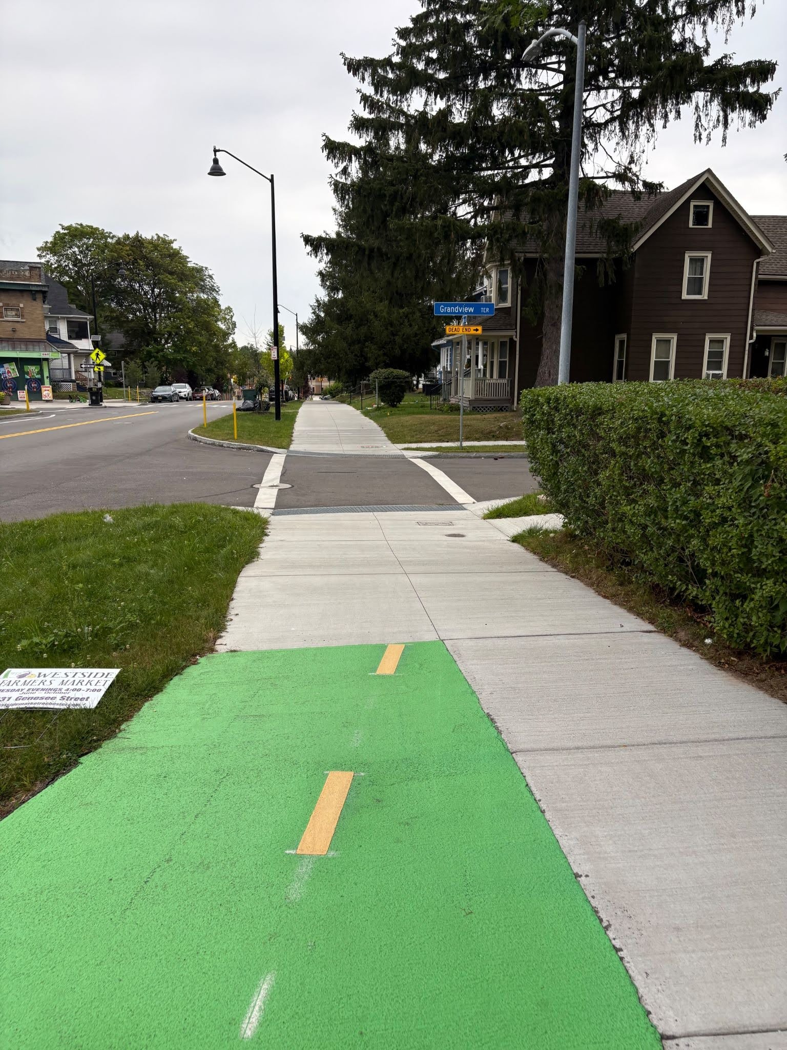
As we’ve expressed before, Reconnect Rochester has several concerns with raised cycle tracks next to the sidewalk. They don’t work everywhere but there are contexts where they can be done right. Graders’ most common comments about this stretch of Genesee Street: It would have gotten a higher grade if it was implemented along the whole stretch from Elmwood Avenue to Brooks Avenue. And the cycle track ought to continue across these residential streets at grade rather than dipping down and up.
What could have improved this reconstruction project:
The cycle track should have continued along the entire project corridor to connect with future sections of the Bike Spine, reconstruction projects provide a once in a generation opportunity to completely transform the street. The cycletrack & sidewalks should have also remained at the sidewalk height across sidestreets.

West Main Street 3.3 stars
West Main Street
(Spine H in the all ages & abilities Bike Spine Network)
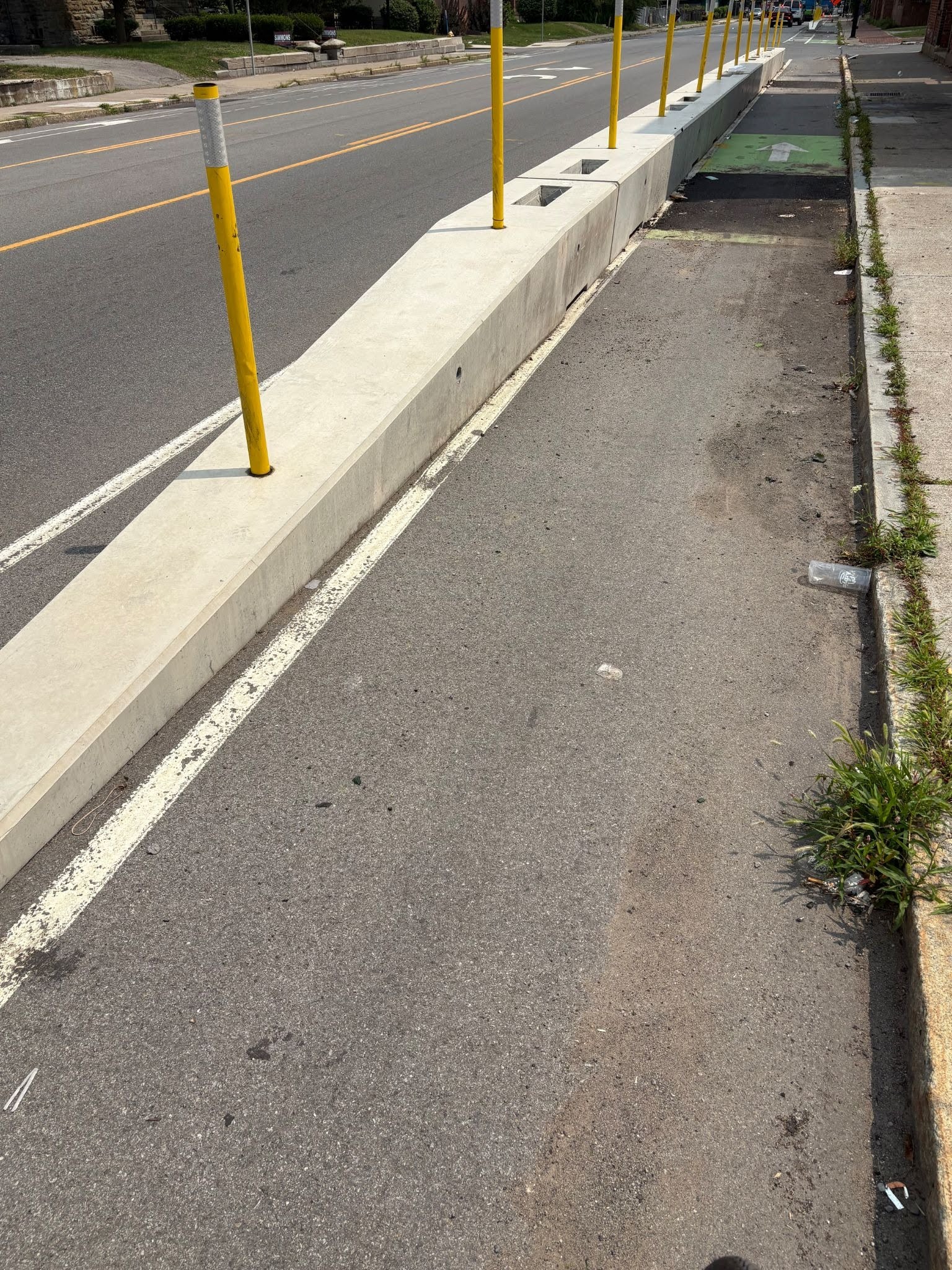
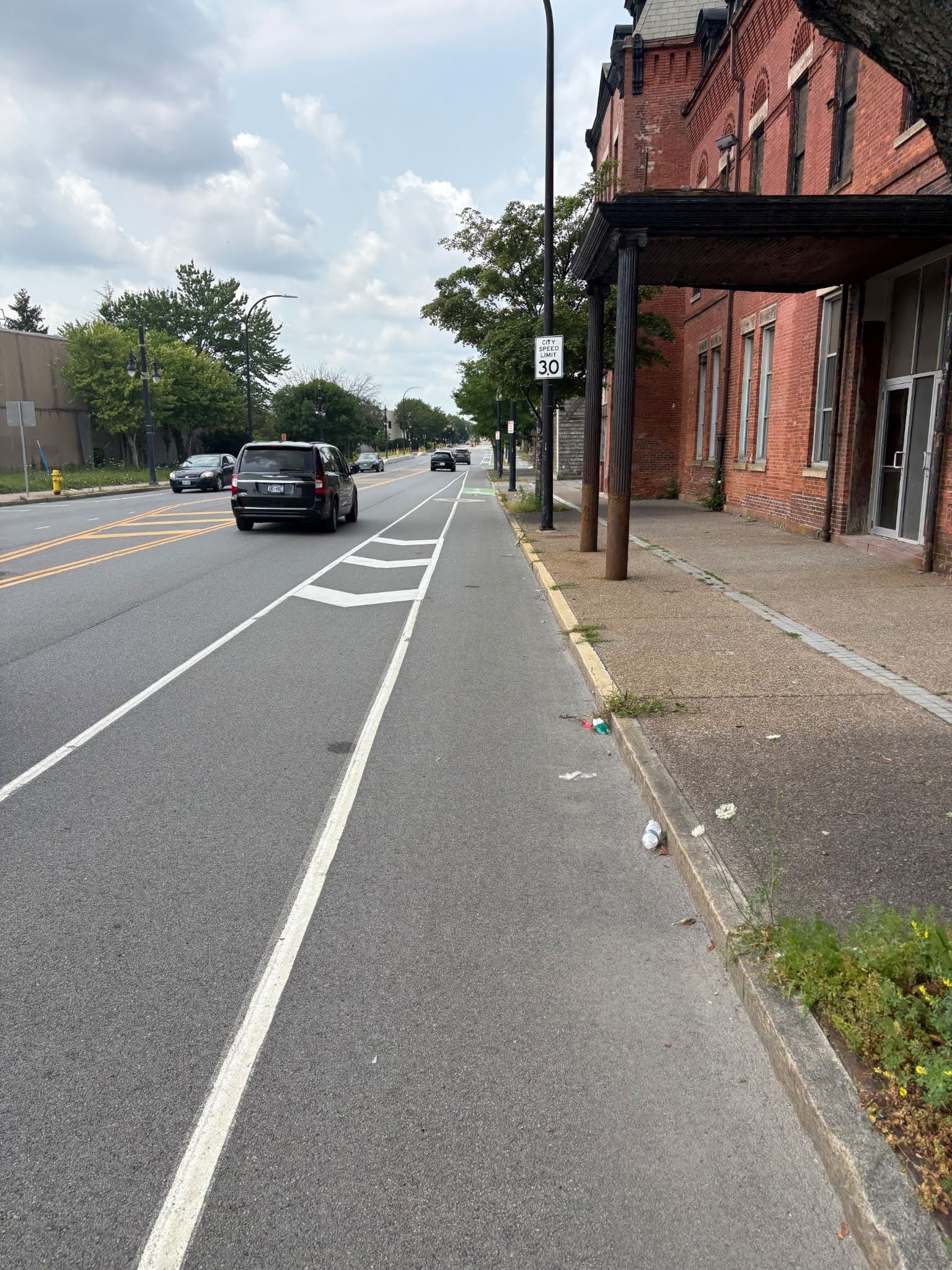
Overall, riders loved the concrete barriers but noted the many gaps without hard separation. (Buses are required to pull to the curb. There are solutions for this). It was clear that the City doesn’t have a plan for keeping the lanes clear of glass, trash and debris at this point. Comfortable connections at either end are lacking. However, this stretch used to be terrifying before the road diet. It’s not terrifying anymore but there are certainly things for the City to figure out.
What could have improved this reconstruction project:
The project could have included bus boarding islands at bus stops, like the preliminary design proposed, to improve bus stop amenities and maintain protected bike lanes. This project should have also offered continuous bike protection to meet all-ages-all-abilities requirements. The City should also commit to regular sweeping of bike lanes. In addition, the barriers should be kept in place throughout the year rather than removing the barriers for the winter and reinstalling them in the spring at the cost of $15,000 per move.

Exchange Blvd & Ford Street 3.2 stars
Exchange Boulevard (Spine C) & Ford Street (Spine J in the all ages & abilities Bike Spine Network)
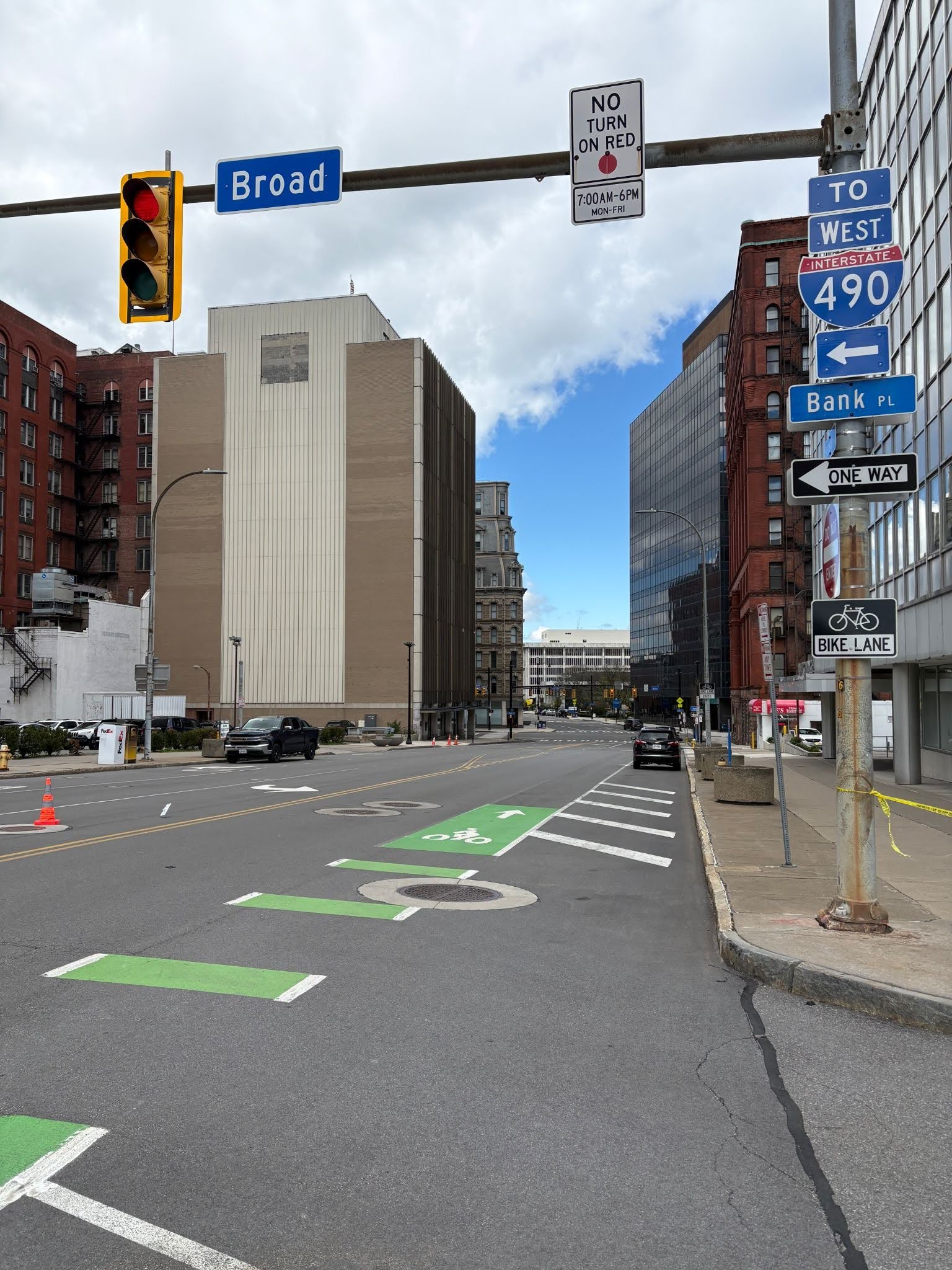
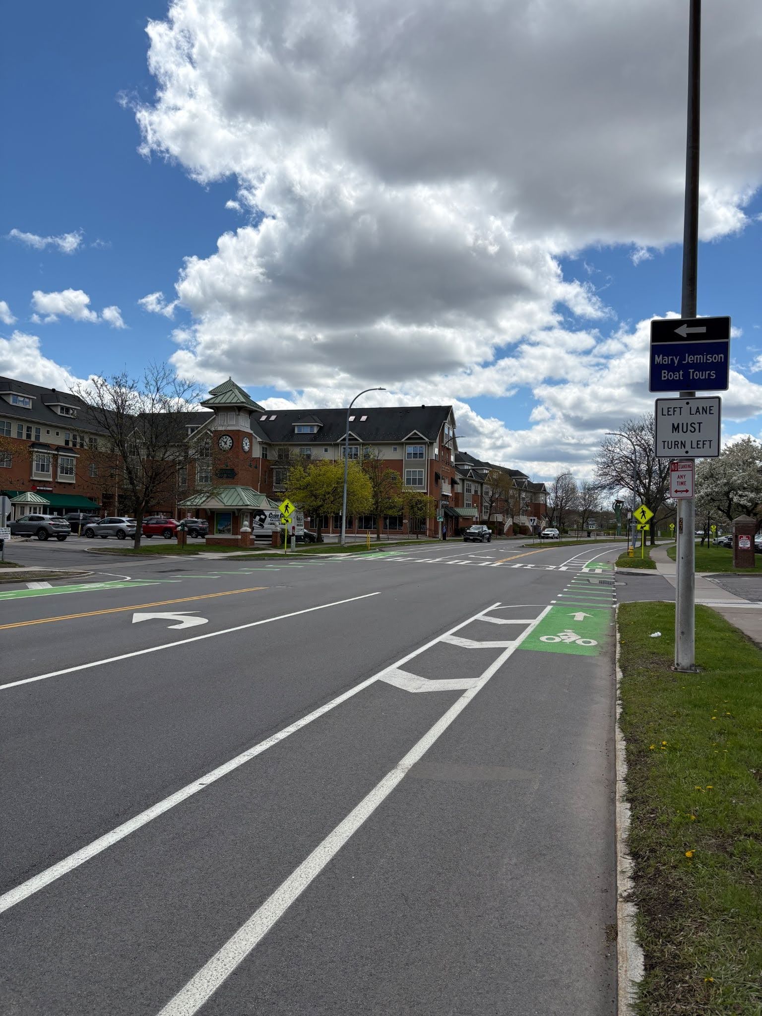
The fact that Exchange Boulevard has lower traffic volumes helps this stretch. The bike community tends to enjoy bike lanes when they’re buffered. (Bollards or curbs could be placed there someday to make them even better). The two-stage turn bike box at Ford Street & Exchange Boulevard is appreciated, but the light won’t detect the cyclist waiting there. Cyclists applauded the raised crossing at Fitzhugh Place S and the roundabout separated cycle tracks.
What could have improved this reconstruction project:
This project should have included a protected intersection at Ford Street & Exchange Boulevard to connect bike lanes to the Genesee Riverway Trail. This project could have also easily included buffered bike lanes all the way to main street, protecting an important section of all-ages-all-abilities bike infrastructure through downtown.

Most of the projects were in the 2 stars range, meaning they’re generally rideable for bolder/more experienced cyclists; not ideal for getting more women, kids and older adults on bikes.
University Avenue (Goodman to Culver) 2.8 stars
University Avenue (Goodman to Culver) – not envisioned as a component of the overall bike network in planning documents
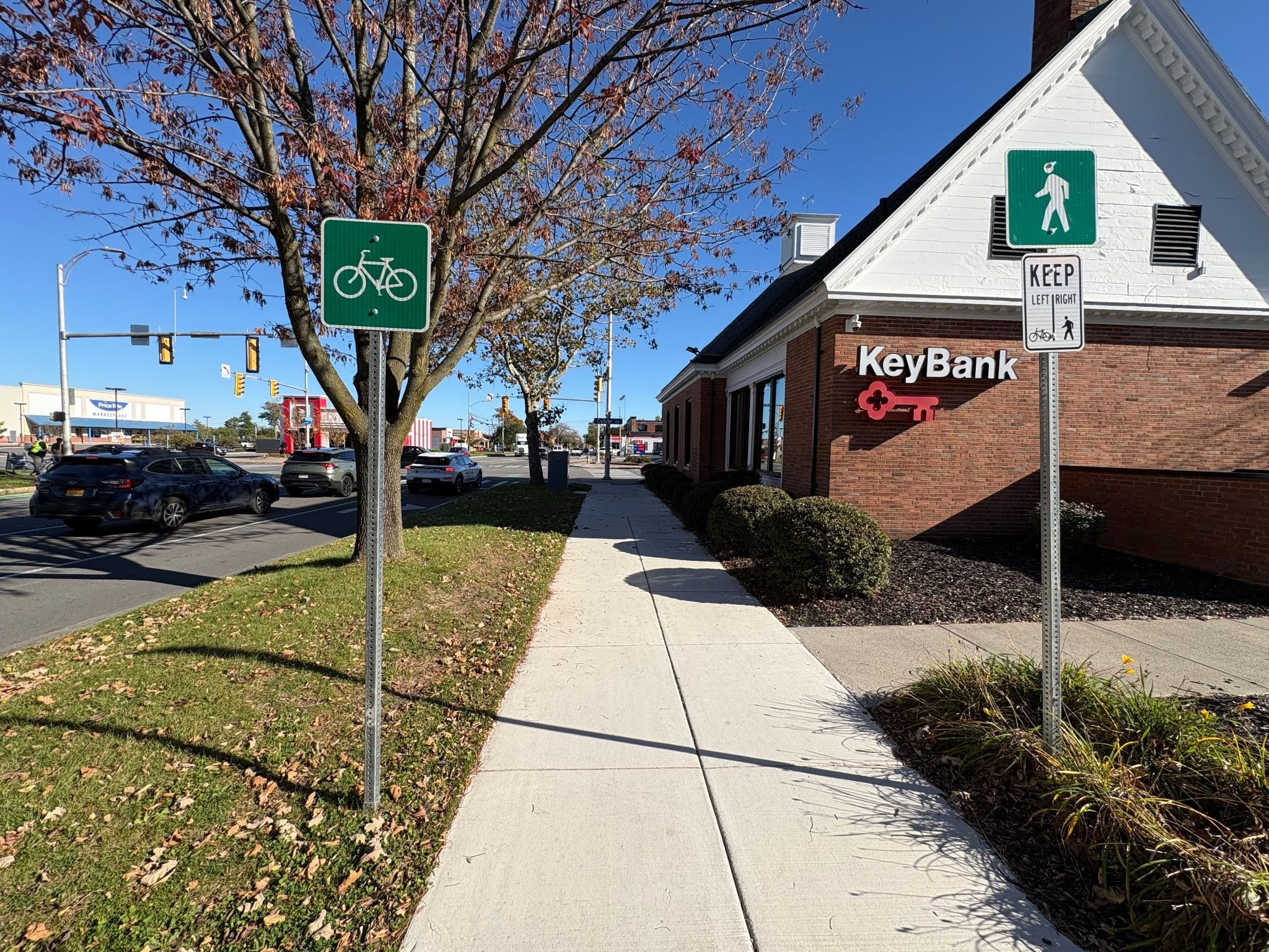
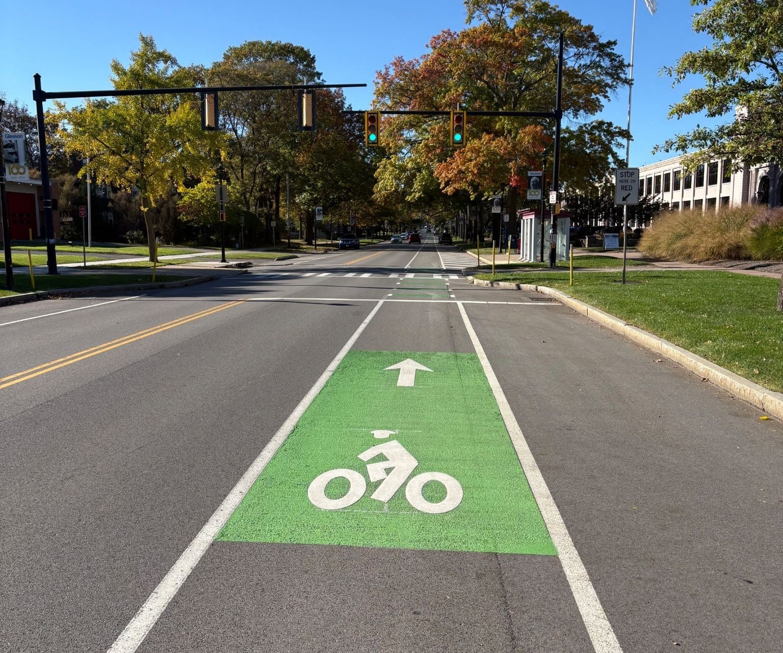
The conventional bike lane westbound by Gleason Works got decent scores. But most riders found the shared sidewalk a disappointing compromise in design. For the record, Reconnect Rochester doesn’t consider shunting cyclists up onto a sidewalk as “bike infrastructure.” This isn’t what good biking cities do. Conflicts with pedestrians are likely, and this is one of the most pedestrian-heavy neighborhoods in the city.
What could have improved this reconstruction project:
This project was a disaster; the public process was not taken seriously and the final design presented to the public was not constructed. During the construction process, the approved final design was modified after a portion of the cycletrack was already built, costing Rochester residents $400,000, and left cyclists with an inferior shared use sidewalk. If it was up to us, this project could have installed a two way protected bike lane on the south side of University Avenue to replace underutilized parking.

State Street 2.7 stars
State Street (Spine C in the all ages & abilities Bike Spine Network)
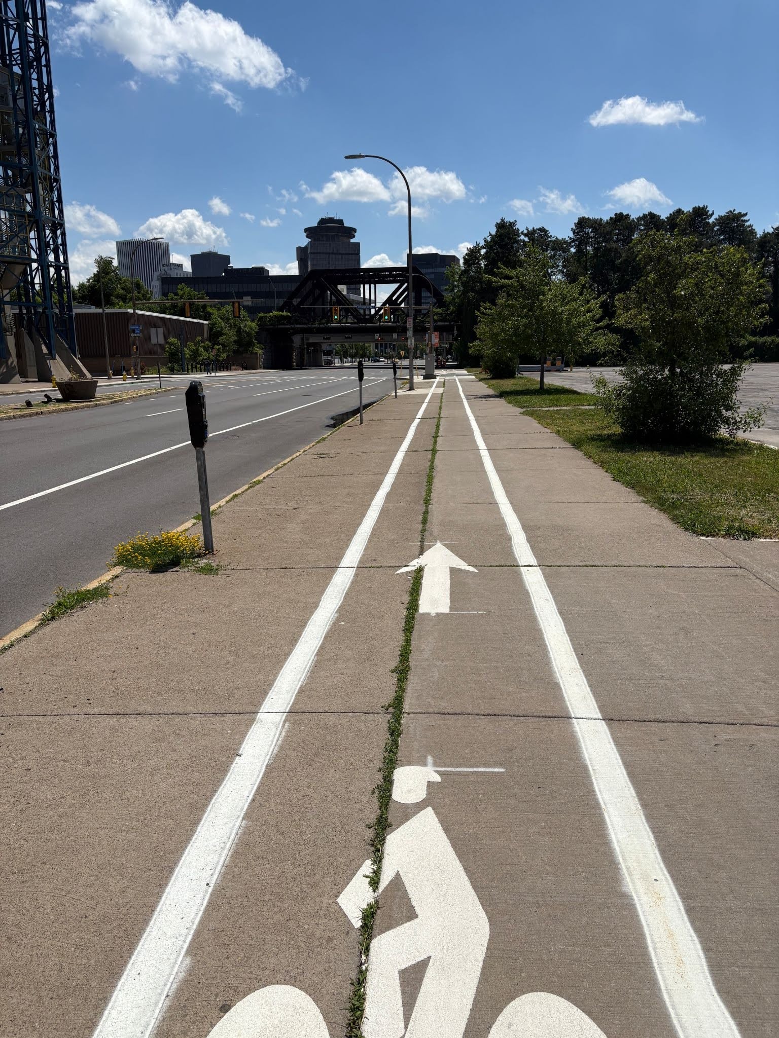
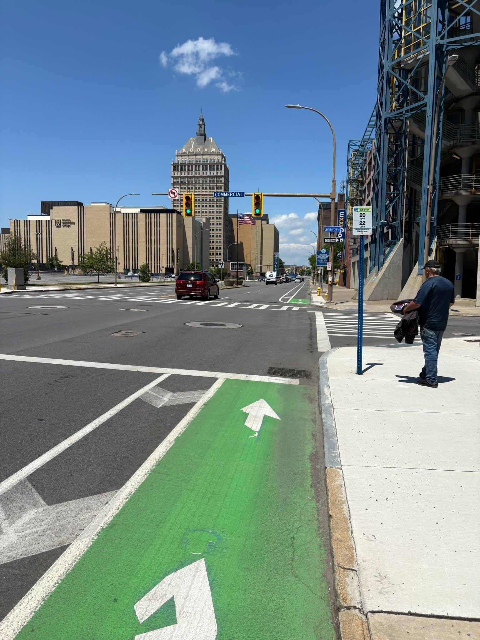
Graders noted the massive improvement under the Inner Loop now that bike lanes are present. The buffered northbound bike lanes got solid reviews but most graders objected to the southbound bike lane being painted on the sidewalk:
One grader chimed in, “The design is not compliant with any contemporary design guidance (AASHTO/NACTO/CROW), and is totally unacceptable for something that is meant to be part of the Bike Spine network. Frankly, it’s a bit insulting with how wide the right of way is here.” Traffic volumes and speeds are very high through here.
What could have improved this reconstruction project:
This project should have removed a travel lane or parking lane to add a protected bike lane southbound within the curb to curb area. Vehicle volumes on this stretch don’t warrant four travel lanes. Cyclists, pedestrians, and wheelchair users should not be forced to fight over small areas of space outside of the curb.

St. Paul Boulevard 2.6 stars
St. Paul Boulevard – envisioned as a supportive corridor in the overall bike network (not one of the crucial all ages & abilities Bike Spines)
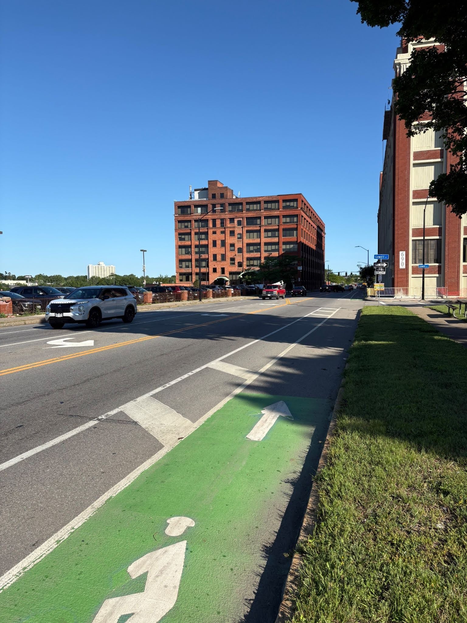
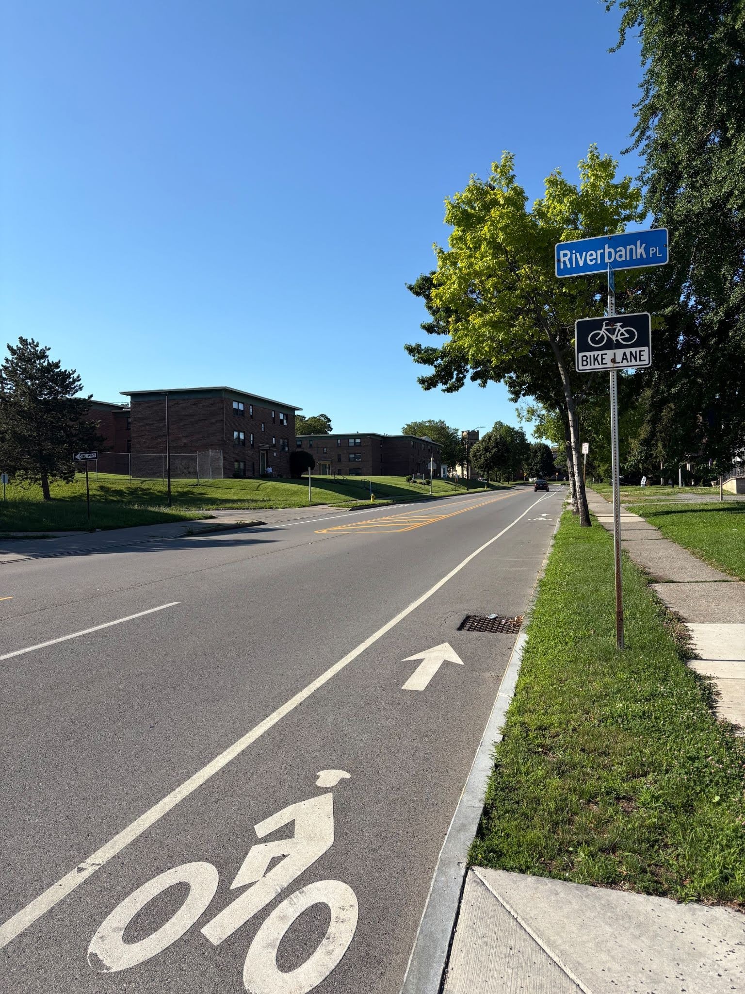
Most graders felt that it’s more experienced cyclists who would be fine with this stretch. Many noted that cars were parked in the bike lanes when they rode. Several noted how uncomfortable the intersection of St. Paul Boulevard and Upper Falls Boulevard is, particularly southbound. The curve on St. Paul Boulevard near Clifford Avenue is also a concern.
What could have improved this reconstruction project:
This project should have installed a protected intersection, or at least maintained bike lanes, at the intersection with Upper Falls Boulevard. This project does offer many areas of buffered bike lanes however, these lanes are regularly blocked by illegally parked cars. Buffered bike lanes should receive barriers to stop motorists from illegally parking in bike lanes. The installation of parking protected bike lanes in some locations could maintain parking while protecting cyclists.

East Avenue 2.5 stars
East Avenue – envisioned as a supportive corridor in the overall bike network (not one of the crucial all ages & abilities Spines)
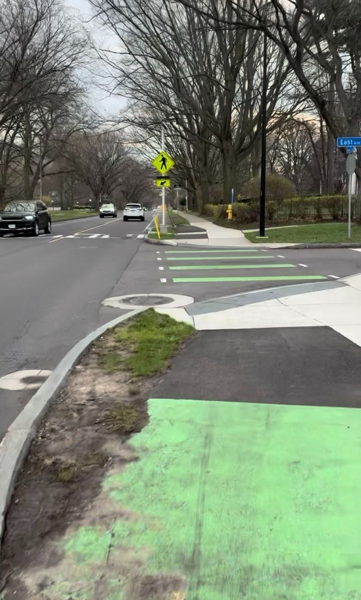
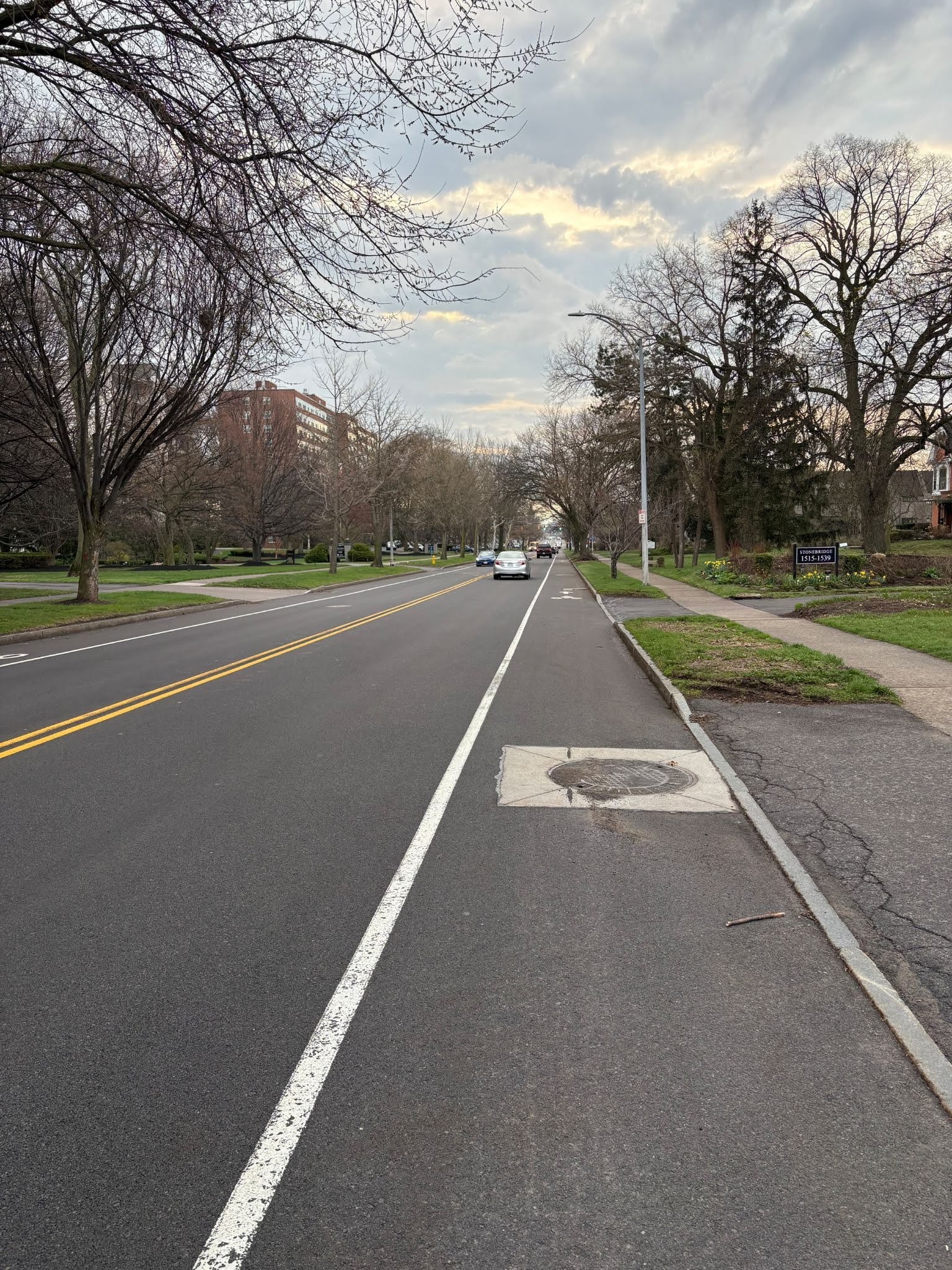
Many feel vulnerable where these bike lanes end. There are many businesses by Wegmans and therefore constant turns by motorists. A popular comment about the protected intersection at East Avenue and East Boulevard was that motorists routinely drive into bike lane while waiting to turn onto East Avenue. Furthermore, the new bike lanes do little to curb the speed or volume of traffic.
What could have improved this reconstruction project:
This project could have been improved by making the East Avenue and East Boulevard intersection a properly designed protected intersection with continuous sidewalk level bike lanes. This communicates right of way and slows turning motorists. The City should also enhance winter and debris maintenance of the bike lanes; the curb ramps to the existing bike lanes are regularly blocked with leaves, trash, and other debris.

South Avenue 2.4 stars
South Avenue (Spine I in the all ages & abilities Bike Spine Network)
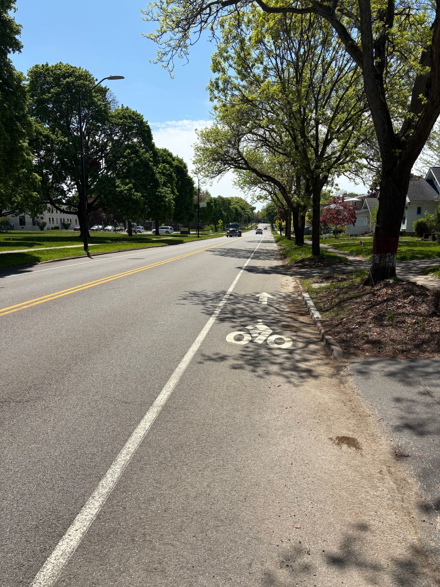
Consensus is that this would be 3 stars if the bike lanes didn’t disappear. The intersection of South Avenue and E Henrietta Road is still very intimidating.
What could have improved this reconstruction project:
This project could be improved by adding continuous bike accommodations throughout the entire project limits.

Culver Road (Southern Section) 2.4 stars
The southern segment of Culver Road – envisioned as a supportive corridor in the overall bike network (not one of the crucial all ages & abilities Bike Spines)
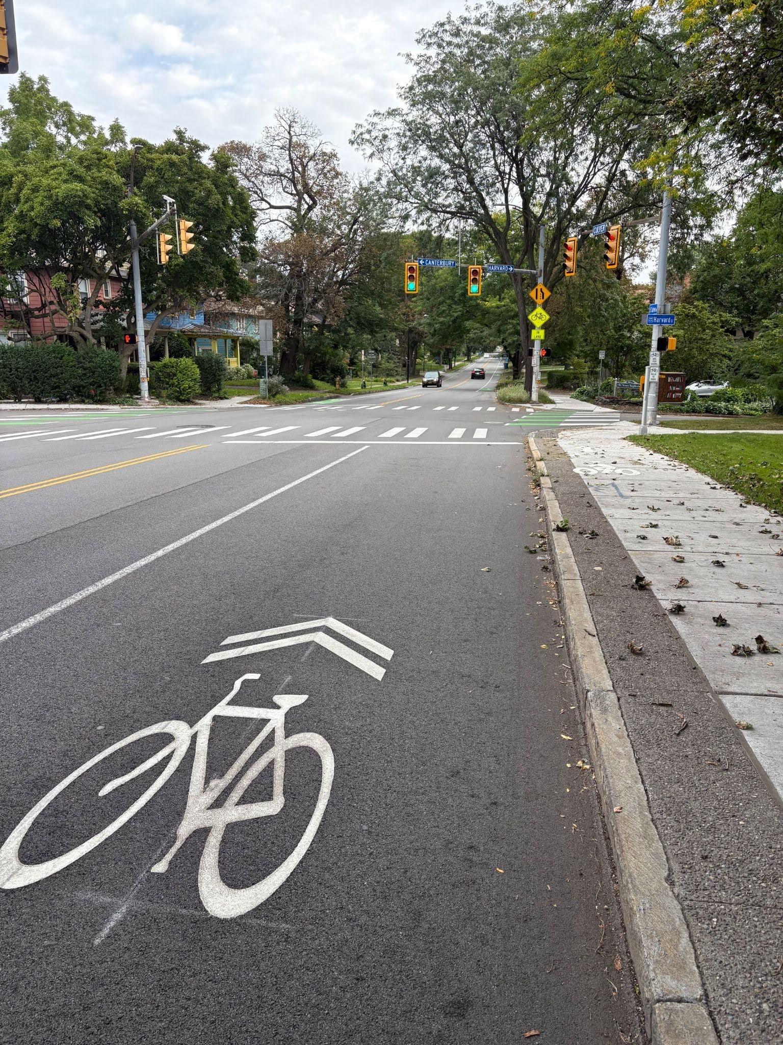
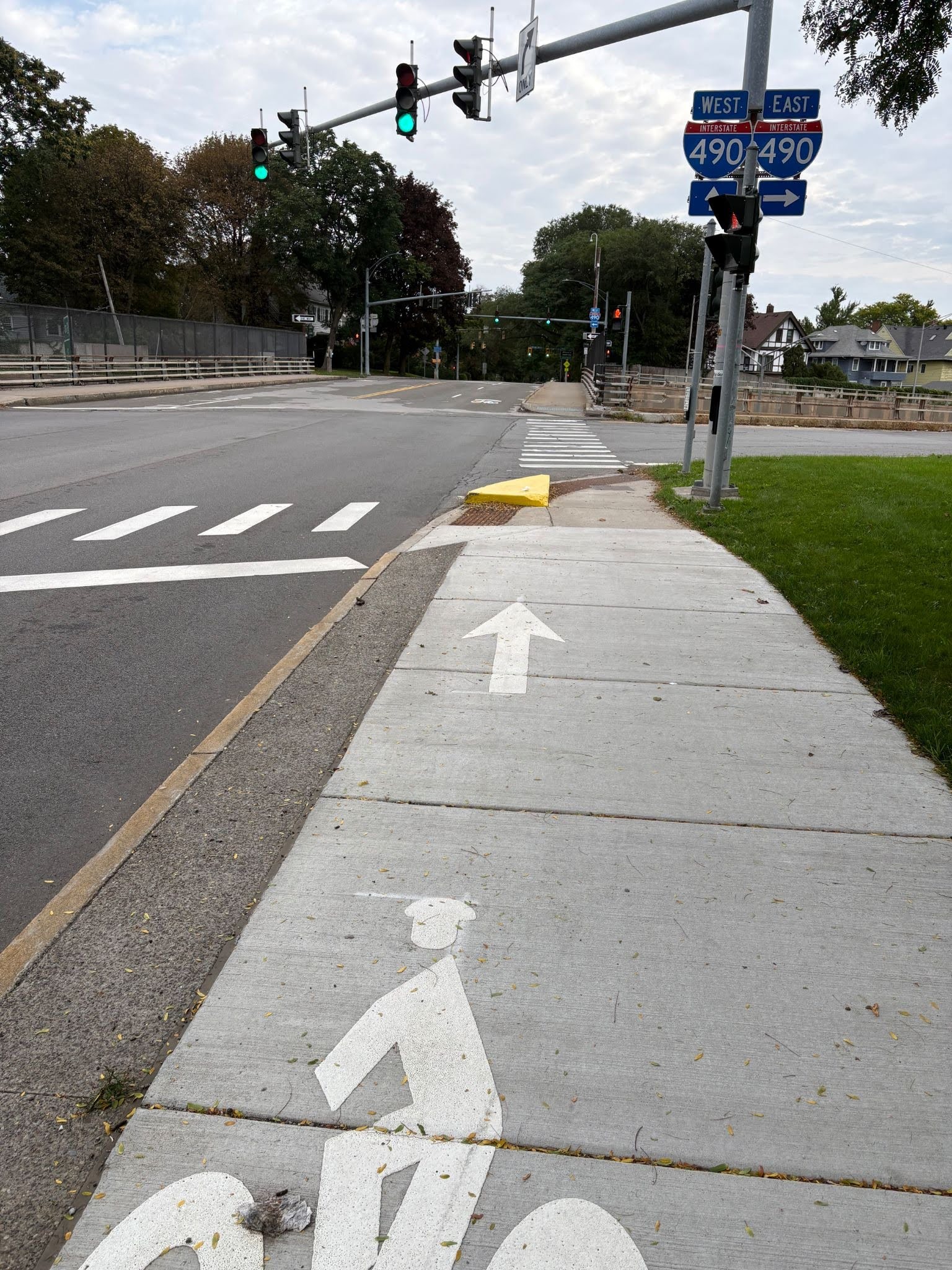
The infrastructure along this stretch from Monroe Avenue to Atlantic Avenue varies widely. The buffered bike lanes by Cobbs Hill Park got high praise. But things grow worse as you head north. Many are confused whether you’re supposed to ride on the sidewalk or on the road heading over I-490. There is paint indicating both, presumably so the cyclist can do whichever they’re comfortable with. Shunting bike riders up onto the sidewalk is never best practice. When the southbound bike lane starts at Humboldt Street, it does so very oddly – motorists drive in the bike lane for a bit and then merge over into the traffic lane when they’ve realized their mistake.
What could have improved this reconstruction project:
Bike facilities should be continuously available along the entire corridor. NYSDOT blocked bike lanes over I-490 after initially allowing this configuration to be shown to the public. The City also shortened sections of bike lanes approaching East Avenue & Park Avenue to lengthen vehicular turning lanes. This could have been avoided by installing protected bike lanes in the tree lawn near these intersections or by removing the turn lanes. The bike lanes also end at Humboldt Street instead of Atlantic Avenue leaving a block without any bike accommodations approaching a school.
University Ave (Culver to Blossom) 2.2 stars
University Avenue (Culver to Blossom) – not envisioned as a component of the overall bike network in planning documents
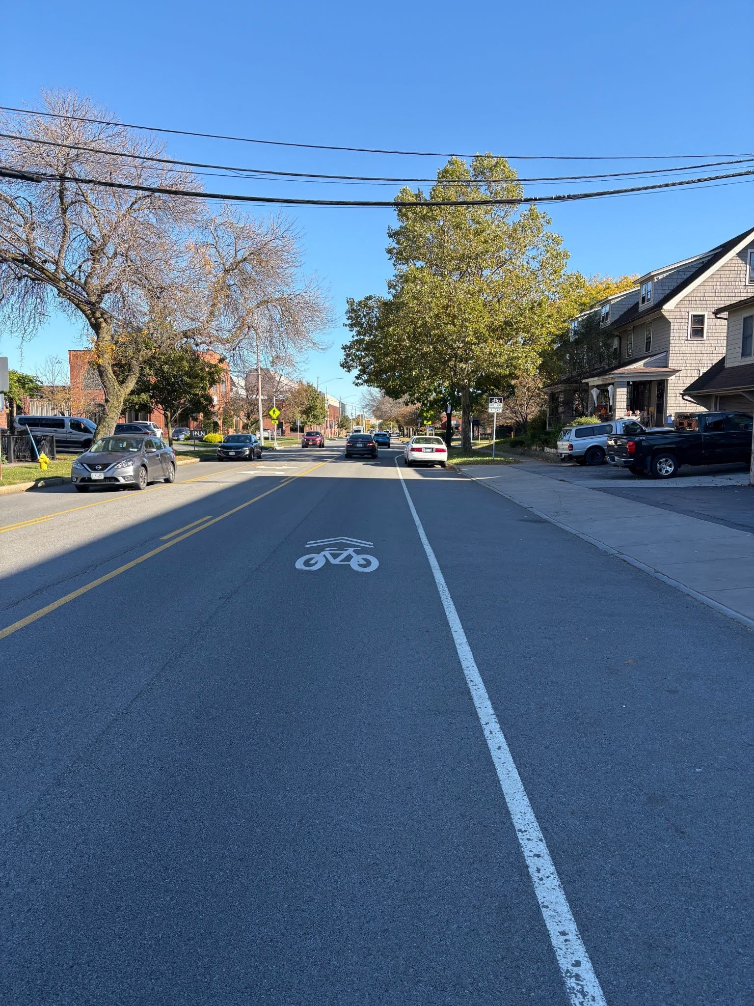
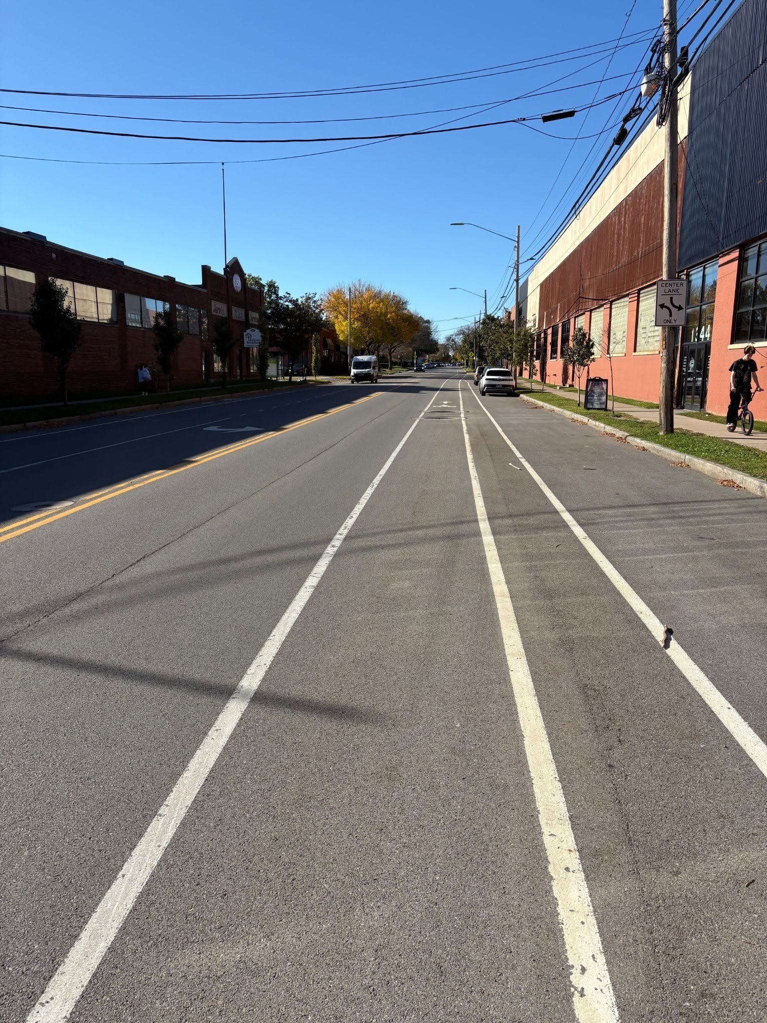
A lot of cyclists take their bikes to Full Moon Vista, one of Rochester’s best bike shops, on this stretch. Unfortunately, much of this stretch in a busy commercial area is uncomfortable sharrows.
What could have improved this reconstruction project:
This project decided to include a two way center turn lane to promote left turn movements over the need of protected bike infrastructure. This project would be improved by removing on street parking OR the two way turn lane to promote continuous bike lanes.

Culver Road (Northern Section) 2.1 stars
The northern segment of Culver Road – envisioned as a supportive corridor in the overall bike network (not one of the crucial all ages & abilities Bike Spines)
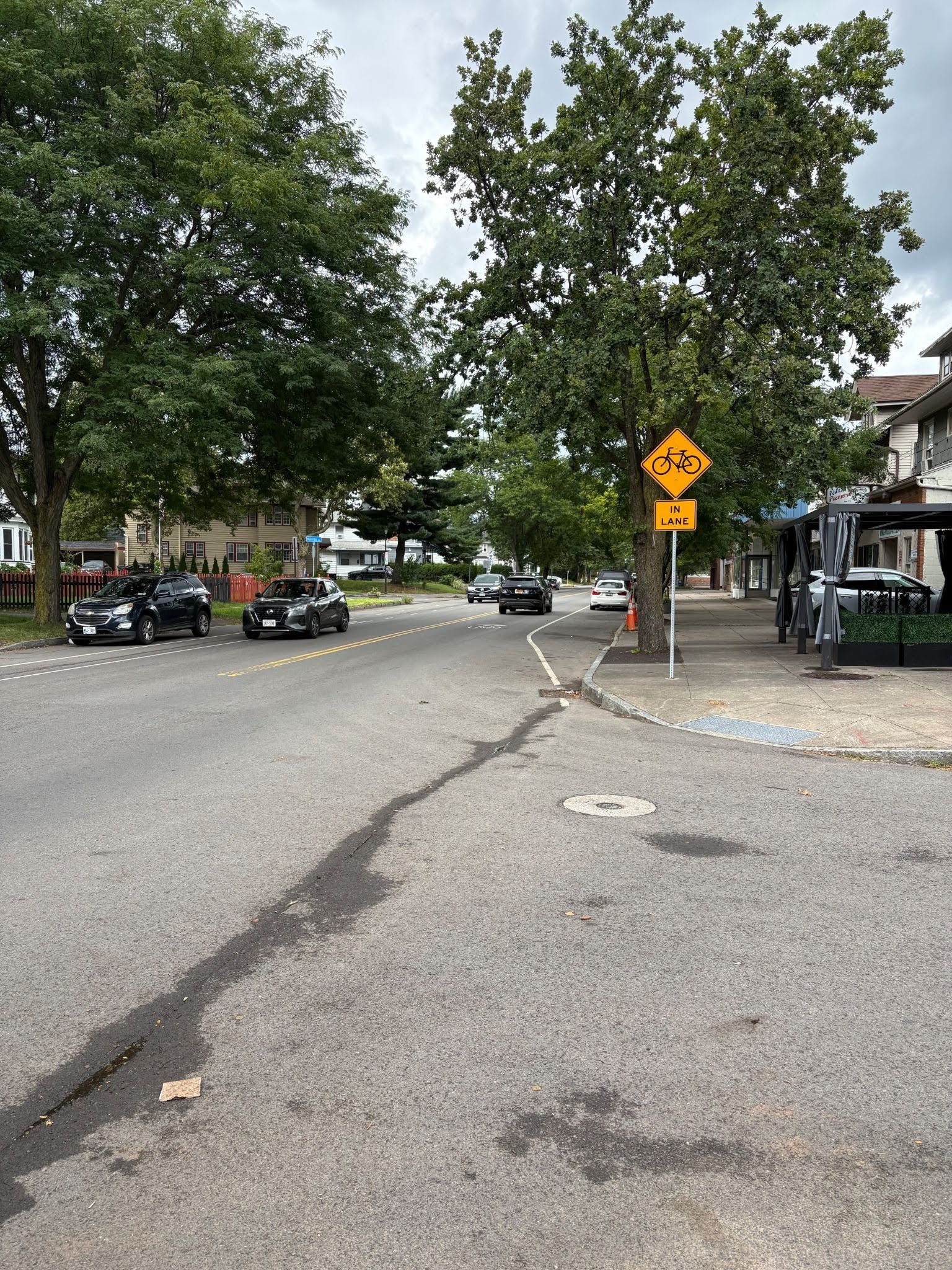
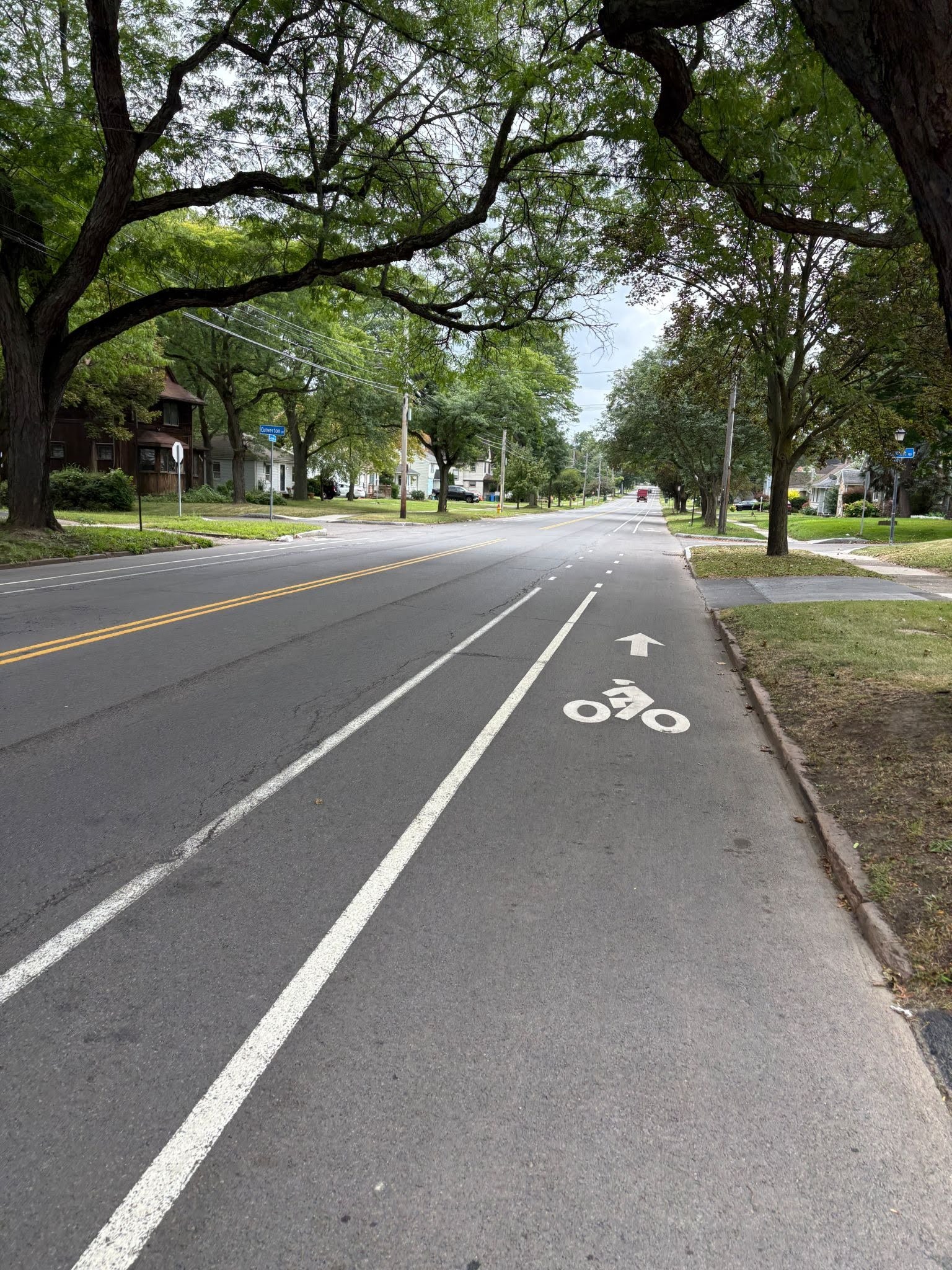
The northern stretch of buffered bike lanes approaching Irondequoit got fine reviews. But the weak link, the bike lane disappearing next to Vault Cafe, Nino’s, and Johnny’s Irish Pub so that car parking could be prioritized, kills this stretch. Add to that the uncomfortable intersection with Clifford Avenue/Empire Boulevard, and it’s only fearless cyclists who will navigate this “supportive corridor.”
What could have improved this reconstruction project:
This project could be improved by including continuous bike facilities throughout the entire corridor. Disappearing bike lanes to include parking on both sides of the roadway is not acceptable. Parking should be removed on one side of the road to promote continuous facilities or significant traffic calming, such as raised crossings, speed humps, chicanes, and more, must be added to keep vehicle speeds under 15MPH if motorists and cyclists are expected to share the road.

S Plymouth Avenue 1.4 stars
S Plymouth Avenue – not envisioned as a component of the overall bike network in planning documents
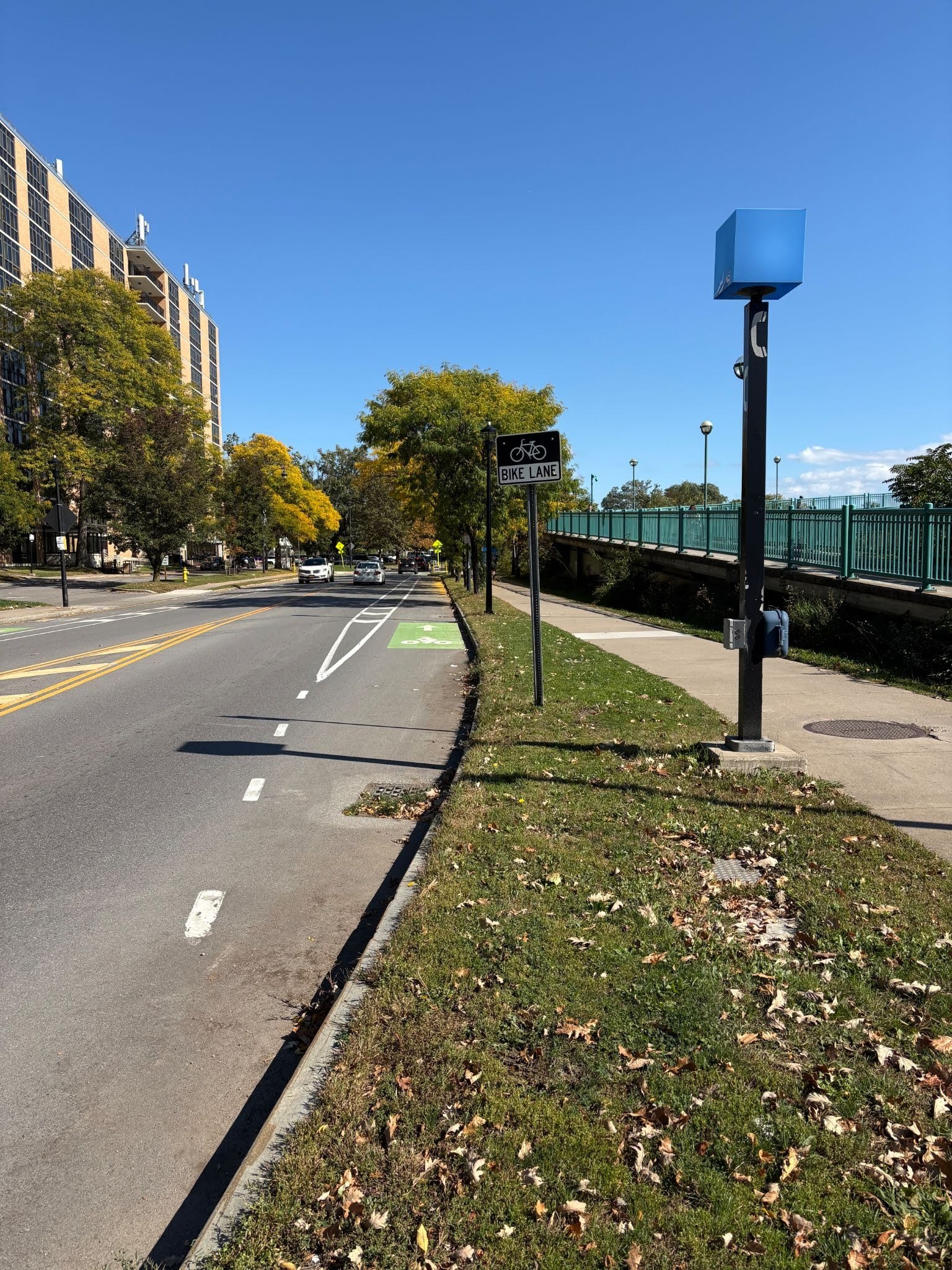
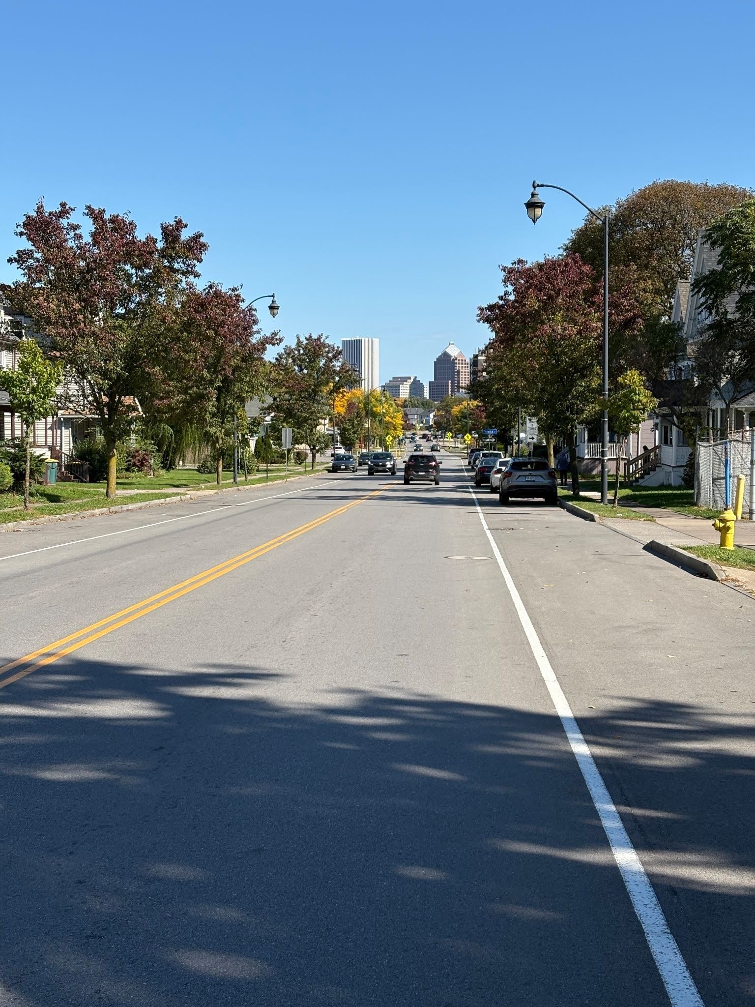
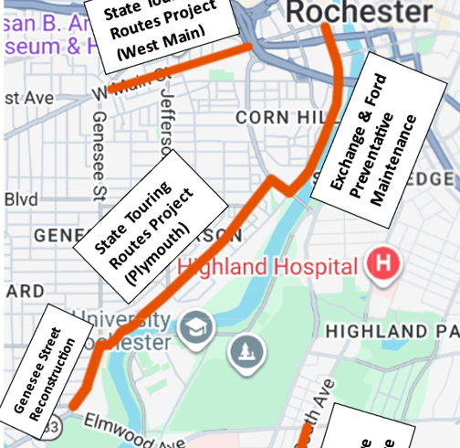
Granted, South Plymouth Avenue isn’t envisioned intentionally as being part of the overall bike network, but why install the nice bits at the northern and southern parts of this project? It strikes us that were it done correctly with the recent projects, there could be seamless on-street infrastructure from Elmwood Avenue to Main Street on the west side via Genesee Street, South Plymouth Avenue, Ford Street and Exchange Boulevard. Missed opportunity.

What could have improved this reconstruction project:
This project had the opportunity to provide increased links between the Genesee Riverway Trail and Rochester’s Bike Boulevard network. For example, a two-way protected bike lane could have connected the Genesee Riverway Trail to Cottage Street. Similarly, protected bike facilities included on this project end less than 150 feet from the Bartlett Street bike boulevard.

Next year, our intention is to extend this grading system to Monroe County DOT and NYSDOT projects.
To be apprised of advocacy opportunities in real time, such as road projects along Rochester’s envisioned bike network, sign up for our mobility action alerts.
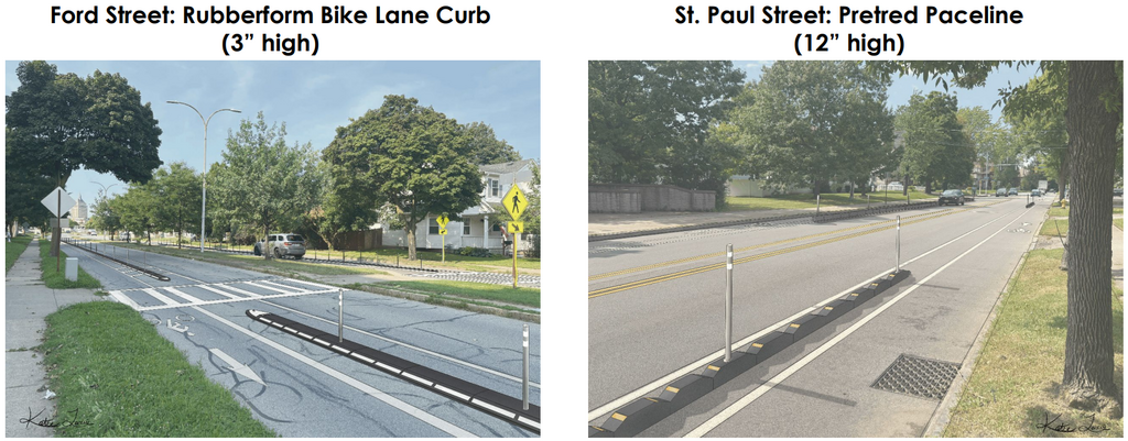
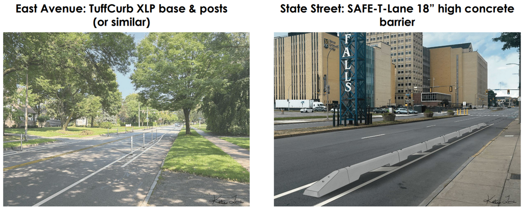
For many years at City Hall, particularly with the previous administration, a “we’ll do what we can where we can” philosophy for cyclists predominated. Hopefully the City is in the midst of turning a corner in its resolve and commitment to seamless, comfortable bikeways as it firms up what the Bike Network Rapid Implementation plan looks like under ROC Vision Zero.
Keep in mind that demo protected bike lanes are coming to St Paul Boulevard, State Street, Ford Street and East Avenue in 2027 as the city experiments with various barrier types!