Story By Arian Horbovetz. Arian is a Rochester resident and creator of The Urban Phoenix, a blog that discusses urban and community design and topics as our cities transition to a better future.
As I write this, the city of Rochester is passively preparing for yet another battle with a dreaded but familiar foe, lake effect snow. Winter boots and labored commutes will surely be the icebreaker (pun intended) conversation starters at the office water cooler today. But for the Urban Planner, as well as the casual observer, periods of light snow can be opportunities for great discovery.
In that time when the first whispers of a snow storm cover our streets and the plows are still dormant in their stalls, we navigate our vehicles on roadways by following the tracks left behind by the cars that recently came before us. To an Urban Planner, these tracks, especially with regard to their path through intersections, are of particular importance.
The ability to see the space that cars use (or rather don’t use) when traveling through an intersection by looking at these tracks through the snow gives us a golden opportunity to demonstrate how and where our streets can be narrowed. Think of it like an Urban Planner’s forensic blacklight, revealing the key unseen evidence of superfluous roadway.
These visual clues created by snow and tire tracks through our intersections are called Sneckdowns. While the name might conjure the image of a Dr. Seuss character, it is actually derived from the combination of “snow” and “neckdown,” which is a term for sidewalk additives and extensions that reduce traffic speeds and increase pedestrian access.
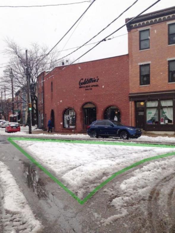
Photo courtesy of Jon Geeting
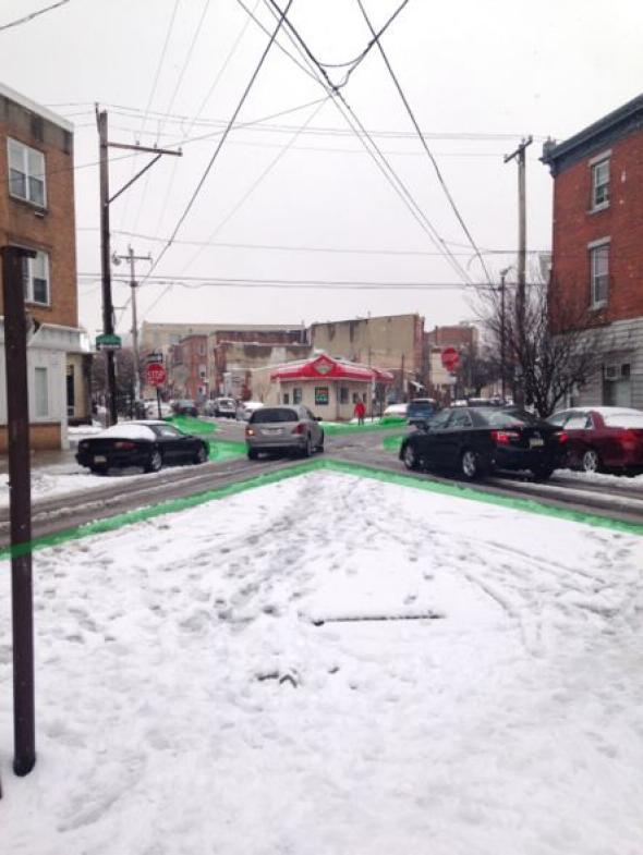
Photo courtesy of Jon Geeting
In 2014, urbanist Jon Geeting authored a Slate article in which he took simple photos of sneckdowns on Philadelphia streets. His efforts inspired walkability advocates around the world to do the same, but best of all, it led to real change in his own backyard.
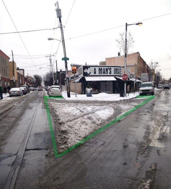
Before Picture. Photo courtesy of Jon Geeting
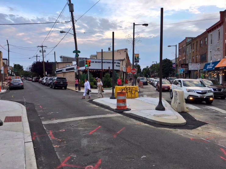
Jon Geeting’s Sneckdown photo of this intersection paved the way for this concrete island which acts as a traffic calming measure and a pedestrian island for safer crossing. Photo courtesy of Jon Geeting
Clarence Eckerson’s famous STREETFILMS video shows some incredible examples of how overbuilt our streets really are. With a measuring device and some cold weather grit, Eckerson puts the power of sneckdowns right in front of the viewer, showing how snowbanks that accumulate on city streets can give us a clearer understanding of how to construct and reconstruct our streets going forward.
Why all this fuss about narrowing streets and slowing traffic? Because decreasing automobile speeds by narrowing lanes and intersections, as well as prioritizing pedestrians, lead to safer, healthier communities. Furthermore, promoting walkability and pedestrian comfort has been shown to feed economic growth and stability.
Sneckdowns also give the average citizen the ability to see where change can be enacted. It doesn’t take a traffic engineer to spot tracks in the snow, it takes a conscious observer who is genuinely concerned about safety and walkability in their environments.
Hey Rochester! Next time it snows, take to the streets and see if you can spot overbuilt space on our roads and intersections. It can be a fun, interesting and positive way to start the conversation about safer streets in your neighborhood, and may even lead to the change we want to see!