Story By Arian Horbovetz. Arian is a Rochester resident and creator of The Urban Phoenix, a blog that discusses urban and community design and topics as our cities transition to a better future.
I get it, if you’ve never taken the bus before, the proposition of hopping on one is a little scary. Nobody wants to look like they don’t know where they are going or what to do. The hardest part for riders in most cities is knowing when a bus is coming, where to get it and what bus to take.
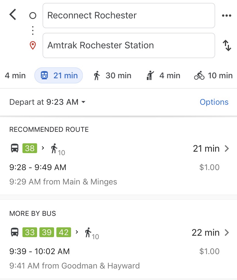
Fear not, for we are in an amazing time of digital information! RTS has its own app, so you can know where your bus is and what time to be at your stop (very handy on rainy or snowy days). You can also plan your trip via desktop at myrts.com. Some people find the app a bit clunky or don’t want another app on their phones, so turn to Google.
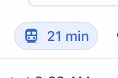
Download the free Google Maps app on your smartphone, enter your destination and click directions. Then if your starting point is different from where you currently are, you can add that as well. Be sure to select the “transit” icon on the screen for directions that feature bus service.
For this example, I want to travel from Reconnect Rochester’s headquarters on 1115 East Main Street to our Louis M. Slaughter station to catch an Amtrak train. The map will show me the best bus routes coming up in the next hour or two…
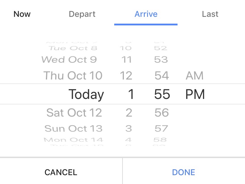
But right now it’s 9:23am… Since my Amtrak train departs Rochester at 2:03pm, I want to see which bus will work for me this afternoon, not right now. In this case, I can click on the drop-down arrow next to “depart at” and select “arrive by” instead. I know I want to arrive at the train station by 1:55pm to be safe on time, so I can enter that time into the Google Maps and the app will show me the best bus options to get me there on time.
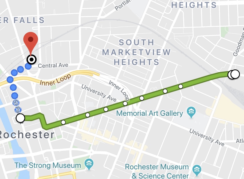
I can see right on the app that I need to leave Reconnect Rochester at 1:26pm and walk a short distance to the Main and Minges bus stop, where the bus will depart at 1:27pm. The bus will arrive at the transit center at 1:35pm, and from there I can walk North to the train station, which should take 10 minutes. I will arrive at the train station at 1:45pm with plenty of time to prepare for my train departure.

Don’t have a smartphone? Go to Google Maps on your desktop or laptop and follow the same instructions above. Remember to bring a dollar for each bus ride you need to take! When you approach your destination, remember to pull firmly on the cord running along the side of the bus to signal the driver that you would like to disembark. And if you don’t want to walk to-and-from the bus, you can bring your bike with you!
Google Maps has done wonders for the directionally challenged with regard to easy automobile navigation, but it can also empower us to efficiently utilize our urban transit systems. The fear of not knowing which bus to take and when, and where to go to catch it is almost completely alleviated, and for most of us, that’s half the battle. So if you’ve hesitated to explore Rochester using public transit (it’s cheap, easy and you don’t have to worry about parking!), try using Google Maps and plan your trip with the confidence of a pro!