No Comments

Bike Access to Nature

By Jesse Peers, Cycling Manager at Reconnect Rochester

I say this on my history bike tours a lot: If I could temporarily time travel back to one decade, it’d be the 1890s. In this decade, the up ‘til then economy-minded City of Rochester started a massive investment in the public realm: it developed its world-class park system and with the electrification and extension of the trolleys, residents could hop on a streetcar and visit our parks and beaches at their leisure. The 1890s is also renowned as the greatest bike boom in history and automobiles hadn’t yet dominated our streets.
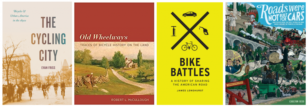
Bike History Books
Rochester’s bike history is featured quite prominently in these four recent books

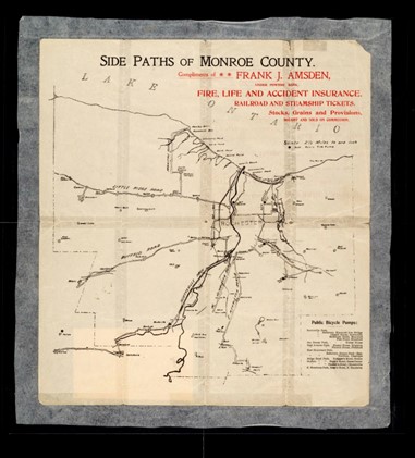
One of the bicycle’s greatest selling points at the time was the ability to access these newly developed parks and to escape the city into nature whenever you wanted. The world was at your fingertips – just a short pedal away! In the early twentieth century, Rochester cyclists would make that access to nature and the surrounding countryside even easier by pioneering a system of sidepaths through Monroe County. For a while, cyclists came to Rochester from afar to see top-notch bike infrastructure!

In Rochester’s early days, the city center was surrounded on all sides by “verdant nurseries and blooming orchards.” Visitors to the Flower City were awed by the “seemingly endless acres of blooming rose bushes, tulip beds & fruit trees, encircling the city.” Before those areas were taken over for housing, Rochester’s early Parks Commissioners proposed a park boulevard 300 feet in width encircling the city with a number of small parks scattered along its route. Instead, priority was given to two large parks straddling the river: “South Park” (Genesee Valley Park) and “North Park” (Seneca Park).

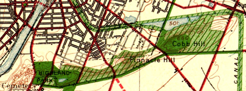
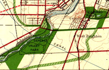
That original idea, though, kept resurfacing as subsequent mayors toyed with the idea of connecting the growing park system. Like many, we are mesmerized by this 1911 vision for Rochester. Because Rochester’s large parks were “comparatively remote,” planners felt their usefulness could be “much enhanced by narrow, extending arms reaching out into the surrounding territory and forming park-like approaches to them.” These connective parkways  would “multiply in effect the extent of park area conveniently available to the community.”

Map of Rochester

Sadly, the costs were too prohibitive and the project was dropped. (Two small beginnings though were made towards its realization: Seneca Parkway in Maplewood and Genesee Park Boulevard in the 19th Ward). For an example of a peer city that got much closer to achieving a similar vision, check out Louisville, Kentucky.

Louisville Loop Overview
Though they are still working towards its full realization, Louisville, Kentucky’s Olmsted Parks are connected with Parkways. Learn more about the Louisville Loop.

With another bike boom happening, the recent adoption of Rochester’s Children’s Outdoor Bill of Rights, the expansion of the City’s Bike Boulevard network, and the simultaneous creation of Active Transportation Plans for the city and county, we thought it a good time to revisit this concept of bike access to nature and our parks. Using the 1911 vision as our guide, let’s examine our modern bike network as connective tissue to our stellar parks.
Rochester's Children's Outdoor Bill of Rights

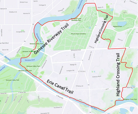
The Highland Crossing Trail, which many residents don’t know about since it hasn’t been incorporated into Google Maps’ bike layer yet, was a unique collaboration between Brighton and Rochester. With the Erie Canal Trail, it connects Genesee Valley Park to Highland Park. These trails together with the Genesee Riverway Trail make a wonderful seven-mile recreational loop we recommend you try sometime.

Bike Route Map
Bike Route Map

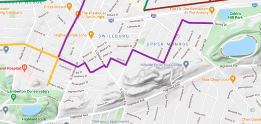
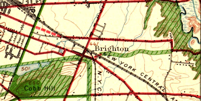
Recurrent calls in the early twentieth century to secure the Pinnacle Hills as parkland connecting Highland Park and Cobbs Hill Park were unsuccessful but today’s Bike Boulevard through Swillburg and Upper Monroe does a good job of connecting them.

Bike Route Map
Bike Route Map

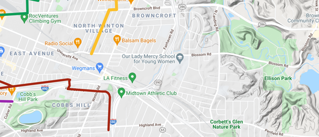
Connecting Cobbs Hill to Irondequoit Bay and what is now Ellison Park is harder. The 1911 planners called for an extension of Richs Dugway Road but today’s railroad tracks present a significant barrier, as does the area around Wegmans and the “Can of Worms” interchange. For now, Browncroft Blvd, Blossom Rd and Highland Ave can be used. Living in the Culver and Merchants triangle, my kids and I are a 10 minute bike ride away from Ellison Park – a ride we cherish, especially in the Fall. We turn off of Browncroft onto Shaftsbury and Corwin Roads for a low-stress approach to the Park.

Bike Route Map
Bike Route Map

Though a parkway or trail extending east to west “along the low land just south of the Ridge Road” and today’s 104 isn’t possible, the El Camino Trail and the new Bike Boulevard through 14621 can connect Seneca Park to Irondequoit Bay.

Bike Route Maps

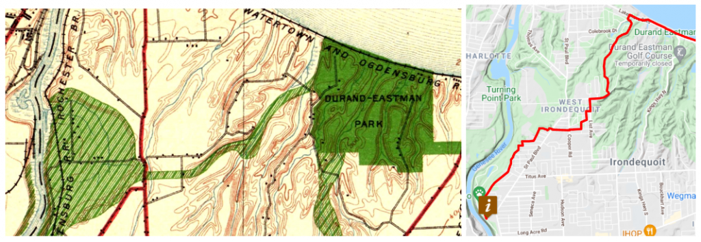
To connect the Genesee River and Seneca Park to Durand Eastman Park, the 1911 plan called for a connection westward “up one of the little valleys” to the northerly end of Seneca Park. Check out this creative route by Pam Rogers.

Bike Route Maps

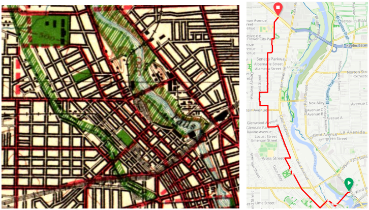
To connect downtown with Edgerton Park and further north, we all know Lake Avenue must be avoided at all costs by bike. But the new Bike Boulevard along Plymouth parallels Lake Avenue and gets you all the way up to Kodak Park in a low-stress manner through the gorgeous Maplewood neighborhood.

What are your favorite low-stress ways to visit nature by bike? Let us know! If you agree with the Children’s Outdoor Bill of Rights declaration that every Rochester child should be able to “safely explore their community green spaces” and nearby parks, we’d ask you to advocate for continuous, high-comfort bike infrastructure for all ages and abilities for the City and County’s Active Transportation Plans this year.
1 Comment

A Climate Solutions Blind Spot: Seeing Beyond Electric Cars

Guest blog by Evan Lowenstein, Director of Communications and Membership at the Climate Solutions Accelerator

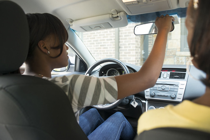
Remember when you learned how to drive? You learned about the blind spots to the left and right of your vehicle, those spots where another car might be, hidden even from all your mirrors. That there might be things there you aren’t seeing. 

There’s another blind spot putting us at risk here in car-centric America: the one that prevents us from thinking beyond the automobile as we strive for climate solutions and a truly sustainable society.

Image Credit: State Farm on Flickr

The rise in concern about climate change in society and industry is encouraging, and happening not a second too soon. But the well-intentioned efforts run the risk of falling way short because of our perilously persistent belief that we can achieve a climate-safe, sustainable future simply by running our cars on something besides fossil fuels.

Transportation accounts for 40% of our climate-changing greenhouse gas emissions, and converting vehicles from fossil-fuels to more cleanly-generated electricity surely can reduce those vehicles’ emissions. But the way they are fueled is just one of many environmental, economic, and equity problems caused by our cars — and just one of the problems inherent in our prevailing transportation model and mindset. 

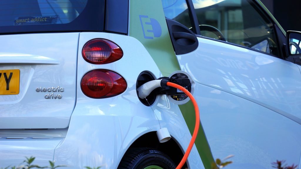
Thus, there is an inconvenient truth hidden in our blind spot: as we seek transportation modes and systems that are better for the environment, for the economy, and for equity, electric vehicles are the next-worst option to the fossil-fueled ones. 

Why Electric Vehicles Aren’t Enough

The switch to electric cars as a solution to climate change depends simultaneously on a massive transition to renewable energy, such as wind and solar, happening at an unprecedented speed. If we don’t transition to renewables as fast as we transition to electric cars, electric vehicles won’t produce any real progress on climate change. The switch also means a massive increase in demand on our already-strained electric grid; in addition to the cost of putting up that much renewable energy, we then have to upgrade the grid to carry it all.

And electric cars are still cars — machines that produce environmental impacts such as water pollution from tire and brake residues, and leaks of toxic materials from millions upon millions of compromised vehicles; pollution from extraction of materials needed and energy needed to make them; gargantuan fossil-fuel expenditures needed to transport them from manufacturer to individual buyer. In addition, the massive road and storage infrastructure (parking lots) needed to accommodate individual cars as a primary transport choice has titanic environmental impact: polluted runoff, biodiversity loss and roadkill from fractured habitat, etc. Having to maintain all this outsized, inefficient infrastructure forever also creates enormous financial challenges for governments, and prevents resources from being used more wisely.  

The Cost of Personal Vehicles 

Speaking of roadkill — cars also kill a lot of people too, upwards of 60,000 annually in our country from crashes and illness from fossil-fueled air pollution. And many people killed by cars are low-income and people of color, forced into walking or cycling in car-centric communities without adequate provisions for pedestrians or cyclists; and/or forced into living in places with the worst auto-borne air pollution.

Car-culture also creates and perpetuates more inequity like this. Cars are already expensive to own, maintain, insure, and fuel. Low-income people without the means to own cars are shut out from many needs and opportunities (jobs, education, recreation, culture) that are accessible only by car. In addition, most low-income people rent instead of own their housing, and even if they were able to access electric vehicles, they likely wouldn’t have easy access to charging. If the shift to electric vehicles makes car ownership even more out of reach for low-income people, the equity gap exacerbated by car-culture will grow even wider. 

Building a Multi-Modal Future

We must start seeing what’s in the blind spot–the fact that a switch from gas-powered to electric vehicles cannot be the primary push as we strive for sustainability. Instead, we must understand that the best car trip for climate and sustainability is not an electricity-powered car trip, but the absence of a car trip.  

Then, we must focus our planning and funding to make it easier for more people to transport themselves by bus, rail, bicycle, and foot. Note that an electric bus or train uses ten to twenty times less electricity per passenger mile than an electric car does — no matter how clean or dirty the electricity supply is, they are always that much better. And even if buses and trains aren’t electrified, they produce less overall impact than electric private vehicles as a whole, simply by transporting more people over less distance. Walking and bicycling for transportation — if done safely using adequate infrastructure provided for it — produces positive health benefits along with the environmental benefits.

Seeing what’s in the blind spot also means developing land and our communities more efficiently so that transit, bike, and pedestrian transportation modes are viable for a lot more people. Community design with this location efficiency in mind will also save energy, land, and natural resources, meaning that planning for car-free lives enables climate solutions well  beyond the transportation modes themselves. This location efficiency also makes it more feasible for car sharing and carpooling — putting more people in each car is a super-sensible and affordable climate solution as well. 

The hard truth is that climate solutions, sustainability, and equity cannot be achieved solely through intention, but rather through execution. And executing requires plugging all the key facts into our designs of policy and place. We cannot let this big blind spot — an overemphasis on electric cars — run us off the road to our destination: a cool, carbon neutral planet.