Monroe County Crash Map

Posted by: Mike Governale, president and co-founder of Reconnect Rochester
Just about every day on the local news we hear about a crime that took place somewhere in our community. And usually after that news you’ll often hear a traffic report… “An accident at the I-590 split has traffic backed up ALL the way to 104. You better give yourself some extra time for your commute this morning!”
What we don’t often hear about—or think about—are the lives that were impacted as a result of that car crash that has inconvenienced our drive.
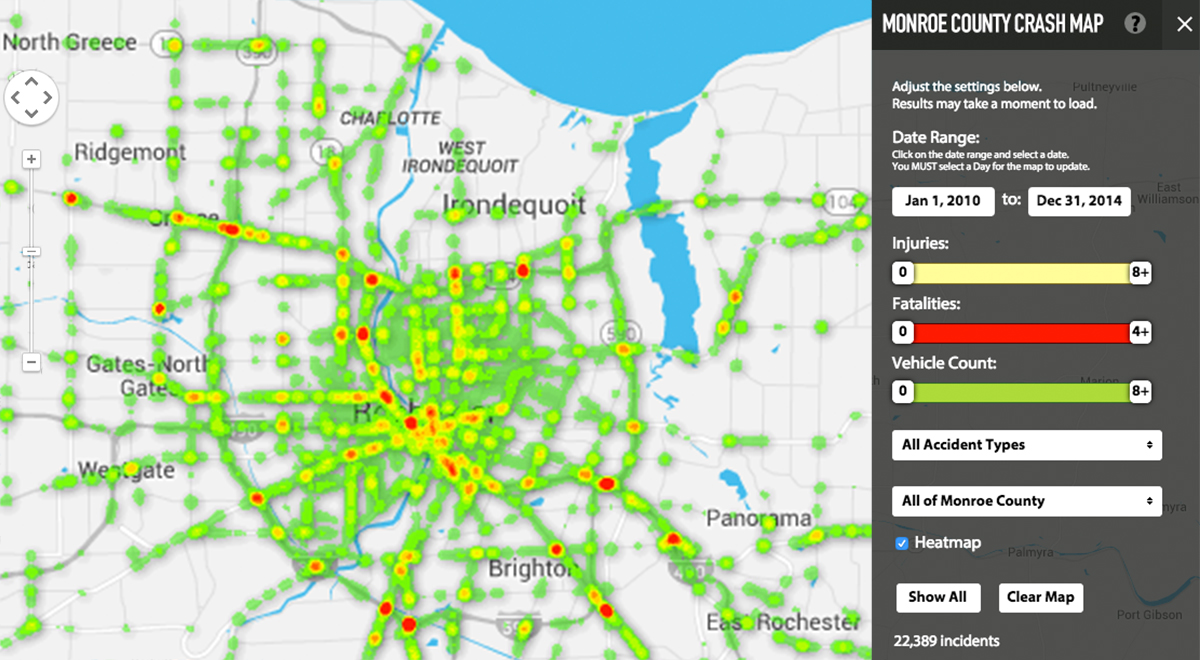
Now here’s something that might help put your daily traffic report in perspective: between 2010-2014 there were 22,389 car crashes in Monroe County which resulted in at least one injury or fatality. The volunteers at Reconnect Rochester have been hard at work collecting that data. And a new “Crash Map” ![]() they’ve created is revealing an enormously high human toll on our local roadways…
they’ve created is revealing an enormously high human toll on our local roadways…