The Rochester area is famous for its 20-minute commute. For driving that is. Reconnect Rochester and the Rochester Cycling Alliance are excited to ask a different question in this blog series: Where can you get within 20 minutes on a bike?
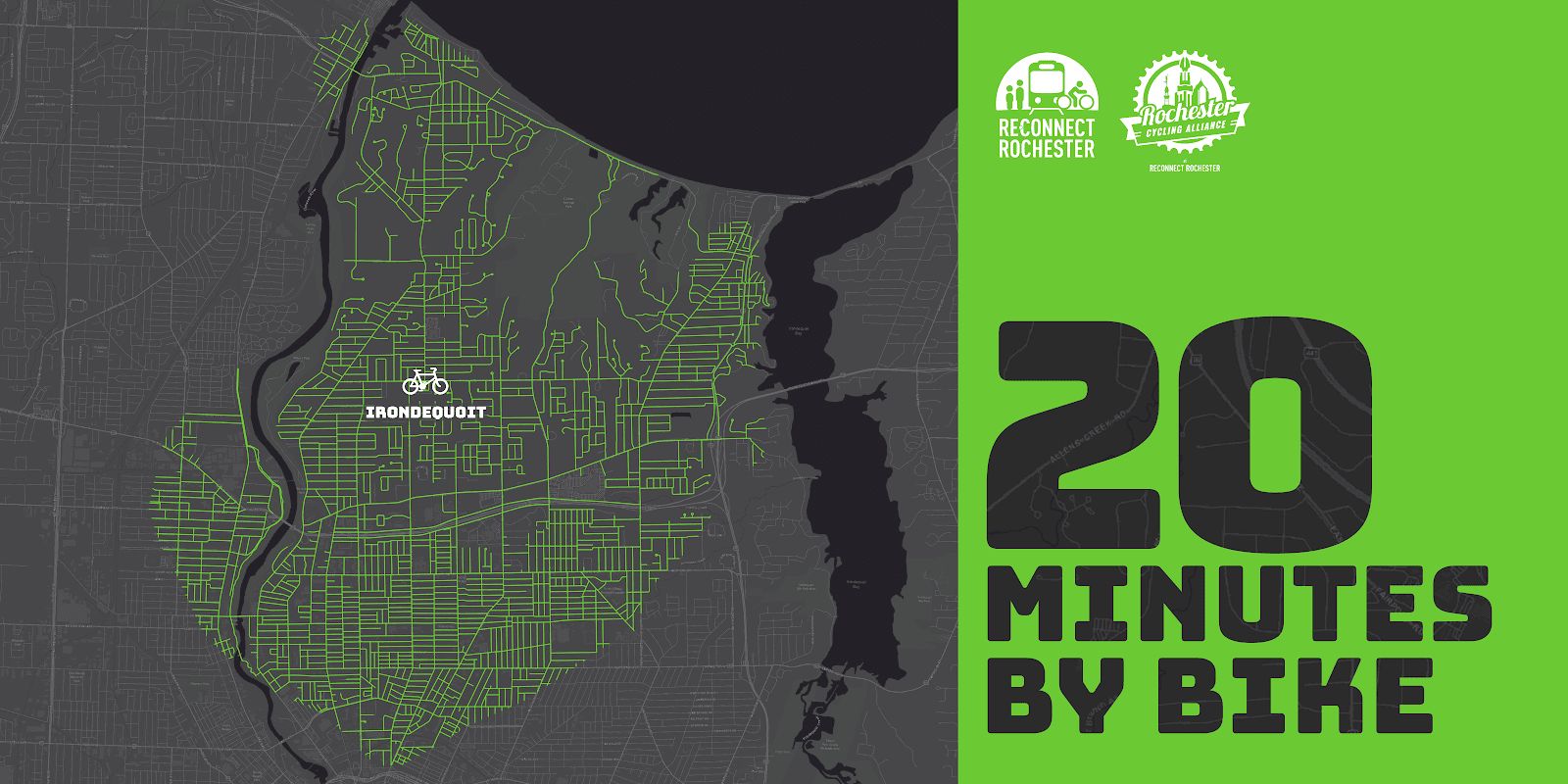
Presenting the second in a series of custom “bike shed maps.” For this next installment, we chose Irondequoit’s “central square” – I-Square – and are showing how far out in every direction you can get on a bike at a casual but steady pace of 10 miles per hour. This means that if you live anywhere in this green area, you can get to I-Square within 20ish minutes on a bike. Thanks again to Brendan Ryan and Mike Governale for their help putting these maps together for us.
To get us familiar with this green territory in Irondequoit, here’s Pam Rogers sharing her personal travel-by-bike experiences.
Introduction
I’m so excited to share with you my personal recommendations for cycling in my favorite area of Rochester, which also happens to be my local neighborhood! Forgive me if it turns out to be an homage to Irondequoit, but it’s my way of letting you know all the best reasons to find yourself cycling here.
If you’re looking for places to ride, no matter what kind of cycling you enjoy, you’ll find something to love here in Irondequoit. It’s full of hills and flats, roads and trails, natural beauty, local history, family fun, and great places to stop and rest for food and drink. Whatever you’re looking for, it can be found between the shores of the Genesee River, Lake Ontario, and Irondequoit Bay!
How To Ride Here
The best route into town are as follows:
- From the Northwest – the LOSP trail that follows along the parkway is the best, and it drops you out right by Pattonwood Dr and will take you over the river and into Irondequoit.
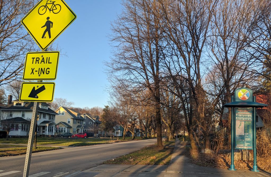
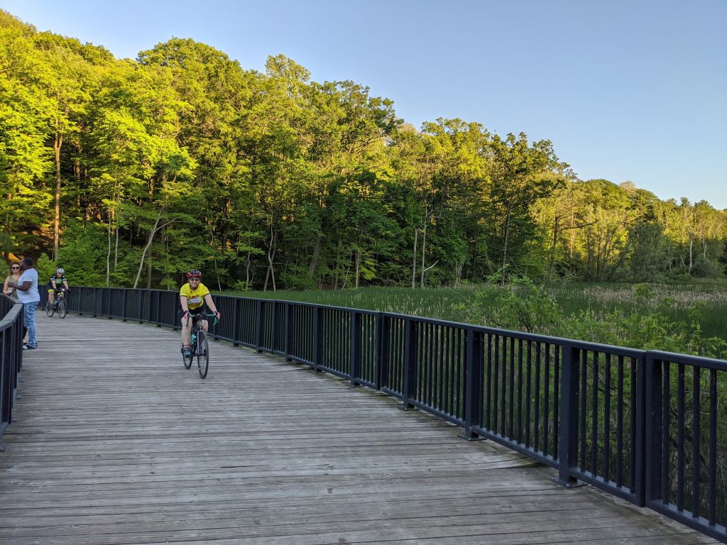
- From the Southwest city environs – come on up St Paul St and then hop on the El Camino Trail that begins at Scrantom St and takes you north all the way up to Navarre Rd and across from the Zoo entrance – you’ll love the old railroad bridge that takes you over 104 without worry
- From the Northeast – Well, when the swing bridge is available it’s easy peasy, but when it’s not you’ll need to approach from the south of the Bay and come around by way of Empire Blvd. Yes, busy with traffic and a very challenging hill to climb – bail out as soon as you can, on Orchard Park Blvd, if you don’t mind a few more hills to climb with a bay view, and then follow Bay Shore Blvd to get you to Ridge Rd and turn right at Kane Dr before it ever gets busy, that will take you right up to Sea Breeze Dr!
- From the Southeast – The only way to get over the 104 expressway is to take Culver Rd but there are plenty of side streets to stay on south of it, and just north you can turn right on Brower Rd and cut through the neighborhood to come out on Ridge at Walnut Park, then quick jog over to Kane Dr to get to Sea Breeze Dr.
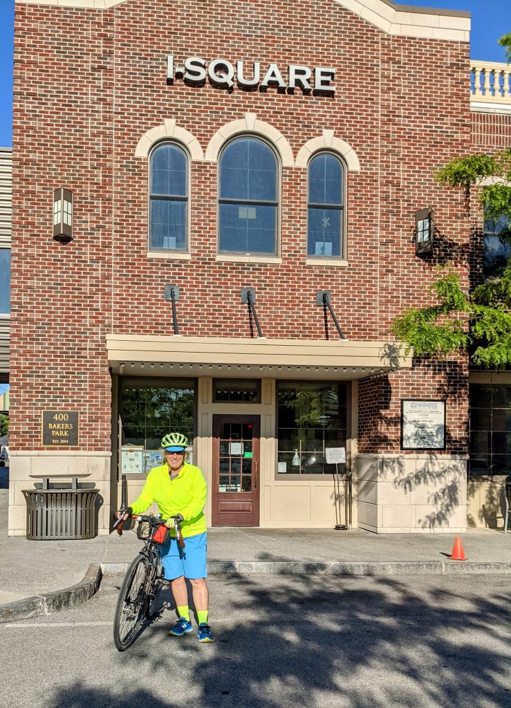
All Roads Lead To/From I-Square!
If you live in Irondequoit, you know our town’s “central square” is now I-Square. It was developed with a vision, to not only improve quality of life for town residents, but also to be a role model for green, environmentally responsible and energy efficient building projects. It’s a destination unto itself with restaurants, rooftop gardens and dining, outdoor amphitheatre, the Imaginarium, Art Gallery and Science Center.
From here, it will take you less than 20 minutes to ride in any direction and find our other local treasures. West to the zoo and the river, north to the lake, east to the bay, and all wonderful tree-lined neighborhood streets along the way. When riding in town, and you must cross busy intersections, it’s safest to pick the crossroads with lights. For example, riding in northern neighborhoods divided by Hudson Ave, you can cross safely at the light using Brookview Dr to Diane Park.
You can find steep hills, nice flats, and occasional rollers. You’ll find most of the steep hills along the shores of Irondequoit Bay. There are serene and quiet neighborhoods tucked away in all corners of town: check out Rock Beach Rd off Lakeshore Blvd in the North, follow Winona off St Paul Blvd, or discover Huntington Hills nestled up against Durand Eastman Park by taking Pine Valley Rd to Wisner, and be sure to take a fun ride down Hoffman Rd behind the Irondequoit Cemetery to the end where it stops at a trail you can take through the Durand Eastman Golf Course. There, you’ll find an old hidden road overgrown with weeds that you can ride from Kings Hwy N, where Horseshoe Rd stops being a maintained road, and you can ride it along the northern edge of the golf course, across the creek, and back up to Lakeshore Blvd.
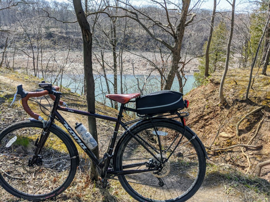
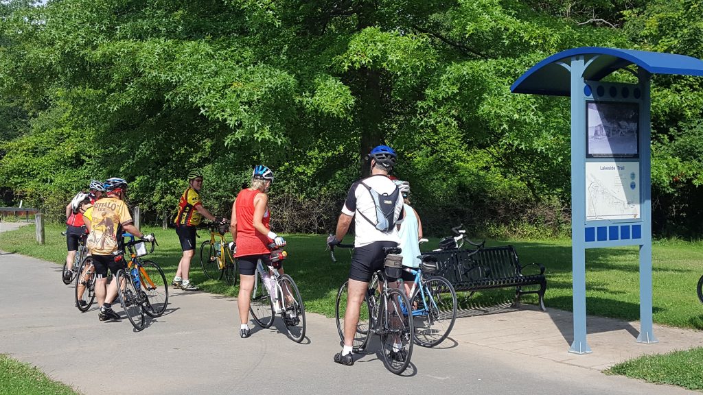
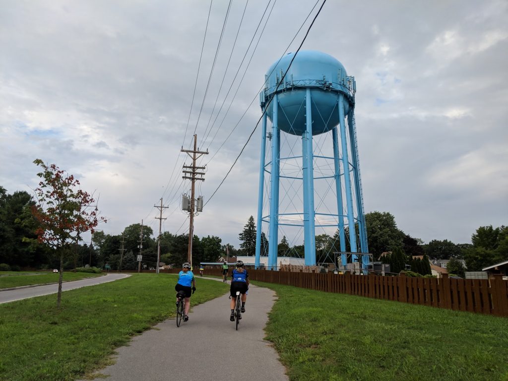
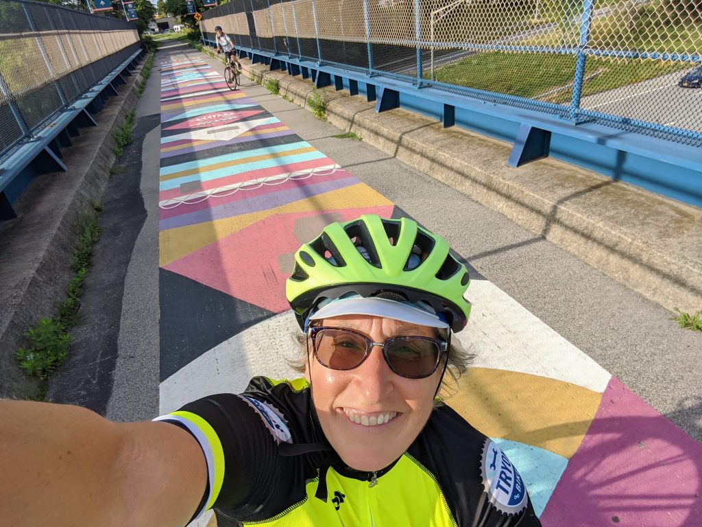
There are off road trails to explore as well. You can follow a dirt/stone trail along the east side of the river from Seneca Park Zoo all the way to the lake, which follows the old Windsor Beach Railroad line started in 1883 that traveled from the city’s Avenue E all the way north to Summerville. You can ride challenging single track trails along the west part of the bay in either Tryon Park or Irondequoit Bay Park West. Don’t forget the nicely paved pathways too! There’s one along the shore of Lake Ontario from the corner of Culver and Sweet Fern (right next to Parkside Diner) and extending to just across from Camp Eastman on the lake shore. The other one is Sea Breeze Dr along the northern section of 590 from Titus down to Culver Rd and Sea Breeze.
Nature/Water/Parks
You may not know this, but Irondequoit, by its very name of Iroquois origin, means “where the land meets the water.” And there’s just nothing like being close to water and natural spaces, is there? The views are beautiful and varied. Some of my personal favorites I’ve already mentioned, and there are smaller parks dotting all the neighborhoods for kids to enjoy too. A completely hidden gem is Densmore Creek Falls, accessible from the back parking lot of the Legacy at Cranberry Landing at the very eastern end of Norton before it crosses over 590 and drops down by the bay.
Food & Drink
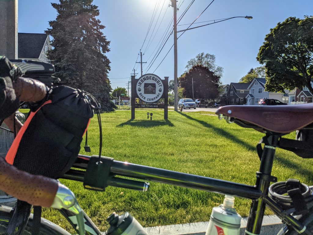
I-Square has plenty of options for food and drink, and beautiful outdoor seating on the roof as well, so if you’re in the neighborhood you can cycle on over and enjoy! Right around I-Square you will also find the Cooper Deli, Titus Tavern and the Irondequoit Beer Company. At the very northern end of Clinton Ave there’s a little-known but exceptionally unique eating experience that awaits you called Atlas Eats, and it’s the best for a weekend breakfast. Another hidden treasure for you ice cream lovers would be Netsins Ice Cream Shop on Culver Parkway.
If you love to ride farther afield, and take a break from your spinning wheels along the way, our waterfront taverns abound. I love to make routes that include these special stops in the neighborhood for that. Summerville has Silk O’Loughlin’s (Olie’s). Sea Breeze has Marge’s Lakeside Inn (sit on the beach!), Bill Gray’s, Shamrock Jack’s Irish Pub, and Union Tavern (it’s haunted!). There’s Murph’s Irondequoit Pub, a neighborhood staple, now down by the O’Rorke bridge, and across the way take Marina Dr down to the end and you’ll find Schooner’s Riverside Pub, an open air only open in the summer fun kind of place.
Family Fun
You could plan a day of cycling with the kids in the small neighborhoods in Sea Breeze, stop by Parkside Diner, play a round of mini-golf next door at Whispering Pines, then head down to the Sea Breeze Pier and Beach. Need I say, Sea Breeze Amusement Park? Or ride the little neighborhoods off St. Paul Blvd. around Winona, and at its southernmost tip, take the sidewalk connecting to Maplehurst Rd, turn right and there’s paved access directly into the Seneca Park Zoo.
Routes You Might Enjoy
Feel free to use these as a starting point to create your own adventure!
I-Square to Aman’s Farm Market – 3.5 miles – see the RWGPS map here.
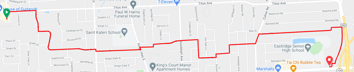
I-Square to Sea Breeze – 5.6 miles – see the RWGPS map here.

I-Square to Seneca Park Zoo – 2.4 miles – see the RWGPS map here.

I-Square to Parkside Diner and Whispering Pines – 5.6 miles – see the RWGPS map here.

I-Square to Stutson Bridge Plaza and Riverside – 3.2 miles – see the RWGPS map here.

Town Tour from I-Square – 15 miles – see the RWGPS map here.

Irondequoit Gravel Growler Beer Ride – 25 miles – see the RWGPS map here.

Pam,
Wonderful article! Hope to see you again soon, perhaps on an RBC ride. I’m leading several this year…
I love to ride all of those areas, and often did when I lived in Summerville from ’86 until we moved to Webster in the late 90’s. That was before I Square but the HOG was a central point of interest then.
I’d like to point out that the vision we need to have is to make the IBOB bikeable 24/7/365.
It sure would improve biking from Webster to Irondeqouit, and Greece. The old Hojack line makes for a great path, unfortunately it is interrupted by the seasonal IBOB at the mouth of Irondequoit Bay.
Solutions to improve that are:
1. Add a new pedestrian bridge at the Irondequoit Bay Outlet.
2. Raise the existing bridge a bit and change the operating schedule.
3. Do both!
Would you be interested in speaking to my neighborhood association about this blog, your recommendations for biking in Irondequoit, and anything else that might help encourage more riders? If so, please let me know. Our meetings are still via zoom, incidentally. Thanks!