Back in May, we launched our Complete Streets Makeover project by asking the general public to help identify the intersections and trouble-spots where you live, work and play that could be redesigned to make them safer for everyone. We received over 90 nominations, and after a careful process to examine each and every submission, we selected the following locations:
- Parsells Ave & Greeley St. – WINNER
- Lake Ave. & Phelps Ave. – FINALIST
- Monroe Ave., Canterbury Rd. & Dartmouth St. – FINALIST
Our winner received the full Complete Streets Makeover treatment, but our finalists didn’t walk away empty-handed. The design team at Stantec produced conceptual drawings of possible street design improvements. The neighborhoods can use these illustrations as a tool to help advocate for changes that would make these streets safer for pedestrians and cyclists.
Potential Revealed in Design Renderings
Read on for illustrations of the proposed designs, along with commentary written in a “designer’s take” style by Michael Damico, Landscape Designer at Stantec.
Traffic calming elements are a variety of options a designer (civil/transportation engineer, landscape architect) can use to implement Complete Streets principles that can serve as placemaking opportunities for communities to enhance public space through inclusive design. These elements alone are not answers to a variety of design challenges presented by automobile traffic, but together can serve as a means to designing safer, comprehensive public space.
As a young landscape designer, I have been exposed less to traditional highway design teachings than civil engineers. In collaboration with and oversight from our Transportation Specialist, Jon Hartley, the design intent for these conceptual solutions were approached from the standpoint of a pedestrian as opposed to the perspective of traditional highway design: automobile circulation.
While these graphics depict potential intersection improvements, these corridors as a whole could benefit from further study and additional traffic calming elements. Please keep in mind that these are only conceptual solutions to a predicament identified by the public.
Lake Ave. & Phelps Ave.
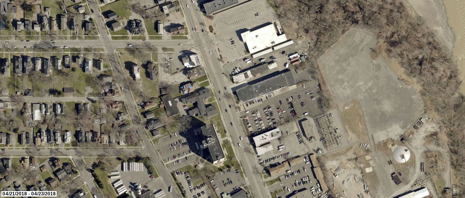
Lake Avenue is a principal arterial that serves as a primary means of getting into and out of the City. It provides for a significant number of automobiles (21,500 Average Daily Trips [ADT]) trips, while simultaneously operating as a heavily used public transportation route. This should come as no surprise as the zoning (Commercial and High-Density Residential) and relative age of the corridor are symbiotic products of such.
Much like the Inner Loop, Lake Avenue generates a demanding obstacle to a significant number of residents living west of the corridor, attempting to access goods and services on the eastern side. Concurrently serving as a core bus route, the corridor is a five lane escapade (replete with center turn lane) that widens to six at some intersections – including Phelps Avenue.
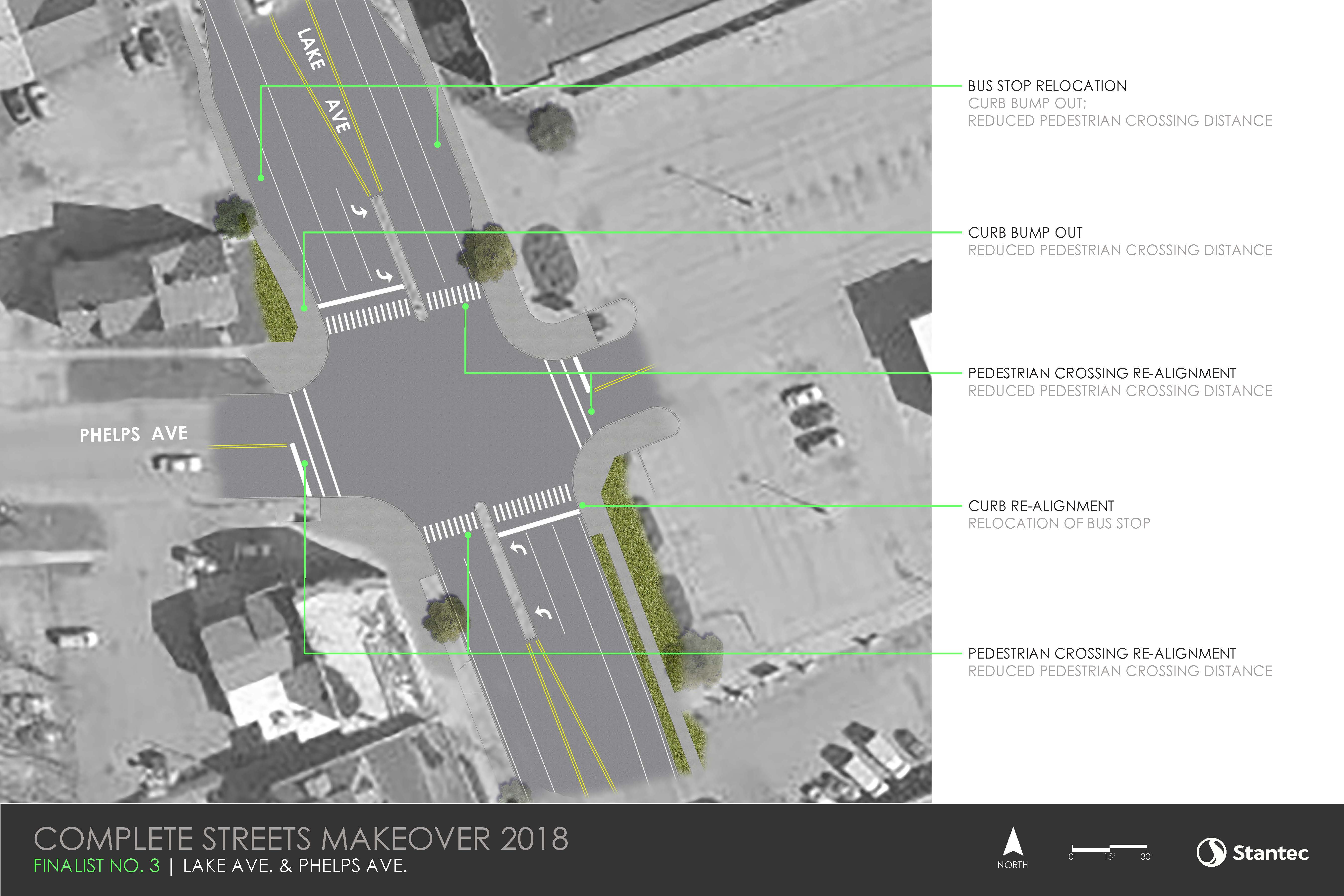
The proposed plan depicts the relocation of bus stops away from the intersection. This (unfortunately only) assures a maximum three-lane pedestrian crossing distance across Lake Avenue to reach the center (reprieve) island. Minimizing intersection curb radii and realigning pedestrian crossing markings to be more perpendicular to traffic lanes will also help to minimize that pedestrian crossing distance. This would help to provide safer crossing for the large number of residents attempting to patronize Aldi and obtain basic grocery needs.
Monroe Ave., Canterbury Rd. & Dartmouth St.
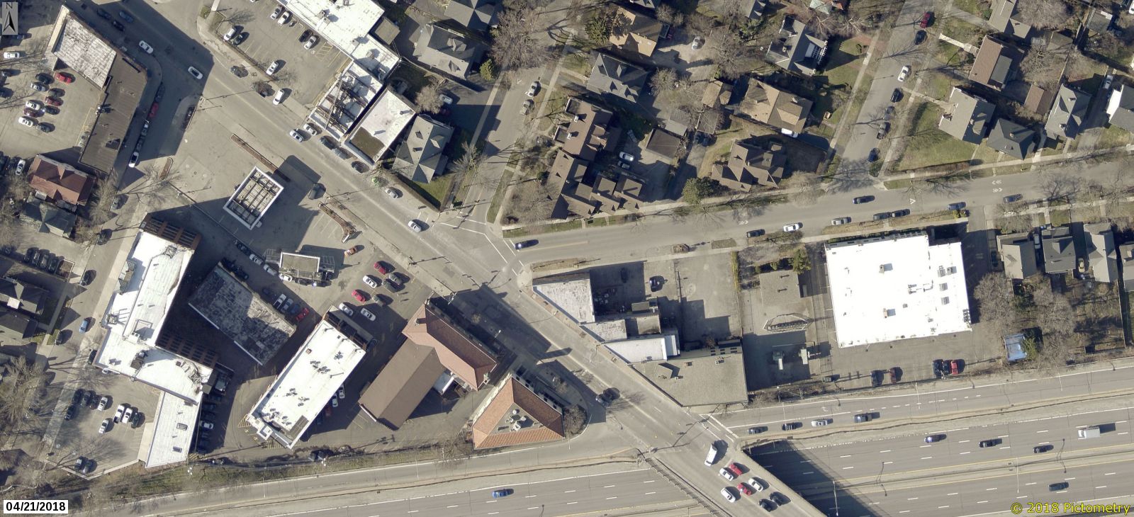
Monroe Avenue – one of Rochester’s finest examples of an eclectic, multi-use, multi-mode corridor – receives just as much daily automobile volume (22,200 ADT) as Lake Avenue through this area. Zoned Community Center, the corridor provides diverse commercial development along with a dense mixture of uses and other complementary uses that serve the adjacent neighborhood.
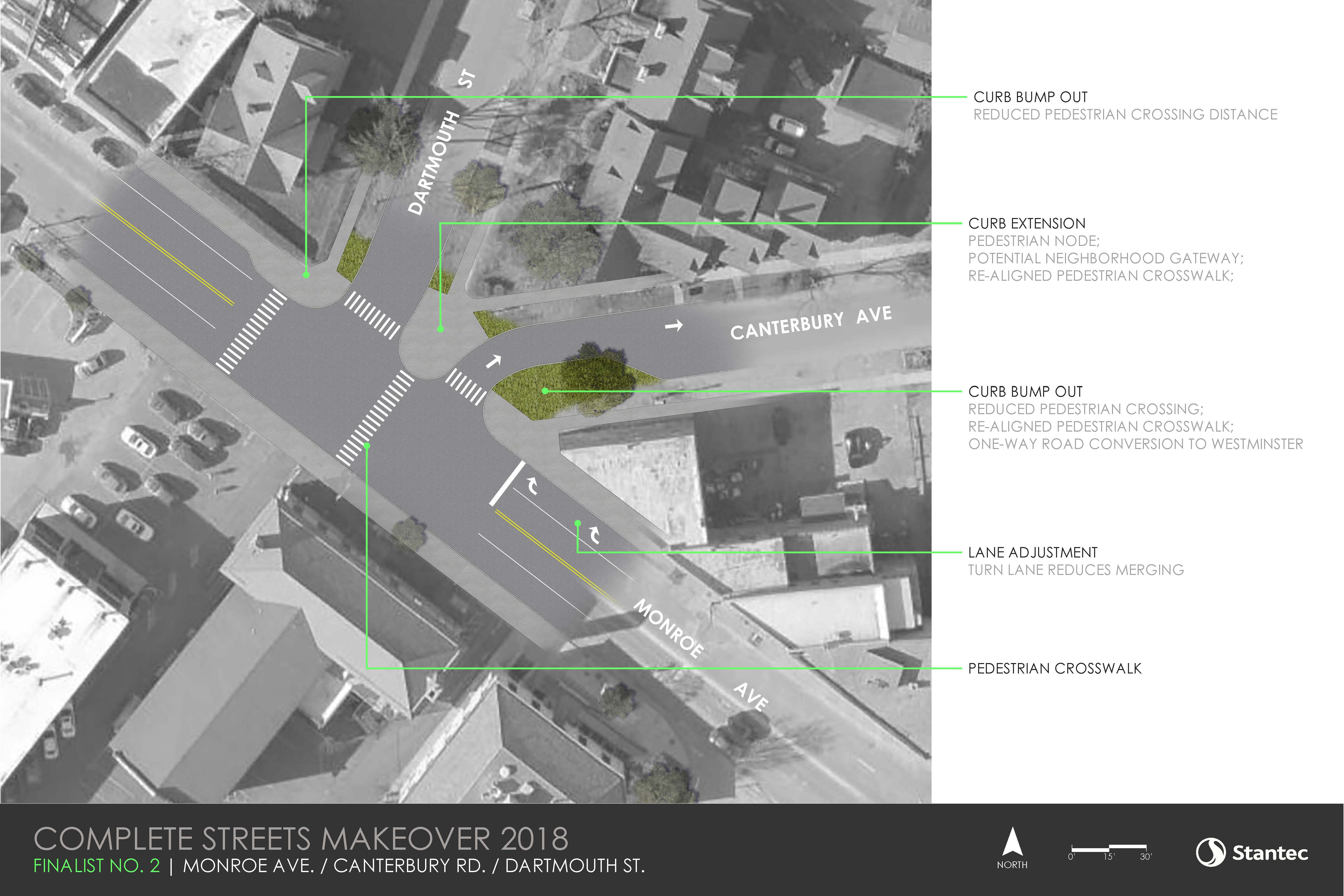
The intent with the proposed plan is straightforward: simplify the already confusing intersection and prioritize the pedestrian by connecting the neighborhood to existing public/private amenities. This can be accomplished primarily through curb realignments.
The plan would call for the potential one-way conversion of Canterbury (heading NE) to Westminster, creating a perpendicular intersection to Monroe, and ‘removing’ it from the existing atypical intersection. In doing such, the pedestrian crossing distances for Dartmouth and Canterbury are significantly decreased, allowing for the removal of the Canterbury traffic signal that currently adds additional sequence timing, affecting automobile traffic on Monroe.
A turn-only lane would be demarcated in the northbound Monroe lane to minimize automobiles from merging in the intersection. Most importantly, the reclaimed space between Canterbury and Dartmouth could be utilized as a neighborhood gateway, offering the residential neighborhood safer, more direct access to the library and YMCA.
________
Stay tuned for Part 3 of this 3-part Complete Streets Blog Series next week! Guest author David Riley will highlight a sampling of other intersections and trouble spots that were nominated for the Complete Streets Makeover project, and share his ideas for making them safer.