Guest blog by Nate August (Data Scientist & Graduate, University of Rochester) and Doug Kelley (Associate Professor of Mechanical Engineering, University of Rochester)
The year 2022 could be a watershed for active transportation in the Rochester region. The City of Rochester is writing a new Active Transportation Plan to update and extend its existing Bicycle Master Plan (completed in 2011). Meanwhile, Monroe County is writing its first-ever Countywide Active Transportation Plan. Both documents will lay out a vision and set priorities to guide transportation policy for years or decades. Their recommendations will literally be made concrete in communities’ sidewalks, bike paths, bus stops, and roads. Smart planning can improve equity and sustainability in everybody’s transportation – and can be empowered by data-driven insights.
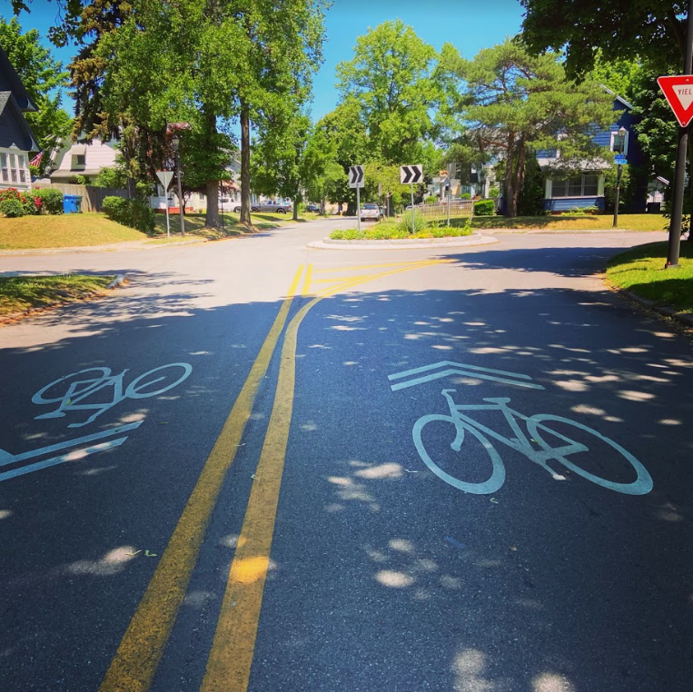
This spring, our team of graduate students and faculty at the University of Rochester’s Goergen Institute for Data Science, in partnership with the City of Rochester, set out to make data-driven recommendations for one key enabler of active transportation, the City’s bike infrastructure. We drew on a recent scientific study of bike networks in 62 other cities around the world, coauthored by researchers at the University of Rochester and the IT University of Copenhagen. We selected 86 points of interest around the City and calculated many thousands of routes among them, each along existing bikeways and streets, then located the street segments that currently lack bike infrastructure but frequently are part of the calculated routes. Those are places where new infrastructure would carry the most bike traffic and could most quickly improve users’ experiences of Rochester’s bike network. Here are the ten segments most important for bike transportation in Rochester, according to our analysis:
-
- Monroe Avenue between Culver Road and Howell Street
- Elmwood Avenue between Mount Hope Avenue and S. Goodman Street
- Driving Park Avenue between La Grange Avenue and Saint Paul Street
- Joseph Avenue between Cumberland Avenue and Norton Street
- A connection between North Street and Central Park, either Davis and Scio Streets or Portland Avenue
- State Street between Andrews Street and Smith Street
- Smith Street between Lake Avenue and Saint Paul Street
- South Clinton Avenue between Gregory Street and East Broad Street
- Stone Street between East Broad Street and East Main Street
- Saint Paul Street between East Main Street and Andrews Street
Our data-driven recommendations agree well with intuition and ongoing community conversation. Many of these street segments are also among the ten most obvious gaps in Rochester’s bike network, according to Reconnect Rochester’s Mind the Gap campaign. Many were recommended for upgraded bike infrastructure in the Rochester 2034 blueprint for growth and development, adopted by City Council in 2019. When different people using different methods tackle the same problem and find similar solutions, it’s a good sign that those could be the right solutions for the community – great minds think alike!
To learn more about the results and analysis that led to our recommendations, check out the interactive map below. It shows the data-driven recommendations along with existing bike infrastructure and the points of interest. You can pan, zoom, and toggle the layers. Altogether, these new segments span just eight miles (13 km) – short enough to be built rapidly and at low cost. As the map shows, they would link disjointed parts of Rochester’s existing bike network and connect it to more neighborhoods, bringing transportation equity to more residents.
Once these ten key segments have bike-friendly infrastructure, further construction would bring further improvements, and we used the same sort of analysis to ask what should come next. The animation below shows what the Rochester bike network could look like as infrastructure is added in 12-mile increments up to 60 miles. According to our analysis, communities are best served by prioritizing dense connections in the City center along with selected arterial connections to outlying areas.
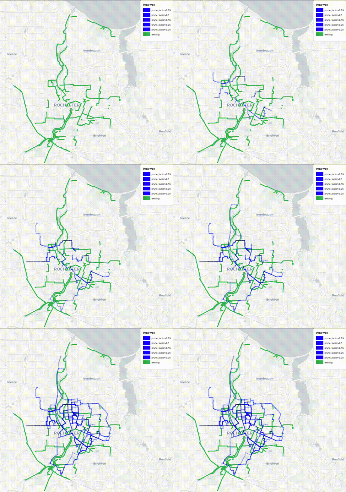
There’s more good news when we rate the impacts of these recommendations in terms of directness. If you’re biking from, say, the Public Market to the downtown library, the directness of your route is the ratio of the actual distance you pedal to the distance as the crow flies. A more direct route is quicker and more efficient. By averaging over all the routes among all the points of interest, the directness of a whole bike network can be calculated. The scientific study found, surprisingly, that building new infrastructure during the early part of a bike network’s development can actually make directness worse because new neighborhoods are at first connected only by tortuous routes. But the good news for Rochester is that our strong foundation of roughly 75 miles of existing protected bikeways, bike boulevards and bike paths allows us to achieve steadily increasing directness. Here, bike routes will tend to get straighter and more direct with each new infrastructure project, as long as projects are chosen sensibly.
Our analysis is all about connecting points of interest, so the results depend strongly on how those points are chosen. We started with the City of Rochester Commercial Corridor Business Data, published as part of the 2034 Plan, which tabulates 1800 locations. By looking for clusters of nearby places, we reduced that long list to 86 points of interest, which constitute parks, museums, convenience stores, schools, and other businesses. We checked to be sure that the points didn’t unfairly favor any of the City’s four quadrants or areas with higher median income. In fact, we repeated our analysis with different points of interest, chosen with a preference for serving underprivileged neighborhoods and combined the results for our final recommendations. We’ve worked hard to make recommendations that promote equity and serve all residents.
Of course, recommendations alone aren’t enough. Concrete improvements to Rochester’s bike network will require, well, concrete – as well as public will. You can help make these recommendations reality. Use this interactive map to mark assets, opportunities, and concerns that should be considered in the Countywide Active Transportation Plan. Respond to the community survey for Rochester’s Active Transportation Plan. Encourage your community leaders to prioritize bike and pedestrian infrastructure, especially when they think about big projects like ROC the Riverway and the Inner Loop North Transformation.
You can also dig deeper into our analysis by reading the full report or adapt our tools and methods to other communities by downloading our analysis code. A similar study of Monroe County would be invaluable and would be easier now that we’ve added much of Rochester’s bike infrastructure to OpenStreetMap.
With more data and analytical processing power available now than humankind has ever before known, our society is in a position to devise and execute truly excellent plans for active transportation networks. Let’s make the most of the opportunity.


This is a great article you have here, very informative indeed. Thank you for sharing!
Thank you for the great work. There is a gaping gap in the last map after all the blue is filled in. there should be a North -South bike path somewhere paralleling the 590/Culver Rd to close the loop!
I would love to see the bike trail on Union street expand further north to connect to the Public Market and expand further East to Culver & University or even Winton & University to give access to all the points of interest along the way including Wegmans.