Car Lite Rochester is a blog series that highlights the stories of Rochesterians living a car-lite lifestyle. The term “car lite” encompasses a variety of multimodal transportation lifestyles, featuring little dependence (but not NO dependence) on a car. It typically looks like sharing one car within a household or only using a car when absolutely necessary.
So, we hope you’ll continue to follow along. Maybe you will be inspired to join our bloggers in living a car-lite lifestyle!
Wanna rep it? Check out our newest t-shirt in our online shop.

Car Lite Rochester: Family Style
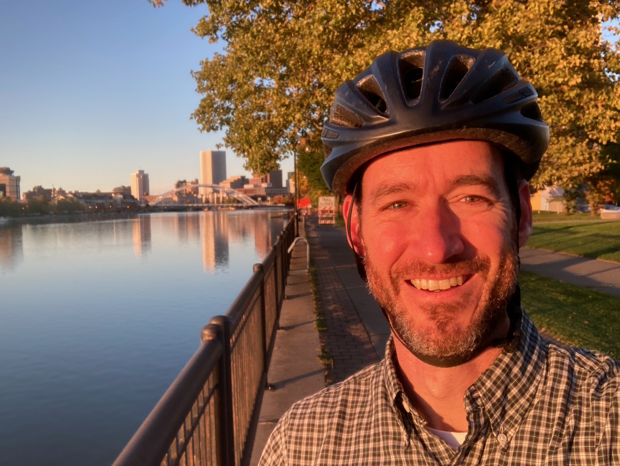
By: Doug Kelley
It was early 2015 when my transportation lifestyle hit rock-bottom. Rochester’s winter had been especially cold and snowy that year. I was still bitter over the cancellation of the RTS route that had shuttled me, all through the prior winter, directly from my own block to my job at the University of Rochester (anybody else have fond memories of the 52 line?). With my children in elementary school and my wife and I both working new jobs, busy-ness and frustration led me to break my routine by buying a parking pass and commuting in a car all winter. It seemed logical enough, especially since my wife and I happened to own two cars for the first time since our daughters had been babies.
But by March, it was clear that car commuting had been a terrible blunder. I found myself much more grumpy, fussing over traffic and parking and gas prices. I was out of shape and feeling lethargic. Canceling the built-in exercise of walking to the bus or biking to the office, and eliminating the routine that gave me quiet outdoor moments for reflection twice a day, had made me miserable — both physically and emotionally. The writing was on the wall: I crave exercise and the joys of active transportation more than I hate the cold. I swore I’d never buy another winter parking pass, and I never have. We soon got rid of that second car.
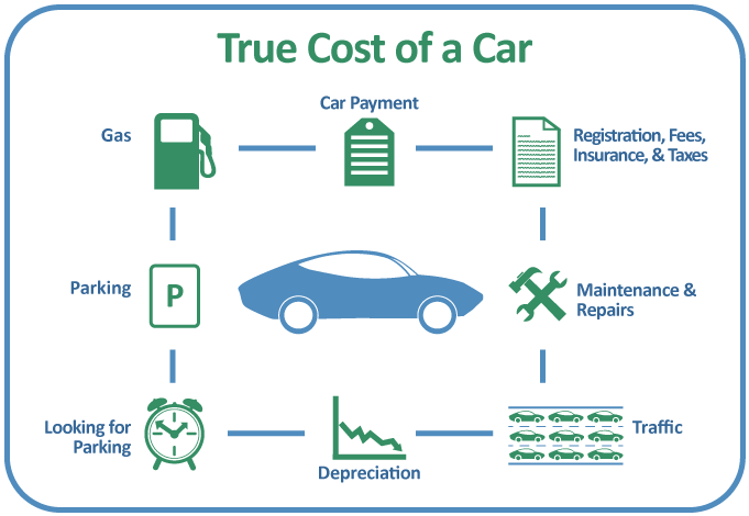
Once we did, the benefits piled up. For starters, living a car-lite lifestyle can be a big financial help for a young family. Driving less meant we spent less on gas, of course — and today’s high gas prices would increase the impact. Dropping my parking pass saved us a few hundred bucks a year. (Shout out to the University’s free Occasional Parking Program!) But the real financial payoff came with getting rid of that car altogether: no car payments, no insurance, no oil changes, no brake jobs or belt jobs or worries about what would break next. Our car-lite lifestyle continues to save us thousands of dollars each year.
Other benefits are less tangible, but for a family, maybe more important. Exercise is one of the best things anybody can do for physical and mental health, so building exercise into daily transportation routines is great for parents and kids alike. Biking and walking make my family and me happier, more focused at school and work, and ready to enjoy time together more fully. Burning less fossil fuel and emitting less carbon make my wife and me feel better about our climate impacts, not only for our own sake but also for our two teenage daughters. After all, they will live through more repercussions of climate change than us, and going car-lite now will empower them to be more adaptable and less dependent on fossil fuels. Meanwhile, strolling and rolling around the neighborhood weaves all of us more tightly into our community. The kids bump into classmates; my wife and I see friends and neighbors.
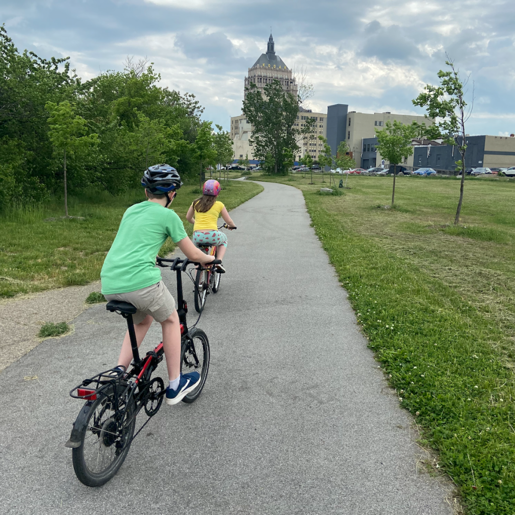
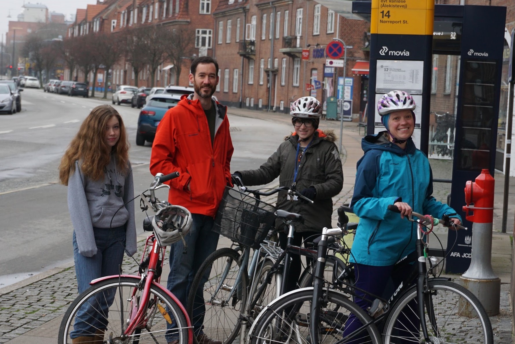
Maybe the best perk for families who go car-lite is one we hadn’t anticipated back in 2015: it has made parenting easier for us. Teaching our kids to walk to elementary school saved us countless hours idling in carpool traffic jams. More importantly, living car-lite lets children gain freedom and learn responsibility in baby steps, as appropriate for their age. In second grade, our girls were big enough to walk by themselves to the playground across the street. In third grade, they could walk to a friend’s house down the block, or another around the corner. Soon, they could bike to see more friends or walk to music lessons. By the time our daughters reached middle school, we found ourselves living a year in Copenhagen. There, great public transportation, world-beating bike infrastructure, and negligible crime rates meant the girls could go nearly anywhere in the city without setting foot in a car. We didn’t own one there anyway. Back in Rochester, though the infrastructure doesn’t match Copenhagen’s, our daughters have the skills and confidence to go many of the places they need, walking to school and work, biking to the pet store and thrift stores. Restricting their childhood transportation to cars alone would have robbed them of the chance to gain agency and independence, steadily and surely, through all those years. Our older daughter will get her driver’s license this fall, and I shudder to think what would have happened if she’d been handed car keys and set loose to drive two tons of high-speed steel without first having learned how to find her way around the world, independently, on foot and on bikes and on buses and trains.
Though living car-free in Copenhagen was a breeze, our family has never lived car-free in Rochester. Looking ahead to a time when all four of us will have driver’s licenses, we’re transitioning now from owning just one car to owning two — but certainly not four! The car-lite lifestyle is a pleasure we will continue.
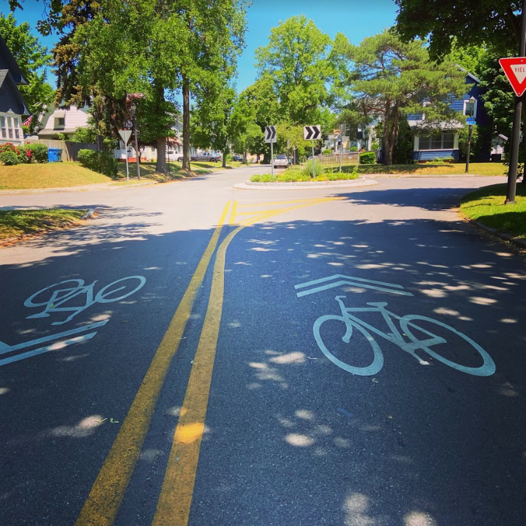
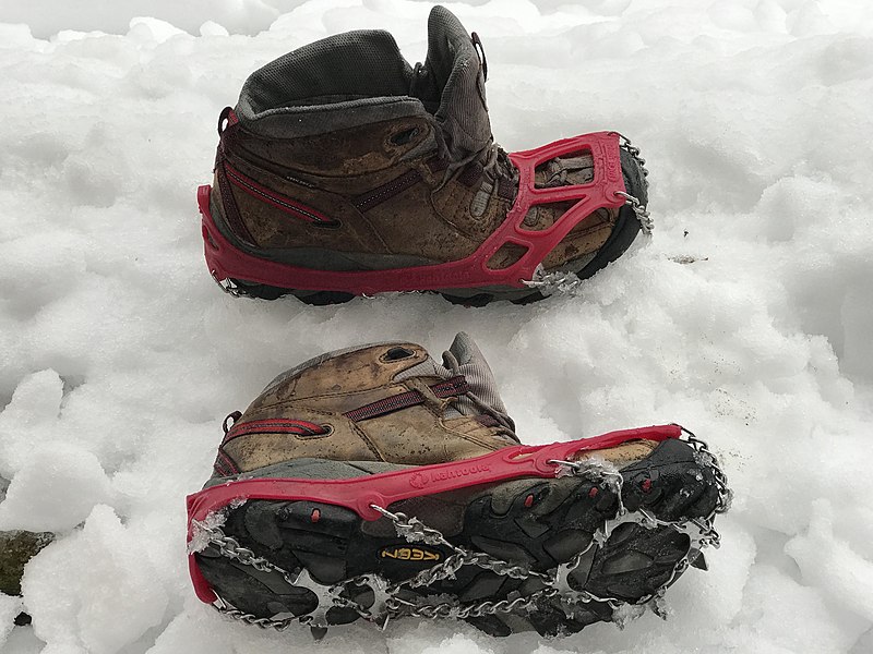
Our chosen lifestyle is made more enjoyable by a few practicalities we’ve figured out along the way. First, we chose to live in a neighborhood with ubiquitous sidewalks and good bike routes to many places, especially our most common destinations, including my workplace, the kids’ schools, grocery stores, gyms, a bank, a pharmacy, a bakery, and a library. If you live near good routes to work and everyday destinations, by bike or bus or walk, transitioning to a car-lite lifestyle could be almost seamless. If you are among the millions working from home nowadays, going car-lite is even easier. If not, and if you’d like to commute by biking or walking, ask whether your employer has a shower. (Pro tip: U of R has many at the medical center, many at the gym, and at least two others on River Campus.) By providing a little extra power, an e-bike can be a key enabler of a pleasurable car-lite lifestyle, especially if you have health or mobility limitations, your commute is a little longer, or you frequently find yourself hauling young children and groceries. Cargo bikes and trailers are wonderful for families, not to mention backpacks and panniers. When children are old enough to pedal themselves but not yet old enough to navigate to school independently, a great solution is a bike train, in which just one or two parents bike along with a group of neighborhood classmates. Carpools are another great way to go car-lite, whether to school or to work. You can find great routes using RTS’s Transit app or browsing Rochester’s Bike Boulevards. When winter weather makes roads and sidewalks slick, you can pull on some microspikes on your way to the nearest bus.
Finally, you can help make a car-lite lifestyle more possible and more pleasurable for your own family and for everybody else by communicating its importance to public officials. A great way to start is by giving input for the City of Rochester’s new Active Transportation Plan and for Monroe County’s new Countywide Active Transportation Plan.