3 Comments

Copenhagen transportation: A day in one family’s life

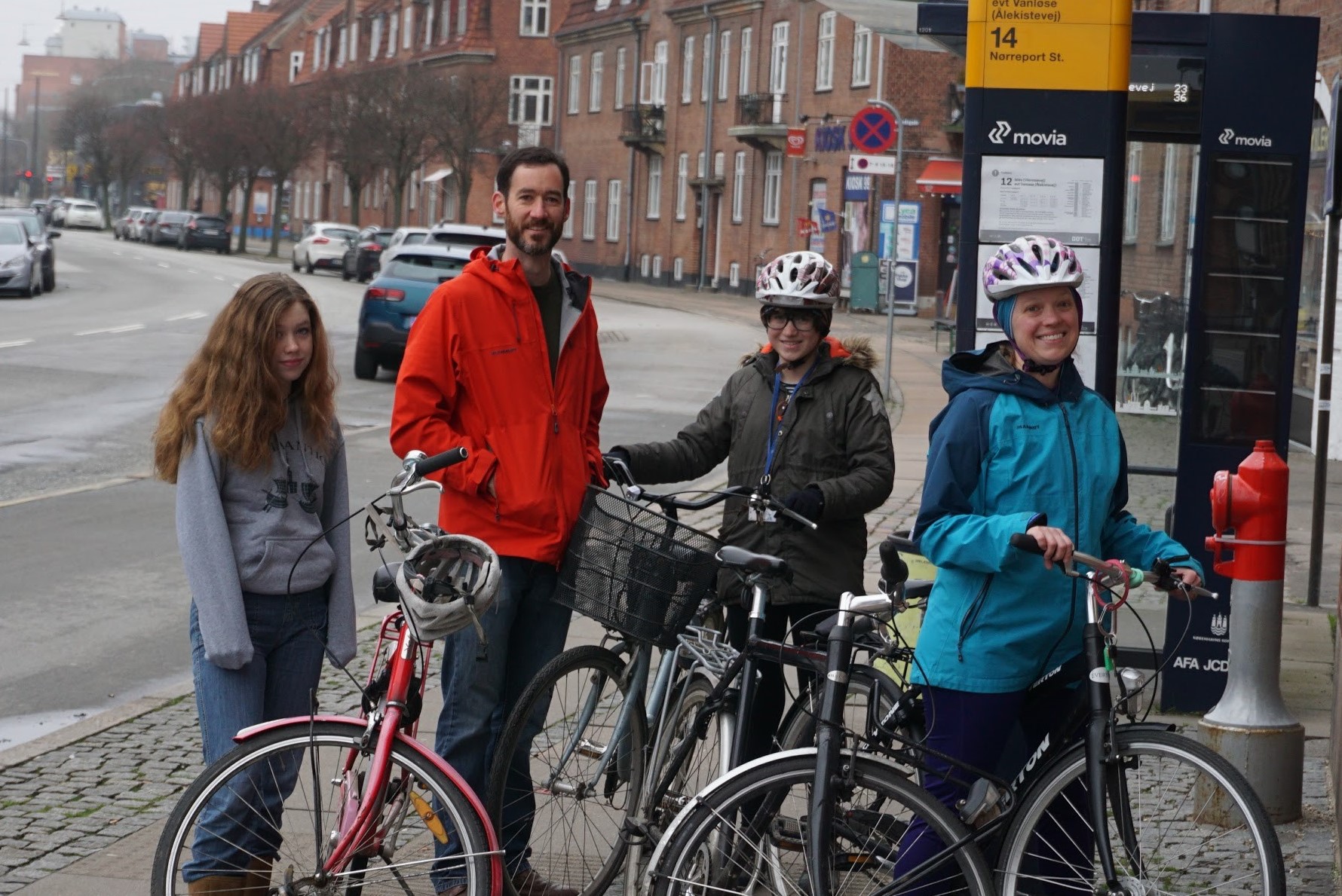
Guest blog by Doug Kelley.

A family in Copenhagen–mine.

Copenhagen is famous for having the world’s best bike infrastructure and highest rates of bike transportation. (OK Amsterdam, you’re not bad, either.) Transit nerds love to extol the engineering details, celebrate the signage, and explain the traffic patterns in excruciating detail. While I admit getting excited by those nerd-outs — I’m an engineering professor and a lifelong cyclist, after all — the real point is the beautiful lifestyle enabled when communities “Copenhagenize.” So here’s a snapshot, one typical day of the lifestyle, as lived by my family and me during our sabbatical year away from Rochester.

The bike lane on busy Lyngbyvej is wide and separated from motor traffic. At rush hour, all the lanes fill, but cycling is safe and pleasant anyway.

After a Danish breakfast of pastries, yogurt, and coffee, I hop on my bike for the morning commute. Neighborhood roads bring me to Lyngbyvej (pronounced “loong boo vye”), busy at rush hour with more car traffic than almost any road in central Copenhagen. Still, it’s a pleasant place to cycle, because its wide bike lanes are separated from the cars by curbs, and because automotive traffic is held to reasonable speeds by stoplight timing and posted limits. At rush hour, Copenhagen’s roads carry more bikes than cars, so I feel like part of the crowd. Some cyclists ride slower, and some ride faster, passing on the left, often after ringing their bells to avoid surprises. (Impatient commuters sometimes ring excessively.) As I head south, motorists turning right wait at the intersection for a gap in the long line of cyclists passing in their own lane.

From experience I know that the stoplight at Tagensvej (pronounced “tah gens vye”) is slow, so seeing its pedestrian signal turn green up ahead, I pedal harder. A green bike signal comes next, then a green signal for motorists. I sail through as the bike signal turns yellow. Arriving at work in under 10 minutes after a 1.5-mile ride, I’m invigorated and just starting to warm up. Bike parking is ample, with spots in the open by the nearby entrance, covered spots further away, and beyond them, an underground bike-only parking deck for bad weather and expensive bikes. Most folks ride commuter bikes, akin to what Americans might call hybrids, neither flashy nor expensive, just practical. I pull into a covered spot.

Cyclists and pedestrians in Copenhagen can be confident that their safe routes won’t dead-end, even when construction in booming Nordhavn gets in the way.

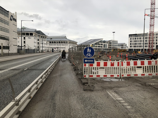
Meanwhile my younger daughter, age 12, sets out for school, also biking. She soon turns left from Lyngbyvej, using the usual jug-handle method: ride across the intersecting street, stop until the signals change, then ride left across Lyngbyvej and on toward school. That keeps her in the bike lanes all the time, so she doesn’t have to change lanes and cut across motor traffic. Like the Danes, she gives a hand signal beforehand. A few blocks later, road signs direct her through a slight detour. Construction is blocking the usual bike lane, so the motor-vehicle lanes have been narrowed to make room for bikes and pedestrians, protected by a steel barrier. Construction is no excuse to block important bike and pedestrian thoroughfares.

Copenahgen may have the world’s highest rates of bike transportation, but it doesn’t have the world’s best weather. Today it’s drizzling, so my daughter is wearing a shell jacket, boots, and her new waterproof pants. Danes like to say there is no bad weather, only bad clothing. Sure enough, rain hardly changes the number of cyclists on the road, and today the nearby cyclists wear clothing varying from Gore-Tex to full-body ponchos to soggy blue jeans. Most of their bikes have fenders, and lights are required by law–winter nights in Denmark are long.

My daughters turn left here on their way to school. Cars, bikes, and pedestrians all have separate lanes and separate traffic signals. Cyclists can lean on the railing above the curb, and the timer (circle of white lights) tells when their signal will change. Also: Danes dress well, regardless of whether they are pedaling!

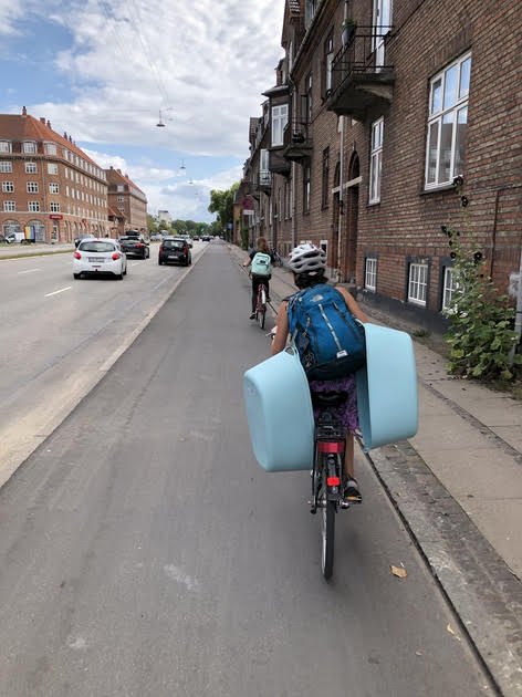
Having stuff to carry doesn’t keep people from cycling, either. I take my laptop and lunch to work in waterproof saddle bags. My daughter carries a backpack, like many of the riders around her. Nearly all their bikes have racks on the back, often bearing loads held with bungee cords. Mail, football equipment, take-out, Ikea furniture, and all manner of things get carted around on sturdy flatbed cargo bikes, sometimes with electrical assistance to make pedaling easier. Danish parents commonly carry their kids to school in cargo bikes with boxed compartments on the front. Older kids sit on tag-along bikes attached to mom’s or dad’s. Most have learned to ride solo by age 3 or 4, and are getting to school on their own bikes by age 6 or 7.

My older daughter, age 13, isn’t a morning person and leaves later, finishing her 2.2-mile commute and parking her bike just in time for class. After school, the clouds persist but the rain has quit, so she decides to bike with classmates to Stroget, one of the largest pedestrian-only market streets in Europe, to window-shop and buy some candy to share. As her dinnertime curfew approaches, she considers the headwinds and decides not to bike all the way home, instead catching the S-train, which allows bikes anytime. Metro trains also allow bikes, though not at rush hour, and only with an extra ticket. But she might be tempted to take the Metro anyway once the new Orientkaj stop opens–it’s next-door to her school.

The nearby Vibenshus Runddel metro station, which my daughters and I pass on our morning commutes.

While the rest of us are away, my wife shops for some hygge (cozy) furnishings at the neighborhood secondhand shop, then picks up groceries for dinner, including fresh-baked bread. She could bike both places, but decides to walk for exercise, and anyway the grocery store is only three blocks from our apartment. After working at home awhile, she rides the S-train to Klampenborg to jog in the woods. In summer, she might instead bike to the Nordhavn harbor for a swim, or cycle 25 miles to Helsingør, then ride the train home. Neither she nor I need to plan our day around driving our kids from place to place, since they can capably bike and navigate public transportation on their own.

Home together at the end of the day, the four of us light candles, start a fire in the wood stove, and sit down to dinner. My younger daughter is ravenous after biking home from football (pronounced “soccer”) practice. My older daughter is proud that her new fitness tracker logged 14,000 steps since the morning. We have lived another day of our full and busy lives, traveling to work and school and many other places without driving a car or wishing for one. Our daily travels have required nearly no fossil fuel and put nearly no carbon into the atmosphere. Outdoor exercise lifts our moods and keeps us fit. Alternative transportation gives the kids freedom to move about independently, making extra time for us parents. And in the summertime, when the days are long and the skies are clear, Copenhagen transportation is even more lovely.

Stroget, the pedestrian street where my older daughter goes with her friends. Cargo bikes like the one parked here can carry a couple of small kids or a lot of groceries.

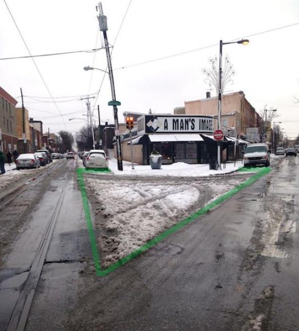
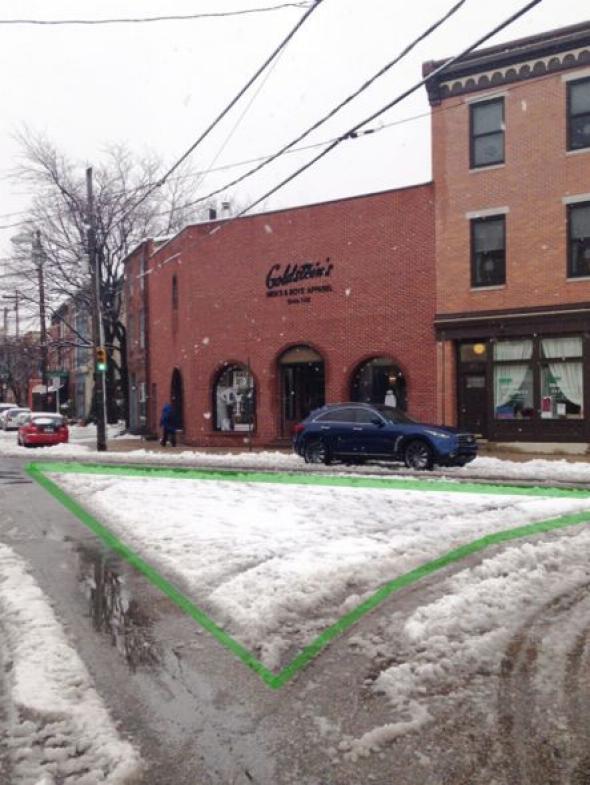
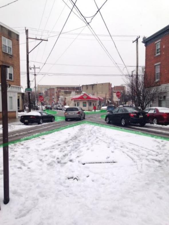
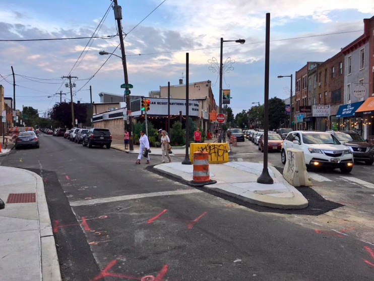
Crucially, you don’t have to live in Copenhagen to enjoy this lifestyle. Ride RTS. Rent a Pace bike. Stroll to your neighborhood cafe. Bike to work and to the Public Market. Though Rochester’s bike infrastructure doesn’t match Copenhagen — nobody’s does — you can bike to many destinations without using big, ugly roads clogged with motorists. Pedal on the Canal Path, on the River Trail, on the cycle tracks along Union Street or Elmwood Avenue, on the network of Bike Boulevards, or simply on quiet streets that parallel the big thoroughfares. Teach your kids to bike, show them safe and effective routes, let them walk, and teach them to use public transportation. Tell community leaders about the importance of building alternative transportation infrastructure. And support organizations like Reconnect Rochester that are enlarging this lifestyle in Rochester. 

No Comments

The Power of the Sneckdown

Story By Arian Horbovetz.  Arian is a Rochester resident and creator of The Urban Phoenix, a blog that discusses urban and community design and topics as our cities transition to a better future.

As I write this, the city of Rochester is passively preparing for yet another battle with a dreaded but familiar foe, lake effect snow.  Winter boots and labored commutes will surely be the icebreaker (pun intended) conversation starters at the office water cooler today. But for the Urban Planner, as well as the casual observer, periods of light snow can be opportunities for great discovery.

In that time when the first whispers of a snow storm cover our streets and the plows are still dormant in their stalls, we navigate our vehicles on roadways by following the tracks left behind by the cars that recently came before us.  To an Urban Planner, these tracks, especially with regard to their path through intersections, are of particular importance.

The ability to see the space that cars use (or rather don’t use) when traveling through an intersection by looking at these tracks through the snow gives us a golden opportunity to demonstrate how and where our streets can be narrowed.  Think of it like an Urban Planner’s forensic blacklight, revealing the key unseen evidence of superfluous roadway.

These visual clues created by snow and tire tracks through our intersections are called Sneckdowns.  While the name might conjure the image of a Dr. Seuss character, it is actually derived from the combination of “snow” and “neckdown,” which is a term for sidewalk additives and extensions that reduce traffic speeds and increase pedestrian access.

Photo of Philadelphia Sneckdown

Photo courtesy of Jon Geeting

Photo of Philadelphia Sneckdown

Photo courtesy of Jon Geeting

In 2014, urbanist Jon Geeting authored a Slate article in which he took simple photos of sneckdowns on Philadelphia streets.  His efforts inspired walkability advocates around the world to do the same, but best of all, it led to real change in his own backyard.  

Before Picture. Photo courtesy of Jon Geeting

Jon Geeting’s Sneckdown photo of this intersection paved the way for this concrete island which acts as a traffic calming measure and a pedestrian island for safer crossing. Photo courtesy of Jon Geeting

Clarence Eckerson’s famous STREETFILMS video shows some incredible examples of how overbuilt our streets really are.  With a measuring device and some cold weather grit, Eckerson puts the power of sneckdowns right in front of the viewer, showing how snowbanks that accumulate on city streets can give us a clearer understanding of how to construct and reconstruct our streets going forward.

Why all this fuss about narrowing streets and slowing traffic?  Because decreasing automobile speeds by narrowing lanes and intersections, as well as prioritizing pedestrians, lead to safer, healthier communities.  Furthermore, promoting walkability and pedestrian comfort has been shown to feed economic growth and stability.  

Sneckdowns also give the average citizen the ability to see where change can be enacted.  It doesn’t take a traffic engineer to spot tracks in the snow, it takes a conscious observer who is genuinely concerned about safety and walkability in their environments.  

Hey Rochester!  Next time it snows, take to the streets and see if you can spot overbuilt space on our roads and intersections.  It can be a fun, interesting and positive way to start the conversation about safer streets in your neighborhood, and may even lead to the change we want to see!

8 Comments

Parking vs. Local Independent Business: Zoning Board Meeting Tomorrow

John Ebel, Marc Lebeau, and Brandon Rizzo want to open small coffee shop in Rochester. But parking rules may prevent that from happening.
Three local entrepreneurs want to open small coffee shop in Rochester. But parking rules may prevent that from happening. John Ebel, Marc Lebeau (co-owners of Smokestack Cowork) and Brandon Rizzo plan to open Pour Coffee Parlor external link at 23 Somerton Street external link in the Park Ave / East Ave area, but the City of Rochester contends that there is not enough parking at the location for the City to grant proper zoning to open. The location has 4 parking spots, and the partners have leased 6 more spots from a neighboring business to reach the quota, but that may not be enough…

Read more

2 Comments

Urban Planning and Design; Two Exciting Events

Peter J. Park, Director of Planning, Denver

On January 31, Rochester Regional Community Design Center will present 'Transformation: Don't be Afraid of It,' a talk by Peter Park, planning director for Denver.On Tuesday, January 31, the Rochester Regional Community Design Center external link will present “Transformation: Don’t be Afraid of It,” a talk by Peter Park, planning director for Denver. Peter Park will take us through a genesis of the transformative process in Milwaukee, Wisconsin during the 1990’s where he was a key player in planning and implementing the creation of the River Walk, a downtown revitalization project , for more than a decade.

Read more

1 Comment

Rochester’s Inner Loop Offers a New Shot at Traditional Neighborhood Development

Posted by: Bob Williams

Removing this enormous physical divide from our city's landscape will open up a world of possibilities for the reclaimed land, and the neighborhoods on either side of the rift. A blank canvas if you will. Before we put pencil to paper, let's go over some of the rules for good neighborhood design.Imagine a Rochester without an noose-like expressway dividing downtown-adjacent neighborhoods on the north and east sides. An obstacle to true connectivity for over 50 years, imagine the loop and its ramps filled in to grade instantaneously at the snap of your fingers. Naturally the next question arrives in our minds immediately, ‘How will we utilize this reclaimed real estate?’

Consider the example of Alexandria, Virginia. Originally platted in 1749. Six fundamental tenets of Traditional Neighborhood Development (TND) differentiate this inviting river city from generic drivable suburbanism.If the goals are to reconnect severed neighborhood conduits, promote commerce, reduce car dependence, ensure ease of navigation, and foster a dynamic and vibrant streetscape, the answer lies not in a grandiose vision of the future, but more likely in our historic roots.

Consider the example of Alexandria, Virginiaexternal link. Originally platted in 1749 on land donated by Philip and John Alexander, six fundamental tenets of Traditional Neighborhood Development (TND) differentiate this inviting river city from generic drivable suburbanism…

Read more

7 Comments

Rochester’s Case for a Streetcar Line

The following article was published at RochesterSubway.com on 2010/02/16. Two weeks later 6 citizens got together and Reconnect Rocheseter was born.

Photo simulation of a new Rochester streetcar on Main Street.

America seems to have taken a renewed interest in mobility. Maybe due to President Obama’s recent commitment to high speed rail—or perhaps the positive results seen in towns like Portland and Denver have caught our collective attention. Whatever the reason, from the top down, people are rethinking our automobile-oriented culture—and getting excited about the possibilities.

There’s also good reason to focus on transportation as a way of jump-starting economic development. Industry requires access to people. And people need to have easy access to centers of employment. Continually improving access makes further development possible. Interrupting access will have the opposite effect. Likewise, doing nothing or simply maintaining existing infrastructure for an extended period of time will also hinder development.

For 30+ years Rochester has relied on the infrastructure choices it made in the 1950’s, 60’s, and 70’s. At that time we made development choices that encouraged our population to emigrate from the downtown core. We scrapped our extensive streetcar system, choked off downtown with the construction of the inner-loop, and paved super highways to take us from the city to the NY State Thruway and beyond. Since then that’s exactly where our money, our workforce, and our future have gone—down I-490 and out of state.

Read more