2 Comments

Car Lite Rochester: From Car-Free to Car-Lite, Three Years Later

car lite logo

Car Lite Rochester is a blog series that highlights the stories of Rochesterians living a car-lite lifestyle. The term “car lite” encompasses a variety of multimodal transportation lifestyles, featuring little dependence (but not NO dependence) on a car.  It typically looks like sharing one car within a household or only using a car when absolutely necessary.

So, we hope you’ll continue to follow along.  Maybe you will be inspired to join our bloggers in living a car-lite lifestyle!

Wanna rep it? Check out the t-shirt in our online shop.

car lite t-shirt

Car Lite Rochester: From Car-Free to Car-Lite, Three Years Later

By: Calvin Eaton

Calvin Eaton is a disabled scholar, author, cultural curator, content creator, and social entrepreneur. He founded the theglutenfreechef brand and website in 2013 and founded 540WMain, Inc. in 2016.

Calvin Eaton
Photo Credit: Adam Eaton

Whew! It’s been a long time since I last checked in! Can you believe it’s been three years since my last blog with Reconnect Rochester? And what a time we’ve had in three years. We’ve survived an incessant global pandemic and  I’ve survived two bouts of COVID-19, vaccinations, boosters, masks, and so much more. With so much change you would think we would be closer to realizing neighborhoods and streets that are more universally designed, pedestrian friendly, and less reliant on the all-powerful automobile. This is hardly the case. So much has changed yet when it comes to a culture that is less reliant on cars so much has remained the same. Still it’s not all doom and gloom. There’ve been lots of positive changes in the realm of more bicycle and pedestrian friendly infrastructure in recent years. Before I dive into that let me update you on what’s been happening with me.

New Bike, New Me

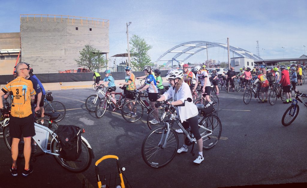
I got a new bike in 2021. Actually, a very kind friend gifted me a brand new bike. It was a complete surprise and I am forever grateful. After what seems like decades of lamenting about how I needed to get a bike, I just wasn’t making it a priority. One day in early summer 2021 I reached out to my Facebook community to ask if anyone had recommendations for a decent used bike and next thing I knew I received a brand new bike on my doorstep. What a thoughtful and amazing gift. I was able to test out my new bike just in time for the 2021 edition of the Juneteenth Roc Freedom Ride through Rochester. Tapping into the robust bike community and the dedicated bike trails has been key for me since I still don’t always feel comfortable riding my bike solo on the city streets. Even though fibromyalgia prevents me from cycling as much as I would like, having my new wheels has been amazing.

Calvin with a friend at a community bike ride

Rochester’s affinity based cycling communities have grown throughout the pandemic. These communities are important to me because they break down the stereotypes and bias that Black people don’t bike or can’t bike. Amazing transformative leaders like Rashad Smith and the Roc Freedom Ride initiative are a beautiful homage to the bus desegregation movement of the 1960s and parallel the modern day desegregation of “cycling culture” in Rochester and other cities around the country. Cycling culture in Rochester like most cities looks very homogenous (i.e white) and groups like Roc Freedom Riders, Black Girls Do Bike, Conkey Cruisers, and the Flower City Feeling Good bike rides are some of the initiatives that have grown over the past few years that diversify and bring equity and inclusion to cycling culture in Rochester. This work is priceless. Despite this progress, bike legislation and biased enforcement has led to over policing, racial profiling and pretext stops for Black and brown cyclists. Group bike rides provide a measure of support and safety for those of us that are new to cycling as a regular form of transportation.

Car-Free to Car-Lite

In my last blog I shared my journey to a car-free lifestyle and three years later I’ve migrated from car-free to car-lite. The short story version is that during the pandemic my brother purchased a used car from Geva’s fleet of cars for performers and then gifted the car to me. It all happened very quickly but I do remember needing a week or two to think about the implications of bringing a car back into my life. This was at the top of 2021 and at the time I was teaching as an adjunct at St. John Fisher University and we were migrating back to in-person learning. After three years of being car-free, having access to my own vehicle again didn’t seem like a bad idea.

Reimagine RTS

My final decision came down to convenience. Even with the many improvements to bicycle infrastructure, and the reimagine RTS initiative I would be being disingenuous if I didn’t admit that having a car is simply more convenient in our city. Owning and maintaining a car is a privilege, this I must admit. Getting reacclimated to car life and taking care of the administrative details like registration, insurance, and transferring the title was relatively easy for me to do and I recognize this immense privilege. As someone living with a disability my lifestyle lends itself to far less driving than the average car owner. Due to the disability that I live with, each month my car sits idle in the driveway for multiple consecutive days. More often than not, I don’t have the stamina or energy to drive. The majority of my work happens online and I hold many meetings remotely via zoom. Even on my good days having a car for me isn’t essential. Understanding this privilege I recently was able to loan my car to a car-free friend who was taking a road trip for a couple of days.

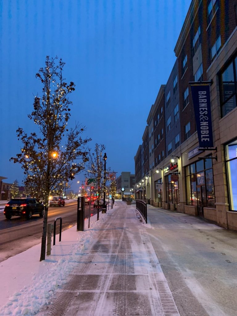
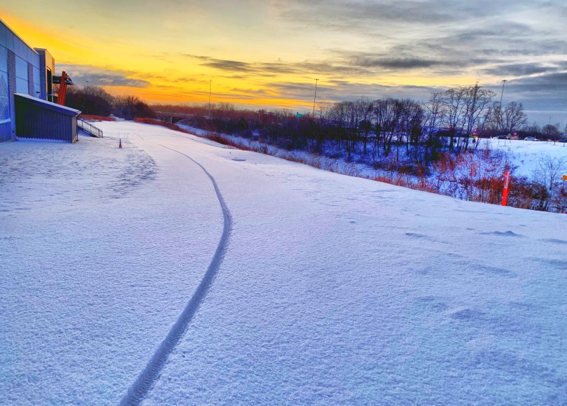
Winter sidewalk in Rochester, NY

For me having a car during the cold winter months is most helpful. And I notice and advocate for improvements in how our streets and sidewalks are plowed during the winter months. Anyone that uses a wheelchair or power chair is figuratively and literally stuck when the snow starts to accumulate, and this is simply unacceptable. There remains much work to be done in this regard.

Transportation Justice is an Ongoing Movement

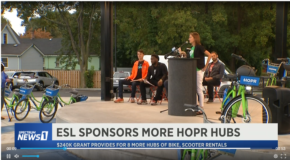
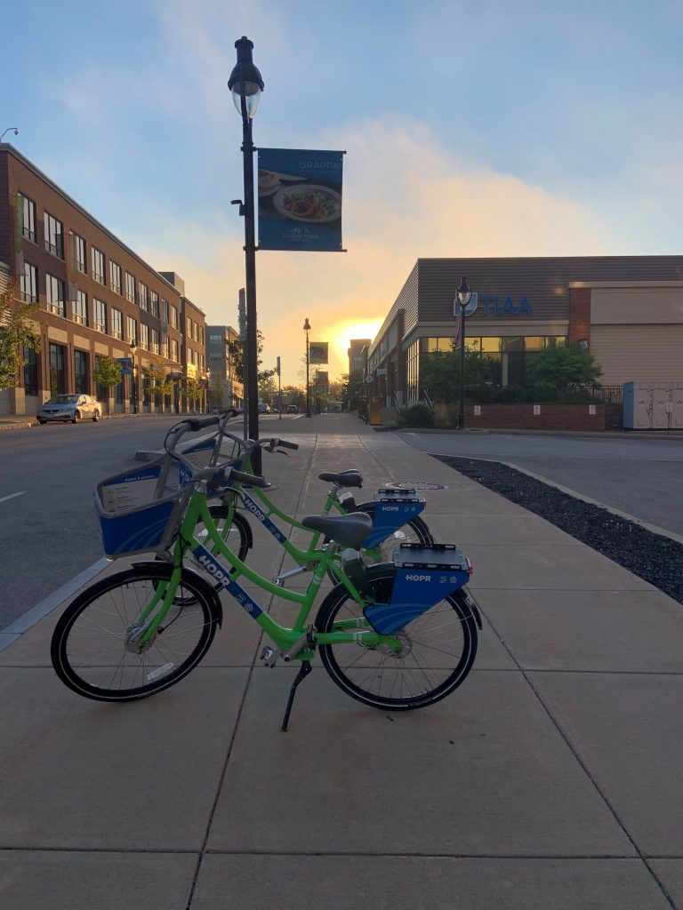
Despite my return to life with a car, I remain an active and vocal advocate for safe streets, increased and improved bicycle infrastructure, and better accessibility for our roads, public transportation and the built environment for disabled people. My journey has taught me to have more compassion and empathy for everyone’s choice to own a car or not and to spend less time making moral judgements about people’s decisions and more time advocating for a city that includes all perspectives and voices. There have been lots of additions that allow more transportation choice in our City like the HOPR bike and scooter share, bike clubs, electric vehicle sharing, renovations to the RTS station, road diets, improvement along East and West Main streets, and the advocacy and education presented by Reconnect Rochester. Still we have so much work to do to reimagine and redesign our city to be more pedestrian safe and friendly.

1 Comment

Car Lite Rochester: Small Decisions Become Core Values

car lite logo

Car Lite Rochester is a blog series that highlights the stories of Rochesterians living a car-lite lifestyle. The term “car lite” encompasses a variety of multimodal transportation lifestyles, featuring little dependence (but not NO dependence) on a car.  It typically looks like sharing one car within a household or only using a car when absolutely necessary.

So, we hope you’ll continue to follow along.  Maybe you will be inspired to join our bloggers in living a car-lite lifestyle!

Wanna rep it? Check out our newest t-shirt in our online shop.

car lite t-shirt

Car Lite Rochester: Small Decisions Become Core Values

By: Tracey Austin

It’s interesting to think through why your life includes (or excludes) something that most other American families find normal. I would say my family’s car-lite life was born from necessity. We never really made a conscious decision on a particular day to be car-lite, yet it has become one of our values. And it has amazed me how such a seemingly small decision has shaped our life.

After college, my sister and I wanted nothing more than to get an apartment together in the City of Rochester. We shared our college car, and since my job was downtown and closer, I was the one who got to take the bus, ride my bike, and walk. I learned so much about Rochester during that time of my life because I used these multimodal ways of getting around. They weren’t an alternative for me; it was just what I had to do, like most people who don’t have access to a car.

After I got married, there was no question whether we would also live in the city near friends and our jobs. Proximity to work and “life things” has always been a natural priority for us. I love this city. I have spent the past 20+ years exploring some of its best short cuts. Back in the day, my favorite shortcuts were through the old midtown building and the enclosed path you could take from MCC to the other side of Main Street – glory days!

I love bike commuting, and the bus has helped in a pinch. But I prefer to walk most places. If I’m short on time, I bike. But walking is a form of therapy for me, especially before and after work in the winter. It’s always a peaceful way to start and end the day. And when I worked downtown it was always a good excuse to pick up coffee on the way into work without having to wait in a drive thru or park my car. I guess all of my life’s decisions usually come down to coffee access.

For these combined reasons, we have been able to get by with one car (even now with a teenage driver also sharing it!). My husband prefers the bus to biking or will walk sometimes when I need the car. And all of us are now very used to asking friends and co-workers for rides. I wish that was more normalized. I even have close neighbor friends who always anticipate my request for a ride if we are both invited to the same event. Most people don’t mind at all, especially if you help pay for gas or bring them something freshly baked. ☺

We manage, and we manage well. Although I sometimes agree with my youngest son’s wish that “we at least had a newer car,” I don’t frame it as a necessity and I never will. What started as an economic decision continues to be one: I could never stomach paying a car payment on a new car, let alone two. And paying for parking when the job or event is fairly close to my house seems silly. I am happy that my kids prioritize material things less, since the necessity of cars wasn’t modeled for them. And sometimes I make a point to say things like, if we had two cars to pay for we wouldn’t be able to go on this trip or pay this bill. As they get older, I hope they will prioritize adventure and healthy budgeting over something that ties them down.

I suppose my story isn’t going to be a huge revelation to most readers. But my car-lite life has revealed a lot to me—about myself and about my city. I choose to interact with it daily in a more tangible way by how I travel through it, and that in turn helps my bank account and our environment. That makes me happy. So as long I have physical mobility to travel the way I prefer, I will do just that. And I hope I can help some friends to try it along the way.

2 Comments

Car Lite Rochester: Family Style

car lite logo

Car Lite Rochester is a blog series that highlights the stories of Rochesterians living a car-lite lifestyle. The term “car lite” encompasses a variety of multimodal transportation lifestyles, featuring little dependence (but not NO dependence) on a car.  It typically looks like sharing one car within a household or only using a car when absolutely necessary.

So, we hope you’ll continue to follow along.  Maybe you will be inspired to join our bloggers in living a car-lite lifestyle!

Wanna rep it? Check out our newest t-shirt in our online shop.

car lite t-shirt

Car Lite Rochester: Family Style

By: Doug Kelley

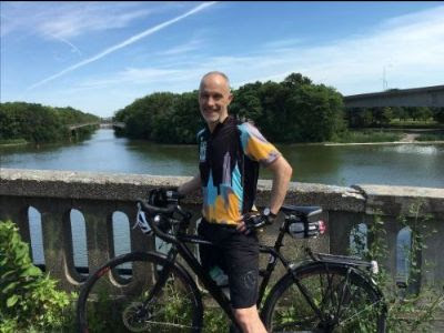
Doug Kelly smiles in a helmet next to the Genesee River

It was early 2015 when my transportation lifestyle hit rock-bottom. Rochester’s winter had been especially cold and snowy that year. I was still bitter over the cancellation of the RTS route that had shuttled me, all through the prior winter, directly from my own block to my job at the University of Rochester (anybody else have fond memories of the 52 line?). With my children in elementary school and my wife and I both working new jobs, busy-ness and frustration led me to break my routine by buying a parking pass and commuting in a car all winter. It seemed logical enough, especially since my wife and I happened to own two cars for the first time since our daughters had been babies.

But by March, it was clear that car commuting had been a terrible blunder. I found myself much more grumpy, fussing over traffic and parking and gas prices. I was out of shape and feeling lethargic. Canceling the built-in exercise of walking to the bus or biking to the office, and eliminating the routine that gave me quiet outdoor moments for reflection twice a day, had made me miserable — both physically and emotionally. The writing was on the wall: I crave exercise and the joys of active transportation more than I hate the cold. I swore I’d never buy another winter parking pass, and I never have. We soon got rid of that second car.

Once we did, the benefits piled up. For starters, living a car-lite lifestyle can be a big financial help for a young family. Driving less meant we spent less on gas, of course — and today’s high gas prices would increase the impact. Dropping my parking pass saved us a few hundred bucks a year. (Shout out to the University’s free Occasional Parking Program!) But the real financial payoff came with getting rid of that car altogether: no car payments, no insurance, no oil changes, no brake jobs or belt jobs or worries about what would break next. Our car-lite lifestyle continues to save us thousands of dollars each year.

Cost of a car diagram
Diagram from EPA

Other benefits are less tangible, but for a family, maybe more important. Exercise is one of the best things anybody can do for physical and mental health, so building exercise into daily transportation routines is great for parents and kids alike. Biking and walking make my family and me happier, more focused at school and work, and ready to enjoy time together more fully. Burning less fossil fuel and emitting less carbon make my wife and me feel better about our climate impacts, not only for our own sake but also for our two teenage daughters. After all, they will live through more repercussions of climate change than us, and going car-lite now will empower them to be more adaptable and less dependent on fossil fuels. Meanwhile, strolling and rolling around the neighborhood weaves all of us more tightly into our community. The kids bump into classmates; my wife and I see friends and neighbors.

Maybe the best perk for families who go car-lite is one we hadn’t anticipated back in 2015: it has made parenting easier for us. Teaching our kids to walk to elementary school saved us countless hours idling in carpool traffic jams. More importantly, living car-lite lets children gain freedom and learn responsibility in baby steps, as appropriate for their age. In second grade, our girls were big enough to walk by themselves to the playground across the street. In third grade, they could walk to a friend’s house down the block, or another around the corner. Soon, they could bike to see more friends or walk to music lessons. By the time our daughters reached middle school, we found ourselves living a year in Copenhagen. There, great public transportation, world-beating bike infrastructure, and negligible crime rates meant the girls could go nearly anywhere in the city without setting foot in a car. We didn’t own one there anyway. Back in Rochester, though the infrastructure doesn’t match Copenhagen’s, our daughters have the skills and confidence to go many of the places they need, walking to school and work, biking to the pet store and thrift stores. Restricting their childhood transportation to cars alone would have robbed them of the chance to gain agency and independence, steadily and surely, through all those years. Our older daughter will get her driver’s license this fall, and I shudder to think what would have happened if she’d been handed car keys and set loose to drive two tons of high-speed steel without first having learned how to find her way around the world, independently, on foot and on bikes and on buses and trains.

Family of four (two parents, two children) with bikes on a Copenhagen street
The Kelley Family in Copenhagen

Though living car-free in Copenhagen was a breeze, our family has never lived car-free in Rochester. Looking ahead to a time when all four of us will have driver’s licenses, we’re transitioning now from owning just one car to owning two — but certainly not four! The car-lite lifestyle is a pleasure we will continue.

Our chosen lifestyle is made more enjoyable by a few practicalities we’ve figured out along the way. First, we chose to live in a neighborhood with ubiquitous sidewalks and good bike routes to many places, especially our most common destinations, including my workplace, the kids’ schools, grocery stores, gyms, a bank, a pharmacy, a bakery, and a library. If you live near good routes to work and everyday destinations, by bike or bus or walk, transitioning to a car-lite lifestyle could be almost seamless. If you are among the millions working from home nowadays, going car-lite is even easier. If not, and if you’d like to commute by biking or walking, ask whether your employer has a shower. (Pro tip: U of R has many at the medical center, many at the gym, and at least two others on River Campus.) By providing a little extra power, an e-bike can be a key enabler of a pleasurable car-lite lifestyle, especially if you have health or mobility limitations, your commute is a little longer, or you frequently find yourself hauling young children and groceries. Cargo bikes and trailers are wonderful for families, not to mention backpacks and panniers. When children are old enough to pedal themselves but not yet old enough to navigate to school independently, a great solution is a bike train, in which just one or two parents bike along with a group of neighborhood classmates. Carpools are another great way to go car-lite, whether to school or to work. You can find great routes using RTS’s Transit app or browsing Rochester’s Bike Boulevards. When winter weather makes roads and sidewalks slick, you can pull on some microspikes on your way to the nearest bus.

Microspikes make car lite easier
Microspikes are a great way to make walking in the snow less treacherous!

Finally, you can help make a car-lite lifestyle more possible and more pleasurable for your own family and for everybody else by communicating its importance to public officials. A great way to start is by giving input for the City of Rochester’s new Active Transportation Plan and for Monroe County’s new Countywide Active Transportation Plan

1 Comment

Car Lite Rochester: A Lifetime of Multimodal Memories

Car Lite Rochester is a blog series that highlights the stories of Rochesterians living a car-lite lifestyle. The term “car lite” encompasses a variety of multimodal transportation lifestyles, featuring little dependence (but not NO dependence) on a car.  It typically looks like sharing one car within a household or only using a car when absolutely necessary.

So, we hope you’ll continue to follow along.  Maybe you will be inspired to join our bloggers in living a car-lite lifestyle!

Wanna rep it? Check out our newest t-shirt in our online shop.

Car Lite Rochester: A Lifetime of Multimodal Memories

By: M. André Primus

Car lite: Andre, his wife, and their daughter pose before a bike ride

I’ve always lived a car-lite lifestyle, but growing up in the hood we used to just call it “broke.” I suppose in Europe they don’t call it anything, it’s just normal. Whatever you call it, it works out to be the same thing: Do you make the majority of your trips with a car or without one? And what does that mean for how you experience your life?

Growing up, we could only afford one car, so I have very early memories of sitting in the child seat on the back of my mom’s bike, watching her standing up in the pedals to get us both up the hill over the train tracks on East Main, on our way to the Public Market. I remember a few years later, pedaling up the same hill behind her on a little bike of my own, my baby sister now taking my place on the back of the bike.

Rochester winters were colder and snowier then, the lead up and lag longer — practically a six-month progression of slush, then ice, then snow, then ice, then slush again. When our bikes were away for the winter, we trudged through the snow to the Sully Library, where I, homeschooled-kid that I was, would sit for hours and read.

Car lite: an adult pulls three kids on a sled down a snowy sidewalk

I remember finding a stash of old RTS tokens in some corner of our old house, undoubtedly uncovered by my mom’s continuous renovations. Even though they had been phased out of use by the mid-1990s, we used them to get on the bus for the next couple of weeks, the driver accepting them out of some combination of bemusement, kindness, and apathy.

The funny thing is, we did have a car for all that time! When gas fit in the budget, or our destination was too difficult for a single mother to haul her two children with alternative transportation, we drove. But I don’t have any memories of my time in the car with my mother, save for a few family road trips. Any day-to-day car travel was struck from my mind, while even the most mundane bike trips stand out with a sort of magical glow. I was a very imaginative child, and as soon as I sat in a car I checked out of this universe. I read a book, or explored the wilds of Hyrule on my Gameboy Color, or simply imagined a world of my own. But traveling without a car, I was present; I could see the world around me. 

As I got older, our life stabilized. My mom started getting higher-paying work, I started attending school, and we used our car more. But I retained a love for alternative transportation. By the time I got to high school I was walking to school every day and exploring the city with my friends, on foot or by bike. 

Once I graduated high school and began attending MCC I biked out to Henrietta daily, year-round. I was occasionally endangered by drivers on my way to school, when I reached the point where Mt. Hope became West Henrietta Road and the shoulder became narrow. More than once the rush of air from a passing truck shook me, or even knocked me off my bike onto the curb. But that couldn’t stop me any more than the snow could. I’d practically been born doing this.

Nowadays I have a family of my own. A wife and two daughters, one four and one six. I’ve worked to create memories for them, the same way my mother did for me. I hope that when they get older, they’ll remember being pulled through the snow in a sled to the Sully Library, or to New City Cafe. Maybe they’ll remember riding to the Public Market as a family on Saturday morning. Maybe they’ll remember how excited they were every time they got to ride the RTS 41 crosstown, how they would cry out and point every time they saw it around the city, “The 41 bus! Look!”

Car lite: Andre poses on his Onewheel in a suit, presumably on his way to work

And I’m still creating my own memories. I ride my Onewheel to work most days, with the exhilarating feelings of floating along powered by electricity and intention, of seeing the city, the people, of feeling the wind in my face. A feeling that, besides the visceral pleasure, provides the sort of feeling of freedom a teenager gets upon getting their license, but without the feeling of being tied down that same teenager will get once they begin dealing with gas, insurance, maintenance, and the inevitable lack of a parking spot.

When it gets too snowy for the onewheel, my mountain bike comes out. In the depths of winter, the effort of plowing through snow banks and navigating the maze of icy berms left by competing snowplows warms me up enough that I often have to remove my jacket, and certainly don’t miss a car’s heating. I’ve watched Rochester’s winters get milder and milder in my 30-odd years, so I take a sort of savage joy in wrestling with the winters we have left. 

I realize I could have made a case here, telling you all the economic, financial, environmental, and sociological reasons why you should consider using your car less, but at the end of the day, I think the emotional experience of living less of your life in a car is reason enough. Maybe you don’t need the monotony, isolation, and immobility of car travel in your life. Maybe, you could have something better?

1 Comment

Car Lite Rochester: From Big to Midsize City

Logo: "Car Lite Brewed by Reconnect Rochester." Styled like a beer logo.

Car Lite Rochester is a blog series that highlights the stories of Rochesterians living a car-lite lifestyle. The term “car lite” encompasses a variety of multimodal transportation lifestyles, featuring little dependence (but not NO dependence) on a car.  It typically looks like sharing one car within a household or only using a car when absolutely necessary.

So, we hope you’ll continue to follow along.  Maybe you will be inspired to join our bloggers in living a car-lite lifestyle!

Wanna rep it? Check out our newest t-shirt in our online shop.

car lite t-shirt

Car Lite Rochester: From Big to Midsize City

By: Chaz Goodman

Chaz Goodman (guest blogger) smiling on his bike. He's wearing a black helmet and red backpack.

I love biking. I do it for fun, and for about eight years it was the only way I got around. I love being a part of my surroundings instead of being isolated in a car. I love seeing a friend on a bike or on the sidewalk and calling a quick hello. I love hearing the birds sing and feeling the breeze. I love hearing a busker playing on the street or snippets of a conversation from outdoor diners on Park Avenue. I love that instead of finding time in my busy schedule to work out in a stale indoor space, I can get exercise during my commute. I love that when I’m not feeling active, I can take it easy, bike slower, and still get to work without much effort.

From Chicago to Rochester

I spent my twenties living car free in Chicago before my wife and I moved back to Rochester. Here our lives would be different. We now had a dog and we would be visiting multiple suburbs rather than mostly staying within the city. One of the first things we did was buy two cars, one for each of us.

I added my new car key to a key ring and put it in my back pocket. The key was large and hard to ignore when I sat back down. I shifted slightly and set off the alarm button on the remote. The symbolism of the moment was a little too on the nose for me. I started thinking about how I could get back to my car free lifestyle – or at least car lite.

Commuting by bike in Rochester wasn’t too much of an adjustment from Chicago. In warmer weather, I ride to work in gym clothes and keep my work clothes in a light drawstring bag to stay cool. When I get to work I splash a little water on my face and change in the bathroom. In the winter, I just throw on a jacket over my work outfit. I put my computer and lunch in my panniers. I take East Avenue which generally has a wide shoulder since cars can’t park there during work hours. It is quite spacious for a bicycle.

The shoulder on East Avenue

I am rarely carrying much so taking my bike to work is pretty easy. Even if I have to run multiple errands, I just make sure to bring my backpack. You’d be surprised how much stuff fits in those three bags (panniers and backpack). Due to commuter traffic, travel times are pretty similar on a bike vs a car (especially if I’m traveling within the city). I almost always bike when I go out for the evening and I never worry about where to park or how much it will cost.

Speaking of cost…that alone is a good reason to consider a car lite lifestyle. My bike initially cost me $200 and I’ve probably put about $500-$600 into it for repairs over the course of ten years. Imagine this minimal cost replacing how much you put toward car repairs/payments over even half that period of time.

Challenges & Allowances

I considered my other travel needs beyond commuting, night life, and errands. I’m a musician and I often play gigs where I have to set up my own sound. Here, I allowed that I would need a car to transport my full PA system and multiple instruments/microphones/stands/amplifiers.

My next challenge was visiting family in different suburbs. I started riding from my place in Brighton to my brother’s place in Irondequoit. It’s a long ride but I enjoy it. The only time I feel nervous on a bicycle is crossing under Route 104. There are a lot of drivers who are in a hurry to get on or off the highway and they just aren’t expecting a cyclist. Nonetheless, it’s definitely doable and 104 is only one small part of my ride. TIP: I stay safe by assuming a car doesn’t see me unless I have made eye contact with the driver.

My next allowance was to drive to my parents’ place in Webster because biking this route is unfortunately quite impractical. The Bay Bridge is obviously not built for bicycles and although Empire Boulevard has a wide shoulder, cars are often going upwards of 60 MPH. I’ve read a few sobering stories about collisions gone wrong there. Plus, biking in Webster itself makes me nervous.  

If I took public transit I would need to take three buses for an hour, without any delays. There isn’t a bus that goes to my parent’s neighborhood so I would need to walk an additional five miles to their house which is not in the RTS demand area. Or I could drive and it would take 20 minutes. I can hardly blame someone who chooses to drive when we have made it so much easier than the alternative.

I decided that other than these allowances, I was going to bike even in challenging circumstances. I have a raincoat for rainy days, staying active on my bike keeps me warm in the winter, and I have multiple lights for night riding.

Then my son was born. Now the lack of protected bike infrastructure I had been blissfully unaware of as an able-bodied adult became glaringly obvious. I’m in the process of putting a toddler seat on my bike so my son can join me for errands in the city, but it’s still nerve-racking to consider. His daycare is located on a particularly busy four lane section of South Clinton Avenue so I plan to ride on the sidewalk with him for safety.

South Clinton Avenue's four lanes
South Clinton Avenue’s four lanes

The Big Picture: Why Be Car Lite?

It’s hard not to feel a little frustrated at the decisions made for our communities. When I mention reducing car usage to people I often hear the counter argument: “don’t force your lifestyle onto the rest of us.” But we’ve already all but forced people to use cars with our street design and inefficient public transit.

Some people genuinely prefer driving and that’s fine. But there are plenty of people who would opt for transit or biking if they felt it was safe and convenient. Many people don’t realize how impractical cars are because they never considered a life without them. I was certainly one of those people before spending nearly a decade without a car.

Stock image of a frustrated driver and passenger, perhaps in a traffic jam

Beyond their environmental impact, cars are just inefficient for most of our daily needs. Go to any public area and look at how much space is devoted to parking. Imagine if we could reduce that. Imagine how much more space we would have and how pleasant it would be. Imagine if drunk drivers weren’t a concern because most people weren’t driving when they went out. Imagine if children could travel with classmates via buses to their various after school activities rather than relying on overtaxed parents to transport them everywhere. Imagine if you didn’t have to drive to work every day and you could spend your commute on public transit; reading or daydreaming or writing or texting or sending emails. Imagine not needing to spend every day operating a dangerous machine that requires complete focus to stay safe. Imagine not needing to worry about car repair bills or auto insurance. Imagine a world where road construction is less common because there aren’t thousands of cars degrading the quality daily.

For those who say it’s impossible: consider the fact that our cities used to operate this way with a multitude of pedestrians, trains, buses, bicycles, and cars sharing public space. Even now our public school bus system shows us this is far from a pipe dream. Systemic change is difficult to imagine and even more difficult to enact but it’s certainly not impossible.

Eventually my son will be able to walk to school and take his own bike to get around town. Then I can reduce my car reliance even more. I hope to eventually go back to being car free when it’s possible. For now, I will continue to support institutions such as Reconnect Rochester that are working to correct the imbalance.

2 Comments

Car Lite Rochester: An Urbanist’s Perspective

Car Lite Rochester is a blog series that highlights the stories of Rochesterians living a car-lite lifestyle. The term “car lite” encompasses a variety of multimodal transportation lifestyles, featuring little dependence (but not NO dependence) on a car.  It typically looks like sharing one car within a household or only using a car when absolutely necessary.

So, we hope you’ll continue to follow along.  Maybe you will be inspired to join our bloggers in living a car-lite lifestyle!

Wanna rep it? Check out our newest t-shirt in our online shop.

car lite t-shirt

Car Lite Rochester: An Urbanist’s Perspective

By: Arian Horbovetz, Creator of The Urban Phoenix

I remember the feeling of thunderous accomplishment as I dismounted from my bike and whacked my kickstand with exaggerated force.  I texted my girlfriend at the time, letting her know I had made it to work safely.  I took a selfie, and entered my workplace, where I immediately began bragging about what I had just done.  I sat at my desk and took yet another selfie, which I posted on my Facebook page.

selfie of white man in blue helmet; car lite rochester

For the first time, I biked to work.  I had researched for days, looking for the route with the least amount of car exposure.  I had to assure my partner several times that this was OK and I would be safe, and that this was something I really wanted to try.  Now that I had done it, it didn’t feel like such a big deal.  Sure, the hit of elation that came from light exercise and being outside on a late-summer morning when everyone else was frantically piling into their car was intoxicating, but honestly my 4-mile Rochester-to-Henrietta bike commute suddenly didn’t seem like the momentous event that I thought it would be.  Something I thought was an outlier of an experience suddenly felt very natural and approachable.  Later, I would realized that by biking to work one time, I had simply and swiftly demolished the construct that is so ingrained in our American persona from the time we are young… the idea that driving is the only way to move about.  For me, the simple act of powering myself to work on two wheels vanquished that concept forever.

So I biked to work the next day.  And the one after that.  And the full week after that!  Suddenly, the activity that seemed so “fringe” just a short time ago felt incredibly normal, almost routine.  I began to take different routes to work, just to see streets I hadn’t spent much time on and mix up the landscape.  I left home earlier and stopped for coffee and read the news.  Suddenly my formally A to B commute turned into a micro-sightseeing adventure on my way to work.  My car began to sit for days, even weeks at a time.  I began to bike everywhere… to the store, the market, out to meet friends.  I started to make use of Greater Rochester’s fruitful trail network, and memorized every low traffic street that would get me where I needed to go with minimal car contact.  My mom lived in Pittsford at the time, so I simply hopped on the Empire State Trail and visited her every week.  Sure, I had a car and sure, I still used it occasionally.  I just didn’t want to.  Or rather I felt like when I got on a bike, I was doing something better.  Not just for me and my health, but for the community and the planet.

Winter sidewalk. Rochester NY.

And it didn’t stop there.  As the winter weather began to creep in, I started riding the bus.  Having time in the morning to check emails on my to work, or simply relax while traveling to a meeting in the city became a joy, especially on those frigid and snowy Rochester days.  Even in good weather, I would throw my bike on the front rack of the bus and go “multi-modal” to countless destinations in the city and even the nearest suburbs.  I found the sense of community on the bus to be enjoyable as well, an aspect of transit that is easy to forget when traveling alone by car.

As far-fetched as it might seem, using a broad range of transportation modes helped to expand the focus beyond my insulated life, allowing me to see that I was part of something bigger and more interconnected… and something I could help to make a little better every day.  It made me realize the importance of urban density and mixed-use development.  It helped me understand that with every car trip turned bike ride or bus trip, I was one less polluter, one less car on the road that was stuck in the traffic jam, one less parking space needed, and one less safety concern for pedestrians and other bike riders.  These were the seeds that led me to create TheUrbanPhoenix.com, a blog that addresses urban issues across New York State, which now enjoys a national readership.

A decade after that first bike ride, I’ve become a full-fledged multi-modal transportation advocate.  With the persistent work by cyclists and transit riders, as well as organizations like Reconnect Rochester, I’ve seen our city slowly progress as we work to make our streets safer and more equitable.  There are tremendous hurdles we must climb to make alternative transportation a safer and more convenient form of mobility in The Flower City, but with the dedication of so many advocates who understand that life is better when you’re multi-modal, I am pleasantly optimistic.

I still own a car.  It’s a used sub-compact that is cheap, slow and completely unsexy.  I went car-free for over a year at one point, but the modern realities of American sprawl, combined with my recent introduction to the “everything suddenly hurts” phase of middle-aged awareness means that a car-lite lifestyle is the way for me.  And of course, with the lack of adequate snow removal from most trails and bike lanes in our community, having a car as a “backup” means that I can still get to where I need to go regardless of the conditions and how we maintain our infrastructure.  And for that I understand I’m privileged, as many in our community cannot afford that luxury.  Still, I bike and ride the bus far more miles each year than I drive, and that helps me feel like I am making a difference.

When I started biking to work, I felt accomplished.  When I started taking the bus to destinations across Rochester, I felt empowered.  When this became a routine, it transformed me into an advocate.  Today, it’s a way of life, and one that has helped me to understand how connected I can feel to my community, just by moving around it.

Today, using multi-modal transportation has become as practical as it is satisfying.  I have even added other mobility options to my “fleet,” such as an an Ebike, an Electric Scooter, a Onewheel, and several longboards (I taught myself to skateboard during COVID!).  All of these options allow me to adapt to nearly any trip, any condition and frankly, they make moving around a lot more fun.

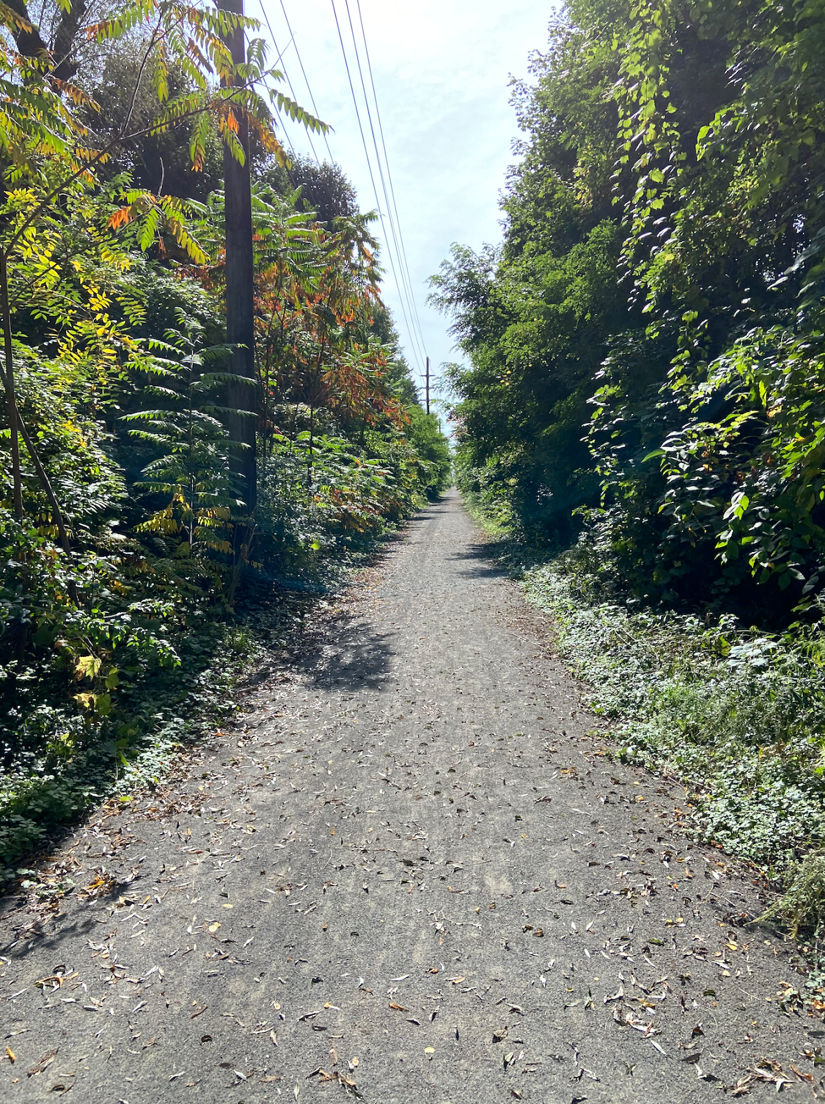
I am relatively unaffected by the realities of stifling gas prices.  Finding parking for our numerous Rochester events like Jazz Fest and Red Wings games is not just easy, it’s always free.  And when others rant about the horrors of their adversarial morning commute, I can’t help but grin, knowing that two-thirds of my bike ride to work is along a trail through nature where I watch the sun speckle through the trees and “befriend” deer, rabbits, ducks, geese, foxes, giant turtles and even a pack of wild turkeys.

And that’s the realization that eventually comes from living car-free or even car-lite for an extended period of time.  Suddenly, you see the battleground of automobile aggression on our roads as you slowly move past it, through it and beyond it, unaffected by the anxiety of the masses who are constantly trying to shave seconds off of their journey.  It’s the wry smile you can’t contain, like knowing that you’re one of the few that have discovered a secret happiness that you wish others could experience, even just once.  I don’t do what I do for purposes of ego or politics… I do it because I know I feel like a better, more complete human being.  I don’t advocate for what I do for any other reason than I wish others had the opportunity to see mobility the way I do… and if they did, I truly believe our world would look very different.  And that “different” is the Rochester I would love to imagine for our future.

2 Comments

Sidewalk Cycling Explained

Arian Horbovetz

Written by Arian Horbovetz and originally published on The Urban Phoenix blog

As early summer finally begins to grace the Northeast, residents of Upstate New York begin their annual euphoric embrace of life without snow, ice, and bitter cold for the first time in 5 months. Like a pauper who suddenly becomes a millionaire, hearty populations of places like Rochester immediately start thinking about what to do with the newfound possibilities created by sunshine and warmth.

For me, this is often the time when people reach out for recommendations on cycling, and specifically, tips on how to commute to work or run errands by bike. Record gas prices have, unsurprisingly, made these requests more frequent and even a bit more urgent than in previous years.

And since I live in a metro that was built to, first and foremost, accommodate the automobile, hesitant first time bike commuters often ask the same question: “is it ok to bike on the sidewalk?”

Thus begins the very multifaceted, multidimensional, and eternally context-driven debate that seems so simple and yet is so very complex. My hope is that this post, once and for all, addresses every perspective on sidewalk cycling and what first time bike-commuters should do, what long-time cyclists should advocate for and what urbanists today should encourage and discourage.

Person cycles on a sidewalk
Image Credit: Bellingham Herald

The Debate

In most of the U.S. the law is clear… bikes are vehicles and are thus supposed to be ridden in the road with cars. This oddity that equates a 20-pound bike with a 2-ton automobile in the eyes of the law is actually the result of cycling advocates decades ago who believed (and still do) that bikes and cars should be afforded the same rights.

But obviously, the bike and the car couldn’t be more different mobility solutions with regard to safety and comfort. For the parents who just want to ride with their kids, or for the new rider or new commuter who is understandably shaken by the idea of riding with traffic, the sidewalk is an appealing alternative to biking in the street. And while a majority of municipalities allow bikes on sidewalks, cycling advocates continue to encourage bike riders to ride in the road.

There are several reasons for this, and most of them have to do with driveways and intersections. A large percentage of car/bike crashes happen when a car turns into a cyclist while making a left or right turn, or when a car is pulling into or out of a driveway. For example, let’s say you’re riding your bike northbound on the left hand sidewalk. The road that is parallel to you is 4 lanes wide. You approach an intersection and while you may have the right away across the perpendicular street, a car turning left from the 4 lane road adjacent to you is looking to make their left turn across multiple lanes of oncoming traffic. In the 5-15 seconds that the driver of that car has been waiting for an opening in traffic to turn left, you, the sidewalk cyclist, have ridden up from behind and started to cross the perpendicular street. The driver who finally has space to move in between oncoming traffic turns quickly and a “T-Bone” crash occurs between the driver and the cyclist.

Two people with long red hair cycle in a Rochester street
Image Credit: Laura Mack

If the cyclist had been riding in the road, they would have been riding with traffic, thus alleviating the sightline issue from the driver’s perspective noted above. Cycling is safer when we eliminate the 90-degree points of conflict between cars and bikes, especially when the bike rider is on the sidewalk.

Also, pedestrians who use sidewalks dislike the presence of faster-moving vehicles like bikes and scooters for reasons of comfort and safety. While I would like to think that sidewalks can be shared space for all of those who navigate their communities without a car, I’ve listened to countless stories of pedestrians who have been struck or rudely surprised by cyclists invading what really should be a “safe space” for those traveling on two feet.

So with regard to a feeling of safety, cyclists are often left without a home. Drivers loath the inconvenience of navigating around road-riding cyclists, while pedestrians on sidewalks see cyclists like cyclists see cars… an uncomfortable point of conflict that needs to be addressed.

Safely Riding The Sidewalk

If riding in the road isn’t for you, here are sure-fire tips to lessen the conflicts that I described above when riding on the sidewalk. To ensure your sidewalk-riding experience is comfortable and responsible, you must be willing to adapt your speed and behavior in acquiescence to pedestrians… and assume drivers don’t see you.

  • When riding on the sidewalk and approaching an intersecting road or driveway, approach slowly, first checking to see if a car is approaching via this road or driveway. Next is what I call the “look-back,” which is the sidewalk cycling game changer. Turn your head to the parallel street to see if there is a car turning into the driveway or street you are about to cross. Look for slowing traffic with a turn signal, and if there is any doubt, slow your momentum until you are sure the driver sees you, or stop if you anticipate that the driver does not. Even if you have the right of way, DON’T EVER ASSUME that the driver can see you and navigate the intersection without this step. Use the “look-back” method multiple times as you approach and move across the intersection. If you do this for every intersection, you essentially eliminate one of the most glaring safety risks with sidewalk riding.
  • When riding on the sidewalk, give maximum priority to pedestrians by riding in the grass to allow oncoming walkers the entire sidewalk. When approaching pedestrians from behind, slow to 5-10mph or less, kindly announce that you are about to move around them on the left, and ride around them on the grass (if applicable). As a cyclist, it’s important to remember you are a guest on a right-of-way that is reserved for pedestrians. Pedestrian access is a sort of an urbanist “Holy Grail” and one that should not be besmirched.
  • Understand that, as a sidewalk rider, you become a pedestrian instead of a vehicle pilot. In other words, let’s say you approach a signaled intersection on bike while riding in the road with traffic. When the light changes green in your direction, you move forward with the flow of traffic. But if you are riding the sidewalk, you may have to press the crosswalk button every time you approach an intersection. If you do not do this, you are taking matters into your own hands. For example, let’s say that you are riding on the sidewalk and the road parallel to you has the green light, but the pedestrian crosswalk signal still says “Don’t Walk” until you press the button to cross the perpendicular street. You decide that the street parallel to the sidewalk you are traversing has the right of way, despite what the pedestrian signal says. If a car turns into you, despite the fact that you didn’t press the button to activate the walk sign, and hits you and a court case is the result, the fact that you did not push the button will likely mean that you are at fault and thus liable for damages.
  • I would HIGHLY advise against riding an electric bike on the sidewalk. As most ebikes are capable of speeds upward of 20mph, and weigh far more than the average bike, the threat to pedestrians is greatly magnified and chances that cars navigating cross street won’t see you is heightened. Sidewalk riding should not exceed the typical leisurely pace of 10-12mph.
  • Never ride on the sidewalk of a dense urban setting with many storefronts and apartment entrances. Few things make shop and restaurant owners angrier than when their customers have to look both ways before exiting their establishment to avoid being hit by a cyclist.

In Sum

Want to ride on the sidewalk instead of in the road with traffic? That’s fine, most municipalities allow it. And beyond that, I understand it. But if you’re going to ride on the sidewalk, know that you are basically giving up your legal status as a pilot of a vehicle and become a pedestrian, who is legally subject to crosswalk signaling, and who is physically responsible for ensuring that drivers see you when you traverse any intersection.

Also, it’s important to realize why bike advocates like myself encourage riding in the road rather than the sidewalk. We know that there is power in numbers, and that worldwide, the more cyclists there are, the safer the roads are for cyclists. Riding on the sidewalk, however, is seen in much of the cycling community as “giving in” to drivers and yielding the road to automobiles.

Person cycling in a city
Image Credit: Unsplash

As a daily bike commuter, I would strongly encourage you to consider finding alternatives to sidewalk riding. Parallel routes with fewer cars and slower traffic can be game changers, for example. And no matter where you ride, bright lights and a helmet can make you feel a little more in control of your own safety. But if you feel there are places you simply won’t ride in the road, remember the tips from this post. Even I have stretches of road I refuse to traverse on bike, so I slow my speed and take to the concrete, and I refuse to be shameful about it.

For me, I’d rather see someone ride a bike on the sidewalk than not at all. My hope will continue to be that the regular sidewalk rider will eventually transition to the road when they feel more comfortable. But if not, no worries… just take matters of safety and responsibility into your own hands and ride any way you can!

No Comments

Bike Access to Nature

By Jesse Peers, Cycling Manager at Reconnect Rochester

I say this on my history bike tours a lot: If I could temporarily time travel back to one decade, it’d be the 1890s. In this decade, the up ‘til then economy-minded City of Rochester started a massive investment in the public realm: it developed its world-class park system and with the electrification and extension of the trolleys, residents could hop on a streetcar and visit our parks and beaches at their leisure. The 1890s is also renowned as the greatest bike boom in history and automobiles hadn’t yet dominated our streets.

Bike History Books
Rochester’s bike history is featured quite prominently in these four recent books

One of the bicycle’s greatest selling points at the time was the ability to access these newly developed parks and to escape the city into nature whenever you wanted. The world was at your fingertips – just a short pedal away! In the early twentieth century, Rochester cyclists would make that access to nature and the surrounding countryside even easier by pioneering a system of sidepaths through Monroe County. For a while, cyclists came to Rochester from afar to see top-notch bike infrastructure!

In Rochester’s early days, the city center was surrounded on all sides by “verdant nurseries and blooming orchards.” Visitors to the Flower City were awed by the “seemingly endless acres of blooming rose bushes, tulip beds & fruit trees, encircling the city.” Before those areas were taken over for housing, Rochester’s early Parks Commissioners proposed a park boulevard 300 feet in width encircling the city with a number of small parks scattered along its route. Instead, priority was given to two large parks straddling the river: “South Park” (Genesee Valley Park) and “North Park” (Seneca Park).

That original idea, though, kept resurfacing as subsequent mayors toyed with the idea of connecting the growing park system. Like many, we are mesmerized by this 1911 vision for Rochester. Because Rochester’s large parks were “comparatively remote,” planners felt their usefulness could be “much enhanced by narrow, extending arms reaching out into the surrounding territory and forming park-like approaches to them.” These connective parkways  would “multiply in effect the extent of park area conveniently available to the community.”

Map of Rochester

Sadly, the costs were too prohibitive and the project was dropped. (Two small beginnings though were made towards its realization: Seneca Parkway in Maplewood and Genesee Park Boulevard in the 19th Ward). For an example of a peer city that got much closer to achieving a similar vision, check out Louisville, Kentucky.

Louisville Loop Overview
Though they are still working towards its full realization, Louisville, Kentucky’s Olmsted Parks are connected with Parkways. Learn more about the Louisville Loop.

With another bike boom happening, the recent adoption of Rochester’s Children’s Outdoor Bill of Rights, the expansion of the City’s Bike Boulevard network, and the simultaneous creation of Active Transportation Plans for the city and county, we thought it a good time to revisit this concept of bike access to nature and our parks. Using the 1911 vision as our guide, let’s examine our modern bike network as connective tissue to our stellar parks.

Rochester's Children's Outdoor Bill of Rights

The Highland Crossing Trail, which many residents don’t know about since it hasn’t been incorporated into Google Maps’ bike layer yet, was a unique collaboration between Brighton and Rochester. With the Erie Canal Trail, it connects Genesee Valley Park to Highland Park. These trails together with the Genesee Riverway Trail make a wonderful seven-mile recreational loop we recommend you try sometime.

Bike Route Map
Bike Route Map

Recurrent calls in the early twentieth century to secure the Pinnacle Hills as parkland connecting Highland Park and Cobbs Hill Park were unsuccessful but today’s Bike Boulevard through Swillburg and Upper Monroe does a good job of connecting them.

Bike Route Map
Bike Route Map

Connecting Cobbs Hill to Irondequoit Bay and what is now Ellison Park is harder. The 1911 planners called for an extension of Richs Dugway Road but today’s railroad tracks present a significant barrier, as does the area around Wegmans and the “Can of Worms” interchange. For now, Browncroft Blvd, Blossom Rd and Highland Ave can be used. Living in the Culver and Merchants triangle, my kids and I are a 10 minute bike ride away from Ellison Park – a ride we cherish, especially in the Fall. We turn off of Browncroft onto Shaftsbury and Corwin Roads for a low-stress approach to the Park.

Bike Route Map
Bike Route Map

Though a parkway or trail extending east to west “along the low land just south of the Ridge Road” and today’s 104 isn’t possible, the El Camino Trail and the new Bike Boulevard through 14621 can connect Seneca Park to Irondequoit Bay.

Bike Route Maps

To connect the Genesee River and Seneca Park to Durand Eastman Park, the 1911 plan called for a connection westward “up one of the little valleys” to the northerly end of Seneca Park. Check out this creative route by Pam Rogers.

Bike Route Maps

To connect downtown with Edgerton Park and further north, we all know Lake Avenue must be avoided at all costs by bike. But the new Bike Boulevard along Plymouth parallels Lake Avenue and gets you all the way up to Kodak Park in a low-stress manner through the gorgeous Maplewood neighborhood.

What are your favorite low-stress ways to visit nature by bike? Let us know! If you agree with the Children’s Outdoor Bill of Rights declaration that every Rochester child should be able to “safely explore their community green spaces” and nearby parks, we’d ask you to advocate for continuous, high-comfort bike infrastructure for all ages and abilities for the City and County’s Active Transportation Plans this year.

8 Comments

A Resident’s Proposal for a New Mixed-Use Trail in Irondequoit

If you’ve ever navigated the world without a car (whether that be for necessity or recreation), you’ve probably had a, “Why can’t I get over there from here?” moment. Guest blogger, Jack Rinaldo, had so many of these “moments” that he actually wrote up a proposal for a new mixed-use trail in Irondequoit, which would connect the eastern edges of Norton Street and Ridge Road. Curious? Read on for the nitty-gritty details in his own words.

Guest Blog by Jack Rinaldo

If you want to walk or bike to or from Southeast Irondequoit, you need to cross 104. There are only three locations to do so, highlighted in red in the picture below. Goodman Street and Culver Road have intersections with on/off ramps for 104. Both of these locations are dangerous for pedestrians and cyclists, no matter if they are on the road or the sidewalk. The other option is Bay Shore Boulevard. This street is calm, but it has huge hills at either end of it, making it unusable for most people.

These barriers cut off the southeast side from the rest of Irondequoit. Would you let your kids use any of the three current routes? I am an experienced and confident cyclist and I will not ride on those sections of Goodman or Culver.

The proposed new trail would run from Norton Street north to Ridge Road. As seen in the picture below, the trail would start just east of the Norton Street/590 onramp. The trail could run very close to the 590 onramp, similar to the Brooks Avenue/390/Erie Canal Trail setup as shown below. It would then run north, connecting with the road that the new Irondequoit town Department of Public Works (DPW) is on. This half mile section would potentially be the only new construction needed.

Once connected to the DPW road, trail users could use that road to reach Ridge Road. Additional sections of trail to the side of the road could be added as well if they are determined to be needed.

This trail would be similar to other local trails near highways such as the Route 390 Trail in Greece, and the Route 104 Trail in Webster.

Brooks Avenue, 390, and Erie Canal Trail

This new trail would easily connect to the Sea Breeze Drive trail as seen in the picture below. Once at Ridge Road, trail users go 1000 feet west to Kane Drive. Kane Drive is a nice calm street. Once at Kane Drive, they would proceed north until they met the Sea Breeze Drive trail at the Titus Avenue roundabout.

The new trail would also easily connect to the City of Rochester’s Bicycle Boulevards. Heading south, traveling 700 feet west on Norton Street brings you to Helendale Road. Helendale Road is another calm street. Once in the Laurelton neighborhood, use Spencer Road and Whittington Road to directly access the Bicycle Boulevard system on Farmington Road.

To connect the new trail to the other systems above, all that would be needed would be signage directing users along the route.

The newly expanded trail system would also connect all six of the schools in the East Irondequoit School district. Students and families could use the trail to access school facilities for class and extracurricular events.

  • Irondequoit High School is 400 feet from the Kane Drive/Ridge Road intersection, and a path to the school’s athletic facilities is on Kane Drive.
  • East Irondequoit Middle school is 1200 feet west of the Norton Road/Helendale Road intersection, then 500 feet up Densmore Road.
  • Laurelton-Pardee Intermediate School is 1700 feet from the Norton Road/Helendale Road intersection.
  • Helendale Road Primary School is directly on Helendale Road.
  • Durand-Eastman Intermediate School is almost directly on the Sea Breeze Drive trail.
  • Ivan Green Primary School is 1 mile away by safe neighborhood roads from Kane Drive.

The newly expanded system would connect many parks such as Irondequoit Bay Park West, Tryon Park, Durand-Eastman Park, the Lakeside Trail, SeaBreeze Amusement Park, Irondequoit Bay State Marine Park, and the beach at the Irondequoit Bay outlet.

Here is a link illustrating the new trail and it’s connectivity to the town: https://www.google.com/maps/d/edit?mid=1CTSRzSTvziHLSrxeJaSAt5wvJEjHc9Sd&usp=sharing (best viewed with Google Maps’ cycling layer turned on)

Irondequoit can look at the successes other towns have with trails, such as the new Brickyard Trail in Brighton, as well as the continued use of miles of trail that already exist in the region. Creating the new trail would be a great opportunity for the town to take unutilized land and better connect residents and neighborhoods, while promoting healthy and environmentally friendly transportation. The half mile of construction needed to achieve all of this would be very worth it.

3 Comments

How should we grow Rochester’s bike infrastructure? Let’s ask the data.

Guest blog by Nate August (Data Scientist & Graduate, University of Rochester) and Doug Kelley (Associate Professor of Mechanical Engineering, University of Rochester)

The year 2022 could be a watershed for active transportation in the Rochester region. The City of Rochester is writing a new Active Transportation Plan to update and extend its existing Bicycle Master Plan (completed in 2011). Meanwhile, Monroe County is writing its first-ever Countywide Active Transportation Plan. Both documents will lay out a vision and set priorities to guide transportation policy for years or decades. Their recommendations will literally be made concrete in communities’ sidewalks, bike paths, bus stops, and roads. Smart planning can improve equity and sustainability in everybody’s transportation – and can be empowered by data-driven insights.

Sharrows in Rochester

This spring, our team of graduate students and faculty at the University of Rochester’s Goergen Institute for Data Science, in partnership with the City of Rochester, set out to make data-driven recommendations for one key enabler of active transportation, the City’s bike infrastructure. We drew on a recent scientific study of bike networks in 62 other cities around the world, coauthored by researchers at the University of Rochester and the IT University of Copenhagen. We selected 86 points of interest around the City and calculated many thousands of routes among them, each along existing bikeways and streets, then located the street segments that currently lack bike infrastructure but frequently are part of the calculated routes. Those are places where new infrastructure would carry the most bike traffic and could most quickly improve users’ experiences of Rochester’s bike network. Here are the ten segments most important for bike transportation in Rochester, according to our analysis:

    • Monroe Avenue between Culver Road and Howell Street
    • Elmwood Avenue between Mount Hope Avenue and S. Goodman Street
    • Driving Park Avenue between La Grange Avenue and Saint Paul Street
    • Joseph Avenue between Cumberland Avenue and Norton Street
    • A connection between North Street and Central Park, either Davis and Scio Streets or Portland Avenue
    • State Street between Andrews Street and Smith Street
    • Smith Street between Lake Avenue and Saint Paul Street
    • South Clinton Avenue between Gregory Street and East Broad Street
    • Stone Street between East Broad Street and East Main Street
    • Saint Paul Street between East Main Street and Andrews Street

Our data-driven recommendations agree well with intuition and ongoing community conversation. Many of these street segments are also among the ten most obvious gaps in Rochester’s bike network, according to Reconnect Rochester’s Mind the Gap campaign. Many were recommended for upgraded bike infrastructure in the Rochester 2034 blueprint for growth and development, adopted by City Council in 2019. When different people using different methods tackle the same problem and find similar solutions, it’s a good sign that those could be the right solutions for the community – great minds think alike!

To learn more about the results and analysis that led to our recommendations, check out the interactive map below. It shows the data-driven recommendations along with existing bike infrastructure and the points of interest. You can pan, zoom, and toggle the layers. Altogether, these new segments span just eight miles (13 km) – short enough to be built rapidly and at low cost. As the map shows, they would link disjointed parts of Rochester’s existing bike network and connect it to more neighborhoods, bringing transportation equity to more residents.

Once these ten key segments have bike-friendly infrastructure, further construction would bring further improvements, and we used the same sort of analysis to ask what should come next. The animation below shows what the Rochester bike network could look like as infrastructure is added in 12-mile increments up to 60 miles. According to our analysis, communities are best served by prioritizing dense connections in the City center along with selected arterial connections to outlying areas.

Suggested bike connections in Rochester

There’s more good news when we rate the impacts of these recommendations in terms of directness. If you’re biking from, say, the Public Market to the downtown library, the directness of your route is the ratio of the actual distance you pedal to the distance as the crow flies. A more direct route is quicker and more efficient. By averaging over all the routes among all the points of interest, the directness of a whole bike network can be calculated. The scientific study found, surprisingly, that building new infrastructure during the early part of a bike network’s development can actually make directness worse because new neighborhoods are at first connected only by tortuous routes. But the good news for Rochester is that our strong foundation of roughly 75 miles of existing protected bikeways, bike boulevards and bike paths allows us to achieve steadily increasing directness. Here, bike routes will tend to get straighter and more direct with each new infrastructure project, as long as projects are chosen sensibly.

Our analysis is all about connecting points of interest, so the results depend strongly on how those points are chosen. We started with the City of Rochester Commercial Corridor Business Data, published as part of the 2034 Plan, which tabulates 1800 locations. By looking for clusters of nearby places, we reduced that long list to 86 points of interest, which constitute parks, museums, convenience stores, schools, and other businesses. We checked to be sure that the points didn’t unfairly favor any of the City’s four quadrants or areas with higher median income. In fact, we repeated our analysis with different points of interest, chosen with a preference for serving underprivileged neighborhoods and combined the results for our final recommendations. We’ve worked hard to make recommendations that promote equity and serve all residents.

Of course, recommendations alone aren’t enough. Concrete improvements to Rochester’s bike network will require, well, concrete – as well as public will. You can help make these recommendations reality. Use this interactive map to mark assets, opportunities, and concerns that should be considered in the Countywide Active Transportation Plan. Respond to the community survey for Rochester’s Active Transportation Plan. Encourage your community leaders to prioritize bike and pedestrian infrastructure, especially when they think about big projects like ROC the Riverway and the Inner Loop North Transformation.

Kids ride on a bike path in Rochester

You can also dig deeper into our analysis by reading the full report or adapt our tools and methods to other communities by downloading our analysis code. A similar study of Monroe County would be invaluable and would be easier now that we’ve added much of Rochester’s bike infrastructure to OpenStreetMap.

With more data and analytical processing power available now than humankind has ever before known, our society is in a position to devise and execute truly excellent plans for active transportation networks. Let’s make the most of the opportunity.

No Comments

Bike Week 2022

The cycling season in Rochester continues with Bike Week 2022, spanning two consecutive weekends from May 13 to 22 and offering cycling events for all ages and levels of expertise.
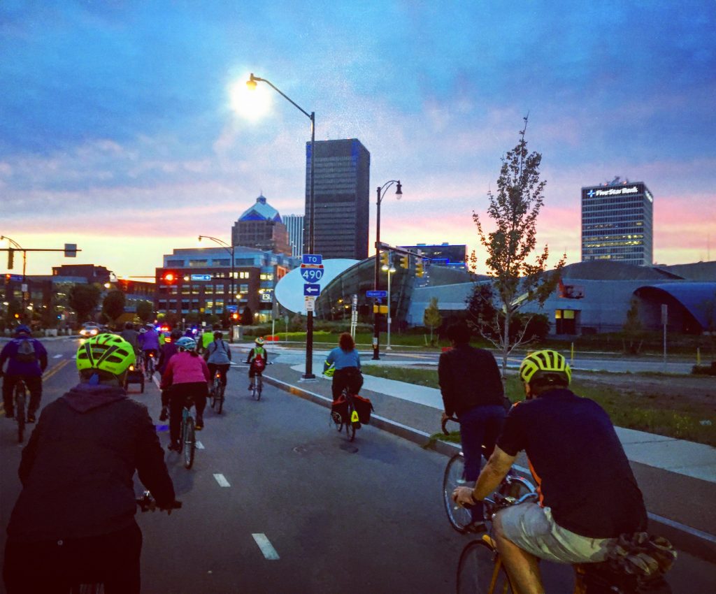
Example of a Bike Week ride
The purpose is to celebrate biking in Rochester and expand the use of bikes as practical, daily transportation. With many people taking up biking during the pandemic, Bike Week welcomes new riders and demonstrates the great community and infrastructure available to cyclists in Rochester.
Bike Week is put together by Reconnect Rochester but is truly a grassroots effort in that each event is organized individually. Information for the rides is below, along with a specific contact for each ride.

Friday, May 13

7:45pm: Light Up the Night Ride (131 Elmwood Ave)

This fun ride to kick off Bike Week begins after sundown and cyclists are encouraged to light up their bikes with glow sticks and bike lights. Gather at the Genesee Valley Sports Complex parking lot after 7pm; kickstands up around 7:45pm. The ride then proceeds through city streets and some trails, at a slow but enjoyable pace. Total distance 11 miles, but there will be shorter loops of 2-5 miles for younger cyclists as well. Dress warm and bring an extra layer for when the temperature creeps down after dark. Contact: Jesse Peers, jesse@reconnectrochester.org

Saturday, May 14

9:00am-2:00pm: Bike Sale (10 Flint Street)

R Community Bikes will have a good selection of ready-to-go bikes along with a huge selection of “project bikes” that need some TLC. They have no children’s bikes or 24″ bikes. Payment can be made by cash, PayPal or checks. Please note that this sale is at their Flint Street location, NOT their Hudson Ave location.

10:00am: George Eastman Bike Tour (900 East Avenue)

See Rochester in a new way. A nod to George Eastman’s own love of cycling, the George Eastman Bike Tour will take you to ten different locations related to the life and work of this pioneer of popular photography and famous Rochesterian. You will see buildings and sites that shaped Eastman’s life—or were in turn shaped by him. $25. Must register and pay beforehand to participate: eastman.org/biketours

Sunday, May 15

10:00am-11:30am: ROC Freedom Riders Kick Off Ride (East High School, 1801 E. Main Street)

Join ROC Freedom Riders for its 2022 season kick-off ride to support a new Black-owned fitness center founded by ROC Freedom Riders captain, Lakeisha Smith, owner of Inspired By Fitness. Meet at East High School parking lot for a ride around the neighborhood. This ride includes a tour of Inspired By Fitness and a fun warmup/cooldown activity facilitated by Lakeisha Smith. Contact: RocFreedomRiders@gmail.com

10:30am: Sunday Funday (Dr. Martin Luther King, Jr. Memorial Park at Manhattan Square, 353 Court Street)

Join Rochester Bicycle Time! for a leisurely cruise around our fine city during Bike Week. Explore fun hidden spots that will give you a different perspective on Rochester and possibly learn some history as well. Meetup at the park water fountain at 10:30am and rollout at 11am. Contact: Bryan Agnello bagnello@gmail.com

Monday, May 16

Nothing currently scheduled. Check back closer to this date for any updates!

Tuesday, May 17

7:30am-9:00am: Bike to Work Day Pit Stop, University of Rochester edition (Elmwood cycletrack, across from the main hospital entrance)

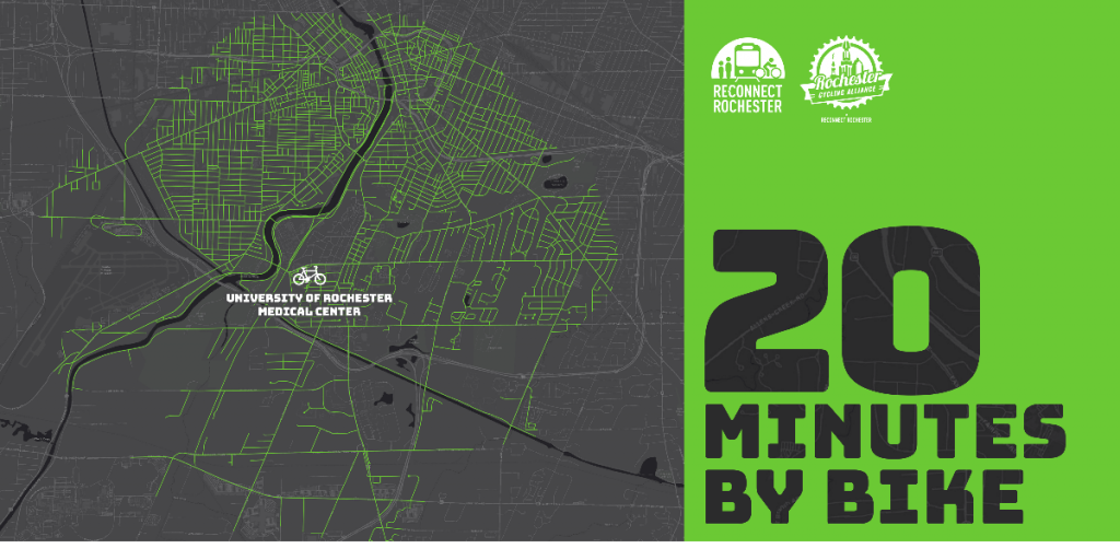
Our region’s largest employer is a wonderful bike destination! Situated along the Genesee River and near the Erie Canal, you’re sure to encounter some scenic spots along your route. The University of Rochester earned a silver “Bicycle Friendly University” award in 2018 and had Rochester’s most used bikeshare station during Pace’s tenure. To thank people cycling to the River and Medical campuses on May 17, they will have snacks to share in a safe manner. Swing by, fuel up, and talk cycling with their staff and Reconnect Rochester volunteers. Contact: Tracey Austin, taustin7@parking.rochester.edu

6:00pm-8:30pm: On-Bike Smart Cycling Class, presented by Reconnect Rochester (Public Market, 280 N. Union St)

Many people like the idea of biking more, but don’t feel safe mixing with traffic. In this class, students will learn the rules of the road and proper roadway position. We’ll examine safe cycling techniques and ways to make cycling easier and more enjoyable. The class will incorporate classroom learning, parking lot maneuvering drills and a short group ride navigating different traffic scenarios together. Cost: $25 per person. Must register and pay beforehand to participate.

Wednesday, May 18

7:00pm: National Ride of Silence (Liberty Pole, Liberty Pole Way)

Join Black Girls Do Bike Rochester and Monroe County cyclists in a silent procession to honor cyclists who have been killed or injured while cycling on public roadways. This slow 8-mile ride with a police escort aims to raise the awareness of motorists, police and government officials that cyclists have a legal right to the public roadways. Registration starts at 5:30pm. Ride will commence around 7pm after ceremony. Contact: Kecia McCullough BGDBRochNY@gmail.com

Thursday, May 19

6:45pm: Rochester Bicycle Time! (Parcel 5, 285 E. Main Street)

RBT’s mission is simple: All riders, regardless of skill level. They meet at Parcel 5 every Thursday around 6:30pm and start rolling at 7pm. Expect a relaxed cruise around the City with an improvised route. This ride is a great way to know how to get around by bike. Contact: Bryan Agnello bagnello@gmail.com

Friday, May 20

6:30am-10:00am Bike to Work Day pit stop (Union Street cycletrack at East Avenue)

If you’ve never tried biking to work, this is the day! Rochesterians are very fortunate to have an average 4.1-mile commute to work, which is about 25 minutes by bike at a casual pace. To thank people cycling to work on May 20th, Reconnect Rochester will have munchies to share and celebrate those who get to work on two wheels. Swing by, fuel up, and talk cycling with our dedicated volunteers. Contact: Jesse Peers, jesse@reconnectrochester.org

Saturday, May 21

MVP Health Care Rochester Twilight Festival

The MVP Health Care Rochester Twilight Criterium is back! This is the second race of the all new American Criterium Cup in the heart of beautiful downtown Rochester. Bring the family downtown for relentlessly high-paced racing on a short closed loop course that gives spectators plenty of access to the action! Grab a beer from the Rohrbach Beer Garden and grub from the array of Food Trucks! Details: rochestercrit.com

**Saturday, May 28** (postponed from 22nd)

10:00am-1:00pm Keeping It Classy Cycling Club’s Flower Pedal Populaire (Roundhouse Shelter, Genesee Valley Park)

Don your favorite outfit, decorate your bike, and pack up your picnic baskets! Meetup at the Genesee Valley Roundhouse shelter at 10am for coffee and a gracious welcome. Kickstands up at 11am for a short, leisurely group ride. Bring your mom and dad. Bring your Grammy and Grandpa. Bring the kids and dog! Just remember to keep it classy! Contact: Dan Slakes, danos.711@gmail.com
No Comments

Bike infrastructure and bike education: Why it takes both to make a bike-friendly city.

By Jesse Peers, Cycling Manager at Reconnect Rochester

Let’s be honest: there are few cities out there that attract a whole lot of bike ridership without protected bike infrastructure. Whether it’s bollards or curbs or planters that are used, it’s understandable that cyclists want something between them and car traffic besides a thin stripe of paint. When protected bike infrastructure is implemented and it connects people to destinations in a low-stress manner, people use it! It is true that “If you build it, they will come”.

This protected bike lane in Portland, Maine gets residents to their Minor League team’s ballpark. Wouldn’t it be great to bike to Frontier Field like this?

It’s also critically important to fill gaps in the bike network so it’s more usable for the average rider. As Brent Toderian notes, there’s a consensus emerging in the bike world that it’s more about quality of bike infrastructure than quantity (how many miles of bike lanes doesn’t matter as much as how safe & stress-free those miles are). The new regional bike map from the Genesee Transportation Council shows the gaps in our local bike network that lack real bike infrastructure (notice shared use lanes or “sharrows” are not counted as such) Where Rochester tends to score weakest in our regular assessments is in bike network analysis. Reconnect Rochester wants to see some continuous, non-interrupted bike routes as we approach 2034, the City’s bicentennial.
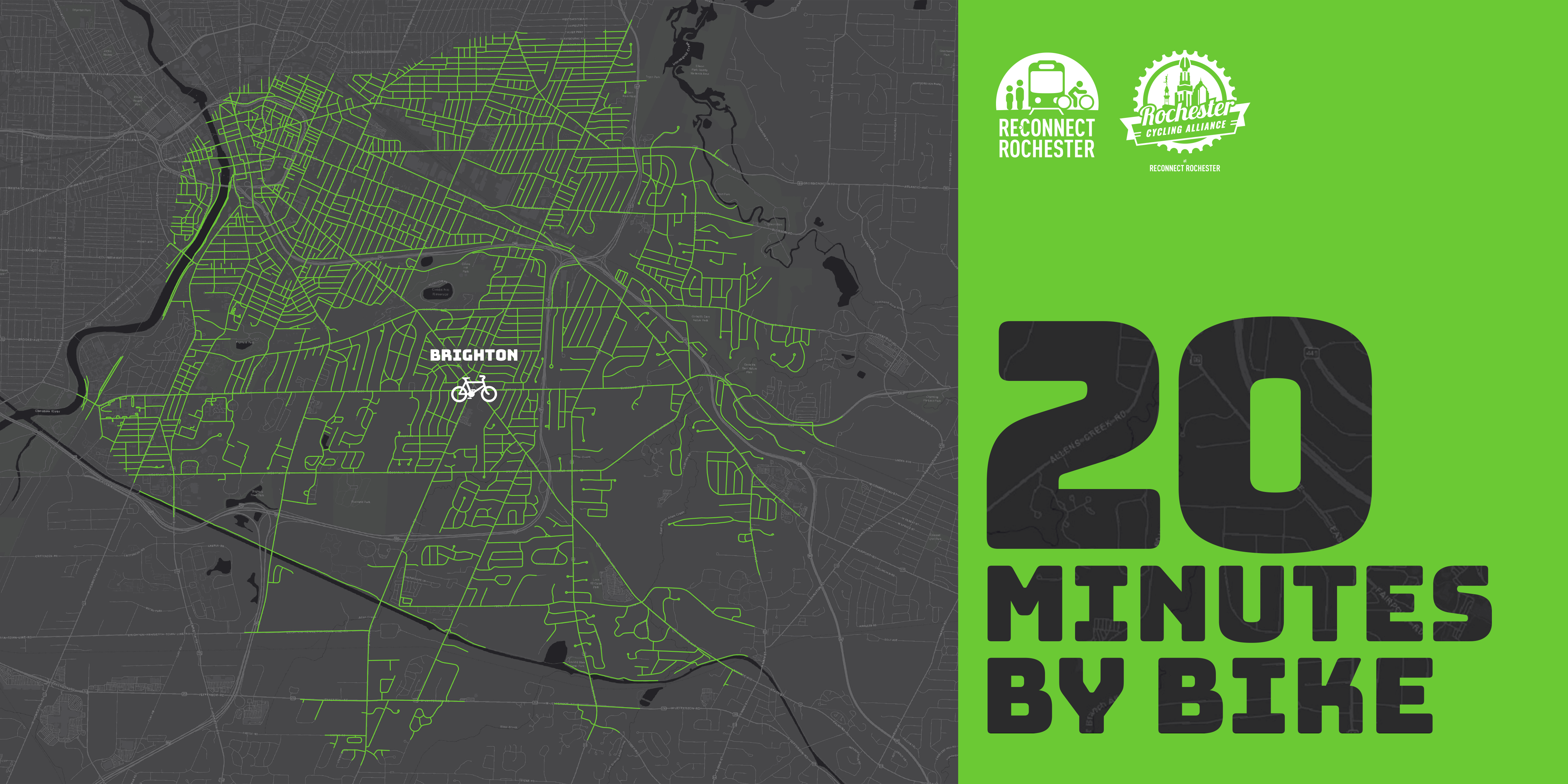
Rochester’s fragmented, piecemeal approach to bike infrastructure installation results in a disjointed “network”

Another key to creating safe roads for riding is messaging to motorists that cyclists have a right to the road. Obviously, drivers harassing cyclists, telling them to “get off the street” doesn’t lead to a very bike-friendly city! We’d love to see every municipality use Bike Month and Bike Week in May not just to tokenly celebrate biking, but a time to get mayors and supervisors in front of cameras and tell motorists this important message: “Cyclists have every right to the street. We want more residents on bikes. More trips by bike helps us meet our goals. Pass them safely and courteously.”
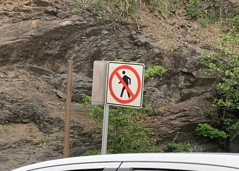
Order a free lawn sign from the Drive2bBetter campaign today!
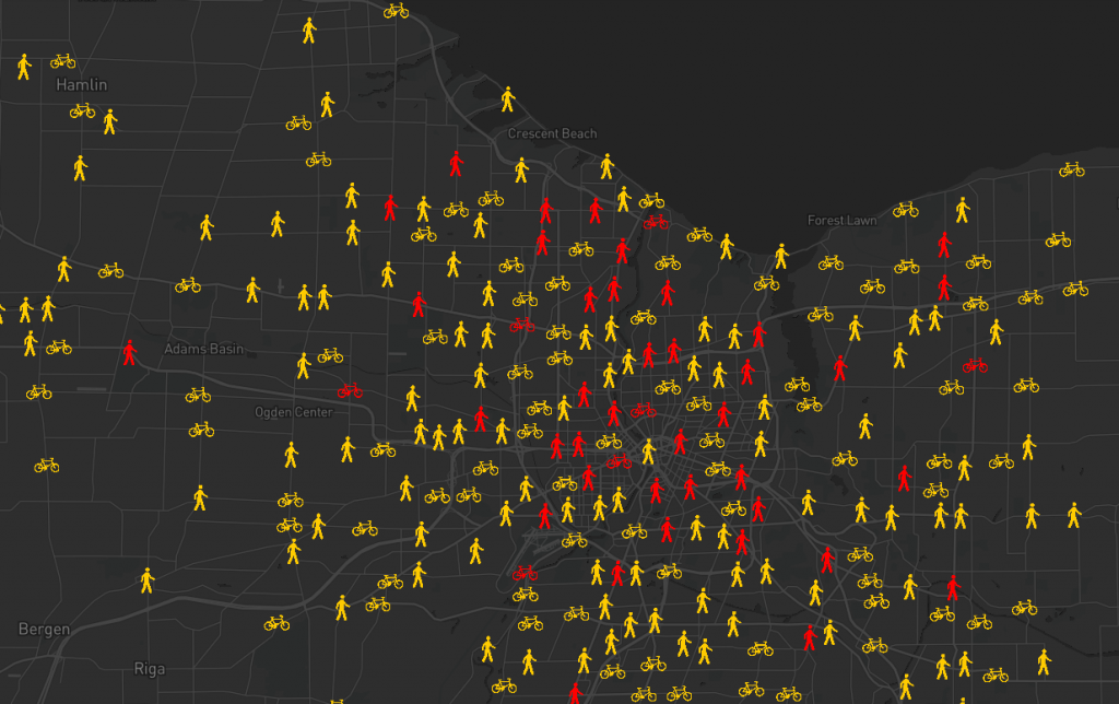
So we’ve established that protected bike lanes are essential to a bike friendly city, and we’ll keep advocating loudly for them. But there’s no need to keep your bike in your garage gathering dust as you wait for Rochester to become the Copenhagen of North America. You don’t have to wait for some future version of Rochester to appear, and here are some reasons why:

Rochester isn’t a cruddy city to bike in. Many local riders concur and Dan Kamalic wrote a great blog last year observing how pleasant he finds Rochester to bike in compared to other cities he’s lived in. Rochester was rated a Bronze level Bicycle-Friendly Community in 2016 and 2020 (after making honorable mention in 2012), which means we’re a good/decent biking city already. Bronze is nothing to sneeze at; it’s a result of over a decade of intentional investment. We’ve made progress since the City made its first Bike Master Plan in 2011.

There’s absolutely room to improve (we’re not content to remain at Bronze) but cruddy cities to bike in don’t get ranked and recognized. Besides, there are parts of our report cards that Rochester scores very well in such as riding groups and bike events. We’ve got a great cycling community here! Plus we have some of the best trails in the country.

Painted, unprotected bike lanes are still very safe (even though they can be uncomfortable or obstructed at times). Most cyclists’ greatest fear, which is understandable, is getting hit from behind as they bike along the right side of the road. One would assume that with a city of bike lanes without physical separation from motor traffic, that cyclists getting hit in bike lanes would be a common crash scenario. Fortunately, such crashes are extremely rare, here and elsewhere. 

Though some bike lanes could certainly be upgraded, protected bike lanes aren’t necessarily required everywhere. It’s a good bet that our city of the future, like many cities, will feature a mix of protected bike lanes, cycletracks, unprotected bike lanes, bike boulevards and trails working together to form a network. Some highly respected figures in the bike planning world only insist on hard separation from motorized vehicles when speeds hit 30mph. Therefore reducing speed limits and keeping drivers accountable to that speed limit is a great, proven way to make cyclists safer and grow ridership.

In 2021, the City greatly expanded its Bike Boulevard network. There is now a usable low-stress bike network in Rochester that enables you to get around much of the City without the need to bike on busy arterials. The Bike Boulevards primarily stick to residential side streets that have been traffic calmed and connect to existing trails.

Protected bike lanes are awesome but they aren’t a substitute for some basic traffic negotiating skills on your bike. No quality level or amount of bike infrastructure will ever alleviate the need to follow the law, maintain traffic awareness, and abide by some best practices when riding. Even if protected bike lanes proliferate, there will never be protected bike lanes or trails all the way to your destination. You will have to mix it up with traffic some of the time.

That’s where our bike education classes come in. Cycling doesn’t have to feel like swimming with sharks! In our fun classes, you can get the knowledge and confidence to enjoy cycling more. And a big part of being less stressed as you ride is learning to ride in such a way that limits motorists’ most dangerous choices. You can take drivers’ most dangerous cards off the table much of the time. It took taking a class for me to get comfortable biking and I suspect that’s probably true for most people. 

You don’t need an encyclopedia’s worth of knowledge to bike; just a handful of tips that really change road dynamics and interactions. I don’t believe a day will ever come when cyclist education isn’t necessary because the bike infrastructure is so awesome. The most bike-friendly cities and countries in the world do a great job of educating cyclists and it starts when they’re very young.

Another reason you should not wait for a city filled with bike lanes: Protected bike lanes and cycletracks aren’t necessarily cure-alls since they can still leave you vulnerable at intersections (where most crashes occur) and at driveways/parking lots. Again, this means that some traffic negotiating skills and awareness are still/always needed. We’ll explore at another time that there are ways to construct intersections much safer for cyclists, and we hope Rochester will pursue these kinds of bold design solutions in the future.

One future possibility for Rochester’s West Main Street: a protected intersection!

So when it comes to bringing about a better biking city, which is ultimately what my job is about, I’m a both/and guy. I’m both pro-protected bike infrastructure and pro-education. It takes both to move the needle and create a bike-friendly city. So get your bike out this spring, and I hope to see you at a great community ride or event. If you want to take one of our classes in 2022 to get more comfortable, reach out and let me know. We encourage you as the City of Rochester and Monroe County create their first Active Transportation Plans this year, to be engaged in the public input process and advocate for better bike infrastructure.

No Comments

Top 10 Things We’re Most Proud of in 2021

2021 is coming to a close. In the realm of transportation, this year brought a mix of positive progress and setbacks. At Reconnect Rochester, we strive to be innovative and to pivot fast when we see input opportunities to capitalize on, or mobility issues that need attention.

Despite the uncertainty and challenges of our times, we moved our mission forward with intensity. Below is “Top 10” list of accomplishments we’re most proud of this year.


TOP 10 THINGS WE’RE MOST PROUD OF IN 2021
(In no particular order of importance.)

#10

Legislative Advocacy

In March, we made a virtual trip to Albany to champion public transit and safe streets for Rochester area residents (and all New Yorkers). In April & May, we made the rounds to meet with our federal legislators. Among other things, we asked for Phase 2 funding to build the station that long-distance bus riders deserve. Here’s our team meeting with staff from Senator Gillibrand’s office.

#9

More Cubes on the Ground

Thanks to the City of Rochester and many other people and partners (you know who you are), we installed 16 more fiberglass bus stop cubes in the 19th Ward & La Marketa neighborhoods. That brings the total to 31 bus stops where RTS riders now have a respectable place to sit while they wait. Here’s a birds eye view from the balcony of Teen Empowerment on Genesee Street.

#8

Weighing In on Projects & Plans

Through our Advocacy Committee, we submitted written input, attended public meetings and served on advisory committees on countless infrastructure projects and community plans. We urge planners and decision makers to create a connected community with streets and spaces designed for people. This kind of hyper-active advocacy work results in big wins, like the cycle track you see emerging here on E. Main Street, a project we weighed in on in 2019.

#7

Supporting Public Transit

We continued to play an active role in what’s happening with public transit in our community. We partner with RTS to advocate for increased funding that will allow them to make service improvements and expand bus stop amenities. We support mechanisms that will give riders visibility and voice around decision making tables. When there was an unexpected rollback in service in September, we made a strong statement and tried to keep the community informed.

#6

Spotlight on Pedestrian Safety

At our November edition of Rochester Street Films, we brought together our safe streets community partners, victims of road violence, community leaders and concerned citizens to have a community conversation about the silent epidemic of pedestrian injuries and fatalities on our streets. In case you missed it, watch the recording to catch up on the conversation!

#5

Informing the Electorate

Leading up to election days in June & November, we surveyed all candidates for Rochester Mayor and City Council to learn where they stand on issues related to transportation and mobility. Questions were designed to learn about their opinions, ideas and vision for a well-connected and accessible community.

#4

Making Monroe County Bike Friendlier

We continued to exponentially expand cycling-focused programs, advocacy, education and outreach. In fact, there are so many accomplishments that we had to create a CYCLING TOP 10 LIST. These efforts are led by Cycling Manager Jesse Peers with support from countless passionate people and partners working to make our community a safer and more bike friendly place.

#3

Supporting New Mobility Options

We helped educate the community and promote HOPR’s first season in our area, and we celebrated the installation of 8 new HOPR stations to expand bike & e-scooter access in Rochester’s underserved neighborhoods. We also spread the word about the launch of Floshare, an electric carshare pilot that offers an option for low income residents that can’t afford to own a personal vehicle.

#2

Blog Content That Inspires

We amped up content on our blog and enlisted guest blog writers to help us provoke thought and community engagement about things like transportation climate solutions, urban density, and designing streets for people. We’re especially proud of our 20 Minutes by Bike blog series.

#1

Strengthening Our Organization

Reconnect Rochester took some big leaps forward in 2021. We completed a 3-year strategic plan that charts our path ahead, announced a transformative investment by Dr. Scott MacRae (pictured above) that will enable us to expand our staff capacity, and appointed Mary Staropoli as Interim Executive Director to lead us through this period of growth and transition. In case you missed it, you can catch up on all the excitement here.

Just imagine what we can do in 2022!

4 Comments

In Praise of the Improved Auburn Trail

By Jesse Peers, Cycling Manager at Reconnect Rochester

A Major Upgrade

Perhaps no place in the Rochester area epitomizes post World War II car-oriented development and suburban sprawl like Pittsford Plaza. Though Monroe Avenue is on a bus line, it’s always been a difficult, time-consuming or intimidating destination to get to without a car.

Several years ago I biked on the Auburn Trail to Pittsford Plaza and it was rough! The trail, a former rail corridor, was just too bumpy for most bikes. But with the recent improvements to the Auburn Trail, the plaza, its restaurants, shops, movie theatre, and of course places of employment are now quite accessible by bike! And because the start of the improved portion of the Auburn Trail is right next to one of the City’s Bike Boulevards (this connectivity was intentional), Pittsford Plaza is definitely bikeable from the City now. Once again, here’s Stefan Korfmacher’s stylized version of Rochester’s bike connections, only incorporating trails and bike boulevards.

Our Journey

On a warm, sunny weekend in October, I convinced our kids, ages 14 and 11, to ride out to Pittsford Plaza with me. Of course I resorted to bribery; they knew some surprise at journey’s end would make it worth their while. Hint, hint, it rhymes with “Joe’s.”

To begin, we biked from our home in North Winton Village to the ABC Streets neighborhood near Park Avenue. The City’s oldest Bike Boulevard is along Harvard Street and connects this neighborhood to Cobbs Hill via the bike/pedestrian bridge over 490. Bicycling along Rochester’s Bike Boulevards is a fun, relaxing experience. The traffic is sparse and slow due to the traffic bumps and the falling leaves on this day made it even better. Plus, regular signage helps cyclists find their way.

The pedestrian-bike bridge over 490 is so much fun! When you get to the other side, you can turn right to go to Cobbs Hill Park, Lake Riley, the dog park, and ball fields. The Rochester Chess Center is here, too, on Norris Drive. We went left on Hillside Avenue, which is another Bike Boulevard on a slow, comfortable, residential street. The boulevard continues past Winton and curves south, ending at Highland Avenue. This is where some brief on-street traffic negotiating is unavoidable. We had to take a left on Highland and bike just past 590. Even though there’s no bike infrastructure on Highland, the shoulder is plenty wide and comfortable and there wasn’t much traffic. When you’re on the other side of 590, the Auburn Trail begins just after Village Lane. The distance between the end of the comfortable Bike Boulevard and the Auburn Trail? 0.1 mile! Piece of cake.

More About the Trail

The Auburn Trail is a treasure! You bike past beautiful gardens, Council Rock Primary School, The Harley School, and the future site of Whole Foods. (TIP: As with all gravel riding, you’ll have an easier time and more stability by shifting into a lower gear on your bike so you can pedal faster.) The crossings at Elmwood, Allens Creek Road, and Clover were a breeze and motorists came to a stop every time to let us cross. A couple of the crossings feature Rectangular Rapid Flashing Beacons (RRFBs) to make crossing easier.

End of the Line (for us)

We ended our trip at Moe’s Southwest Grill, where we grabbed lunch. Our entire trip from North Winton Village to Moe’s was less than 6 miles, about 35 minutes of fun, comfortable cycling. (If you’re starting from the Colby Street bike/ped bridge in the ABC Streets neighborhood, the trip would be just 3.6 miles, about 20 minutes by bike). The property didn’t have a bike rack so we just locked up to some signage; not ideal but it works.

Less than ideal bike parking at Moe’s

After some burritos and queso, we biked across the street, through one of the Monroe Ave intersections with a traffic light, to Pittsford Plaza and Barnes and Noble. B&N has bike racks right next to the front door. With a lot of eyes on the street and foot traffic, it’s a very safe place to lock up your bike.

Bike racks at Barnes & Noble

Thanks Rochester, Brighton, and Pittsford for making this bike trip so delightful!

Additional Notes:

  • Thank your Brighton and Pittsford leaders for this collaborative effort on the Auburn Trail.
  • Pittsford Plaza and its environs could certainly use more bike racks. Now that this popular destination is bikeable, it’s worth getting in touch with Wilmorite and politely requesting that more racks be installed throughout the plaza.
One of the few bike racks in Pittsford Plaza, at Trader Joe’s
  • Though we stopped at Moe’s and Barnes & Noble, the Auburn Trail does continue all the way to 96 and the Pittsford Farms Dairy! The trail ceases to be crushed gravel and becomes a narrow dirt trail. But it’s absolutely bikeable if the ground isn’t soggy. No special bike required. For riders seeking a longer recreational ride, try: the Auburn Trail out to Pittsford > the Erie Canal Trail west to Genesee Valley Park > the Genesee Riverway Trail north up to downtown; it makes a wonderful triangle.
In 2022, we’ll feature more blogs like this – hoppable trips by bike. We hope it inspires you to leave your car at home for some trips and that you gain an appreciation for our budding bike network and trail system.
1 Comment

“Flower City Feeling Good” Summer Group Rides: Building Community & Learning Road Lessons Along the Way

By Jesse Peers, Cycling Manager at Reconnect Rochester

After taking a bike class in 2013 which made me much more comfortable biking around, in 2014 I adopted the bike as my primary mode of transportation. Since biking short distances was easy and fun, it wasn’t long before I wanted to ride with other people. In May 2015 I took our son and we went on our first group ride: a tour of public art as part of RoCo’s Ride It exhibit. Riding in such a large group was euphoric! I knew I wanted more.

That summer I started attending the weekly Unity Ride at Bulls Head Plaza, then in its first season. The people, the diversity of the crowd, and the Unity Ride’s message – cyclists coming together to stand for non-violence and community – kept me coming back each week. I also started attending the City’s Tuesday Guided Bike Tours sponsored by the Recreation Department. That’s how I got to know Richard DeSarra, who was leading those rides at the time. For decades, Richard was the godfather of all-things-cycling in Rochester. If there was anything happening related to bikes, he had his fingerprints all over it. Most notably, he cofounded the Rochester Cycling Alliance with Jon Schull and was instrumental in the creation of Rochester’s first Bicycle Master Plan.

Richard was a perfect bicycle tour guide. Not only was he a natural at herding a large group of cyclists across the city, but he just knew so much about local history, architecture and culture that anywhere we went, I’d learn something new. It was through those Rec Dept guided bike tours that I got to know Rochester by bike, particularly the Genesee Riverway Trail and other scenic locations.

Eventually Richard’s health started deteriorating and he wasn’t able to lead the tours anymore, though his advocacy and leadership continued until he passed away in 2019.

For several years, Oscar Wilson led the tours and did a great job growing the community. As with many things, the pandemic threw a wrench in those weekly tours and this year, the Recreation Department felt it was time for a reboot of sorts. The City reached out to Reconnect Rochester to see if we’d be interested in organizing and leading the weekly tours. We jumped at the unexpected opportunity and asked longtime collaborator Exercise Express and R Community Bikes to help.

We changed the night to Wednesdays and decided to use these fun community rides to familiarize residents with bike infrastructure, and to focus the tours on the newly expanded Bike Boulevard network.

For those unfamiliar with bike boulevards, they are a low-stress network of mostly residential side streets that parallel busy arterials. Traffic calming measures such as speed bumps are installed to slow down and even deter car traffic, so cyclists have a better experience. Over time, wayfinding signage will be added for cyclists. Until this year, Rochester barely had any Bike Boulevards. Many are probably familiar with the first in the area: the Harvard/Canterbury boulevard from Hillside Ave/Cobbs Hill to Monroe Ave.

In 2021, the City added 20 miles to the network! When you include the next phase of boulevards (the yellow routes above, which are absolutely cyclable now!), the future Running Track Bridge connection, and pre-existing trails, you end up with a bike network like this:

Thanks to Stefan Korfmacher for creating this stylized map for us to generate interest and discussion. Click here for a key.

Here is the best thing about the Bike Boulevards: They are Rochester’s first and up to this point only centrally planned bike network. Whereas bike infrastructure on arterials is too often done in piecemeal fashion “where feasible” with no overall view to connectivity, the Bike Boulevards are the first instance of Rochester zooming out and implementing a centrally coordinated plan to connect the city. As a result, from one end of a particular boulevard to the other, there are no gaps. Keep in mind these boulevards cross major, busy streets but for the most part avoid cycling along them.

It’s important to note that the City views these bike boulevards as complementary to, not substitutes for, on-street infrastructure on arterials. But the boulevards in large part can get you where you need to go within the city comfortably as long as you’re willing to go a little bit out of your way. Someday the network could expand to look like this.

Our hope over the summer was to build up bike traffic along this growing network ahead of time and amp up excitement for construction. We rode from a different Rec Center each week and each ride was about seven miles so it could be comparable in length to other community rides like the Unity Ride. Over the course of the series, we were able to show how these various routes connect with each other to form a usable network. Here are all of our different rides over the summer combined in one image.

Map courtesy of Bob Williams at Genesee Transportation Council

Great emphasis was put on the City’s north side, where not much bike infrastructure is present and where many Rec Centers were kept open during the pandemic due to the vital support they provide to their surrounding communities. Participants enjoyed riding along the east-west boulevards in this area that serve as wonderful alternatives to Norton, Clifford, and Bay.

Though we weren’t able to ride every boulevard this summer, you can see how these low-stress routes really do connect the City! From our marker campaign, we knew residents wanted an easier way to bike to the Zoo and to the Public Market. Well, this bike network delivers! The El Camino Trail, which you can get to via bike boulevards, ends at the Seneca Park Zoo and the Public Market is approachable via bike boulevards from all four directions!

The best part of the series was having participants ride through neighborhoods they had never seen before. Maplewood and 14621 just west of RGH got a lot of love. To my surprise, participants’ favorite ride was the longest one with the most hills! To wrap up the series, we stopped by Exercise Express, which is situated on the Ames Street bike boulevard, for some treats. Along with some group photos, here is some of the neat stuff we spotted along our journeys:

2 Comments

20 Minutes by Bike Blog Series: University of Rochester

The Rochester area is famous for its 20-minute commute. For driving that is. Reconnect Rochester and the Rochester Cycling Alliance are excited to ask a different question in this blog series: Where can you get within 20 minutes on a bike?

Presenting the sixth in a series of custom “bike shed maps.” For this next installment, we chose the University of Rochester Medical Center on Elmwood Avenue and are showing how far out in every direction you can get on a bike at a casual but steady pace of 10 miles per hour. This means that if you live anywhere in this green area, you can get to U of R within 20ish minutes on a bike or scooter. Thanks again to Brendan Ryan and Mike Governale for their help putting these maps together for us.

To get us familiar with this green territory surrounding the University of Rochester Medical Center (URMC), here’s Tracey Austin sharing her personal travel-by-bike experiences.


When I started commuting by bike 14 years ago, I didn’t realize how much ground a bike can cover in a short amount of time. And I’m not a fast rider! It was surprising to me that commuting by bike was almost as fast as driving my car to work. And when I started working at the University of Rochester, I was happy to find out I could save even more time and money on parking by biking to work.

Over the years, I have found that there is so much within reach while biking. There are many wonderful parts of Rochester within a very reasonable 20 minute ride to and from the University. Let me share with you a few of the discoveries I’ve made!

One of the best discoveries by far is that UR is only a 12-minute pedal away from the RTS Downtown Transit Center. Even better, this commute runs along the beautiful Genesee Riverway Trail! If you don’t have a bike or prefer not to bring one on the bus, you can rent a HOPR bike or scooter right at the Transit Center. Google Maps is a great navigating tool for this route. These photos show the Google Maps directions while also highlighting bike boulevards around the area. This is a very exciting prospective route for someone wanting to commute from a surrounding suburb who would rather take the bus for the first part of their trip.

I have driven my car to work only once since starting at UR. The annual parking pass can cost several hundred dollars on up. Also, UR has recently added a daily $5 occasional parking pass so you can just pay for the days you are not able to walk or bike. Not only do I love not paying for parking, but I’ve realized that I could save time by biking to work once I account for time spent walking or shuttling from my assigned parking lot!  This is definitely worth testing out to see if it may work for you, even if only in the warmer months of the year.

There’s no doubt UR is a hot spot for bikes! When Pace/Zagster was in our region, UR had the most utilized bikeshare station of the entire network. Now with 3 new HOPR hubs on our campuses, we are well on our way to being another great connection point—not only for students and employees, but for anyone needing to rent a bike in the area.

Having my bike at work adds convenience during the day, too: if I have to leave for a meeting, I don’t have to walk all the way to a car in a distant parking lot; my bike is parked right outside my office at an easily accessible rack. And I can go for a leisurely ride on my lunch break, because I am close to both the Genesee Riverway Trail and the Erie Canal Trail. These scenic trails also provide great commuting options and a way to get off the busy surrounding streets.

Speaking of lunch, taking the pedestrian bridge from River Campus over to the 19th Ward gives cyclists 10 minute access to Brooks Landing. Expand your horizons beyond just College Town! If you have 20 minutes, you can make it all the way downtown, to Corn Hill Landing, Fuego Coffee, the Foodlink Café at the Central Public Library, and more. And taking South Ave toward Rochester City Center lands cyclists in the South Wedge for any number of restaurant choices. And that’s just if you head north from UR!

Heading south you can easily reach the border of Henrietta and all the stores and restaurants at Park Point. Take the Lehigh Valley Trail (a superhighway for bikes!) from the South Lot and follow it all the way down to Brighton Henrietta Town Line Rd. From there you can easily head on over to RIT or down Jefferson Rd as well. This gives you so many awesome connection points to cut commuting time and stay off the major roadways.

Genesee Valley Park is also directly south of the River Campus and is a great access point: to the Canal Trail and all points west, plus the Greenway Trail, which can open even more commuting options for people in Scottsville and Henrietta (that would sometimes work out to be over 20 minutes, though).

Heading east from URMC, you can easily make it to 12 Corners in Brighton and all the parks in between. Highland Park is a mere 10 minutes by bike from anywhere at UR, and taking a short detour through Mt. Hope Cemetery offers a peaceful route coming from any direction.

The Memorial Art Gallery and surrounding Neighborhood of the Arts can easily be accessed by biking north on the Genesee River Trail on the east side of the river up to the Genesee Gateway Park where you can exit the trail and immediately cross Mt Hope Ave and be on Alexander St, taking that all the way to University Ave! Make a right on University and the MAG is one block up on the left.

 A similar distance to the Susan B. Anthony House neighborhood on the west side of the river can easily be achieved straight up Jefferson Ave from the Riverview Apartments on the river trail west. Not to mention all of the streets of housing that can be accessed in the 19th Ward from two pedestrian bridges and the Ford Street Bridge! 

The UR shuttle service is also a great resource for bike commuters since all of the shuttles have bike racks on the front. So if you are an employee or student and you live Downtown near Eastman School of Music, in the 19th Ward, or Southwedge you have access to a shuttle right in your neighborhood. Check out the shuttle schedules on the transportation website to see if you could even bike to a shuttle stop and then hitch a ride the rest of the way to work/school.

There are many other points you can reach from UR in 20 min by bike, some of which are:

    • Southwest YMCA
    • Parcel 5
    • Eastman School of Music
    • Downtown Rochester
    • Greater Rochester International Airport
    • Frontier Field
    • MCC
    • Brighton Town Park

Free covered bike parking on Library Rd on River campus, more of these solar-lit covered bike parking shelters to come!

If you’re pedaling to work, you can keep your bicycle safe and secure at one of our fully enclosed bike stations. The bike stations are located on the ground level of the hospital’s ramp garage, with one at Jackson Drive and the other at East Drive. Both bike stations offer:

    • 24/7 access
    • space saver bike racks
    • security cameras
    • weather-protection
    • self-service bike repair stations

For $40 per year, bike commuters can purchase a permit to either bike station which offers:

Permits for the bike stations can be purchased through the Transportation and Parking Management Center at 70 Goler House during regular business hours or at the Parking Office inside the main hospital garage after business hours. Appointments are now required if you are visiting the Parking Management office in person. Book an appointment online using the online appointment reservation form. For more information, please contact the Parking Management Center at 585-275-4524.


Newly renovated Jackson Drive Bike Cage:

East Drive Bike Cage:

No Comments

20 Minutes by Bike Blog Series: Rochester General Hospital Map (+ a Bonus)

The Rochester area is famous for its 20-minute commute. For driving that is. Reconnect Rochester and the Rochester Cycling Alliance are excited to ask a different question in this blog series: Where can you get within 20 minutes on a bike?


Presenting the fifth in a series of custom “bike shed maps.” For this next installment, we chose Rochester General Hospital (RGH) and are showing how far out in every direction you can get on a bike at a casual but steady pace of 10 miles per hour. This means that if you live anywhere in this green area, you can get to RGH within 20ish minutes on a bike or scooter. Thanks again to Brendan Ryan and Mike Governale for their help putting these maps together for us.

To get us familiar with this green territory surrounding RGH, here’s Dr. Gerald Gacioch sharing his personal travel-by-bike experiences.

I am a doctor at RGH and have been biking to work for the past 15ish years. I am not comfortable riding before sunrise or after sunset (despite bright lights and neon clothing) so my bike to work season is usually late-April to mid-September. There is really nothing like the feeling I get when my workday starts with a ride instead of the usual car commute on 490 (cycling is sort of a cross between Rocky running up the library stairs and a tranquil Zen master). I live on the border of Pittsford and Fairport. My route is Rt 31 to Schoen Place to Rt 96 past Nazareth to Fisher, left onto East Ave (GREAT new bike lane!) to University to Culver to Norton and Portland. The whole way is very safe and now has a bike lane almost the entire route.

Lessons Learned

Here are some of the lessons I have learned from now hundreds of days of bike commuting:

    • Pick a safe route. I tested out several routes when I started biking to work on a Sunday when roads were pretty quiet. I have used the same route since then and I now know the timing of the lights, where the potholes are, where people drive weirdly, etc.
    • Check out an e-bike. Still a great workout when you want it to be, but lots of fun to blast up a hill with little effort sometimes. I can cut 10-15 minutes off my commute when on the e-bike.
    • Enjoy the ride and be in the moment.

Rochester’s Bicycle Boulevards

One of the best things that Rochester has to offer in terms of bikeability is its ongoing Bicycle Boulevards implementation. Back in 2015, the City identified priority routes that could be used by cyclists to navigate the city. This year the City is implementing 20 miles of this network! Bike Boulevards are mostly residential side streets that parallel busy, sometimes intimidating roads. Over time, traffic calming measures like speed humps will be installed to slow down or even deter car traffic along these corridors, keeping the experience as comfortable as possible for cyclists of all ages and abilities. Wayfinding signage will also be added to help cyclists navigate. One of the best kept cycling secrets in Rochester is that you can use these routes now, even if they haven’t been technically converted to Bike Boulevards yet. See the purple dotted routes below.

As always, no quality level or amount of bike infrastructure will ever alleviate the need to have some basic traffic-negotiating skills under your belt. Sometimes biking on a major road is unavoidable for a block or two, and even if you stick to comfortable Bike Boulevards, you’ll still have to cross major streets. So stick to these general principles and if you want to get more comfortable and confident on your bike, take one of Reconnect Rochester’s classes sometime.

Biking (or scooting) to RGH along Bike Boulevards from the South, you get your own easy, private entrance to the complex! Northaven Terrace is a dead-end street for cars. But on your bicycle, just open the gate at the end and you’re there.

The Routes

This trip along low traffic, residential bike boulevards from North Winton Village is 3.6 miles (21 minutes by bike):

Here is a route biking (or scooting!) from the downtown Transit Center to RGH, primarily along Bike Boulevards. This is 3.3 miles, under 20 minutes! (TIP: Thomas Street, a great connection for cyclists wanting to avoid Joseph and Hudson Avenues, is one way between Upper Falls Boulevard and Clifford Avenue, so use the sidewalk for that brief section.)

Biking to RGH from the north above 104 is a little more challenging. Unless you can use the El Camino Trail to cross 104, as seen below, you’ll have to bike on Carter Street or Portland Avenue to approach the complex (Seneca Avenue is a less stressful alternative).

When you arrive on the campus, there are currently three places to lock your bike:

    1. Carter St Garage, where there is a locked bike cage (to gain access to it you go to the Parking Office located right in the garage near the entrance to the hospital).
    2. Portland Ave Garage, where there are bike racks next to security (stationed 24/7).
    3. Near the Emergency Department, where there are also bike racks.

RGH will soon be placing more bike racks by the main entrance. Cyclists can look forward to this custom bike rack in the shape of a stethoscope!


Bonus!

As a bonus, we’re throwing in a bike shed map of Rochester Regional’s other primary campus, Unity Hospital on the west side. Though outside the 20-minute scope for most people, Unity is approachable via the Erie Canal Trail from Spencerport, Gates, and the 19th Ward. It’s also not far from the City’s Maplewood Historic District. To get to Unity from Maplewood, we recommend taking Ridgeway to Latona to Welland, which takes you straight to the Unity entrance. Stay tuned for developments on the Eastman Trail, which will parallel Ridgeway Avenue. As you can see below, there are plans to connect these west side trails and we’re excited for that connectivity!

4 Comments

20 Minutes by Bike Blog Series: Brighton Map

The Rochester area is famous for its 20-minute commute. For driving that is. Reconnect Rochester and the Rochester Cycling Alliance are excited to ask a different question in this blog series: Where can you get within 20 minutes on a bike?


Presenting the fourth in a series of custom “bike shed maps.” For this next installment, we chose Twelve Corners in Brighton and are showing how far out in every direction you can get on a bike at a casual but steady pace of 10 miles per hour. This means that if you live anywhere in this green area, you can get to Twelve Corners within 20ish minutes on a bike. Thanks again to Brendan Ryan and Mike Governale for their help putting these maps together for us.

To get us familiar with this green territory in Brighton, here’s WomanTours’ Jackie Marchand sharing her personal travel-by-bike experiences.

One of the many things I love most about living in Brighton is its bikeability. It seems I can ride my bike to nearly everywhere I need or want to go. You’d think with more than 50 years of living here that I’d be able to find my way around without Google’s help. However, it’s become a game. Do I know my community better than my phone does? Can I find a safer, quieter and prettier way to bike to my destination than Google can? Or will it surprise me and show me a hidden bike trail?

Yesterday, I had a breakfast meeting at Morgan’s Cereal Bar on East Avenue. I used the bike feature on the Google Maps app and it sent me down Monroe Avenue. That wasn’t bad because it has a bike lane. Then I was supposed to turn down Alexander, but I knew there was a beautiful new bike path on Union Street. I went one block further than Google recommended and reveled in cycling the former Inner Loop on my way to East Ave.

I left my house ten minutes earlier than if I’d driven, and managed to complete a 20-minute bike ride before breakfast. The best part of all was that while others had to pay the meter, my parking was free!

When I grocery shopped at Tops last week, my phone sent me straight down Elmwood Avenue for one mile to the store. I always avoid cycling down Elmwood Avenue, as the lanes are too narrow for both a car and a bike. Fortunately, that could change in the future. There are plans to extend the Elmwood Avenue cycletrack from South Avenue to 12 Corners, which will be fantastic but is still years away.

For now, I have to find my own safer way. I know there’s a small trail behind Temple B’rith Kodesh to quiet Ashley Drive. At the end of Ashley, another trail connects to Brandywine and then another short trail connects to Lac De Ville into the Tops parking lot. I arrived at Tops in 15 minutes by cycling only one block on Elmwood Avenue. Google – 0, Jackie – 2. 

Last weekend, I wanted bagels from Bagel Land at 12 Corners, the cornerstone of Brighton. In addition to the fastest route straight down Elmwood Avenue, Google offered me the longer but better route through side streets to the back of the plaza. There was even a bike rack waiting for me. It took one minute longer but was well worth it. Thanks Google.

It’s actually pretty easy to navigate around 12 Corners using the small side streets to avoid the tight busy intersections. If traffic is low though, I’ll choose to cycle through it rather than around it. All the stoplights keep vehicles moving slowly.

Now that the Auburn Trail is improved, my favorite after-office ride is to the Pittsford Wegmans on my way home. Google actually found this route for me. My office is just over the Brighton/Henrietta line and an easy half-mile to the Canal Trail. After a mile on the trail, I linked to the unpaved Railroad Loop Trail that took me behind Pittsford Plaza all the way to Wegmans. Google even told me how long it would take – just 18 minutes. Google – 2, Jackie – 2.

After shopping, I crossed Monroe Avenue to hop on the Auburn Trail. Google didn’t know about this trail yet – it’s that new. I exited the trail at Elmwood Avenue and then meandered some calm streets through quiet neighborhoods to my house. It felt safe and relaxing. When was the last time you called a trip to Wegmans relaxing?! 

In search of some comfortable biking clothes last week, I googled the bike route to Sierra Trading Post from my office. Most of the 16-minute trip to the store was on roads, but there were shoulders and the traffic was light, so I felt safe. Google even knew to take me around the back of the stores where the loading docks were to avoid the busy parking lot. Surprise – there was a bike rack waiting for me in front of the store! Google – 3, Jackie – 3. 

Examining the ride home after shopping, I learned that my phone wanted me to take the Canal Trail to the Brighton Town Park, but from there Google failed me. It was sending me on Westfall to South Clinton to Elmwood Avenue for a total of two miles on busy thoroughfares. 

When I zoomed in, I saw that there was a small path connecting Westfall to Schilling Lane in a small residential neighborhood. It allowed me to cut out the hilly intersection at Westfall and S. Clinton and cycle nearly the entire two miles on a mix of quiet roads and paths. Admittedly, I probably wouldn’t have found the trail without Google, so I gave us each a point. Google – 4, Jackie – 4.

Finally, I already knew that the two newest trails in Brighton are not recognized by Google as bicycling routes. The one-mile long Brickyard Trail recently celebrated its fifth anniversary and connects Westfall and Elmwood Avenues. It’s a stroll through wetlands where I’ve regularly spotted foxes, turtles, owls and turkeys. The Highland Crossing Trail is less than two years old and also connects Westfall and Elmwood Avenues, but then continues north through Highland Park, ending at the Genesee Riverway Trail. Its highlight is an elevated boardwalk through a forest.

Jackie on the Highland Crossing Trail

The two trails are my favorite place to go when I don’t have anywhere I need to be. I tried the loop the other day, incorporating a couple calm bike boulevards that Google suggested. So I gave Google two points for the bike boulevards, and myself a point for each trail. Google – 5, Me – 5. I’m going to have to keep cycling so I can get ahead!

2 Comments

Shamokin Dam, PA: No Pedestrians Allowed

Written by Arian Horbovetz and originally published on The Urban Phoenix blog

Last weekend my wife and I enjoyed a quick overnight trip to one of our favorite cities, Philadelphia, PA. In an effort to avoid toll roads, we took Route 15 for much of the way through the Keystone State, marveling at the beautiful rolling hills while skirting the Susquehanna River.

But in many places along the way, Route 15 transitions into Big Box Store Islands. One such place is in Shamokin Dam, home to massive parking lots servicing Best Buys and AutoZones, featuring every restaurant chain from McDonalds and Burger King to Pizza Hut, Chipotle, Denny’s, Red Robin, Applebee’s and more. What caught my eye on this particular journey through the minimum-wage wasteland was the total lack of sidewalks.

Let’s unpack this for a moment. We have a sea of low paying retail jobs that literally cannot be reached on foot or by bike. If you can’t afford a car, you don’t get a job here and you don’t get to shop here, plain and simple.

Furthermore, and this is my favorite… not only do they not have sidewalks, the local signage actually forbids pedestrians!

And beyond that, I tried to see if there might be a public transit option so that residents of nearby Selinsgrove, for example, might be able to access this area without owning a car. Spoiler alert, there is no public transit option.

A similar collection of big box retailers and chain restaurants exists south of Rochester, New York in the suburb of Henrietta. And while the land use and development strategies in this area are hideously car-centric and exclusive, at least it has sidewalks on both sides of the road and regular transit access.

Jefferson Road, Henrietta, NY

Shamokin Dam, on the other hand, is an island of minimum wage jobs that is only accessible by the most expensive form of transportation. Pennsylvania’s citizens living in this area must own a car and all the incredible costs that come with it in order to access these retail opportunities, either as an employee or as a customer. This is a perfect example of how flawed and shortsighted our U.S. development patterns and land use constructs truly are.

2 Comments

20 Minutes by Bike Blog Series: Pittsford Map

The Rochester area is famous for its 20-minute commute. For driving that is. Reconnect Rochester and the Rochester Cycling Alliance are excited to ask a different question in this blog series: Where can you get within 20 minutes on a bike?


Presenting the third in a series of custom “bike shed maps.” For this next installment, we chose Four Corners in Pittsford Village and are showing how far out in every direction you can get on a bike at a casual but steady pace of 10 miles per hour. This means that if you live anywhere in this green area, you can get to Four Corners within 20ish minutes on a bike. Thanks again to Brendan Ryan and Mike Governale for their help putting these maps together for us.

To get us familiar with this green territory in Pittsford, here’s Flower City Family Cycling’s Brooke Fossey sharing her personal travel-by-bike experiences.

Introducing 20 Minutes by Bike Pittsford

You don’t have to be a cycling enthusiast to appreciate how connected Pittsford is. My humble hope is that after reading this, you’ll discover a new route available to you, and maybe you’ll pull out your bike for a trip that you’ve only considered accessible by car before. At the very end, I’ll share some tips that I hope will help you get started. 

48110148487_669dba10b5_o.jpg

I’m struck by three things about this 20 Minutes Map:

    1. You can bike to the heart of the village—our Library, shops, restaurants, Bakery and Dairy—from pretty far away in just 20 minutes or less, including from East Rochester, Pittsford Plaza, two colleges, and many of our neighborhoods. 
    2. We have been gifted, through good planning and leadership, with a great trail system that connects so much of Pittsford completely off the roads, including the Erie Canalway Trail and Town trails that connect cul-de-sac neighborhoods.
    3. We still have a long way to go to make major roads comfortable for most riders. We have to keep advocating for safety improvements on our major arterials. Although trail connections are great, direct routes should be viable and safe by bike – for everyone.

Take a look at the major attractions we have that are bikeable in the same length of time widely considered in Rochester to be the longest it takes to drive anywhere (20 minutes):

    • Library
    • Community/Recreation Center
    • Village and Town Halls
    • Main Street shops and restaurants
    • Schoen Place shops, restaurants, and breweries
    • Bushnell’s Basin shops and restaurants
    • Pittsford Plaza shops and restaurants, including Wegmans
    • Schools
    • Doctor and dentist offices
    • Banks
    • Yoga, pilates, and the YMCA
    • Hair salons
    • Parks like Great Embankment, Thornell Farm Park, Kreag Rd Park
    • Playgrounds
    • Erie Canal
    • East Rochester amenities, including restaurants, a pool and splashpad
    • Nazareth and St. John Fisher colleges

That list is pretty incredible. Now, let’s break some of this down further. 

Bike to your Books! 

The Pittsford Community Library has not one, but two bike racks: one in front on State Street and one behind with an adjacent bike repair station. If you haven’t considered biking to the Library, strap on your backpack or grab your bike basket. You’ll feel great when you arrive and you’ll have the best parking spot there. 

35777049031_f042db6766_o.jpg
Pittsford Community Library bike parking

Let’s say you’re coming from one of the neighborhoods off Rt-96. You can take the sidewalk along Rt-96, cross at the light at South Street and take the quieter neighborhood roads right to the Library in 5 minutes by bike, 1 mile each way. 

Screen Shot 2021-02-10 at 11.10.13 AM.png

Coming from the other direction, Google will send you on the most direct path, on N. Main Street, and you can cut in through the parking lot. Or, take the quieter, but slightly longer, neighborhood route down Schoen Place. Sometimes going a little bit out of your way on your bike makes for a much more enjoyable and relaxing ride, until our main streets are made safe enough for everyone to feel comfortable riding on them. I’d probably take this longer but quieter route if I had my kids riding independently next to me. It would be a little longer, but on a bike, it’s not that noticeable, and it would be much less stressful. 

*Note: State Street Bridge is closed for repairs until mid-July.

Middle School Mileage

A few of our friends who live in or near the village have middle-school age children who biked to Calkins Road Middle School. To many of us, that sounds a little scary, but there’s actually a sidewalk that connects all the way, and a trail system that connects cul-du-sacs and allows for riding on much quieter streets. Having route choices makes biking more accessible as each person can tailor their ride to their own comfort level. Biking to school has so many benefits: independence for teens, reduced congestion, transportation savings, and kids can arrive to school more awake and ready to learn. This is something I believe we should be actively encouraging as a community. 

32105750_1999652596734556_7492071836528672768_n.jpg
Calkins Road Middle School bike racks are packed on Bike to School Day

Many of Pittsford’s neighborhoods have walking and biking paths that connect cul-du-sacs with the next neighborhood without having to go out on the main road, and I’ve found that you can travel quite far on these side roads—if you know about them! 

50055540776_462214809f_o.jpg
Trail connection between Crestview Dr and the Jefferson Road School grounds
48110146237_c4b02e7756_o.jpg
Neighborhood walk/bike connection between Stonegate Ln and the Pittsford Community Center

Groceries and Gears

Getting groceries by bike requires a little more planning, but it is not only possible, it can be so rewarding. Do I wish there was a small grocery to pop into to grab a few things by bike a few times a week – heck yes. Is Wegmans by bike an option? Believe it or not, also heck yes. Maybe you can’t bring as much home as you would in your car, but you can actually haul quite a bit on your bike with panniers or just a large backpack. Plus you have the added benefits of exercise, parking right up next to the building, and—let’s not underestimate the badass factor. You’ll feel really proud of yourself. I’ve done this route myself, but my husband usually runs it weekly during three seasons using the trails to completely avoid Monroe Avenue. 

IMG_20200714_211008133.jpg
Hefty Wegmans haul via bike

The approved Active Transportation Plan calls for a multi-use trail along Monroe Avenue, but until that happens, did you know you can reach Wegmans completely on trails? Check it out: 

Screen Shot 2021-02-14 at 10.15.22 AM.png

This route uses the Auburn Trail, accessible behind the Pickle Factory. Unfortunately Google maps doesn’t show this connection. From the Four Corners, get on the Erie Canal towpath heading west, turn right on the turnoff near Pittsford DPW’s building, and hop on the Auburn Trail behind the Pickle Factory storage building. Cross to Wegmans at the light and cruise right into the parking lot, with bike parking on either side of the store. 

Alternatively, you can come up on the west side of Wegmans taking the Erie Canal towpath farther west and coming down the ramp near the old Lock 62. 

Screen Shot 2021-02-14 at 10.16.02 AM.png

College Connections

Connecting young people to the village and giving them the option to get here without driving will help our local economy and give students more freedom. Nazareth has a great connection to the village, thanks to the new sidewalk installed by the Town this past year. St. John Fisher also has a straight shot on main roads. How can we encourage students to visit the village on foot or on bike, and how do we make that an attractive option? 

What Does This Mean for YOU?

If you are even the slightest bit curious, I encourage you to try biking to your destination. You will arrive invigorated and pretty darn proud of yourself. You can do this! One trip builds on the next and pretty soon, it becomes a true option, and you start to ask: should we take the car or bike today? 

33450641684_992960b5c3_o.jpg

Tips for Getting Started

Short and easy destination. If you’re brand new to biking and want to give it a try, pick a destination no more than a mile away, and which will be low-stress to get there. Ex: Pittsford Dairy: access the canal path from your closest neighborhood spot and ride to N. Main Street, and then from there just a short distance to the Dairy. Grab your milk (or ice cream!), throw it in a backpack, and head back home. Once you master that, you’ll start to see that the world opens up to what you can reach just by the power of your own legs. It’s walking, only faster! Here are some great destinations to check out in the Village: Pittsford Dairy, Lock 32 Brewery, Copper Leaf Brewing, Simply Crepes, The Coal Tower, Village Bakery, Pittsford Library, Thirsty’s, Label 7, Olives, Aladdin’s, Breathe Yoga, BluHorn Tequilaria…the list goes on and on, so pick what interests you and go for it! 

School run on a weekend. Try a school run one day – but do it on a weekend. Try it without the stress of getting there at a certain time, or rush hour traffic. Do the run and see how it is, and then when you do it for the first time on a school day, it’ll be so much easier. Pretty soon, your kids might start asking you to drop off or pick-up that way because they get more time with you and like moving their bodies before settling in at school.

Ride with other people. There are many biking groups around Rochester that do club rides. You can find one that suits your skill level and interest and ride with others. There’s a sense of camaraderie riding in a group, and you can learn from other people. Here’s a shameless plug for Flower City Family Cycling, a group I co-run that plans chill, social rides for families. All ages and abilities welcome, and we’d love to see you.  

Wrapping Up

As this map shows, Pittsford has some amazing connectivity. But it also overstates connections we do have: many of the main arterials shown as straight shots through Pittsford are often not enjoyable by bike—they can even be downright stressful and scary, depending on the time of day. They will require a great deal more effort to improve the ride experience to encourage new riders. 

The next step to making this 20-min map a reality for many people is to make the roads safer to bike on. That means lowering vehicle speeds, narrowing lanes, considering bike lanes or shared bike/walk trails, and educating the public on how to safely drive alongside someone on a bicycle.